Re-suspended ash from the Katmai volcano in Alaska
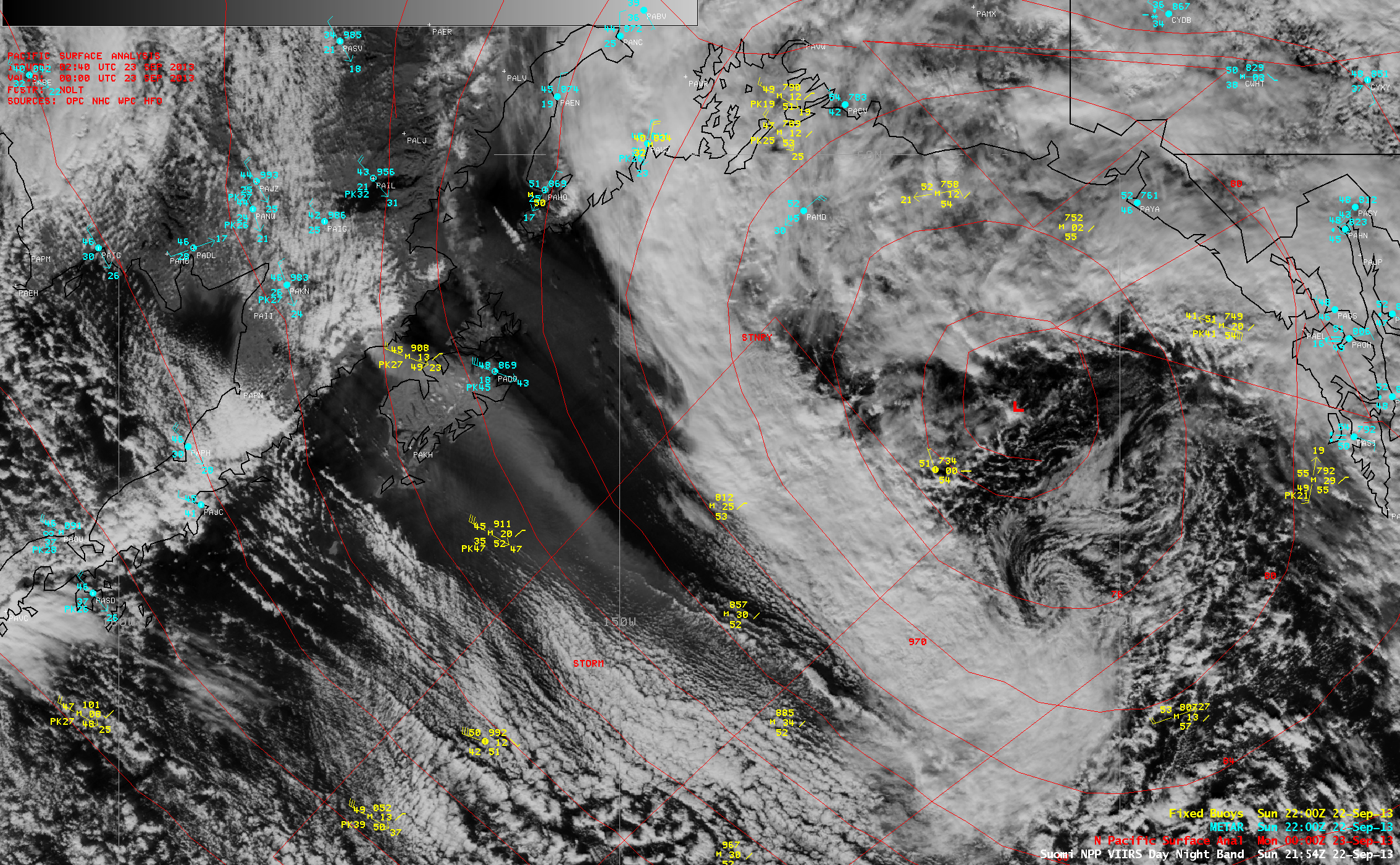
GOES-15 0.63 µm visible channel images (above; click image to play animation) showed a distinct hazy plume streaming southeastward from the Katmai volcano area in Alaska on 22 September 2013. This was a signature of re-suspended volcanic ash — a deep layer of ash has remained on the ground near the volcano following the massive 1912 eruption — which was carried aloft by strong winds on the back side of a deep area of low pressure over the Gulf of Alaska (below).
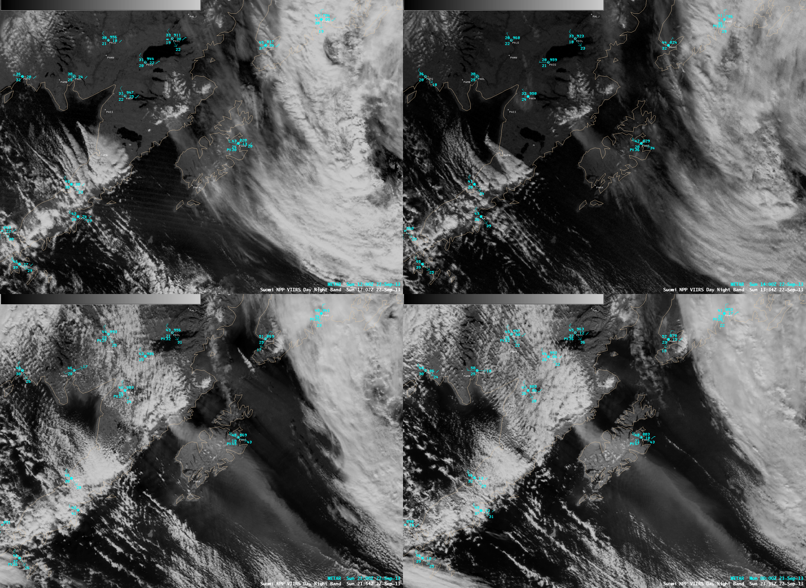
A closer view using a sequence of four Suomi NPP VIIRS 0.7 µm Day/Night Band images (below) showed the evolution of the ash plume as it moved over southeastward over Kodiak Island and then out over the Gulf of Alaska. Winds at Kodiak (station identifier PADQ) gusted as high as 55 knots or 63 mph. With limited snow cover and strong winds (which were enhanced by local terrain effects), the surface volcanic ash was easily lofted to great heights.
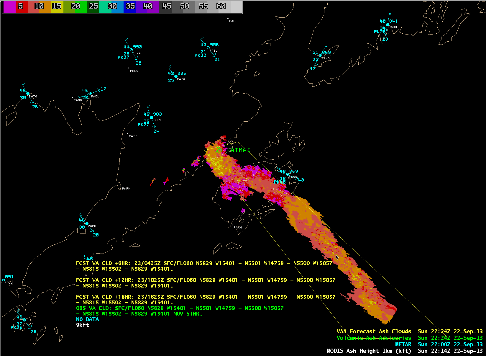
An image of a MODIS-based NOAA/STAR/CIMSS Volcanic Ash Height product is shown in combination with the Volcanic Ash Advisory that was issued by the Anchorage Volcanic Ash Advisory Center (below).
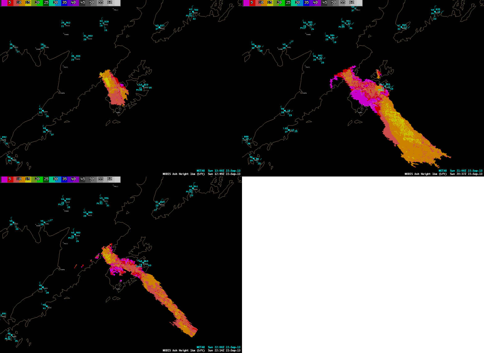
A sequence of three MODIS Volcanic Ash Height product images (above) suggested that the average height of the re-suspended ash plume was around 9,000 – 11,000 feet. A vertical profile of CALIPSO satellite-based lidar data near the source of the ash plume (below; courtesy of Mike Pavolonis, NOAA/NESDIS/STAR) indicated that the top of the plume was around 3.5 km or 11,000 feet (at 12:57 UTC, near latitude/longitude 58 N / 155 W).
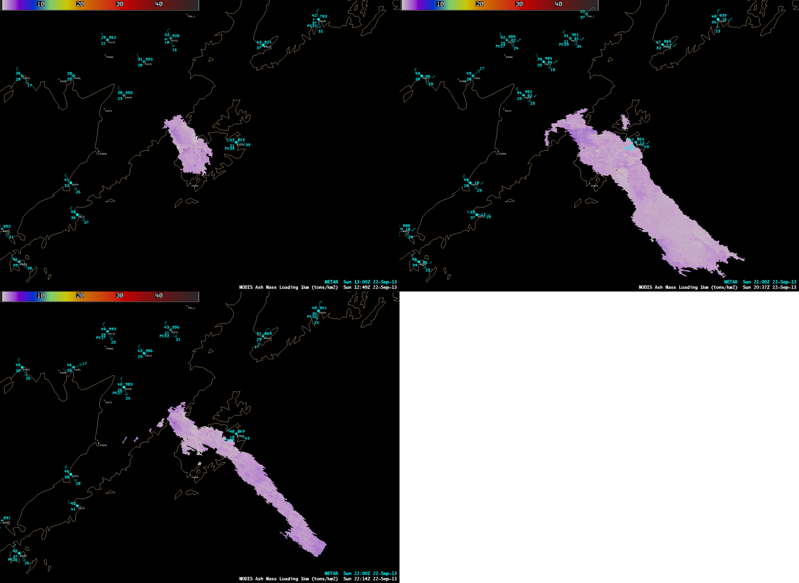
The corresponding MODIS Ash Mass Loading product (below) indicated values of 2-3 tons per square kilometer existed over much of the ash plume.
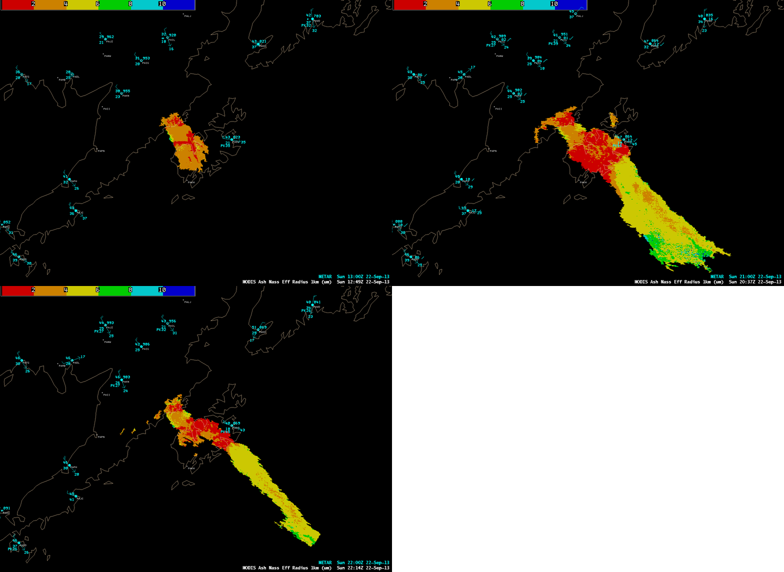
Finally, the corresponding MODIS Ash Mass Effective Radius product (below) showed that much of the plume likely consisted of particles with radii in the 4-6 µm range, with a maximum value of 8.33 µm.
Additional information on the NOAA/UW-CIMSS GOES-R Volcanic Ash Products shown above can be found in this Java-based VISITview lesson (a separate Lesson Playback Control window will open to assist in viewing the lesson content).
===== 23 September Update =====
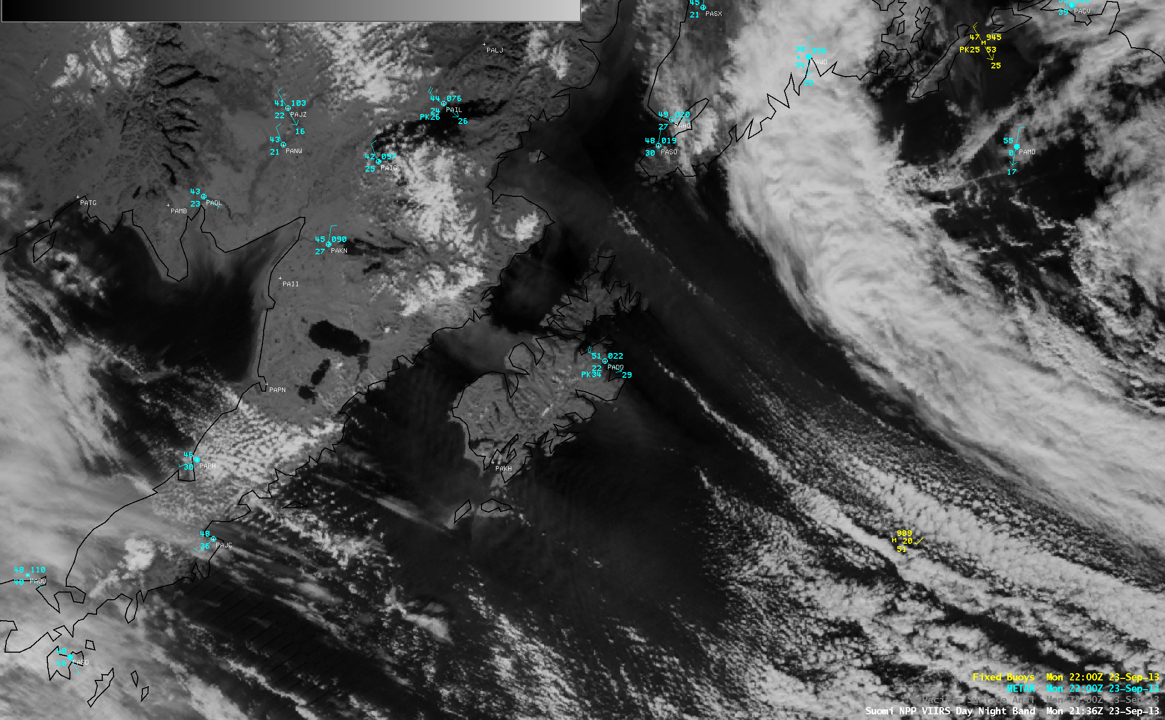
On the following day (23 September), a Suomi NPP VIIRS 0.7 µm Day/Night Band image (above) showed that the resuspended Katmai ash plume was still present, but was much less expansive than what was seen on 22 September.
Hat tip to Mark Ruminski of the NOAA/NESDIS Satellite Services Division for bringing this interesting event to our attention!


