Interesting “O-shaped clouds” over the Eastern Pacific Ocean
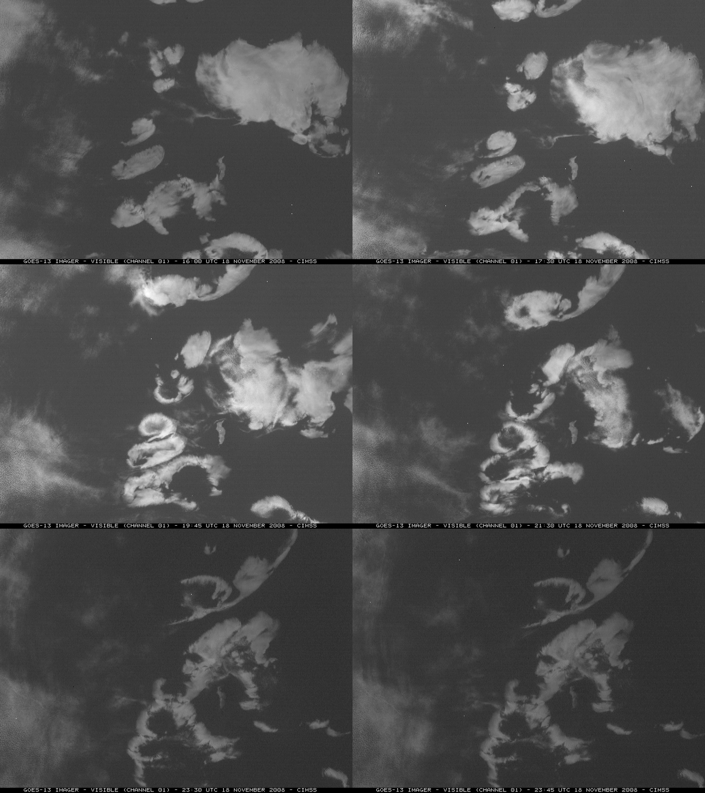
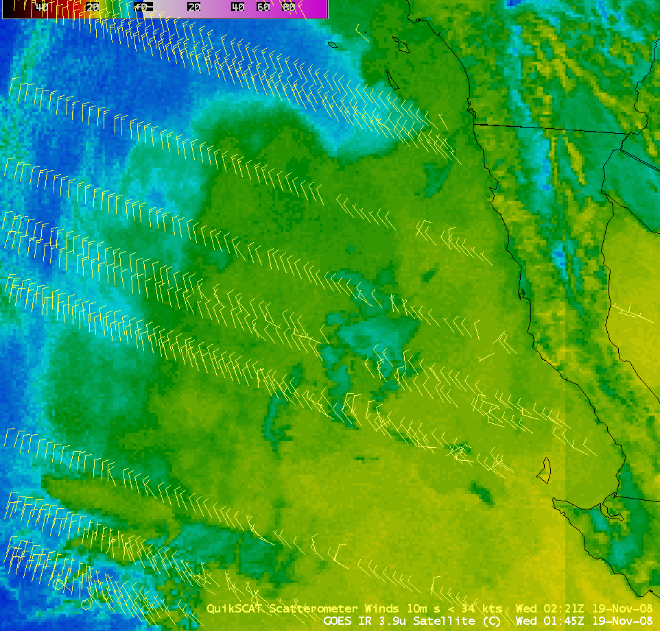
We created the “What the heck is this?” category just for the type of case that is shown here: GOES-13 visible images (above) displayed an interesting cluster of O-shaped clouds forming over the Eastern Pacific Ocean (near Isla Guadalupe, off the coast of Baja California) on 18 November 2008. A few hours later, an overpass of the QuikSCAT satellite allowed an overlay of WindSat surface wind data on a GOES-11 3.9 µm shortwave IR image (below) — and the QuikSCAT wind data seemed to suggest that these O-shaped clouds were actually perturbing the general northwesterly marine boundary layer flow to some extent.
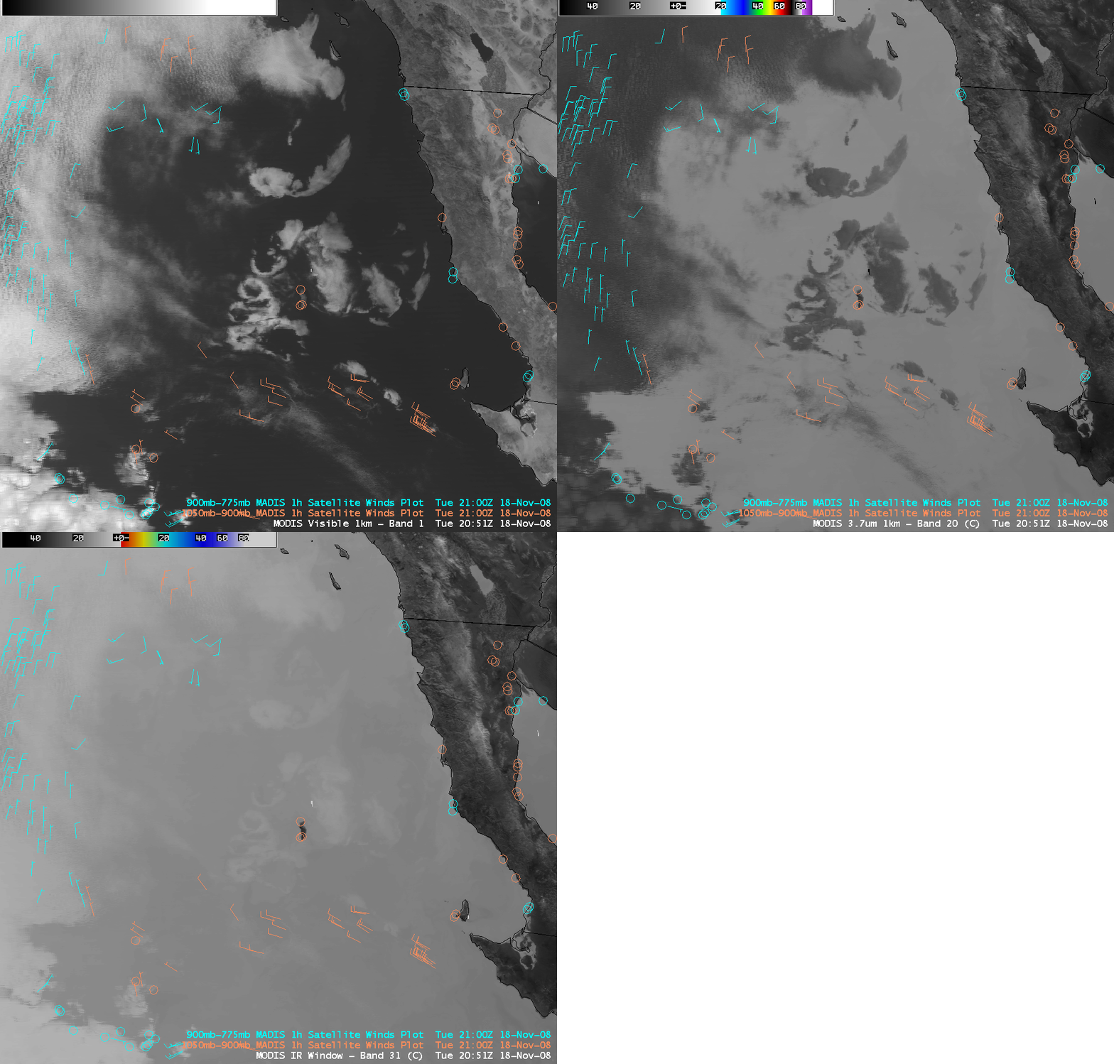
AWIPS images of the MODIS visible, 3.7 µm shortwave IR, and 11.0 µm IR window channels (above, with an overlay of lower-tropospheric MADIS atmospheric motion vectors) provided two important clues about these cloud features: (1) they were composed of supercooled water droplets, which reflected large amounts of solar radiation leading to a display of very warm (> 30º C, darker gray shades) 3.7 µm brightness temperatures, and (2) they were shallow clouds within the marine boundary layer, with fairly warm cloud top IR window brightness temperatures in the 13-14º C range. These points were further confirmed by examining additional MODIS images (below): the MODIS Cloud Top Temperature (CTT) product showed CTT values of 16-17º C (red color enhancement); the MODIS Cloud Phase product indicated these clouds were composed of supercooled water droplets (blue color enhancement); and the GOES-11 Sounder Cloud Top Height product placed the cloud tops in the 3000-5000 foot range (tan to orange color enhancement).
A closer view using 250-meter resolution MODIS true color image from the SSEC MODIS Today site (below) showed impressive structure to the O-shaped clouds, with hints of fine-scale outflow boundaries along the outer edges of some of the cloud features. These cloud features somewhat resemble Pockets of Open Cells that have been previously documented — these open cells are apparently related to the formation of areas of precipitation (in this case, drizzle) that then act to dissipate a portion of the cloud to the point that a hole forms in the cloud feature. The downdrafts created by the formation of these pockets of open cells may indeed have had enough of an impact on the surface winds to be apparent in the QuikSCAT surface wind data seen above.
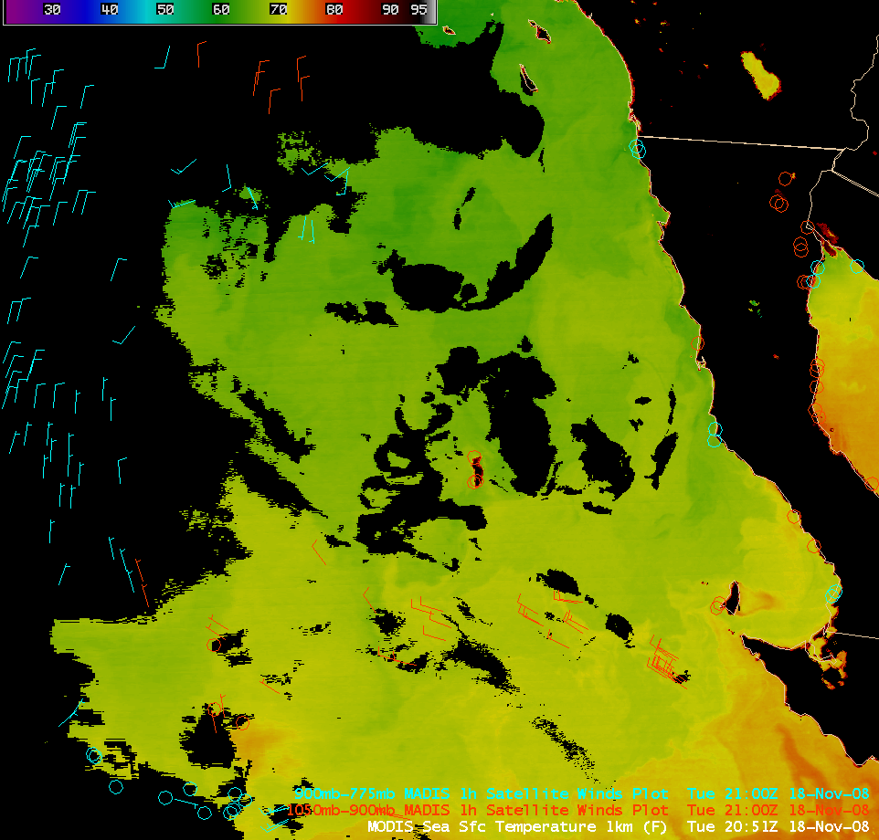
As an aside, the MODIS Sea Surface Temperature (SST) product (below) showed that SST values were generally in the mid 60s F (darker green colors) over the area where the O-shaped clouds were forming — and there was a well-defined SST gradient just to the south, where SST values rose into the lower 70s F (lighter green to yellow colors).


