Tropical Storm Andrea
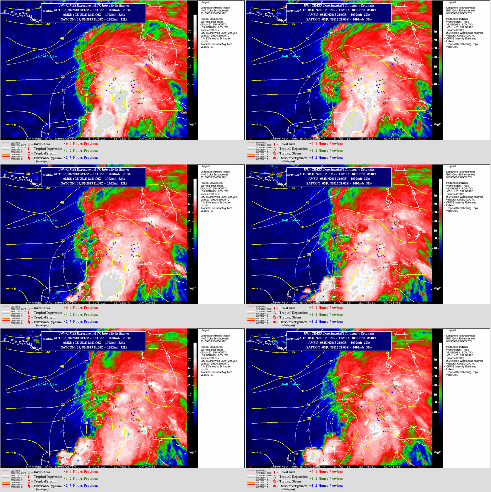
Tropical Storm Andrea (the first Atlantic Basin tropical cyclone of the 2013 season) formed in the eastern Gulf of Mexico on 05 June 2013. GOES-14 10.7 µm IR images from the CIMSS Tropical Cyclones site (above) showed that the center of Andrea was located along the western edge of deep convection, which exhibited numerous Tropical Overshooting Tops. Andrea was forecast to move northeastward into an environment characterized by increasing values of deep layer wind shear, so rapid intensification was not anticipated.
Due to partial obscuration by high clouds from the deep convection, the low-level center of circulation was difficult to identify on McIDAS images of GOES-14 0.63 µm visible channel data (below; click image to play animation).
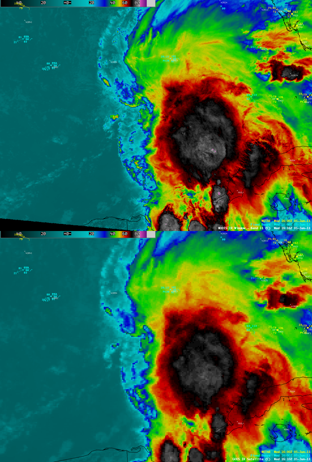
Early in the day, an AWIPS comparison of 1-km resolution MODIS 11.0 µm IR and 4-km resolution GOES-14 10.7 µm IR images (below) demonstrated that the higher spatial resolution data was able to display the small yet very cold areas of tropical overshooting tops — the coldest IR brightness temperatures seen on the MODIS image were -87º C (violet color enhancement), compared to -78º C (lighter gray color enhancement) on the corresponding GOES-14 IR image.
===== 06 June Update =====
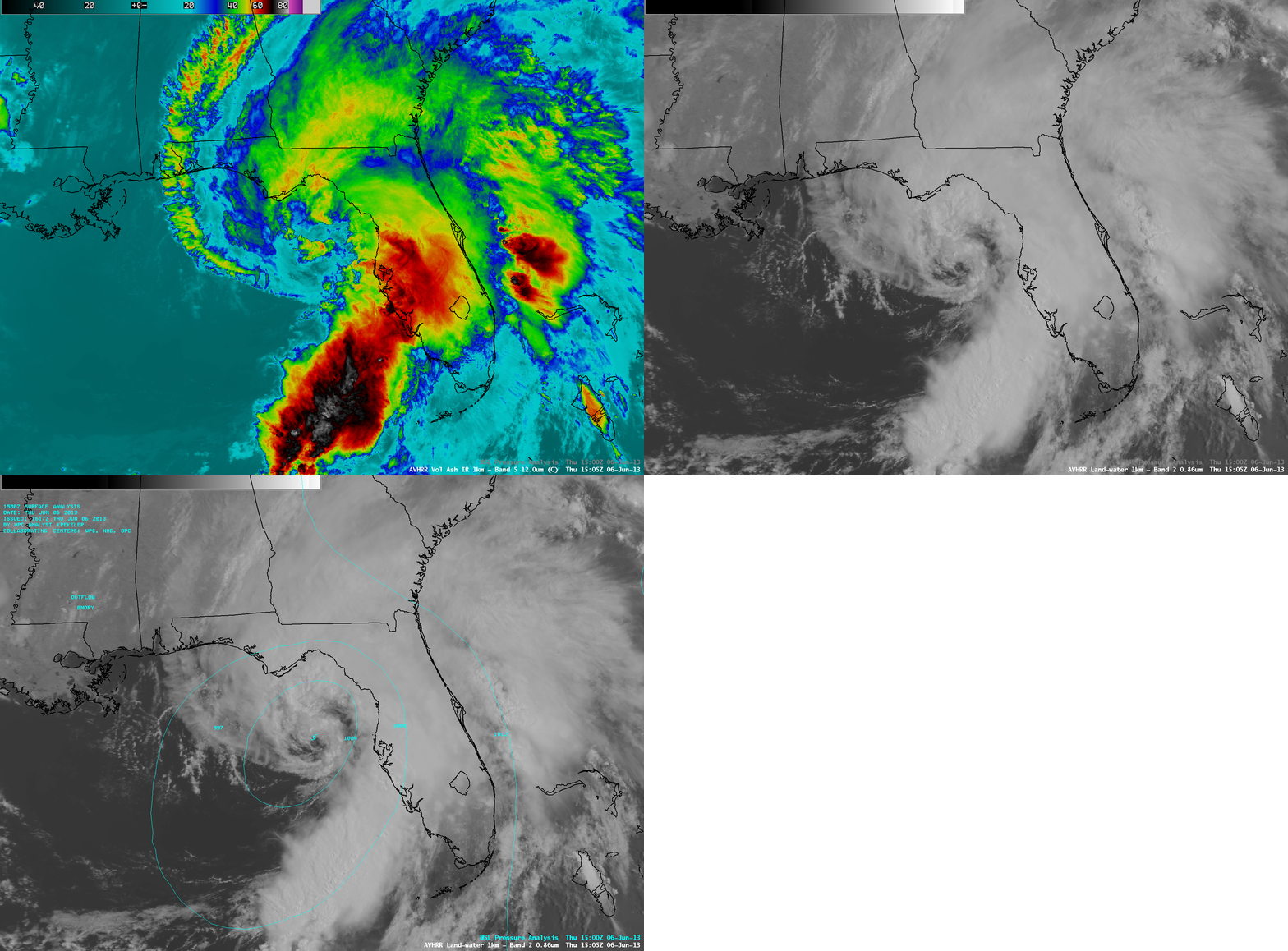
1-km resolution POES AVHRR 12.0 µm IR channel and 0.86 µm visible channel images (above) showed Andrea off the west coast of Florida at 15:05 UTC. There was some suggestion of a closed eye beginning to form on the visible image.
1-km resolution GOES-14 0.63 µm visible channel images (below; click image to play animation) revealed that the center of circulation became more well-defined as the tropical storm made landfall around 21:40 UTC (5:40 PM local time) near Steinhatchee, Florida. Maximum sustained winds at landfall were estimated to be 65 mph.


