November: a month for blizzards, gales, and tropical storms
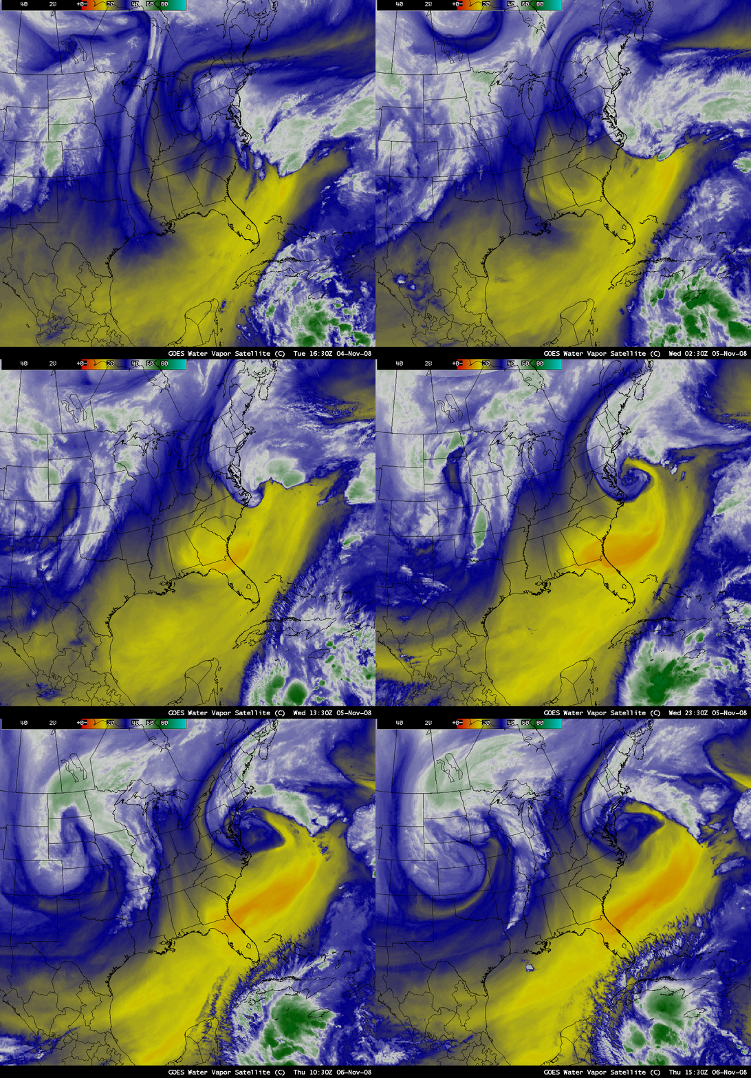
AWIPS images of the GOES-12 6.5 µm “water vapor channel” (above) displayed 3 impressive storms during the 05 November – 06 November 2008 period: a powerful blizzard in the northern Great Plains states, a strong “gale force” storm along the US East Coast, and Tropical Storm Paloma in the western Caribbean Sea. The Plains blizzard produced wind gusts to 85 mph at Rapid City and snowfall amounts as high as 45.7 inches at Deadwood in western South Dakota; the East Coast storm was responsible for wind gusts in excess of 58 mph and waves greater than 18 feet at the Diamond Shoals buoy off the coast of North Carolina; and Tropical Storm Paloma was showing signs of entering a period of rapid intensification.
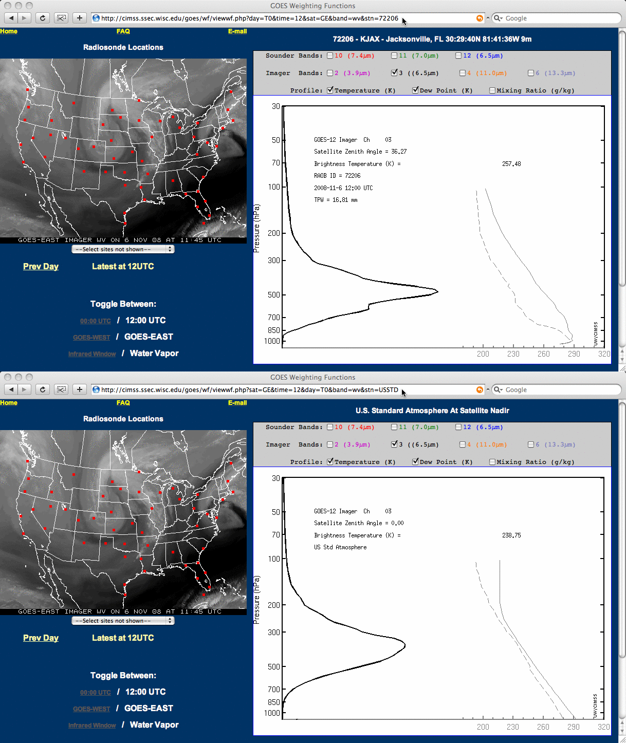
Note the presence of abnormally dry air on the water vapor imagery over southern Georgia, northern Florida, and the adjacent offshore waters of the western Atlantic — water vapor brightness temperatures were as warm as -10ºC (darker orange color enhancement) early in the day on 06 November. GOES-12 water vapor channel weighting functions (below) showed that the altitude of the layer being detected within the dry air mass in place over Jacksonville, Florida was at a significantly lower altitude (centered near the 500 hPa pressure level) compared to what would be detected in a more “normal” US Standard Atmosphere (centered near the 325 hPa pressure level).
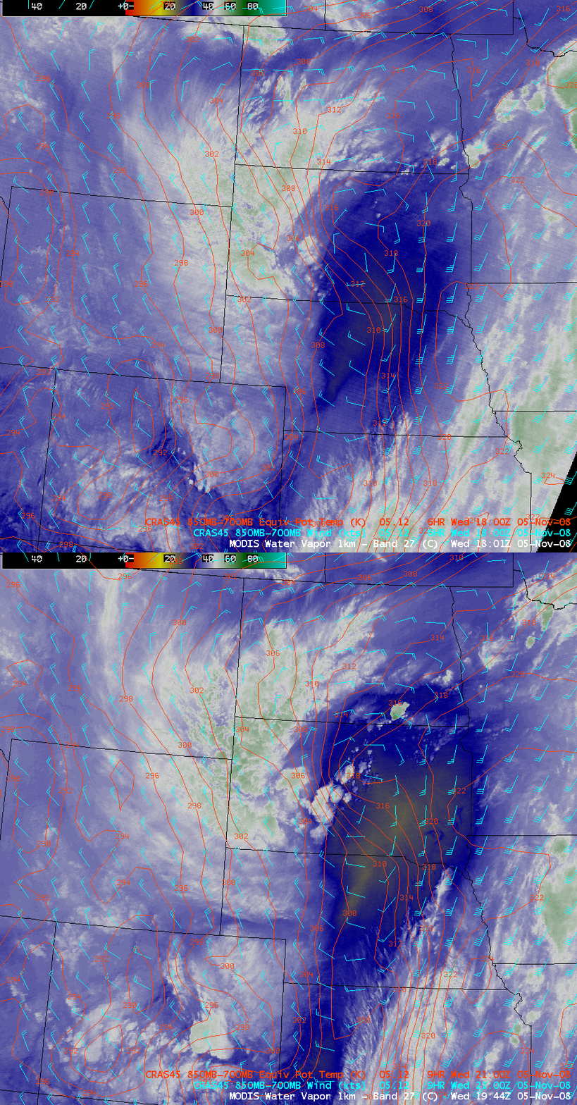
Taking a closer look at the Great Plains blizzard, AWIPS images of the MODIS 6.7 µm water vapor channel (below) revealed an intensifying dry slot that was moving northward across Nebraska and South Dakota on 05 November. CRAS model fields of the 850-700 hPa layer equivalent potential temperatures (red contours) suggested that a Trough of Warm Air Aloft (TROWAL) was in the process of forming over central South Dakota, which was helping to fuel a line of new convective development around 19 UTC.
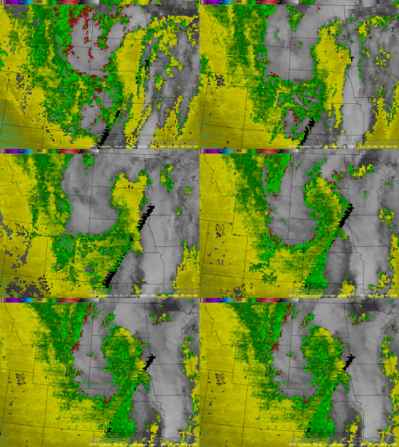
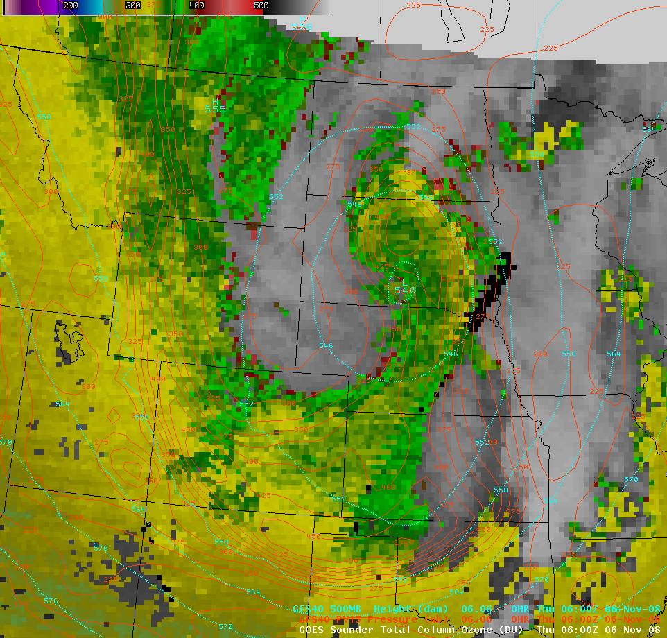
Several hours later, the GOES sounder Total Column Ozone product (below) revealed a tongue of higher ozone values (around 350 Dobson Units, green colors) surging northward from Nebraska into central South Dakota.
This higher-ozone feature was apparently associated with a potential vorticity (PV) anomaly (below), with the dynamic tropopause (taken to be the pressure of the 1.5 Potential Vorticity Unit surface, red contours) being brought downward to near the 500 hPa pressure level over north-central South Dakota at 06 UTC on 06 November. The approach of this PV anomaly may have played a role in further intensification of the blizzard later that day.
Around this time, the NWS forecast office at Rapid City noted that the TROWAL (below, as seen in GFS model 300-310 K layer equivalent potential temperatures, red contours) was also becoming better defined, stretching southwestward across North Dakota into western South Dakota:
AREA FORECAST DISCUSSION FOR WESTERN SD AND NORTHEASTERN WY
NATIONAL WEATHER SERVICE RAPID CITY SD
229 AM MST THU NOV 6 2008.DISCUSSION…DEEP CYCLONE CENTERED ACROSS CENTRAL SOUTH DAKOTA WITH WIDESPREAD BLIZZARD CONDITIONS ACROSS WESTERN SOUTH DAKOTA.
WINDS GUSTING TO 78 MPH IN THE RAPID CITY AREA. MOST OTHER LOCATIONS GUSTING TO 60-65 MPH…EVEN IN CUSTER. TROWAL WRAPPED ACROSS NORTH DAKOTA INTO WESTERN SOUTH DAKOTA…AIMED AT THE BLACK
HILLS.
Finally, Tropical Storm Paloma: GOES-12 IR images with an overlay of ASCAT winds from the CIMSS Tropical Cyclones site (below) showed a series of convective bursts having cold cloud temperatures along with a well-defined wind field associated with the intensifying tropical cyclone.


