Mountain wave “banner cloud” over Montana
GOES-15 (left) and GOES-13 (right) 6.5 µm water vapor channel images (click image to play animation)
McIDAS images of 4-km resolution GOES-15 (GOES-West) and GOES-13 (GOES-East) 6.5 µm water vapor channel images (above; click image to play animation) showed a well-defined high altitude mountain wave cloud (or “banner cloud”) immediately downwind of the high elevations of the Rocky Mountains in western Montana on 01 March 2013.
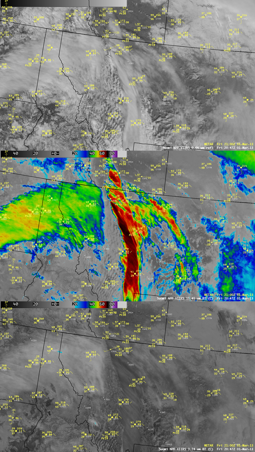
A comparison of AWIPS images of 1-km resolution Suomi NPP VIIRS 0.64 µm visible channel, 11.45 µm IR channel, and 3.74 µm shortwave IR channel image at 20:47 UTC (below) revealed that this banner cloud exhibited 11.45 µm IR cloud top brightness temperatures as cold as -70º C (darker black color enhancement), yet on the 3.74 µm shortwave IR image the cloud top brightness temperatures were as warm as +24º C. These very warm shortwave IR brightness temperature values indicated that the banner cloud was composed of ice crystals that were quite small, and were thus very efficient reflectors of incoming solar radiation (reference: Ackerman, S. A., C. C. Moeller, K. I. Strabala, H. E. Gerber, L. E. Gumley, W. P. Menzel, and S-C Tsay, 1998: Retrieval of Effective Microphyscial Properties of Clouds: a Wave Cloud Case Study, Geophys. Res. Lett., 25, 1121-1124.)

Suomi NPP VIIRS 0.64 µm visible channel, 11.45 µm IR channel, and 3.74 µm shortwave IR channel images
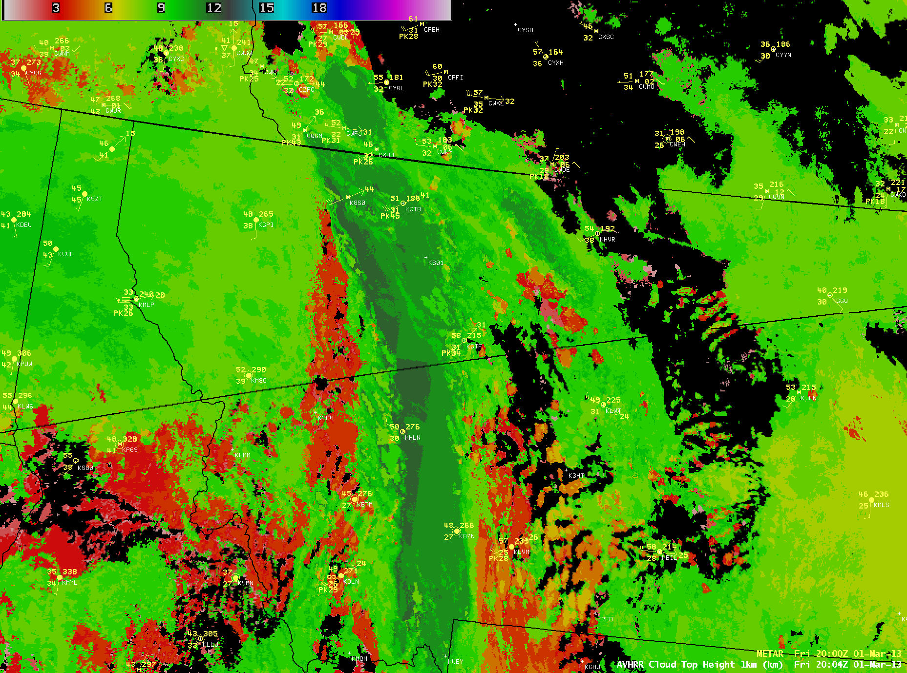
The 1-km resolution POES AVHRR Cloud Top Height product (below) indicated that portions of this banner cloud were as high as 12 km (or around 39,000 feet). While an AIRMET had been issued advising of the possibility of moderate turbulence below 20,000 feet across the region, there was one pilot report of moderate turbulence at 38,000 feet earlier in the day at 16:37 UTC in the vicinity of the banner cloud.
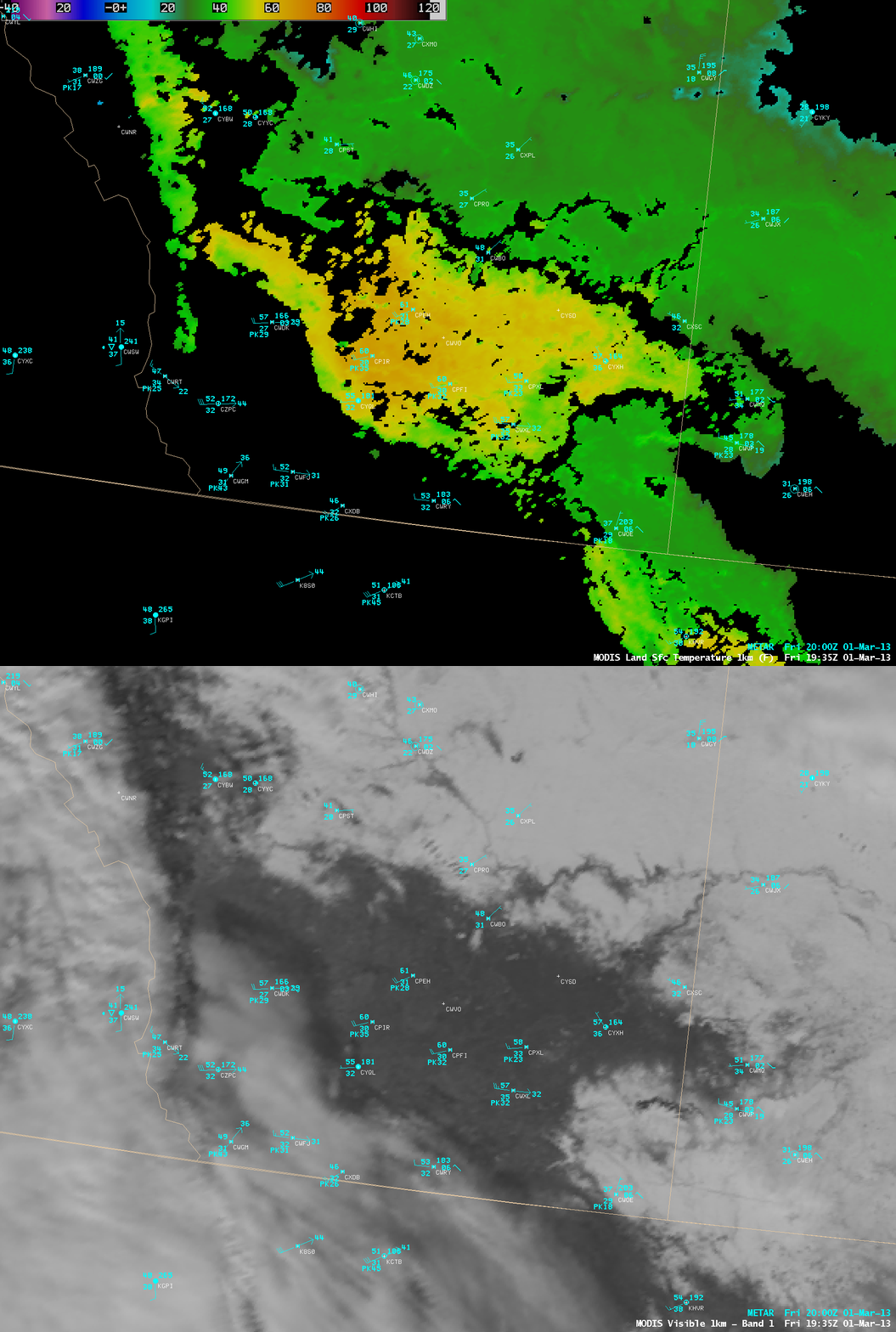
Strong westerly to southwesterly winds flowing across the higher elevations of the Rocky Mountains were causing a chinook wind event to occur, as adiabatic compression of the downsloping winds warmed the air. Some of the warmest surface air temeratures were seen in areas of southern Alberta, Canada that were free of snow cover — in that region MODIS Land Surface Temperature values exceeded 60º F (below).
===== 02 March Update =====
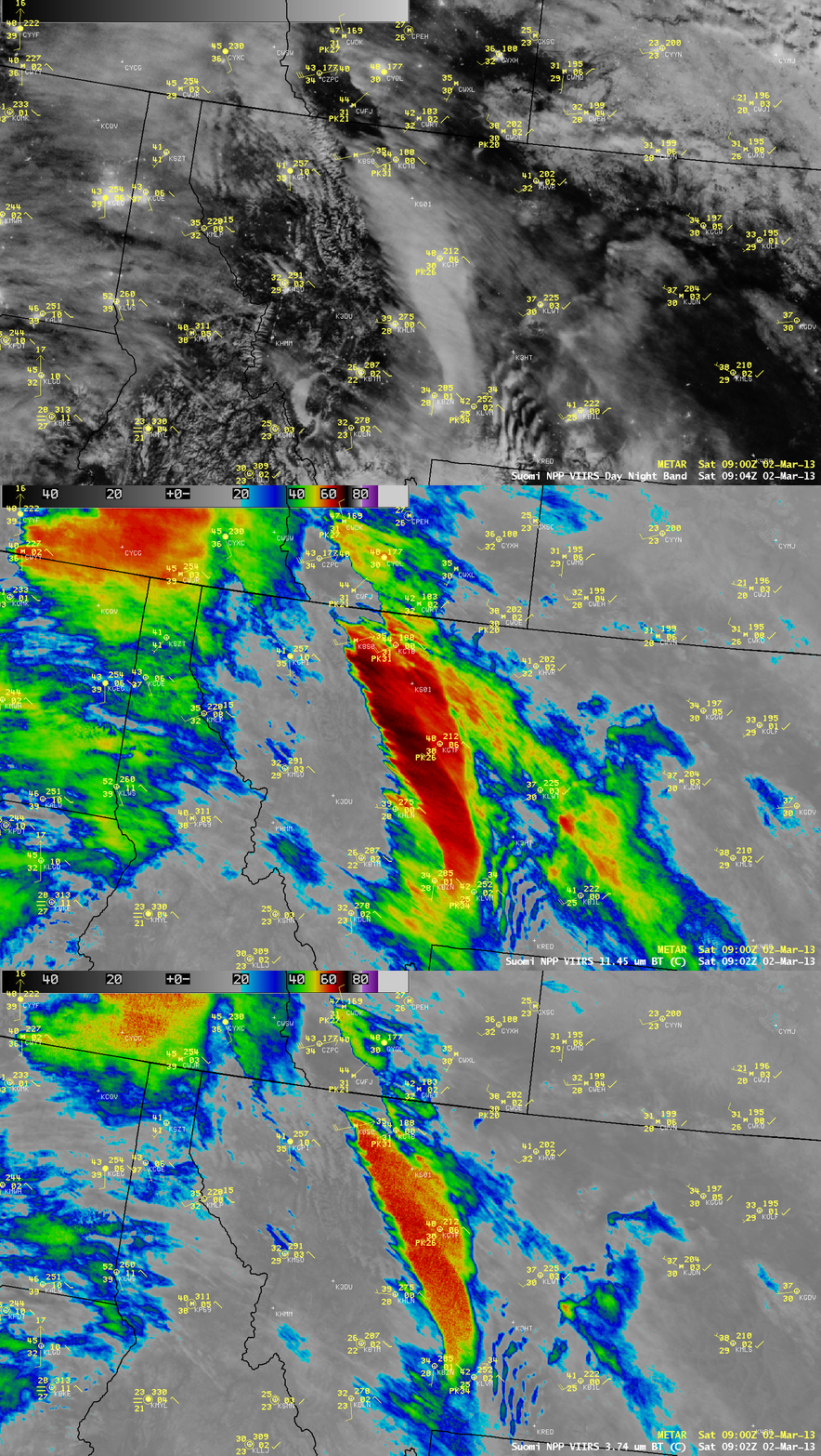
In a night-time comparison of Suomi NPP VIIRS 0.7 µm Day/Night Band, 11.45 µm IR channel, and 3.74 µm shortwave IR channel images at 09:02 UTC or 3:02 AM local time (below), note that in the absence of reflcted sunlight the coldest shortwave IR brightness temperatures seen within the banner cloud (-63º C) were much closer to those seen on the 11.45 µm IR image (-69º C).


