Historic Late April Nor’easter Storm
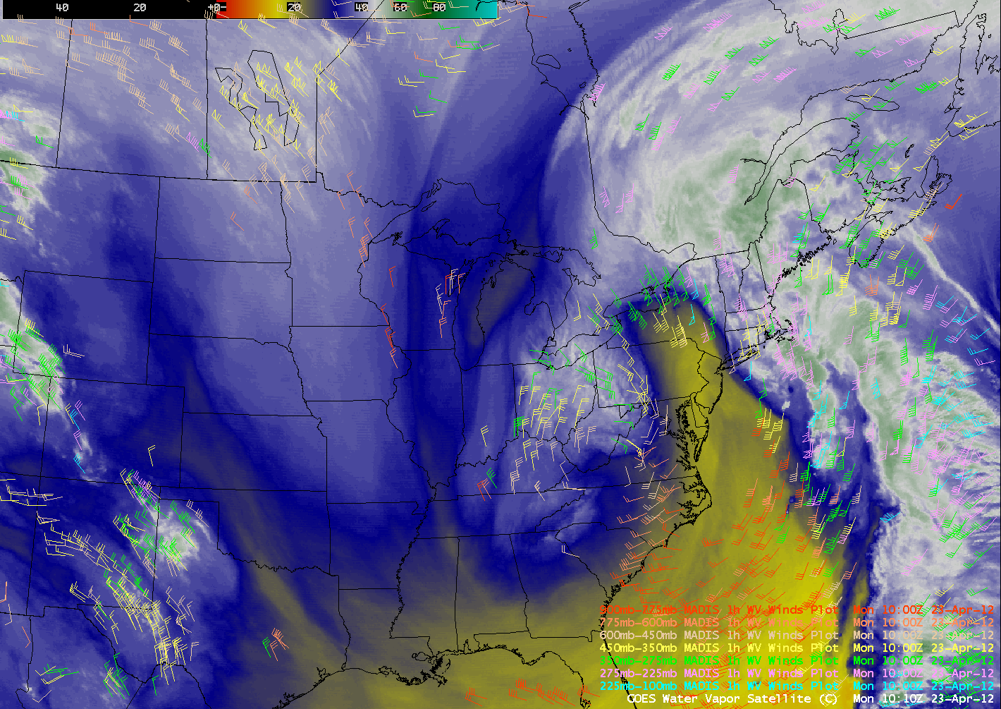
A historic late-April “nor’easter” storm affected much of the northeastern US during the 22 April – 23 April 2012 period. This storm produced heavy snowfall (as much as 23.3 inches at Laurel Summit, Pennsylvania), heavy rainfall (as much as 5.74 inches at New Boston, New Hampshire), and wind gusts as high as 94 mph at Mount Washington, New Hampshire. AWIPS images of 4-km resolution GOES-13 6.5 µm water vapor channel images (above; click image to play animation) showed the development of various features of the storm on 23 April, including a large and well-defined comma head, dry slot, and deformation zone.
By tracking the movement of various water vapor image features between consecutive images, atmospheric motion vectors can be calculated which give an indication of the wind direction and wind speed within the middle to upper troposphere. GOES-13 6.5 µm water vapor images with overlays of MADIS 1-hour interval water vapor winds are shown below (click image to play animation).
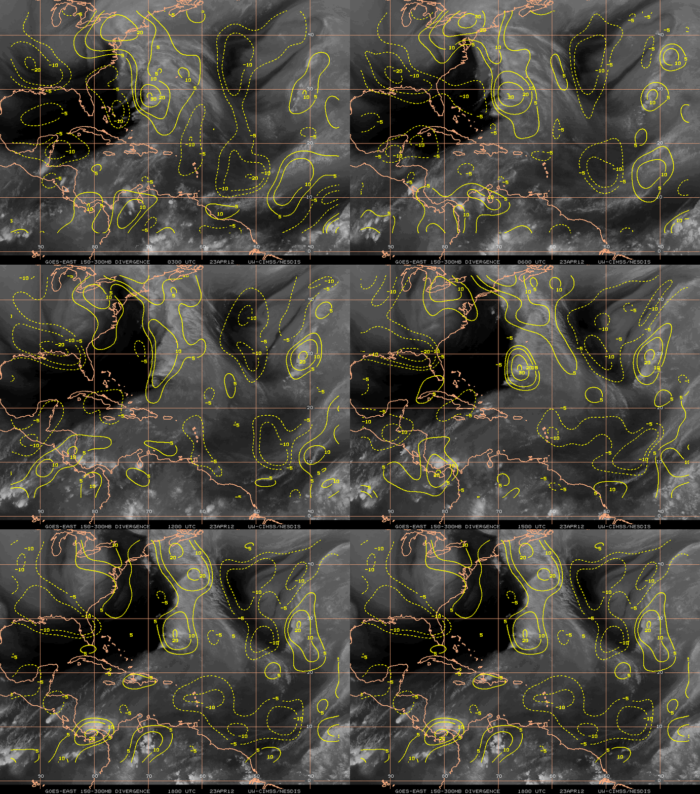
Satellite-derived water vapor winds can also be used to calculate an upper-tropospheric (150-300 mb) divergence product (below), which in this case showed persistent divergence aloft over much of the northeastern US on 23 April. This upper-level divergence created an environment that favored upward vertical motion within the atmospheric column, helping to enhance and prolong the ongoing precipitation over those areas.
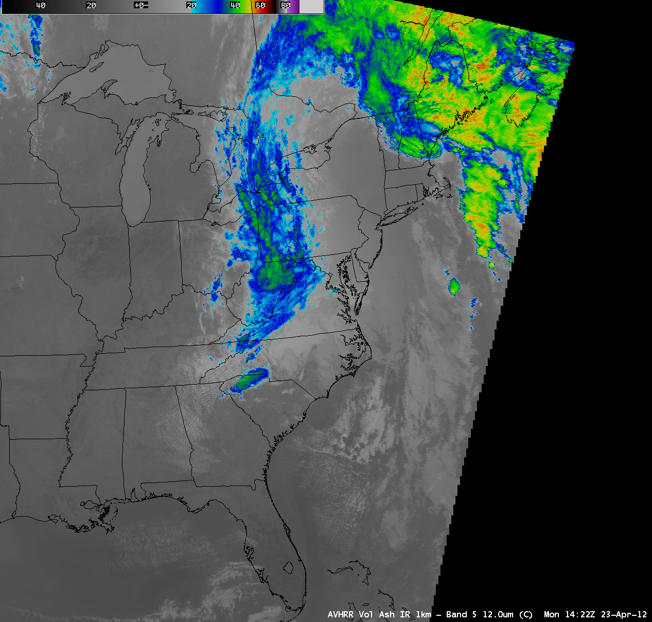
A series of 1-km resolution MODIS 11.0 µm IR and POES AVHRR 12.0 µm IR images (below; click image to play animation) indicated that enhanced areas of colder clouds (some exhibiting a banding structure) developed over the region of persistent upper level divergence.
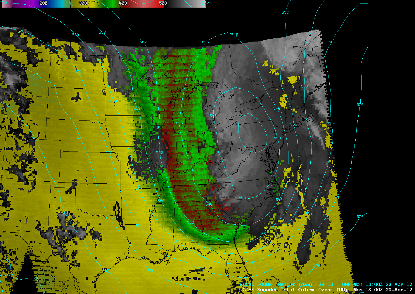
The 10-km resolution GOES-13 sounder Total Column Ozone (TCO) product (below; click image to play animation) revealed an anomalously large area of elevated TCO covering much of the eastern US, indicative of a lowered tropopause associated with the large upper-level trough of low pressure.
===== 24 April Update =====
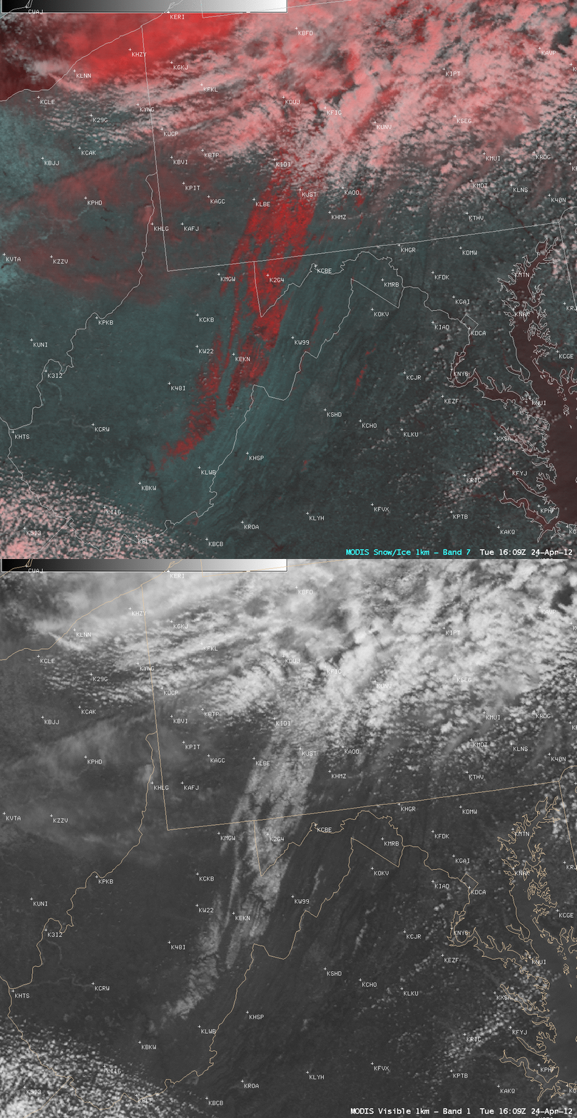
A comparison of the 1-km resolution MODIS 0.65 µm visible channel image at 16:09 UTC (12:09 pm local time) with a corresponding false-color Red/Green/Blue (RGB) image created using the MODIS 2.1 µm “snow/ice detection” channel (above) helped to identify high-elevation areas with significant snow cover remaining after the passage of the storm — snow appears brighter white on the visible image, and darker red on the false-color image. Note that cirrus clouds appear as a lighter shade of red in the RGB image.
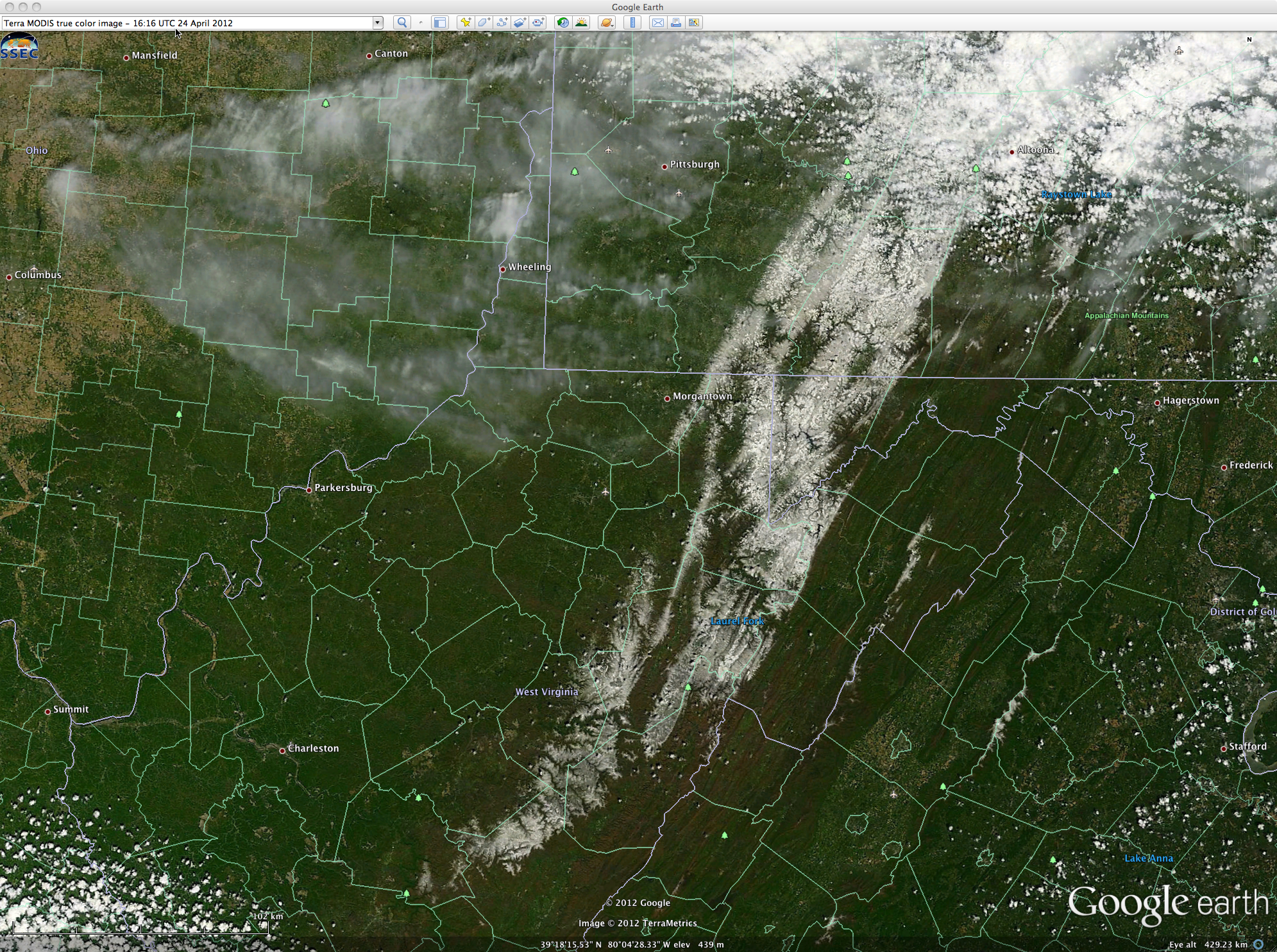
A 250-meter resolution MODIS true color image from the SSEC MODIS Today site (below; viewed using Google Earth) showed even better detail of the snow-covered high terrain.


