Severe weather outbreak across the central US
A major outbreak of severe thunderstorms occurred across parts of the central US during the 14 April – 15 April 2012 period, producing widespread tornadoes, large hail, and damging winds (SPC storm reports). Noteworthy events included a tornado that produced EF-4 damage at Kanopolis Lake, Kansas, hail up to 4.5 inches in diameter at Randolph, Kansas, and a wind gust to 97 mph at Oskaloosa, Iowa. Six fatalities resulted from an EF-3 rated tornado that struck Woodward, Oklahoma.
1-km resolution GOES-13 0.63 µm visible channel images (above; click image to play animation; also available as a QuickTime movie) showed a number of overshooting tops associated with some of the stronger thunderstorms. A large plume of blowing dust can also be seen toward the end of the animation, moving northeastward across New Mexico and eventually over the Texas and Oklahoma panhandle regions.
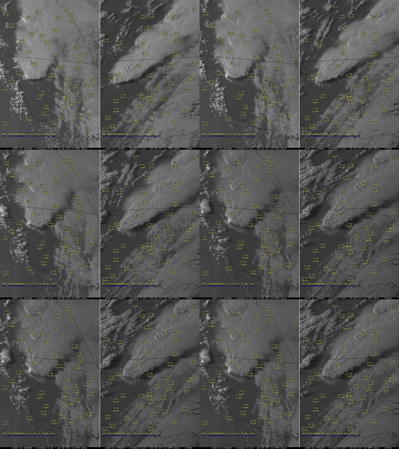
A closer look at a strong thunderstorm in northwestern Oklahoma using 0.63 µm visible channel images from GOES-15 (GOES-West) and GOES-13 (GOES-East) (below) showed the development of bands of inflow feeder clouds along the southern edge of the storm — this satellite signature is often seen prior to the time that a supercell storm is about to begin a period of intensification. GOES-13 was in Rapid Scan Operations (RSO) mode, providing images twice as often as GOES-15; this allowed the development of the inflow feeder bands to be more easily identified and followed using GOES-13. This particular storm went on to produce the large tornado that inflicted EF-3 damage in the Wichita, Kansas area.
4-km resolution GOES-13 10.7 µm IR channel images (below; click image to play animation; also available as a QuickTime movie) revealed that a large number of storms exhibited well-defined “enhanced-V” signatures (an indicator that a storm has a high probability of producing tornadoes, large hail, or damaging winds). The GOES-13 satellite was placed into Rapid Scan Operations (RSO) mode, providing images as frequently as every 5-10 minutes from 15:45 UTC on 14 April to 01:15 UTC on 15 April.
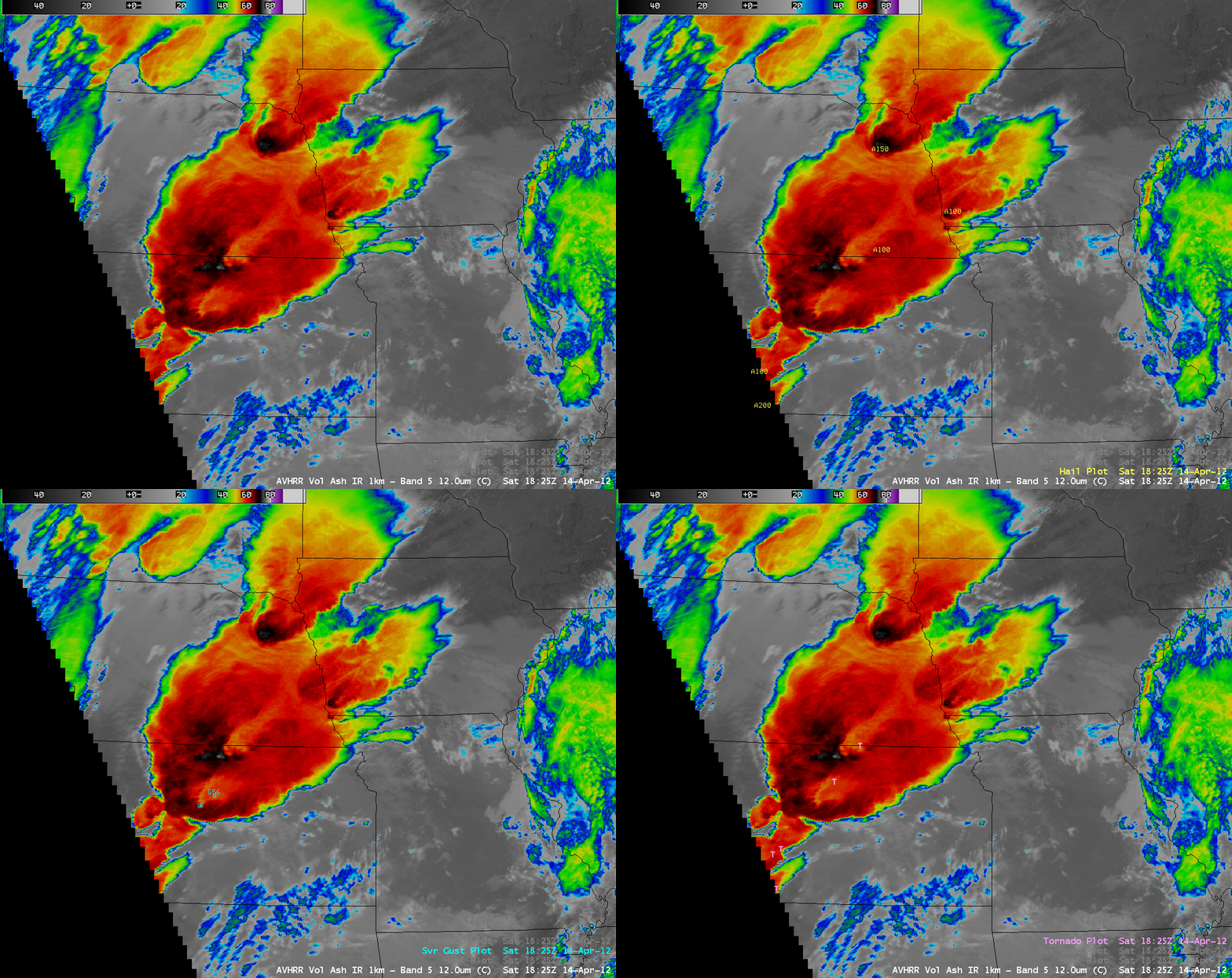
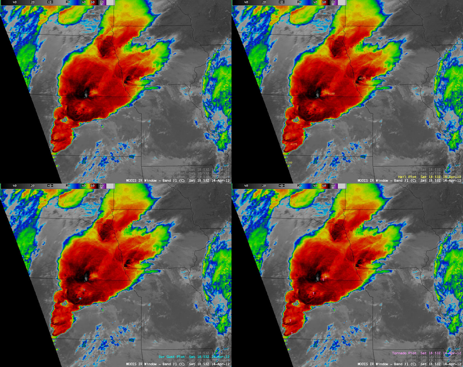
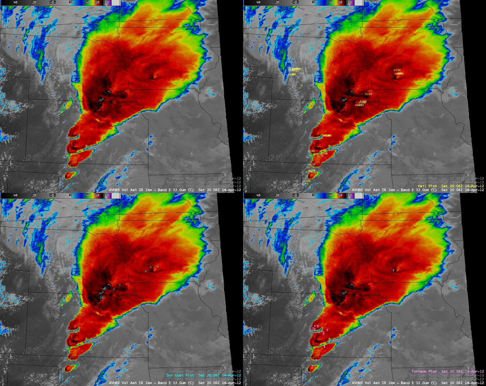
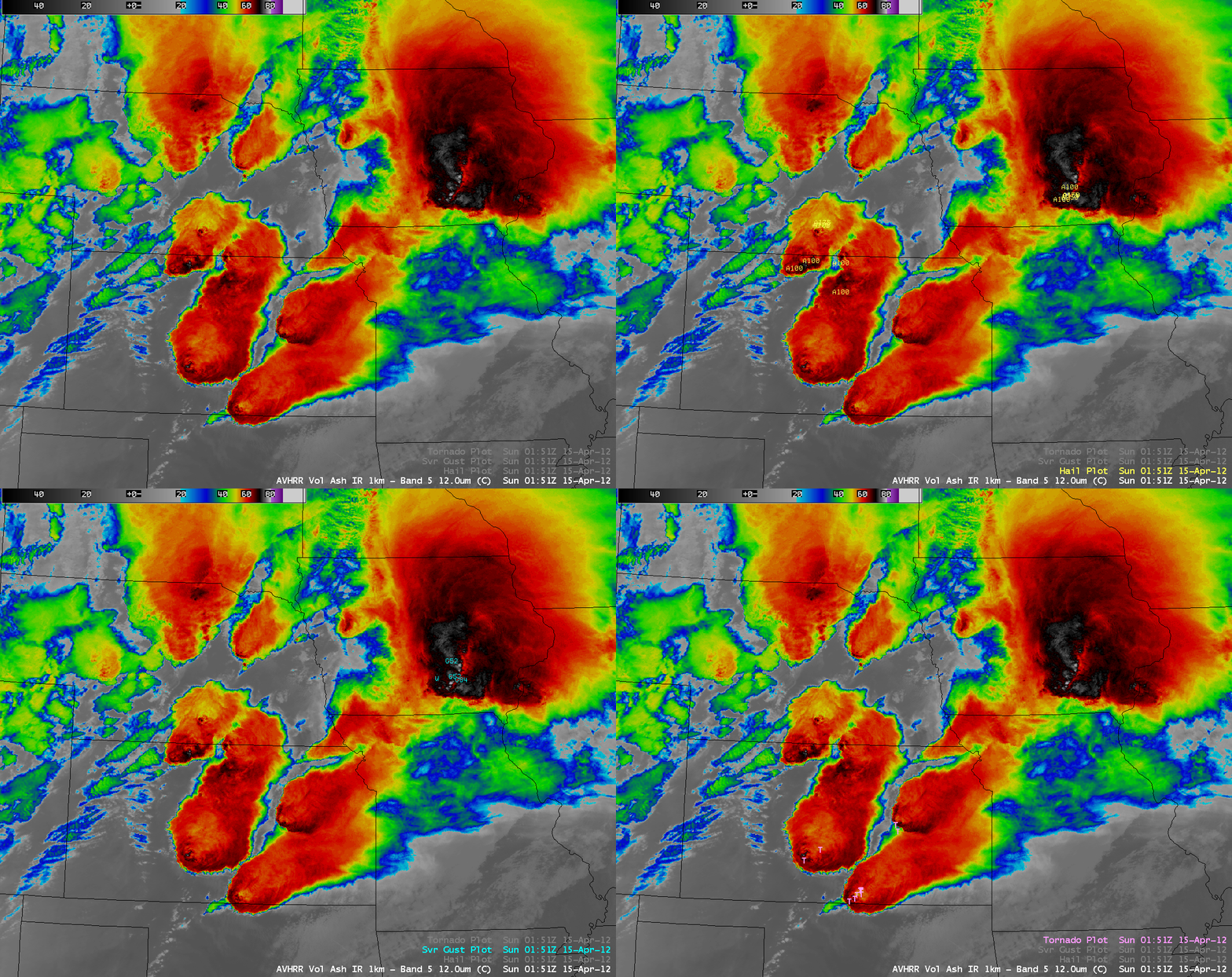
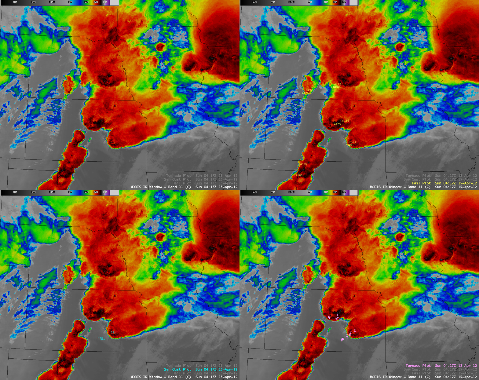
Shown below is a sequence of five separate 1-km resolution MODIS 11.0 µm IR channel or POES AVHRR 12.0 µm IR channel images, with overlays of SPC storm reports of large hail, damaging winds, and tornadoes within +/- 30 minutes of the image time. Many of the enhanced-V signatures were much more detailed in the higher spatial resolution IR imagery.
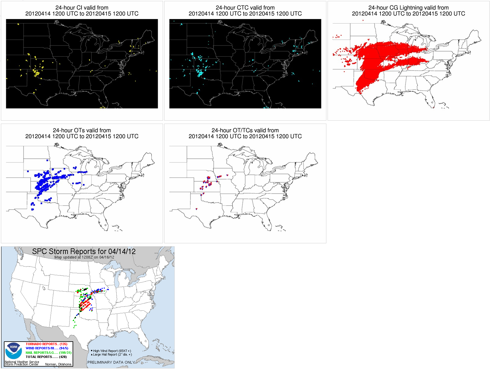
A display of maps of the University of Wisconsin Convective Initiation (CI), Cloud Top Cooling (CTC) rate, Overshooting Top (OT), and Overshooting Top/Thermal Couplet (OT/TC) automated detection products showed a good correlation with the map of plotted SPC storm reports (below).
Finally, a comparison of 375-meter resolution Suomi NPP VIIRS 0.64 µm visible channel, 11.45 µm IR channel, and 3.74 µm shortwave IR channel images centered near the Dodge City, Kansas (KDDC) area (below) showed a pair of well-defined “enhanced-V” signatures (with cold/warm thermal couplet IR brightness temperatures in excess of 25º C), which also exhibited anvil plumes extending downwind (to the northeast) of the vertex of each enhanced-V. The enhanced-V storm just to the southeast of Dodge City was producing a tornado and 1.75-inch diameter hail at the time of the VIIRS images. In addition, the IR and shortwave IR images revealed a number of southwest-to-northeast oriented swaths of cooler ground (lighter gray enhancement) due to heavy rainfall from the recent passage of thunderstorms.

Suomi NPP VIIRS 0.64 µm visible channel, 11.45 µm IR channel, and 3.74 µm shortwave IR channel images
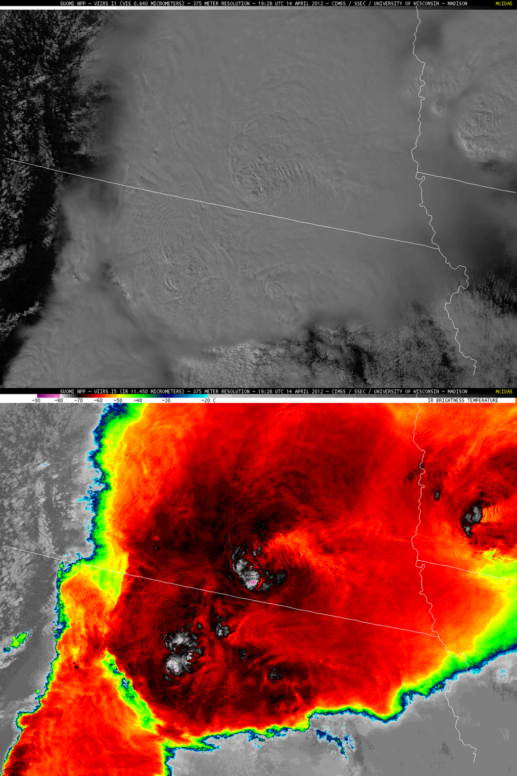
Farther to the northeast, a comparison of 375-meter resolution Suomi NPP VIIRS 0.64 µm visible channel and 11.450 µm IR channel images (below) showed that the thunderstorms over northeastern Kansas, southeastern Nebraska, and southwestern Iowa were exhibiting well-defined overshooting tops, with packets of concentric anvil-top gravity waves propagating away from some of the strongest overshooting top features. The satellite detected a cloud top IR brightness temperature as cold as -85º C (purple color enhancment) associated with the overshooting top over far southern Nebraska.
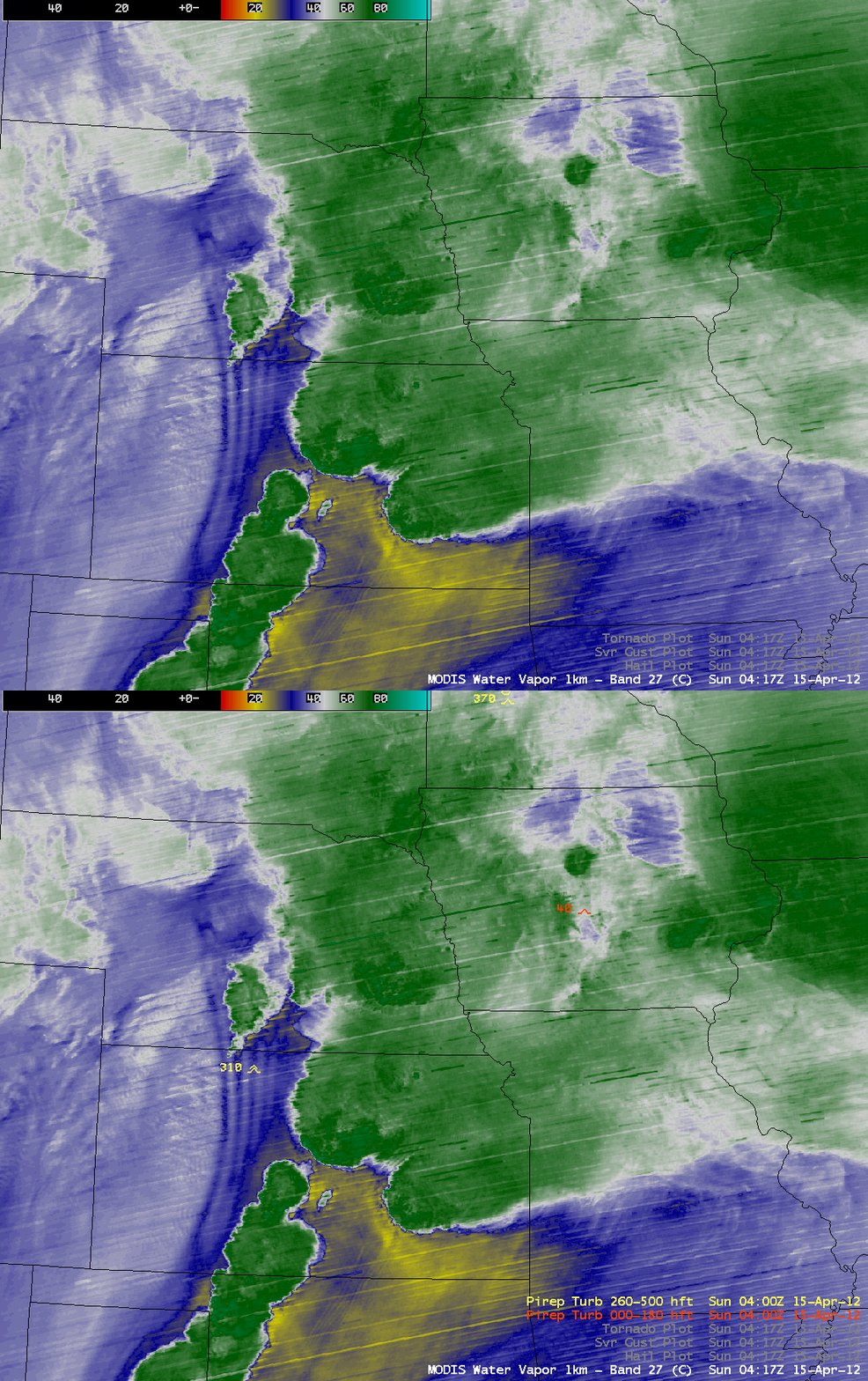
On a side note, it is interesting to point out that a 1-km resolution MODIS 6.7 µm water vapor channel image at 04:17 UTC (below) displayed an elongated north-to-south oriented wave packet from Nebraska into Kansas — and there was a pilot report of severe turbulence at a flight altitude of 31,000 feet over this water vapor wave signature. These waves were not seen in the corresponding 04:17 UTC MODIS IR image, implying that they were likely located within the middle troposphere (GOES-13 water vapor weighting function plot).
4-km resolution 6.5 µm water vapor channel images from GOES-15 (GOES-West) and GOES-13 (GOES-East) (below; click image to play animation) suggested that this gravity wave may have formed in response to pronounced middle-tropospheric subsidence/drying related to the formation of a strong rear flank downdraft along the trailing edge of the thunderstorm that was located in central Kansas around 01:00 UTC (schematic diagram from Lemon and Doswell, 1979). This packet of waves generally remained quasi-stationary, but did begin to move westward around the time of the pilot report of severe turbulence. However, it is also possible that the severe turbulence was due to the aircraft’s proximity to a rapidly-developing thunderstorm in south-central Nebraska.


