Strong winds affect southcentral and eastern Alaska
McIDAS images of 4-km resolution GOES-15 6.5 µm water vapor channel data (above; click image to play animation) showed an intense upper level shortwave trough of low pressure moving northeastward across southcentral and eastern Alaska on 18 December 2011. Strong southerly flow associated with this system brought unseasonably warm air into the region, with Anchorage (station identifier PANC) reaching a daily maximum temperature of 45º F (one degree F shy of their record high for the date), and Big Delta (station identifier PABI) tied their daily record high of 37º F. Strong winds were also experienced with this disturbance, with surface winds gusting in excess of 100 mph in southcentral Alaska. It is also interesting to note the development of a small westward-propagating “wave feature” at the end of the water vapor animation near Tanana (station identifier PATA).
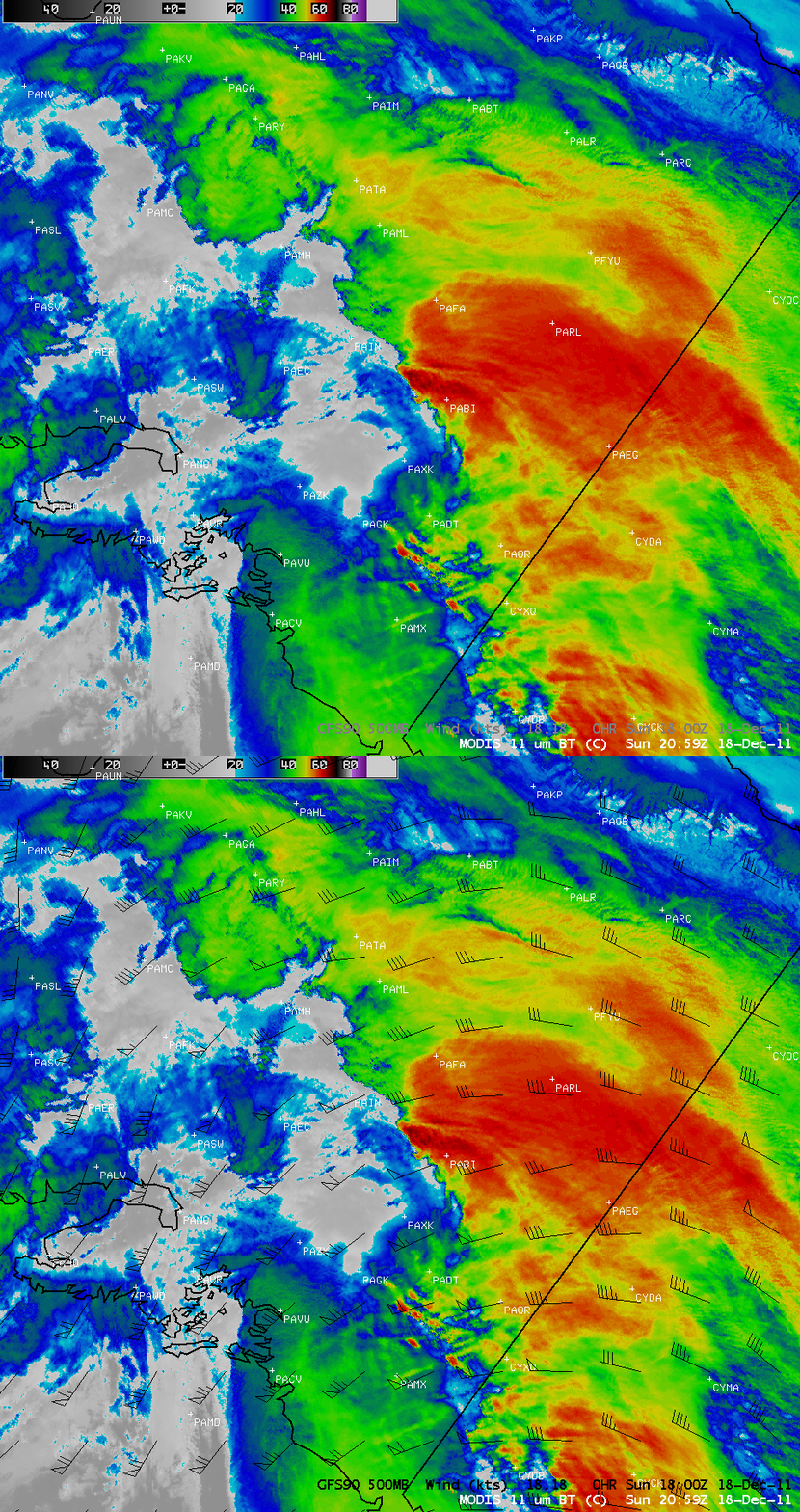
Over eastern Alaska the water vapor images also showed a large orographic “banner cloud” that formed downwind of the high terrain of the Alaska Range. A closer look at this banner cloud feature can be seen using an AWIPS image of 1-km resolution MODIS 11.0 µm IR channel data with an overlay of GFS model 500 hPa winds (below). The coldest MODIS IR brightness temperatures along the leading edge of the banner cloud were -65º C, which was just a few degrees colder than the tropopause temperature on the 12:00 UTC Anchorage rawinsonde data. The winds aloft then turned anticyclonically, carrying some of the banner cloud materail eastward into the Yukon Territory of Canada.
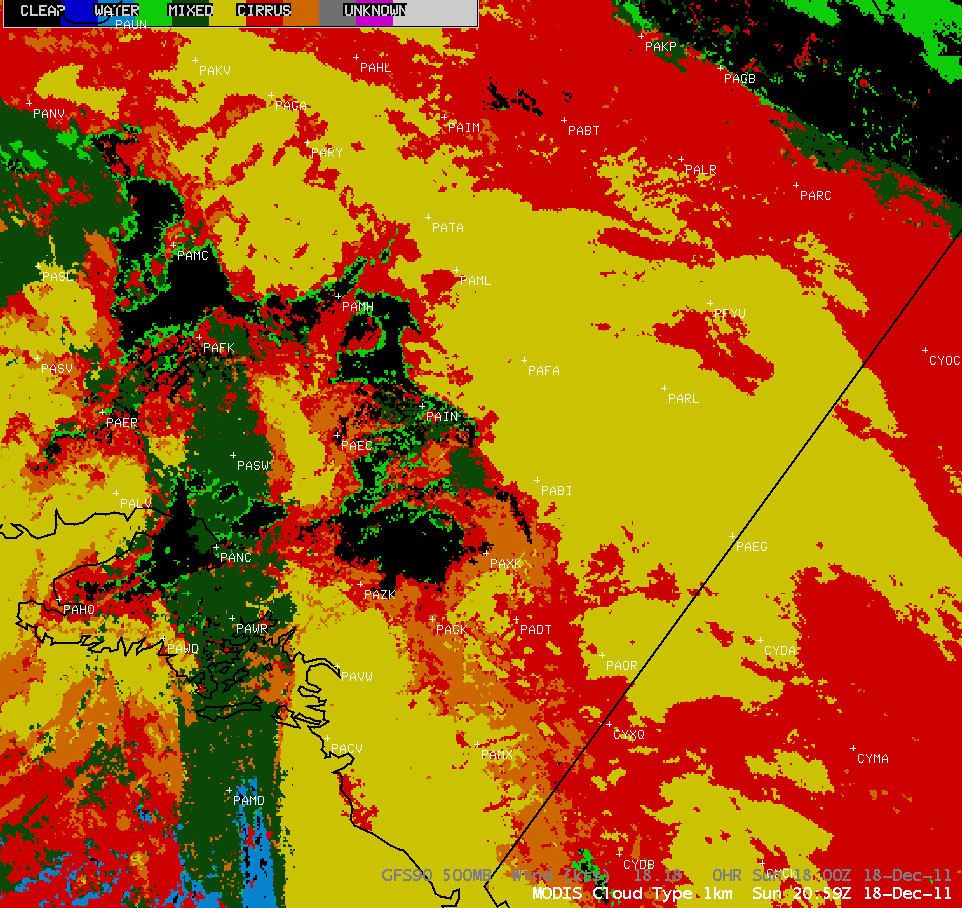
The corresponding 1-km resolution MODIS Cloud Type product (below) indicated that much of this banner cloud was of the “opaque ice” category (yellow color enhancement).
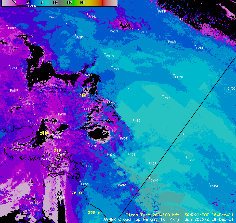
The 1-km resolution POES AVHRR Cloud Top Height product (below) indicated that the highest portions of the banner cloud feature were in the 10-11 km range.
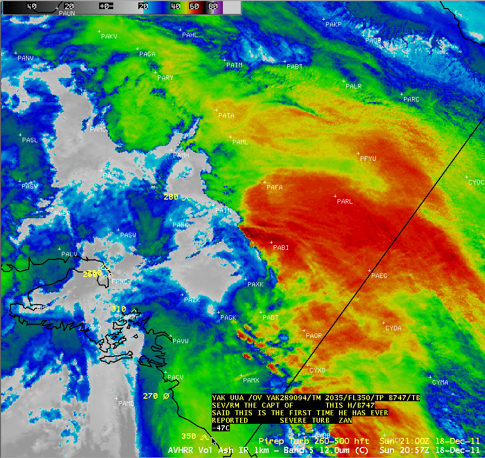
As an interesting aside, a Boeing 747 flying just off the coast of Alaska encountered severe turbulence at a flight level of 35,000 feet — the captain of the aircraft “said this was the first time he has ever reported severe turbulence” (below).
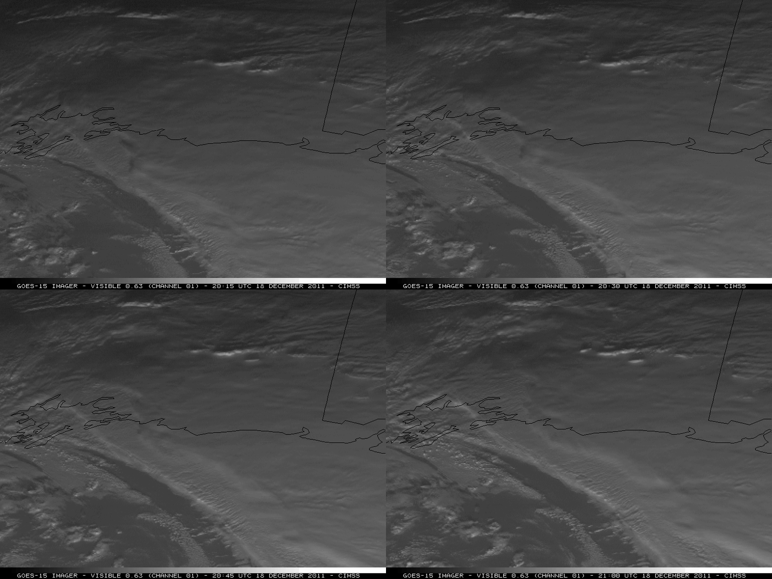
Note on the GOES-15 water vapor images shown above that this area was near the leading edge of an advancing dry slot — and 1-km resolution GOES-15 0.63 µm visible channel images (below) depicted a few cloud features resembling banded convective cells along the trailing edge of the cloudiness just ahead of the dry slot. These convective bands (or the strong deformation axis seen developing on the water vapor imagery) may have been responsible for producing high-altitude turbulence across that region.


