Pyrocumulus clouds and dense smoke from fires in Georgia
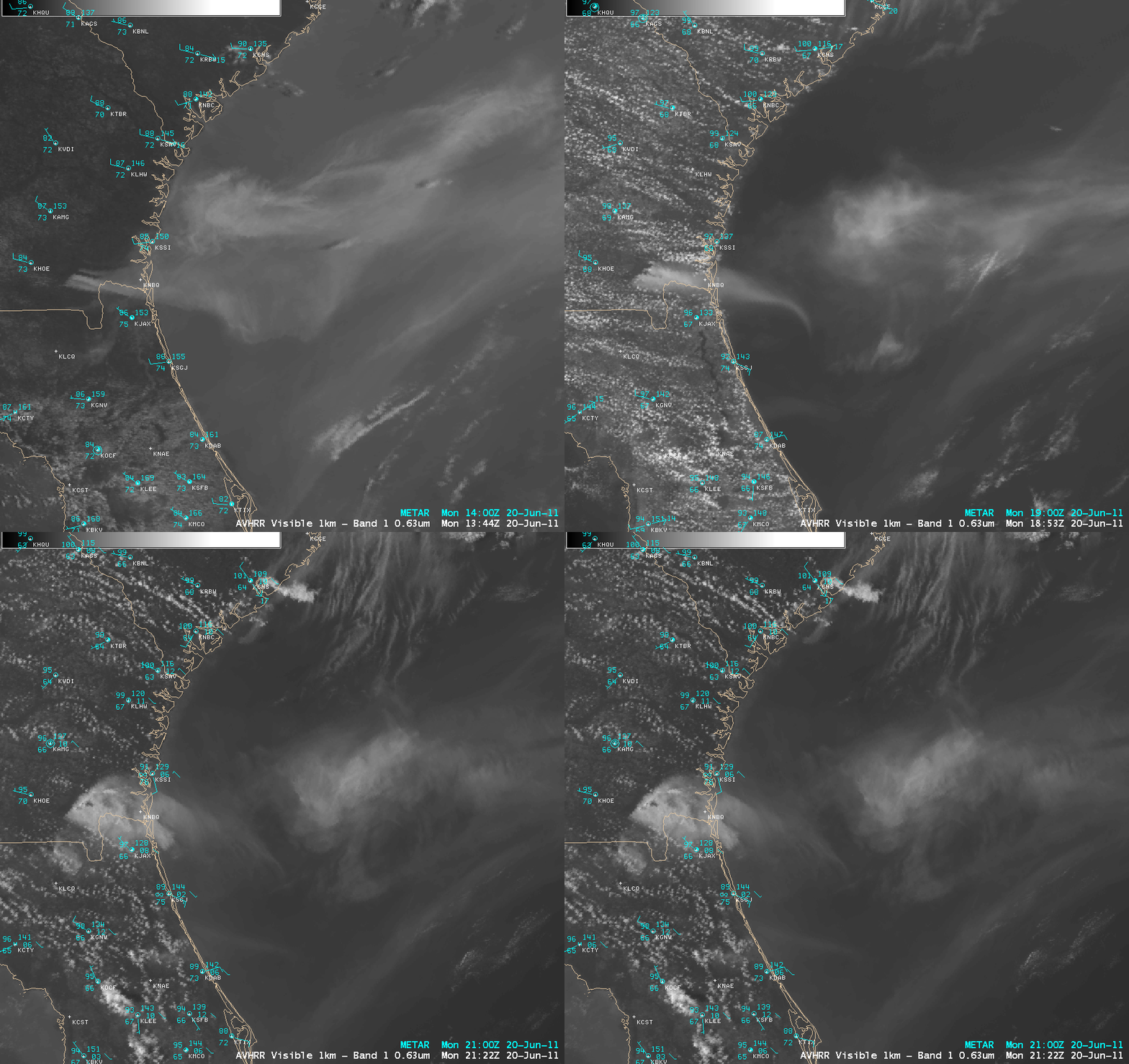
McIDAS images of GOES-13 0.63 µm visible channel data (above; click image to play animation) revealed numerous pyrocumulus clouds and large areas of very dense smoke associated with the “Honey Prairie Fire” in the Okefenokee Swamp area of southeastern Georgia on 20 June 2011. The shadows cast by the pyrocumulus towers almost resembled those cast by overshooting tops which are often seen on the anvil tops of severe thunderstorms.
A sequence of 3 AWIPS images of POES AVHRR 0.63 µm visible channel data (below) offered a larger-scale view of the smoke as it drifted eastward across the adjacent offshore waters of the Atlantic Ocean. The shadow cast by a pyrocumulus tower could be seen on the final 21:22 UTC image. As expected, this dense smoke plume exhibited very high Aerosol Optical Depth (AOD) values (see the US Air Quality “Smog Blog” and the NOAA IDEA sites for AOD imagery).
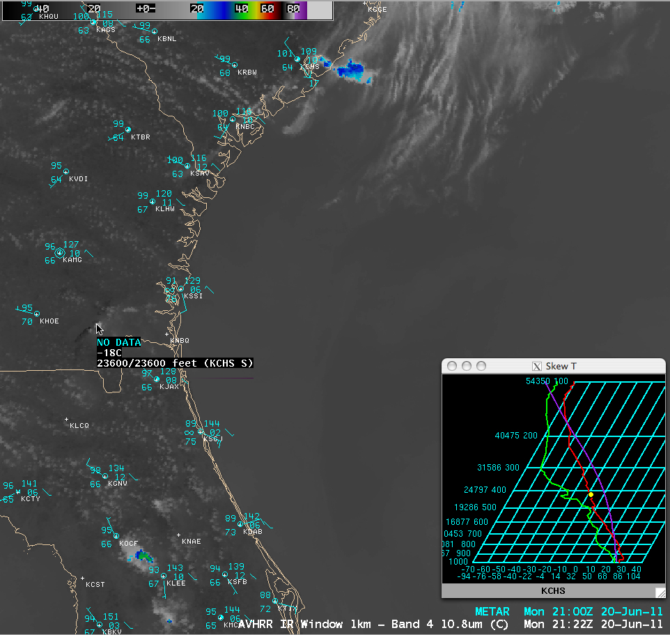
The 21:22 UTC POES AVHRR 10.8 µm IR image (below) showed that the coldest cloud top IR brightness temperatures at that time were -18º C, which corresponded to an altitude of nearly 24,000 feet using the interactive Skew-T diagram with data from the rawinsonde report from Charleston, South Carolina.
=====================================================
On the following day (21 June 2011) the winds were much lighter across the region, so the smoke was not being transported as far eastward over the Atlantic Ocean. In fact, GOES-13 0.63 µm visible channel images (below; click image to play animation) showed that significant amounts of the smoke remained just offshore — so when a sea breeze front began to move inland during the afternoon hours, much of this smoke was brought back inland. For example, at St. Augustine, Florida (surface identifier KSGJ), the surface visibility dropped from 10 miles to 0.75 mile after the surface winds shifted to easterly behind the sea breeze front.
=====================================================
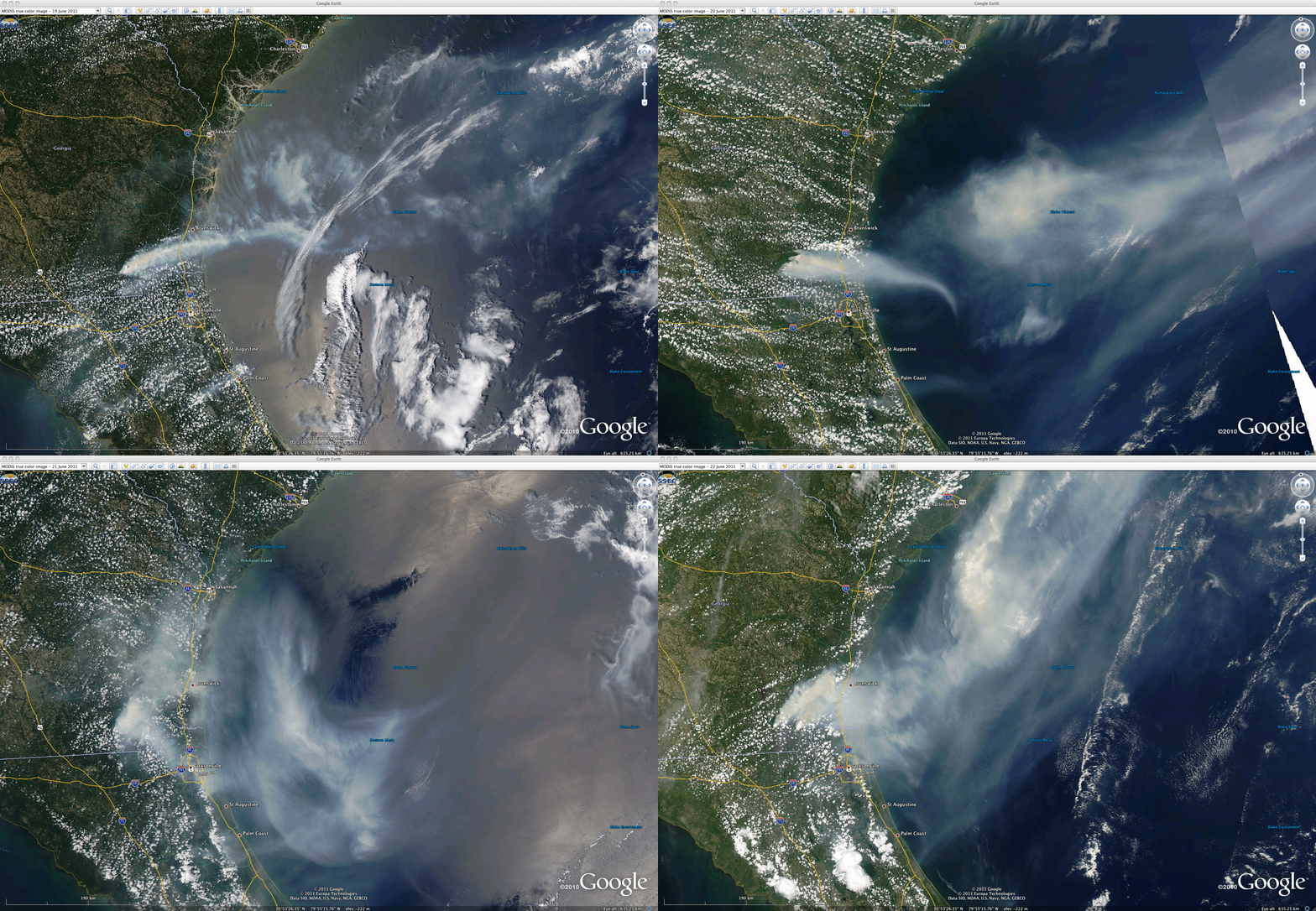
A sequence of 250-meter resolution MODIS true color Red/Green/Blue (RGB) images from the SSEC MODIS Today site (below; displayed using Google Earth) showed varying regimes of transport of the thick smoke on 19 June, 20 June, 21 June, and 22 June 2011.


