Offshore transport of glacial silt from the northern Alaska panhandle

10-minute GOES-18 daytime True Color RGB and nighttime Dust RGB images, from 1930 UTC on 09 December to 1200 UTC on 10 December [click to play MP4 animation]
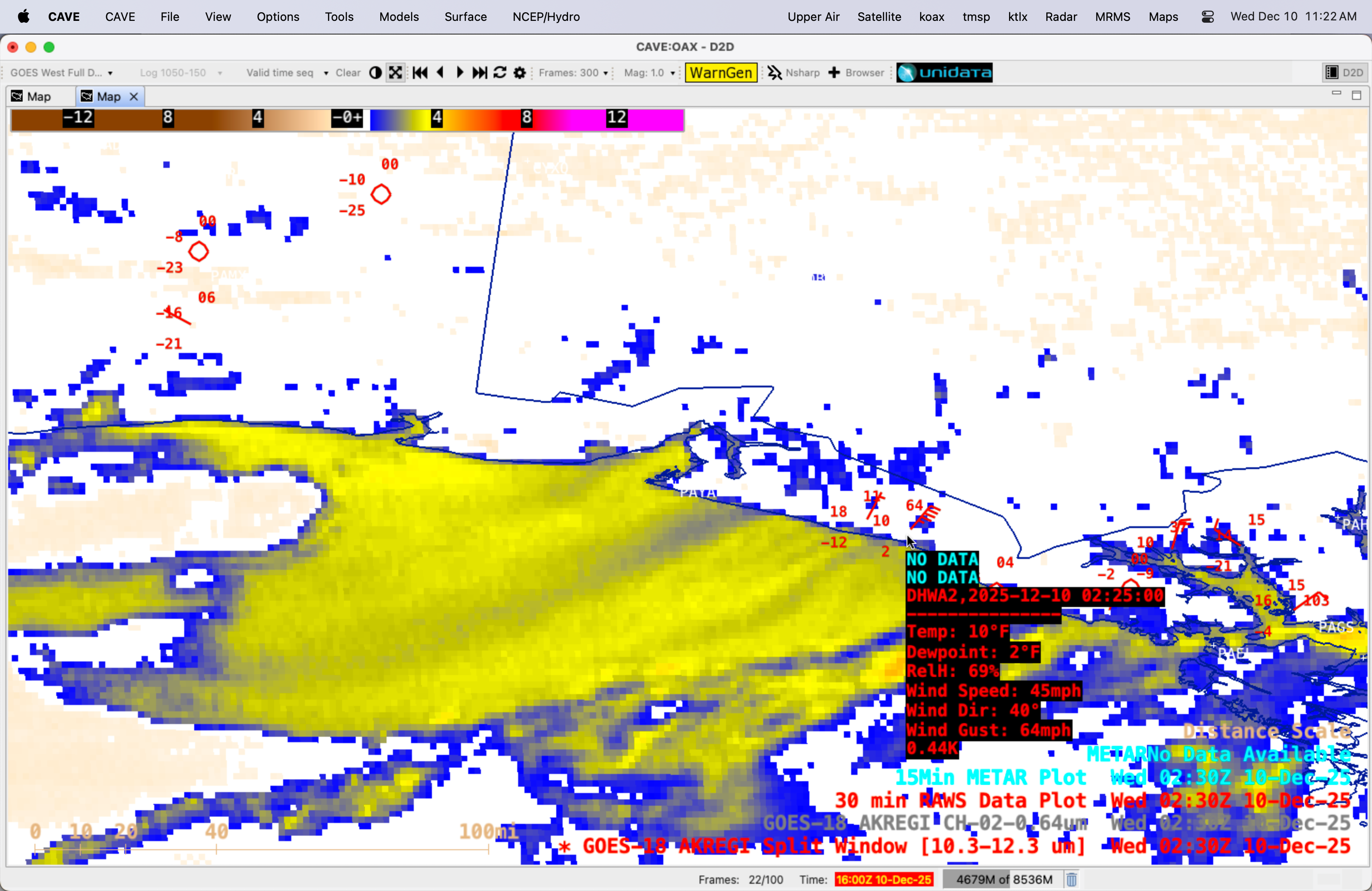
GOES-18 Visible images (below) included plots of METAR and RAWS surface reports — which showed that surface air temperatures at high-elevation inland sites were in the -40s F, compared to around +20 F along the coast. The aforementioned pressure gradient between the cold/dense air inland and the warmer/less-dense air near the coast acted to channel winds through valleys and mountain passes (topography), with these winds accelerating as they approached the coast. During the daytime hours, RAWS site DHWA2 (located 62 miles southeast of Yakutat, PAYA) reported a wind gust to 56 mph at 2225 UTC on 09 December — and after sunset, a wind gust to 64 mph at 0225 UTC on 10 December.

10-minute GOES-18 Visible images, with plots of METAR (cyan) and RAWS (yellow) surface reports, from 1900-2230 UTC on 09 December [click to play MP4 animation]

NOAA-21 VIIRS True Color RGB image valid at 2047 UTC on 09 December [click to enlarge]

NOAA-21 VIIRS Day/Night Band image valid at 1217 UTC on 10 December [click to enlarge]

Metop-B Ultra High Resolution ASCAT winds at 0448 UTC on 10 December
Similar events involving the offshore transport of glacial silt occur from the Copper River Valley in south-central Alaska.