Undular bore over the Gulf of Mexico
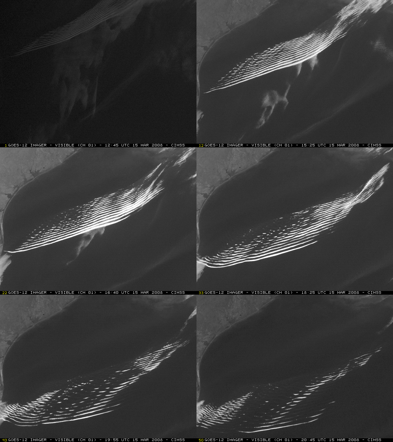
A spectacular gravity wave train (or “undular bore“) was captured on a sequence of GOES-12 visible images (above) as it propagated southward across the northwestern Gulf of Mexico on 15 March 2008; as many as 16 separate cloud bands were evident (denoting individual wave crests along the wave train). Because of severe convection over the southeastern US on that day, the GOES-12 satellite had been placed into Rapid Scan Operations (RSO) mode, allowing images as frequently as every 5 minutes. Note how the patches of marine stratus cloud that were moving northeastward (ahead of the gravity wave train) are seen to dissipate very quickly as they encountered the wave. These undular bore features occur with some regularity over that particular part of the Gulf of Mexico — similar events were noted back in April 2007 and March 1998.
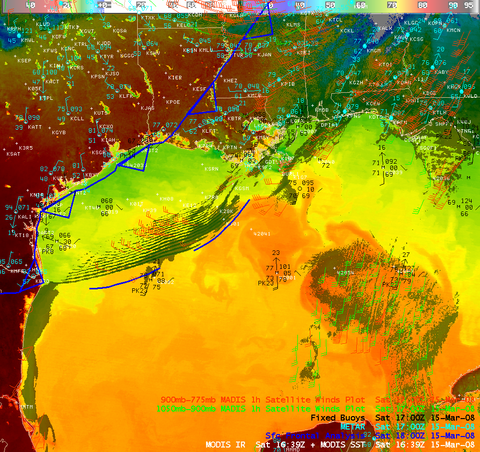
An AWIPS image combination using the MODIS 11.0 µm IR + MODIS sea surface temperature (SST) images (above) revealed that the gravity wave train was moving over increasingly warmer waters as it progressed southward across the Gulf of Mexico. The wave train was located north of a pre-frontal trough axis, and MADIS atmospheric motion vectors in the 900-775 hPa layer (red wind barbs) tracked the feature’s motion at 25-30 knots. The large plume of warmer SST values (75 – 80º F, darker orange colors) is a feature known as the Gulf of Mexico Loop Current (Reference #1 | Reference #2).
The MODIS Aerosol Optical Depth (AOD) product from the SSEC IDEA site (above) indicated the presence of elevated levels of particulate matter over the northwestern Gulf of Mexico on that day (presumably due to smoke from numerous small fires that had been burning across parts of Texas and northern Mexico during the previous day — or was it dust/sand from White Sands, New Mexico??).
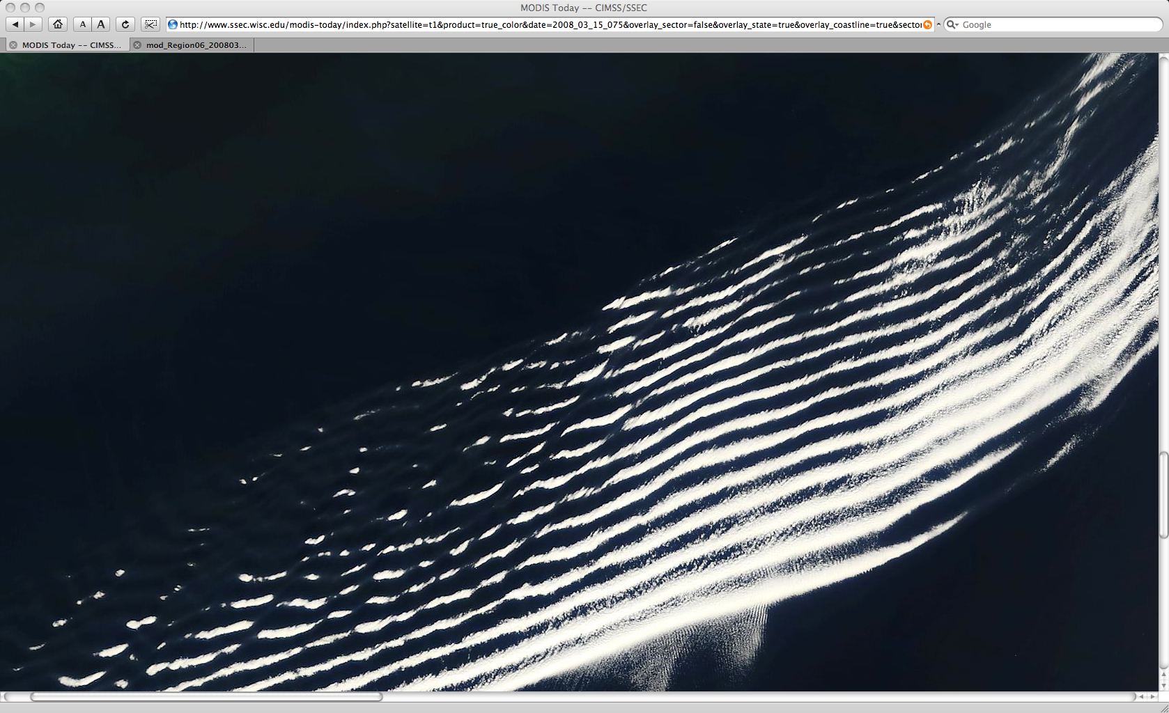
A 250-meter resolution true color image from the SSEC MODIS Today site (below) showed that the wave motions of the gravity wave packet were also acting to organize the airborne smoke/haze aerosols into narrow banded features (similar to the cloud features seen on the GOES visible imagery).


