A West Coast water vapor vortex, an Idaho wildfire, and a North Dakota severe thunderstorm
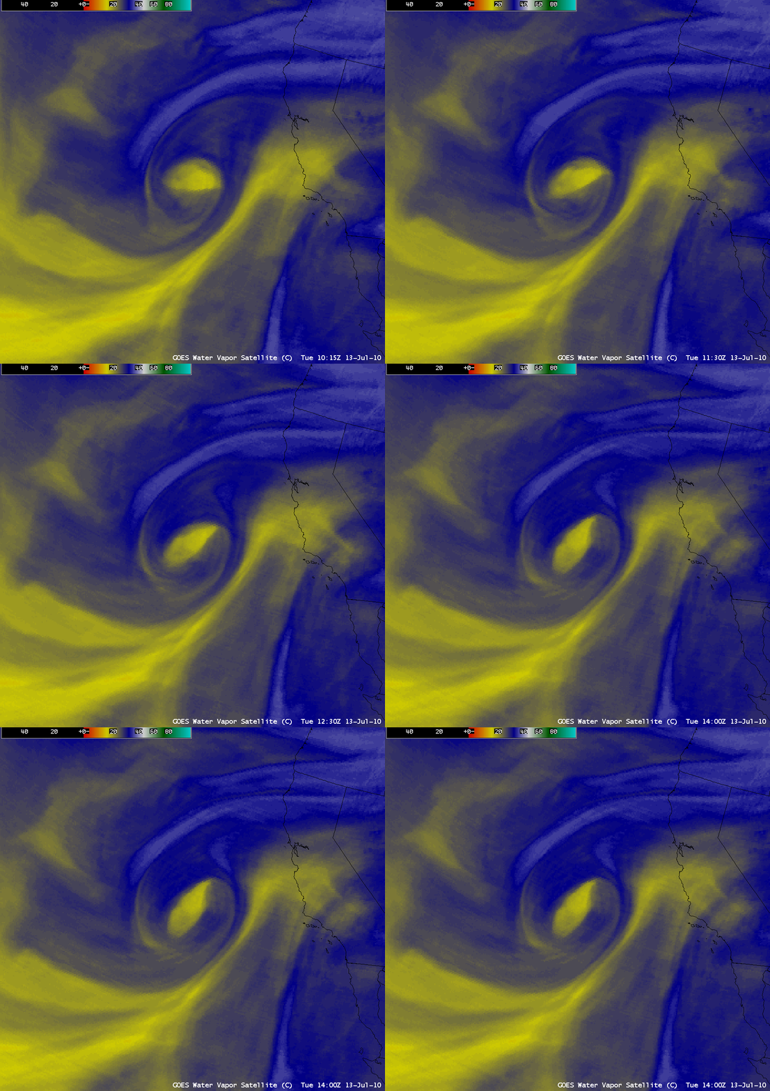
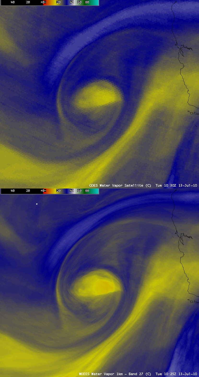
There were three items of interest to discuss that exhibited interesting satellite signatures on 13 July 2010. The first feature was a middle-tropospheric vortex that was spinning off the coast of California, as seen on AWIPS images of 8-km resolution GOES-11 6.7 µm water vapor channel data (above). However, note the striking improvement in the details of this vortex that could be seen using the 1-km resolution MODIS 6.7 µm water vapor image (below).
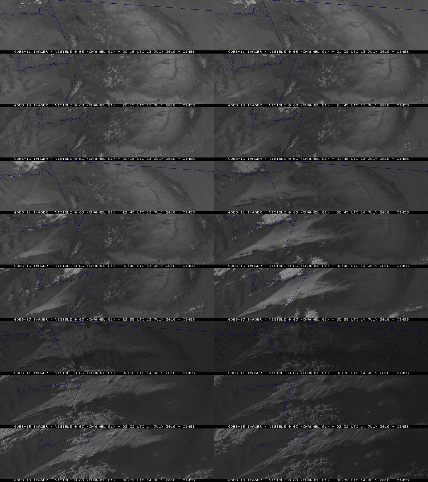
The second feature of interest was a very large smoke plume that was spreading northeastward from a wildfire that was burning in northeastern Idaho. The so-called “Jefferson fire” started on the property of the Idaho National Laboratory (INL) and quickly grew in size to about 109,000 acres, making it the largest fire in INL history (it was also the largest fire burning at the time in the entire US). Note the rapid growth in size of the smoke plume on the McIDAS image comparison of GOES-11 (GOES-West) 0.65 µm visible channel, GOES-15 0.63 µm visible channel, and GOES-13 (GOES-East) 0.63 µm visible channel data (below) — each of the image sets are displayed in the native projection of the respective GOES satellite. GOES-13 was in Rapid Scan Operations (RSO) mode, so images were available more frequently (as often as every 5-10 minutes) than from either GOES-11 or GOES-15. The smoke plume was seen to quickly spread across western Wyoming as night-time approached and visible imagery became unavailable.
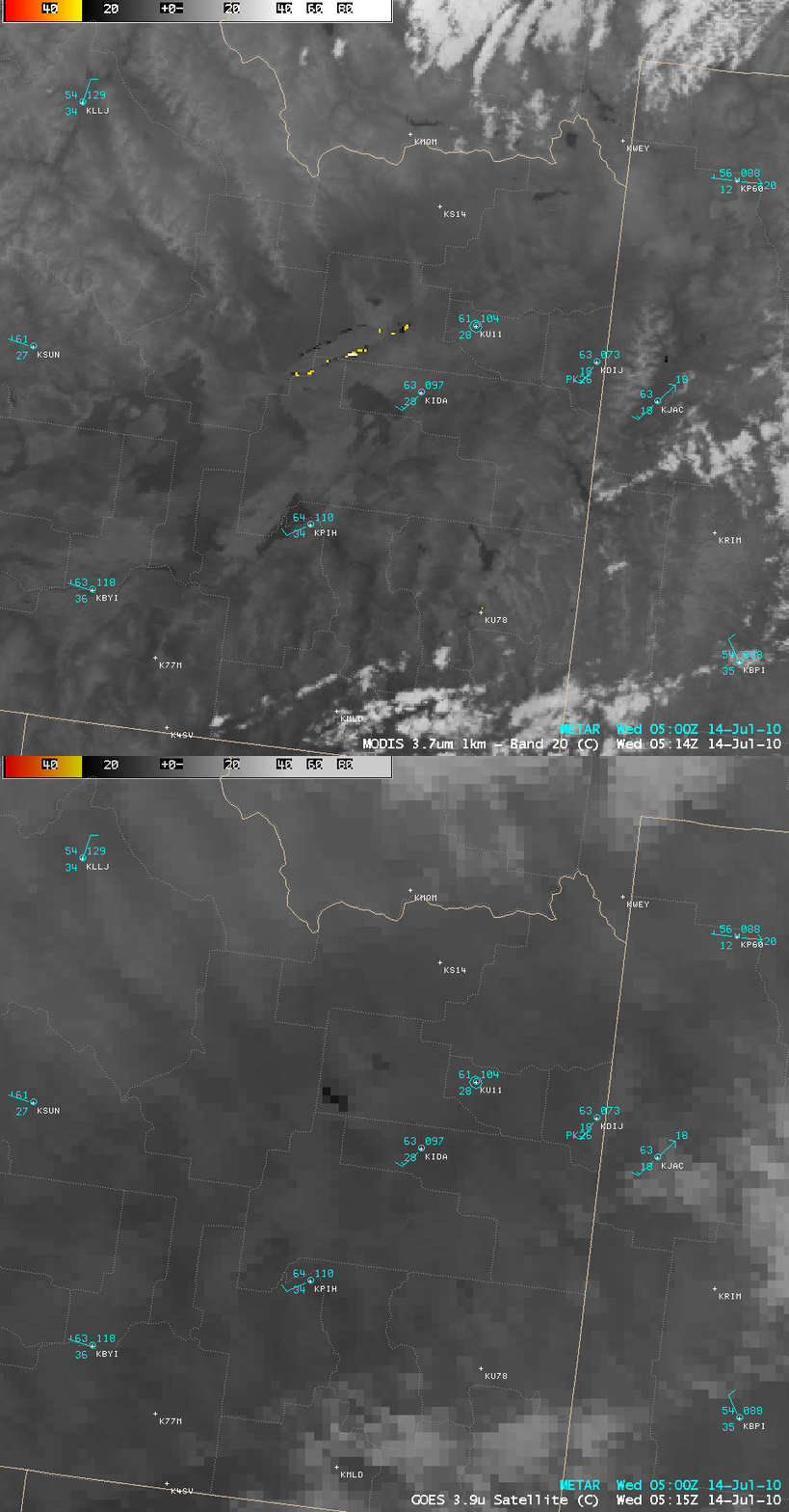
A few hours after the final GOES visible images, an AWIPS comparison of the 4-km resolution GOES-11 3.9 µm shortwave IR image and the corresponding 1-km resolution MODIS 3.7 µm shortwave IR image (below) demonstrated that more accurate information about the location of the active fire hot spots could be determined using the higher spatial resolution MODIS data. The MODIS shortwave IR image displayed a number of very hot pixels (yellow color enhancement) along the southern periphery of the burn area, which were not evident on the GOES-11 shortwave IR image.
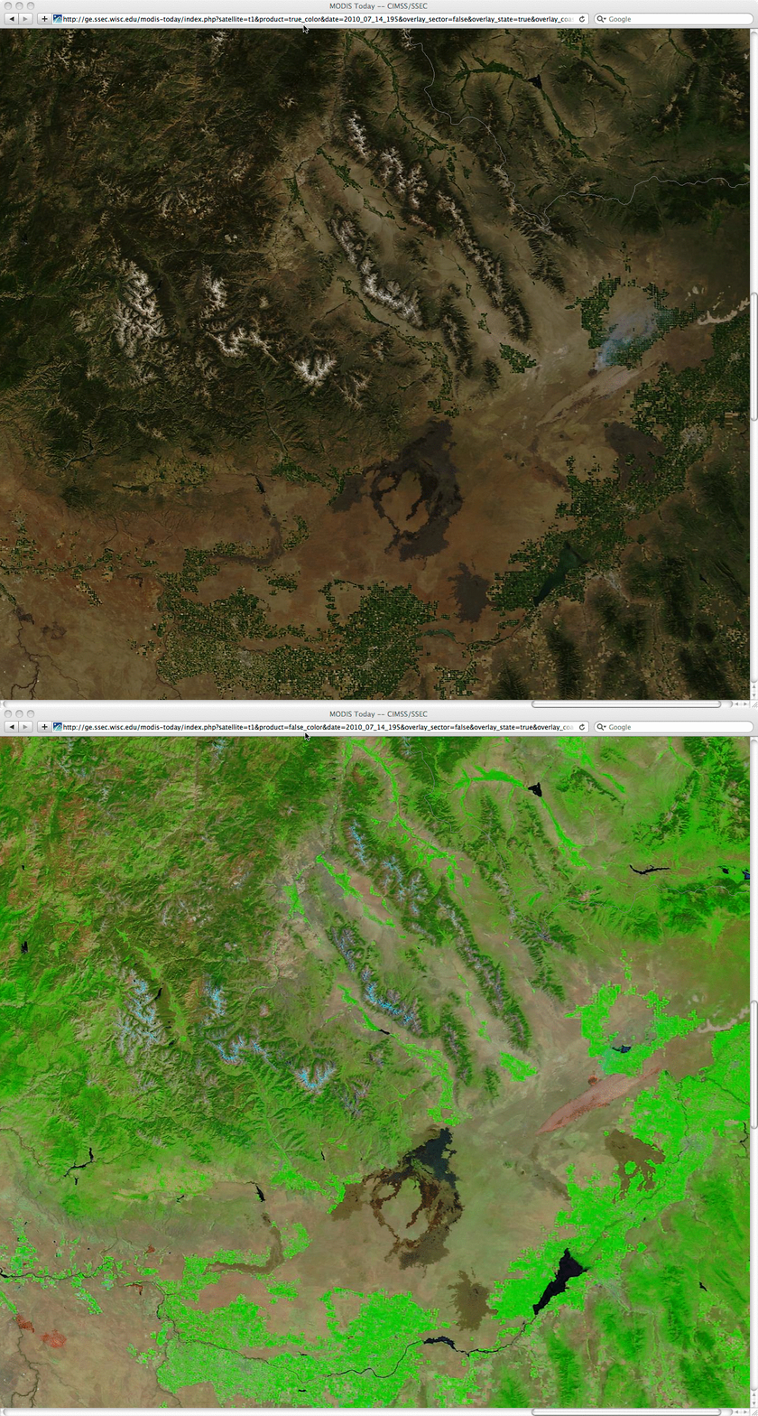
On the following day (14 July), 250-meter resolution Red/Green/Blue (RGB) true color (using bands 1/4/3) and false color (using bands 7/2/1) images from the SSEC MODIS Today site (below) showed a close-up view of the burn scar feature (located in the right center portion of the images). A small smoke plume was still evident on the true color image, streaming northeastward from the northern periphery of the burn scar area.
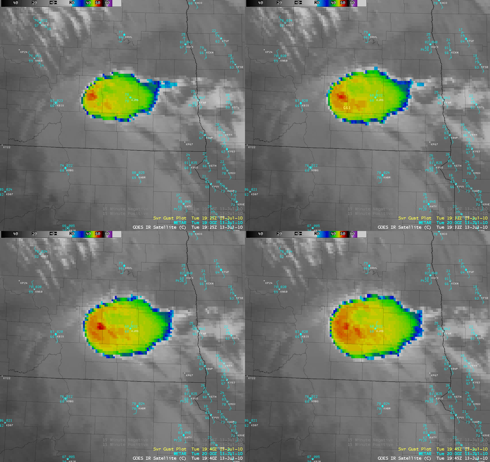
The final feature of interest was a severe thunderstorm that had developed over southeastern North Dakota. Since GOES-13 had been placed into RSO mode, a sequence of 4 images (between 19:25 and 19:45 UTC) is shown (below) around the time that the storm produced a wind gust of 61 knots (70 mph).
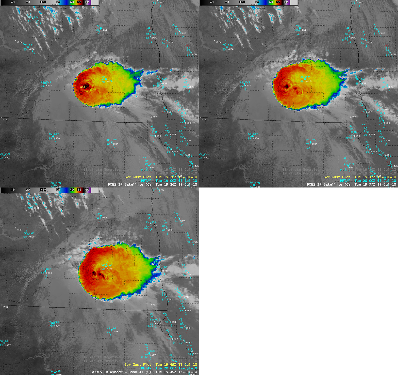
During that same time period, a sequence of 1-km resolution POES AVHRR 10.8 µm IR and MODIS 11.0 µm IR images (below) showed much greater detail in the cloud top temperature structure of the severe thunderstorm. Due to the finer spatial resolution, the coldest storm top IR brightness temperature value seen on the 1-km imagery was -73º C (compared to only -60º C on the 4-km GOES imagery).


