TROPICS views of Cyclone Mocha

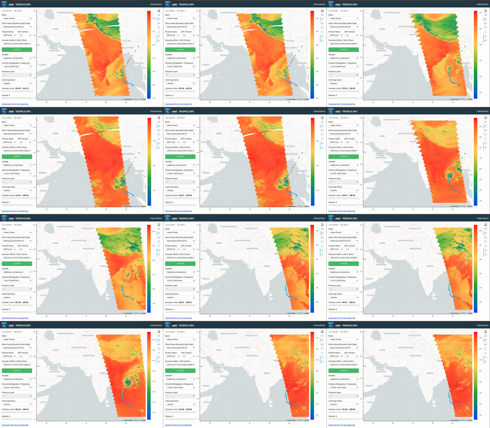
TROPICS (Time-Resolved Observations of Precipitation structure and storm Intensity with a Constellation of SmallSats) satellite observations include microwave data at 12 different frequencies between 91.6 and 204.8 GHz. (Click here for a Satellite Book Club presentation on TROPICS). A TROPICS launch occurred from New Zealand in early May (link), boosting two satellites into orbit; a second launch is pending. In addition, TROPICS Pathfinder launched in 2021 (link), was designed to test TROPICS capabilities (see this blog post), and is still transmitting the data used in this Blog post. The animation above, from a website internal to SSEC, shows TROPICS data over the Indian Ocean from 11 May through 14 May. Land/sea differences are discernible in the 91.6 GHz imagery on top, but not in the 204.8 GHz imagery on the bottom; microwave energy at 204.8 GHz is absorbed by water vapor in the atmosphere.
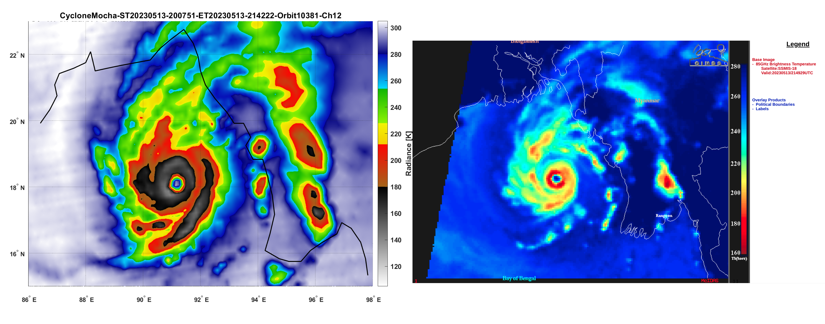
Storm-centered (and zoomed-in) imagery from TROPICS (204.8 GHz) (courtesy the TROPICS team including Glenn Perras at Nick Zorn at MIT/LL), shown below, is compared from the DSMP SSMI/S imagery (85 GHz) (from this CIMSS Blog Post, courtesy Scott Bachmeier) at nearly the same time. The TROPICS Channel 12 data is more influenced by water vapor in the atmosphere; the SSMI/S 85 GHz data is more affected by scattering by ice. That could account for some differences in the imagery, especially in rain bands. There is excellent overall agreement between the two images, however.

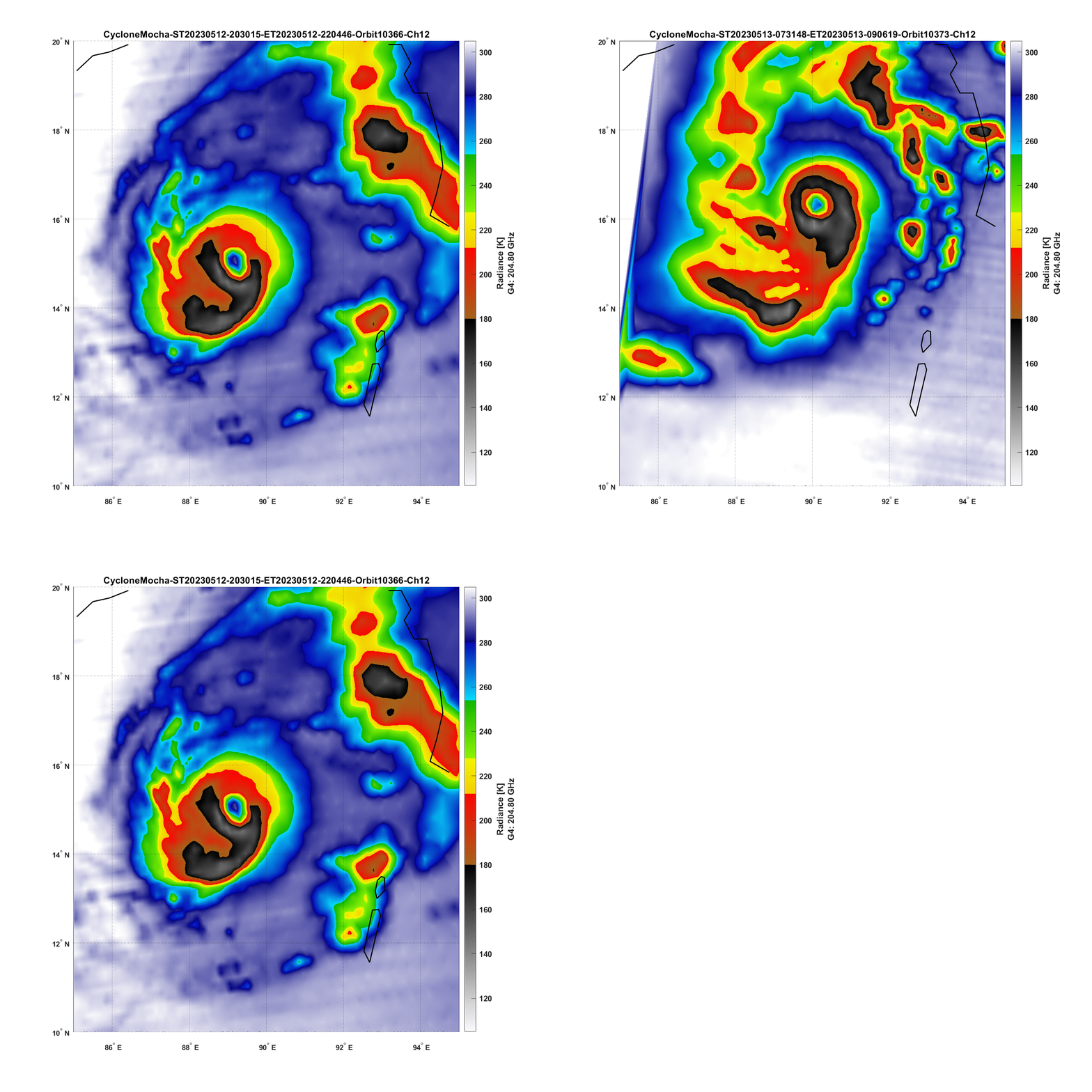
Earlier overpasses over the storm are shown below (images also courtesy of from Glenn Perras and Nick Zorn, MIT/LL). The ongoing organization of the storm between the two times includes the development of a cold brightness temperature ring around they eye. The evolution of the Himawari-9 Clean Window Band 13 (10.4 µm) imagery (at half-hour time-steps) spanning the two times below is here. It also shows increasing organization.


