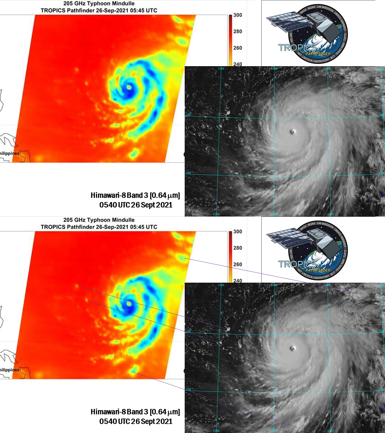
TROPICS Pathfinder view of super typhoon Mindulle

Time-Resolved Observations of Precipitation structure and storm Intensity with a Constellation of Smallsats (TROPICS) Pathfinder imagery from 0545 UTC on 26 September, when super typhoon Mindulle was near peak intensity, is compared above to Himawari-8 visible(0.64 µm) imagery at about the same time. A separate image links small features in the Pathfinder image to small convective elements that are apparent in the Himawari imagery. Click here to view the TROPICS Pathfinder image with a NOAA-20 true-color image from 0426 UTC.
The pathfinder satellite that provided the microwave data used for the image above is the first in a series of a constellation of low-Earth orbiters; six additional satellites will be launched next year. These are very small satellites, with a size of 10 cm x 10 cm x 36 cm. They weigh in at 5.34 kg / 11.8 pounds! Pathfinder imagery was provided courtesy of the Science Team working with the data. Himawari-8 imagery are courtesy of JMA.
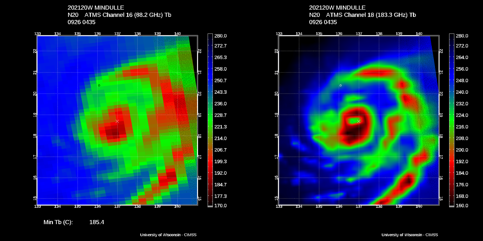
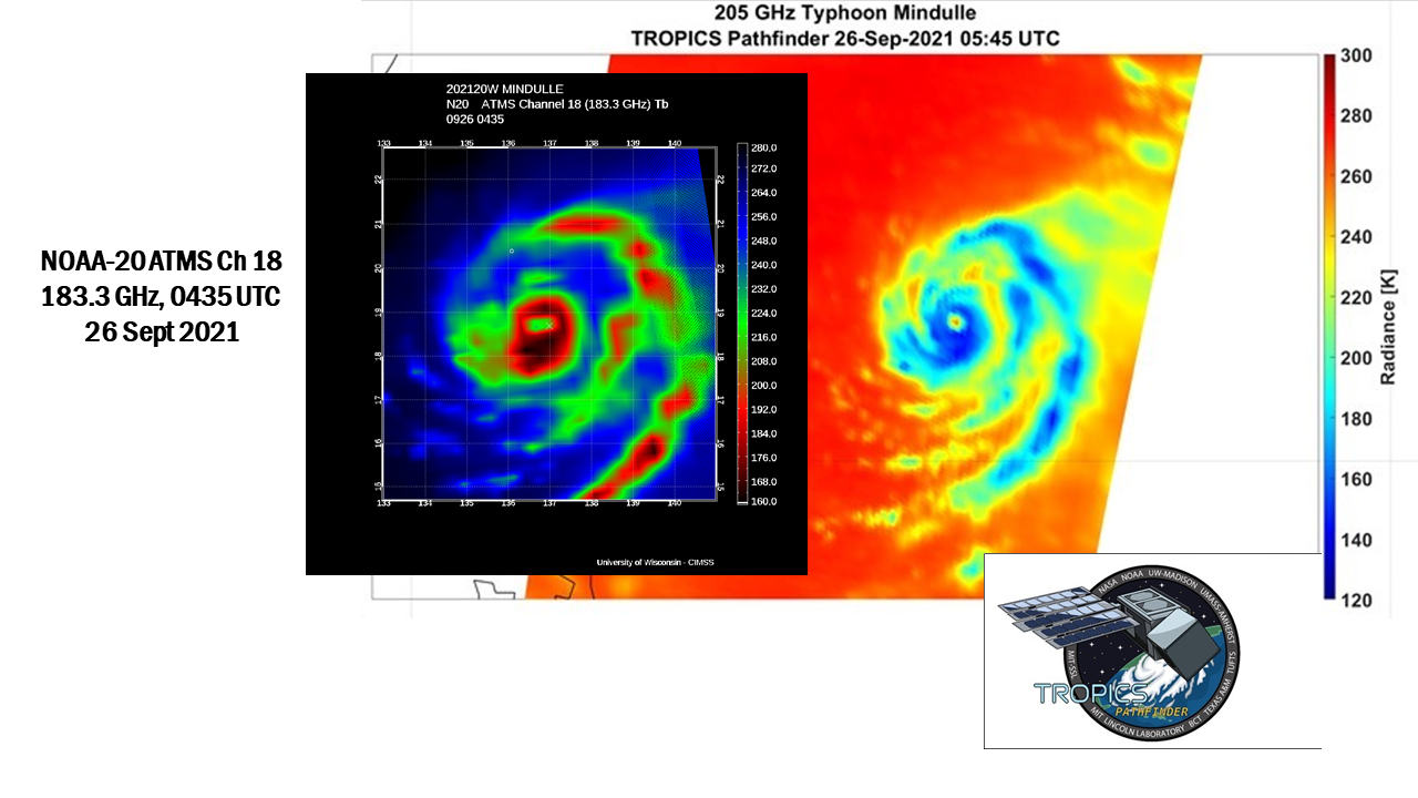
As noted above, NOAA-20 overflew Mindulle at about 0430 UTC. The Advanced Technology Microwave Sounder (ATMS) instrument on NOAA-20 sampled the storm, and imagery (88.2 GHz and 183.3 GHz) with a timestamp of 0435 UTC (from this archive) is shown below. The NOAA-20 orbits over the western Pacific on that day are shown here (from this site). Structures in the Pathfinder imagery at 0545 UTC can be identified in the 0435 UTC ATMS imagery below. A side-by-side comparison of the Pathfinder 205 GHz and NOAA-20 ATMS 183.3 GHz is shown at bottom.


