SAR Wind observations near American Samoa, part VI
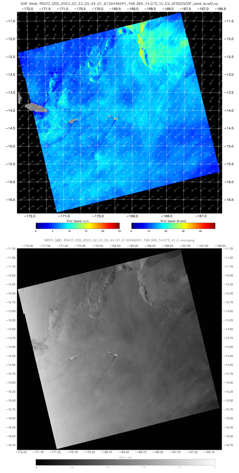
A second pair of SAR observations occurred on 23 February, one at 0544 UTC (above) and one at 1647 UTC (below). The character of the two scenes is quite different. The 0544 UTC wind imagery and NRCS imagery (from this site) shows a mostly quiescent scene with widespread northeasterly winds. One arc of winds just west of 12.25oS, 168.5oW is present with peak winds in excess of 40 knots; the NRCS does not show any of the structures that might suggest that high wind observations is influenced by ice within the cloud.
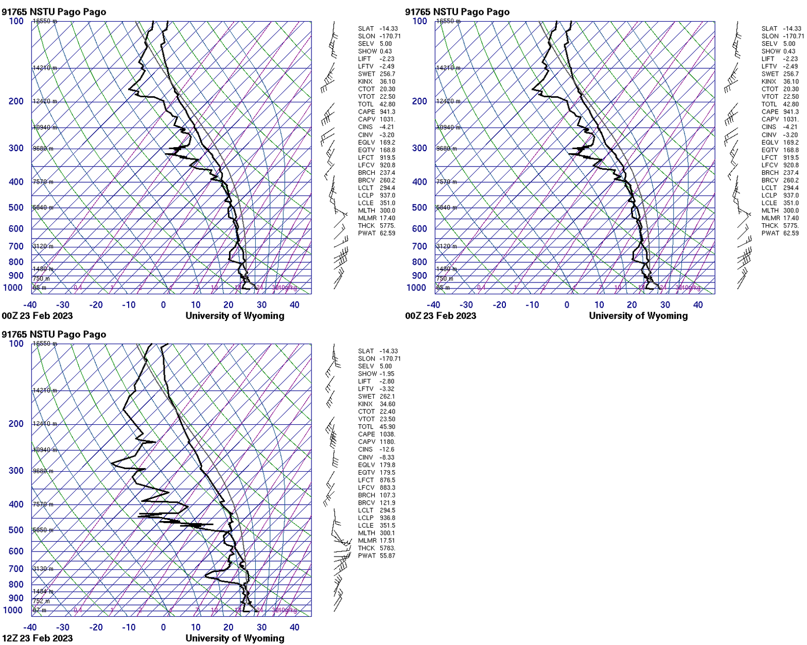
In contrast to previous SAR wind scenes over American Samoa (here, here, here, here, here), the scene above shows a long downstream ‘tail’ to the island influence on the wind from both Tutuila and the Man’ua Islands (Ofu/Olosega and Ta’u). Perhaps this is due to the lack of convection at 0544 UTC. However, the 0000 UTC and 1200 UTC soundings from Pago Pago (from this site), shown below, show a developing low-layer stable layer — between 700-800 mb — that might trap the effect of the wind at lower layers, allowing it to persist.
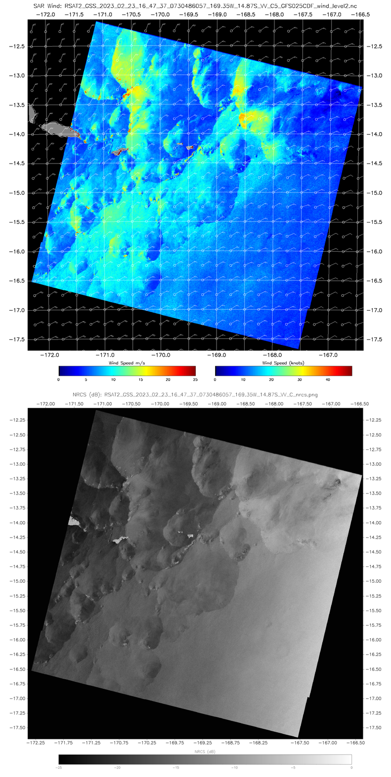
The 1647 UTC SAR winds, below, (both the winds and the NRCS data, both from this site), show a much more chaotic scene suggestive of widespread shower activity. In addition, the NRCS data at this time does include features that suggest ice within clouds (widespread, in fact, near 13.25oS, 170.6oW that will affect derived wind speeds.
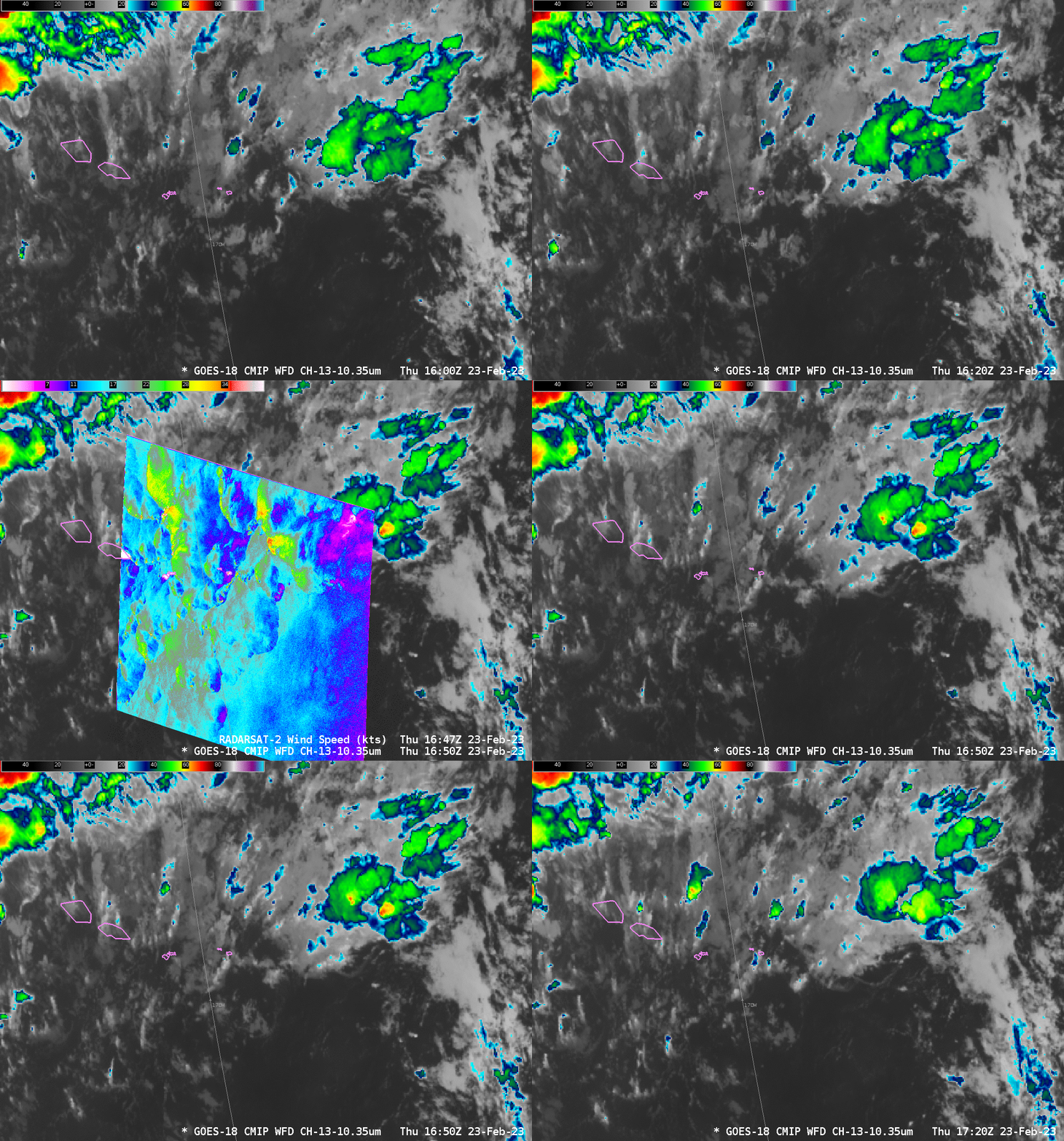
Given the SAR winds above, what do you think the GOES-18 Clean Window infrared (Band 13, 10.3 µm) imagery looks like? The animation below, from 0400 to 1800 UTC on 23 February, including toggles that show the SAR winds (click here for an animation without the SAR wind overlays) spans the two times above. A couple of features stand out, especially an low-level boundary that becomes apparent near 1200 UTC and propagates southwestward to near Ta’u at 1800 UTC. Intermittent convection forms along its leading boundary. Intermittent convection is producing orphan anvils to the south of the Samoan islands during much of the animation.
Added: one might make an argument that the arced feature at 0544 UTC propagates eastward and is assoicated with the north-south band that intersects Tutuila around 1240 UTC and Upolu (the eastern of the two main islands of Western Samoa) around 1530 UTC. In both cases, the line results in convection that is a bit more vigorous.
The orphan anvil features are easily seen in the Night Microphysics RGB, below (using imagery from the CSPP Geosphere site; direct link to the animation), as bright red evanescent features that move northward (in contrast to the southwestward motion of the lower clouds).
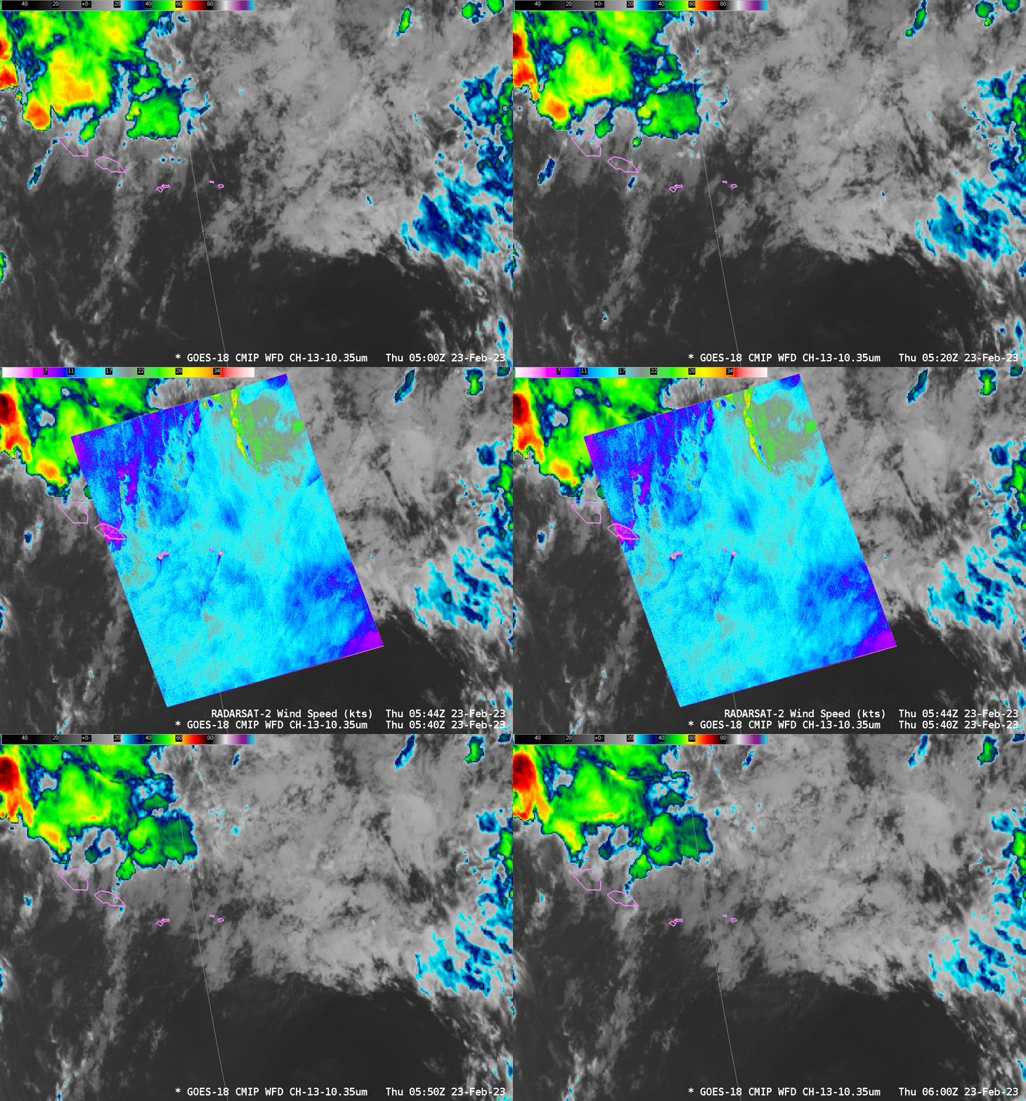
The imagery below compares the GOES-18 clean window infrared imagery to SAR winds. AT 0540 UTC, it is very difficult to relate surface SAR features to infrared imagery.
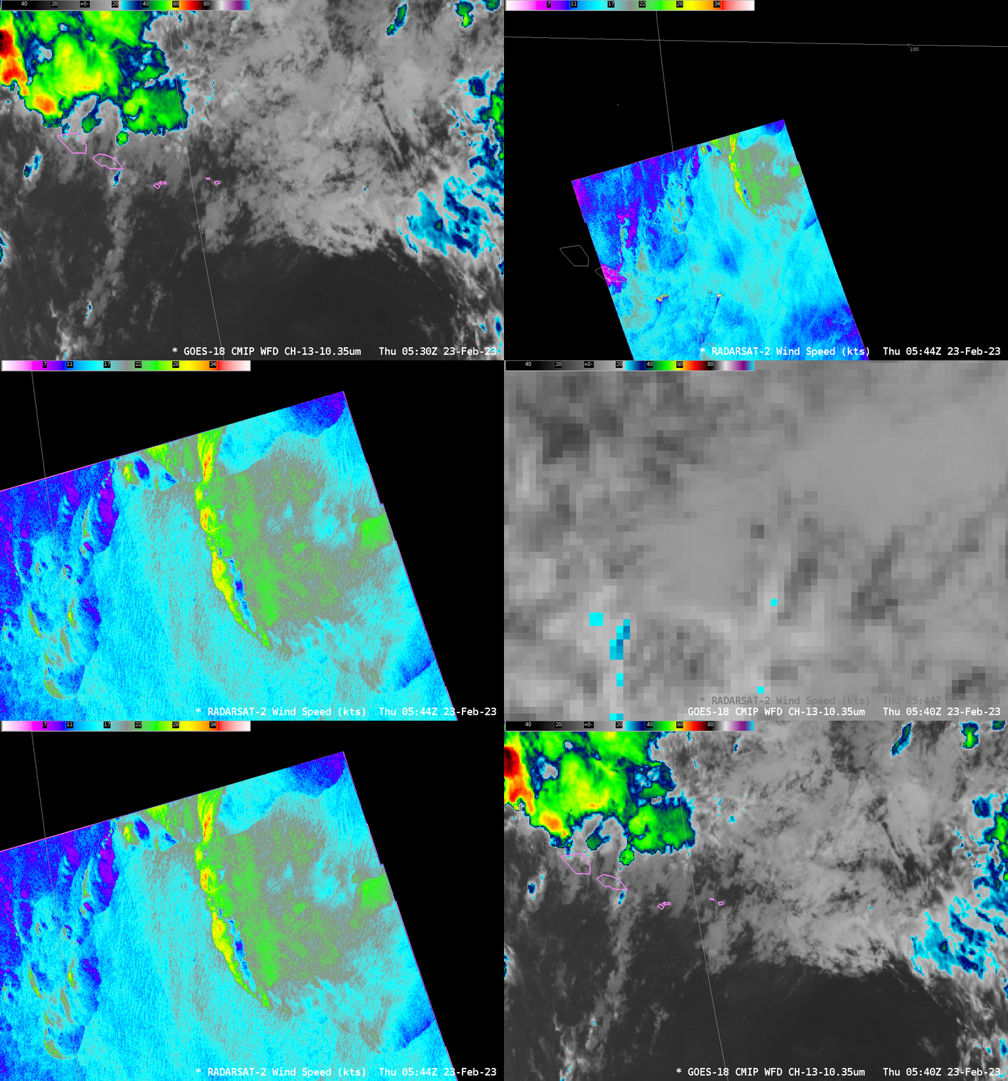
Careful inspection of the Band 13 (10.3 µm) animation between 0500 and 0600 UTC, below, does reveal a cooler cloud top aligned with the northern segment of the arc of stronger SAR winds. It would be difficult indeed to highlight a region of enhanced surface winds with just the GOES-18 data however!
There is a better-defined relationship between the GOES and SAR data at 1647 UTC? Wind maxima are linked to features in the GOES-18 imagery. However, not all cloud-top features in the ABI data are linked to SAR wind maxima. The challenge for a forecaster is to learn when the linkage exists.
