Rapidly intensifying midlatitude cyclone off the US East Coast
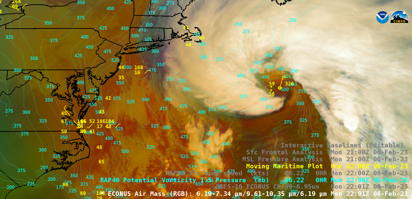
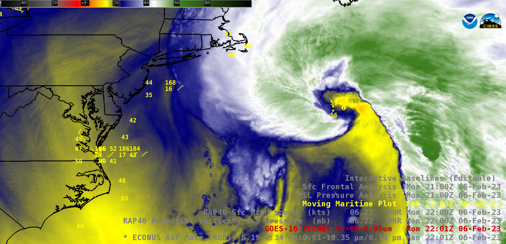
GOES-16 (GOES-East) Air Mass RGB images (above) included contours of RAP40 model PV 1.5 Pressure — and showed a Hurricane Force low pressure that had rapidly intensified as it moved northeastward off the US East Coast (surface analyses) on 06 February 2023. The PV 1.5 surface (which represents the dynamic tropopause) descended to the 500 hPa pressure level at 2200 UTC.GOES-16 Mid-level Water Vapor (6.9 µm) images (below) included contours of RAP40 model surface wind speed. One prominent cloud feature was the development of what resembled a “scorpion tail” just south of the low pressure center — which is sometimes seen in storms that feature a sting jet.
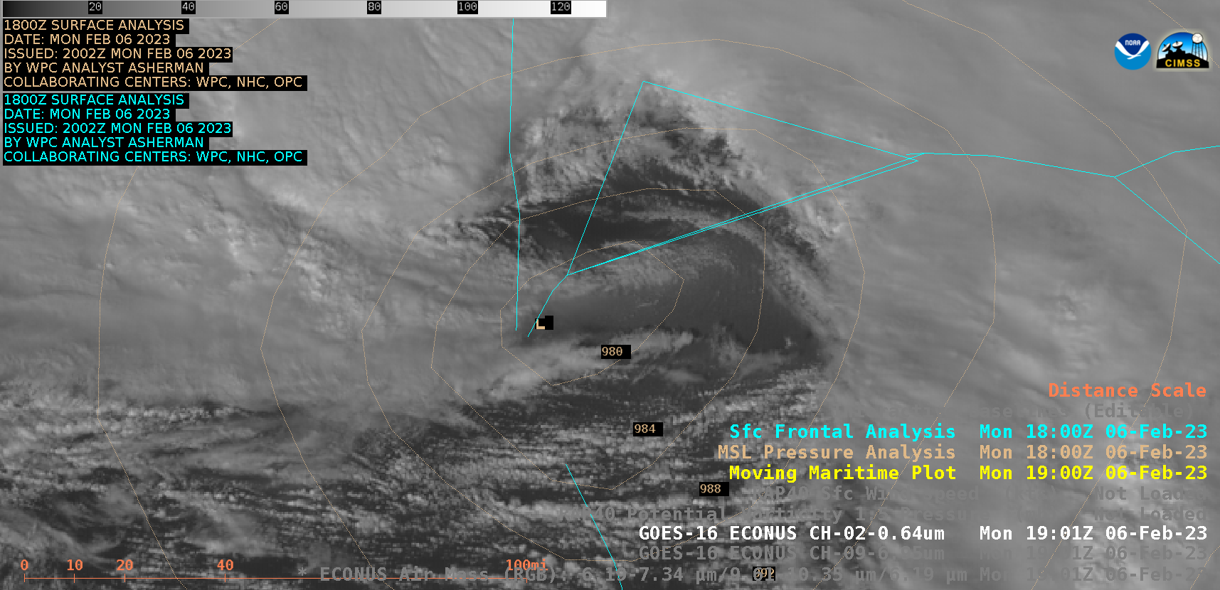
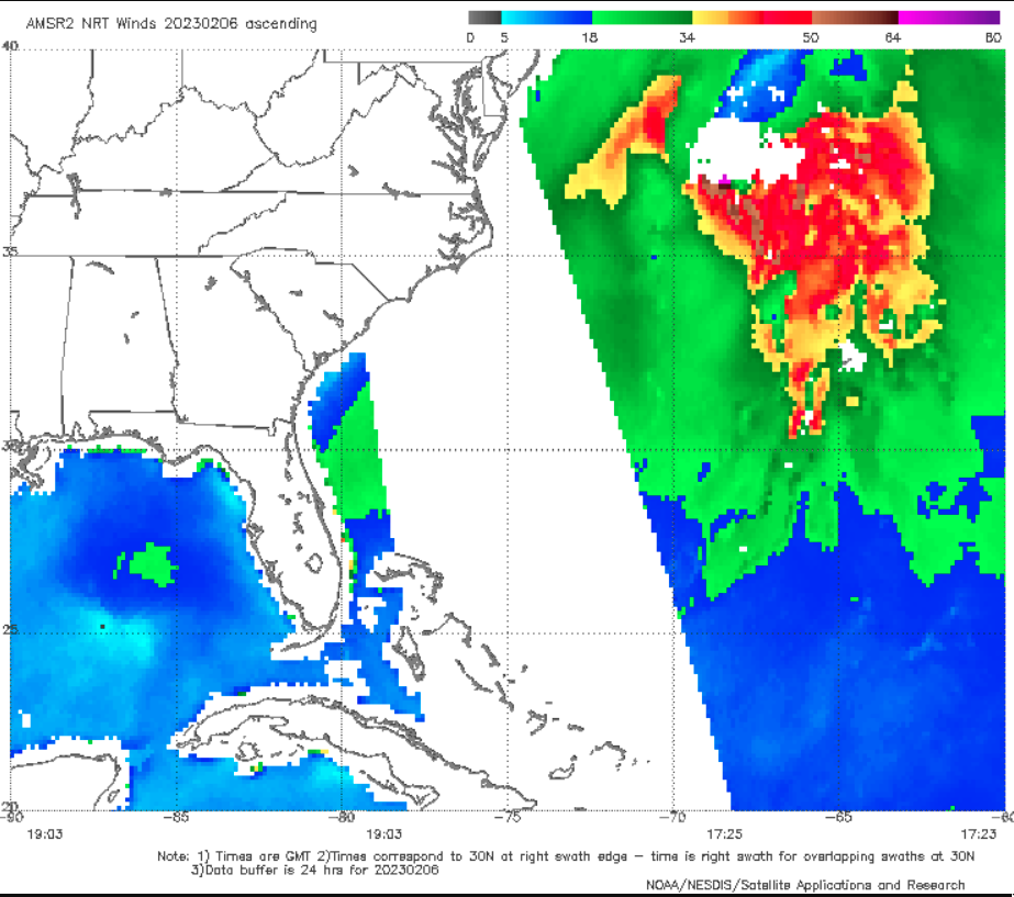
GOES-16 “Red” Visible (0.64 µm) images (below) included the 1800 UTC analysis of surface pressure and fronts. Note the cloud-free area of water just east of the low center and just south of the occluded front, which exhibited a slightly brighter “milky/hazy” appearance — enhanced diffuse solar reflection off a highly-agitated ocean surface with large waves (generated by very strong winds) supported the existence of either a sting jet or a cold conveyor belt jet that had descended to the surface. A similar ocean surface signature has been observed in other cases where a sting jet was likely, such as here, here and here. GCOM-W1 AMSR2 surface wind speeds at 1725 UTC on 06 February (below), from this site, showed hurricane force winds (darker brown to violet enhancement) in the same area where a hazy ocean surface appearance was evident in GOES-16 Visible imagery.