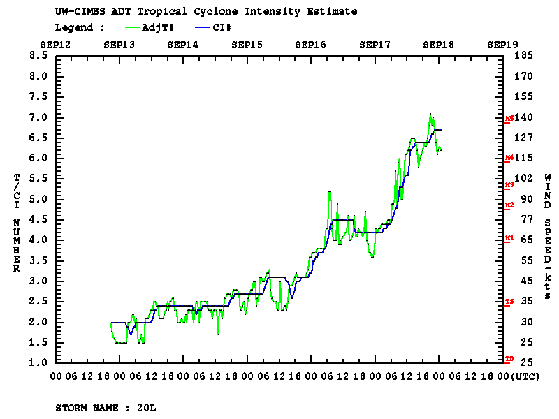
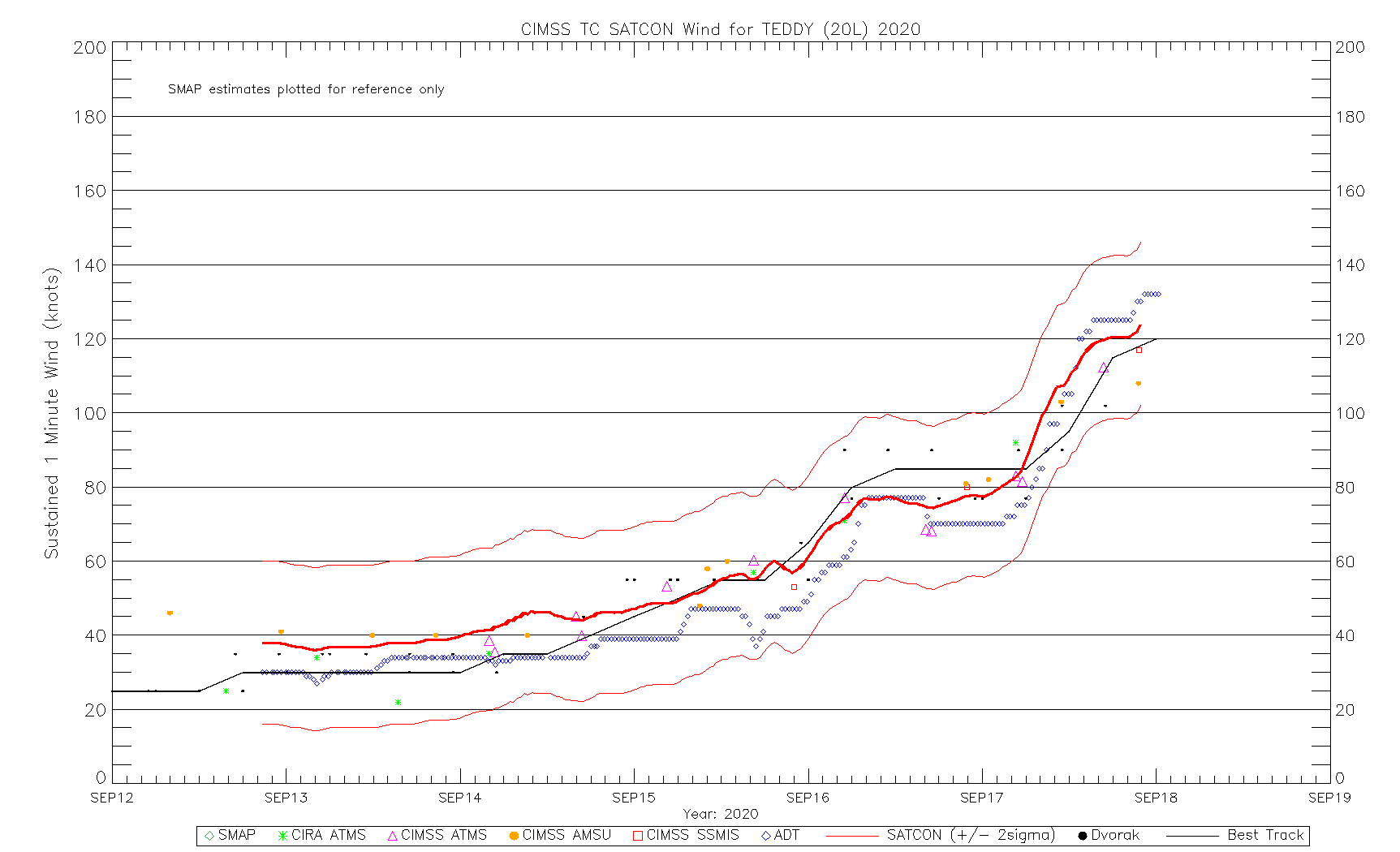
Hurricane Teddy rapidly intensifies to a Category 4 storm
![GOES-16 “Red” Visible (0.64 µm) and “Clean” Infrared Window (10.35 µm) images (with and without an overlay of GLM Flash Extent Density) [click to play animation | MP4]](https://cimss.ssec.wisc.edu/satellite-blog/images/2020/09/200917_goes16_visible_infrared_Hurricane_Teddy_anim.gif)
GOES-16 “Red” Visible (0.64 µm) and “Clean” Infrared Window (10.35 µm) images (with and without an overlay of GLM Flash Extent Density) [click to play animation | MP4]
Metep-A ASCAT surface scatterometer wind speeds were as high as 74 knots in the northwestern portion of the eyewall (below).
![GOES-16 “Red” Visible (0.64 µm) image, with plots of Metop-A ASCAT winds [click to enlarge]](https://cimss.ssec.wisc.edu/satellite-blog/images/2020/09/200917_1231utc_goes16_visible_ascat_Hurricane_Teddy.png)
GOES-16 “Red” Visible (0.64 µm) image, with plots of Metop-A ASCAT winds [click to enlarge]
![DMSP-17 SSMI Microwave (85 GHz) image at 1023 UTC [click to enlarge]](https://cimss.ssec.wisc.edu/satellite-blog/images/2020/09/200917_1023utc_dmsp17_ssmis_microwave_Hurricane_Teddy.png)
DMSP-17 SSMI Microwave (85 GHz) image at 1023 UTC [click to enlarge]
![GMI Microwave (85 GHz) image at 1720 UTC [click to enlarge]](https://cimss.ssec.wisc.edu/satellite-blog/images/2020/09/200917_1720utc_gmi_microwave_Hurricane_Teddy.png)
GMI Microwave (85 GHz) image at 1720 UTC [click to enlarge]
![DMSP-18 SSMI Microwave (85 GHz) image at 2034 UTC [click to enlarge]](https://cimss.ssec.wisc.edu/satellite-blog/images/2020/09/200917_2034utc_dmsp18_ssmis_microwave_Hurricane_Teddy.png)
DMSP-18 SSMI Microwave (85 GHz) image at 2034 UTC [click to enlarge]