Tropical Depression #1
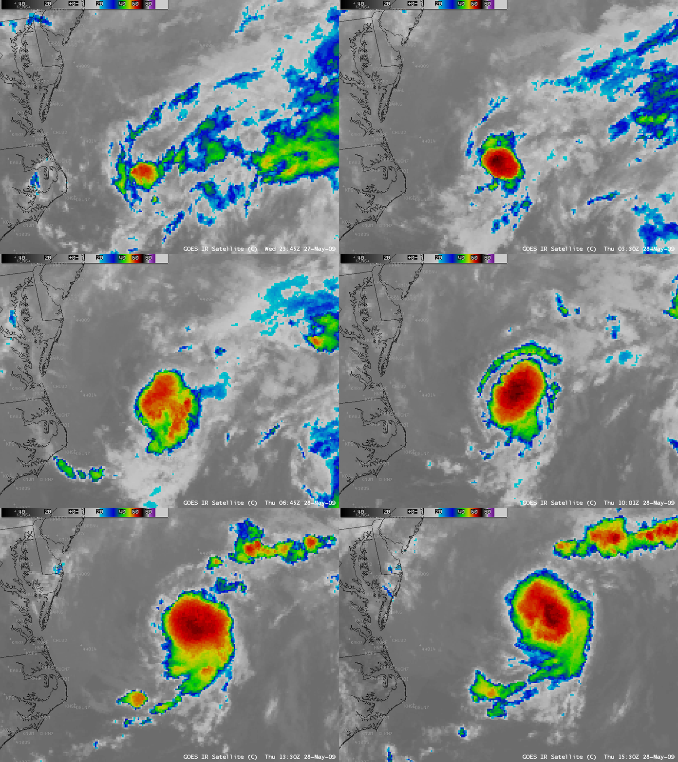
The first tropical depression of the 2009 season formed off the US East Coast on 28 May 2009. An AWIPS animation of GOES-12 10.7 µm “IR window” images (above) revealed several bursts of convection as the canopy of cold cloud tops slowly increased in areal coverage.
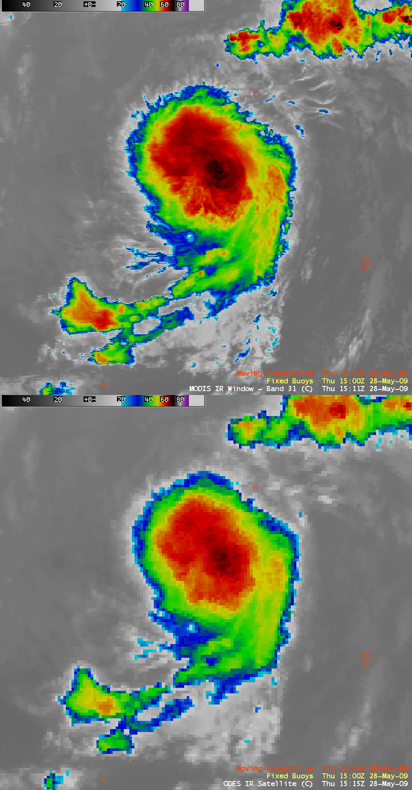
One of the convective bursts occurred around 15:00 UTC , and a comparison of the 1-km resolution MODIS 11.0 µm IR window and the 4-km resolution GOES-12 10.7 µm IR window images around that time (below) depicted cloud top brightness temperatures several degrees colder on the MODIS image (-72º C, vs -68º C on the GOES-12 IR image).
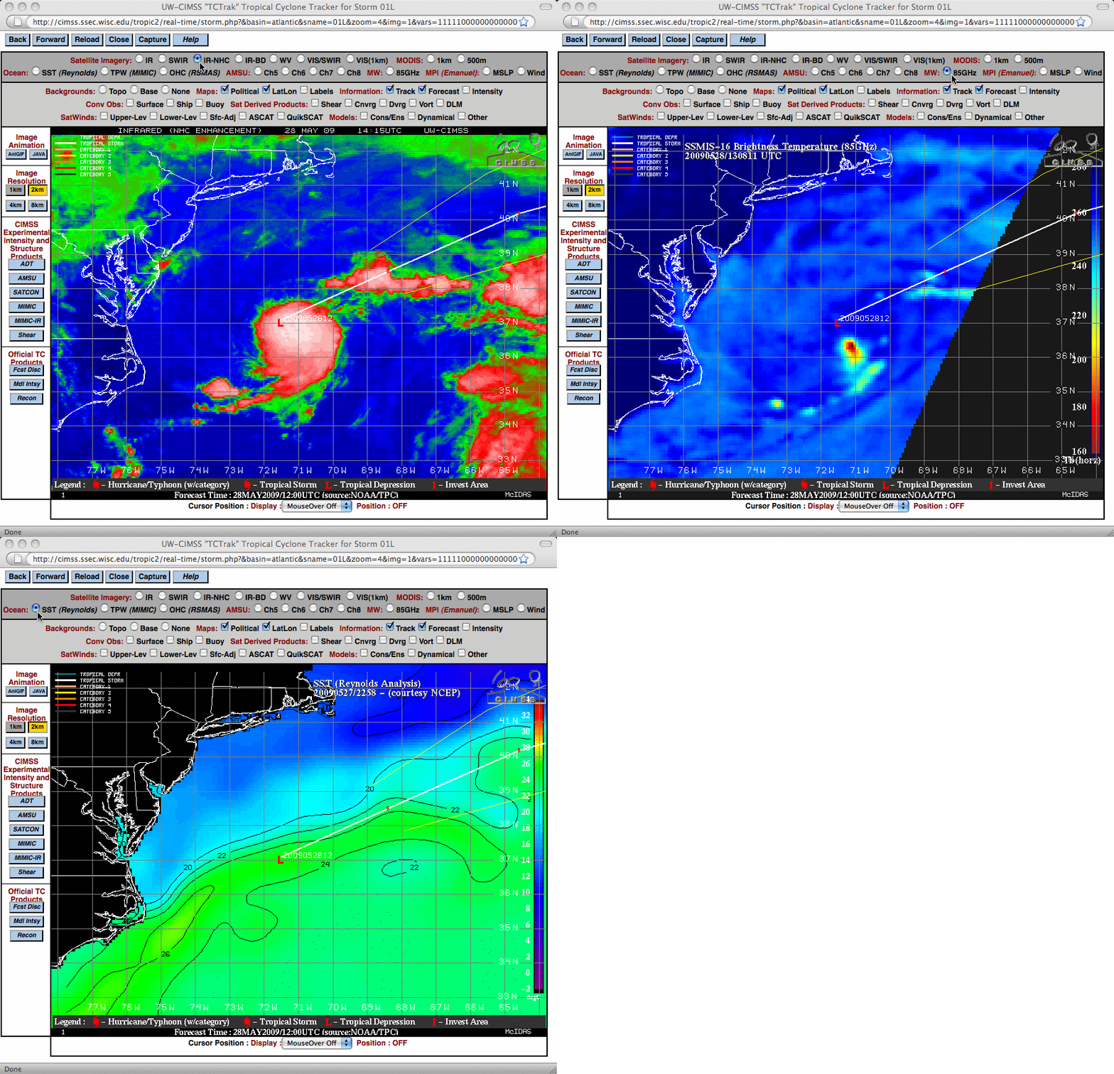
Products from the CIMSS Tropical Cyclones site (below) showed that the coldest SSM/I microwave brightness temperatures (red colors) were found in the southeastern quadrant of the cold IR cloud shield. In addition, it could be seen that the tropical depression was situated over the warmer waters of the Gulf Stream (SST values greater than 24º C, green colors), which was likely aiding in the intensification process. The deep layer wind shear was also light, which was another factor that favored further intensification.
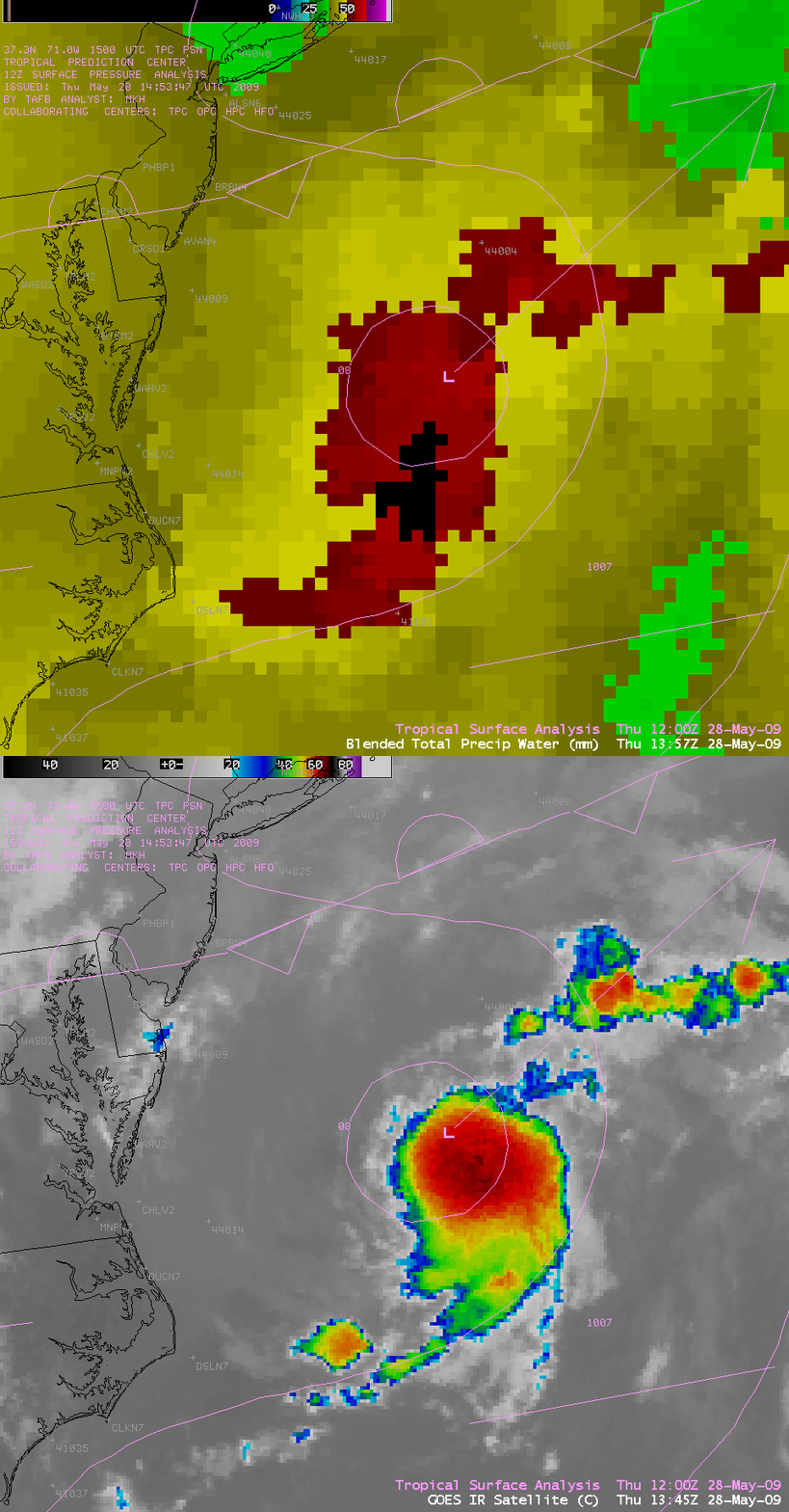
The Blended Total Precipitable Water product (below) showed that TPW values were as high as 50-57 mm (2.0 to 2.2 inches, red colors) in the vicinity of the tropical depression. The POES AMSU Rainfall Rate product depicted rainfall intensities as great as 29 mm per hour (1.14 inch per hour) around 13:30 UTC.
===== 29 MAY UPDATE =====
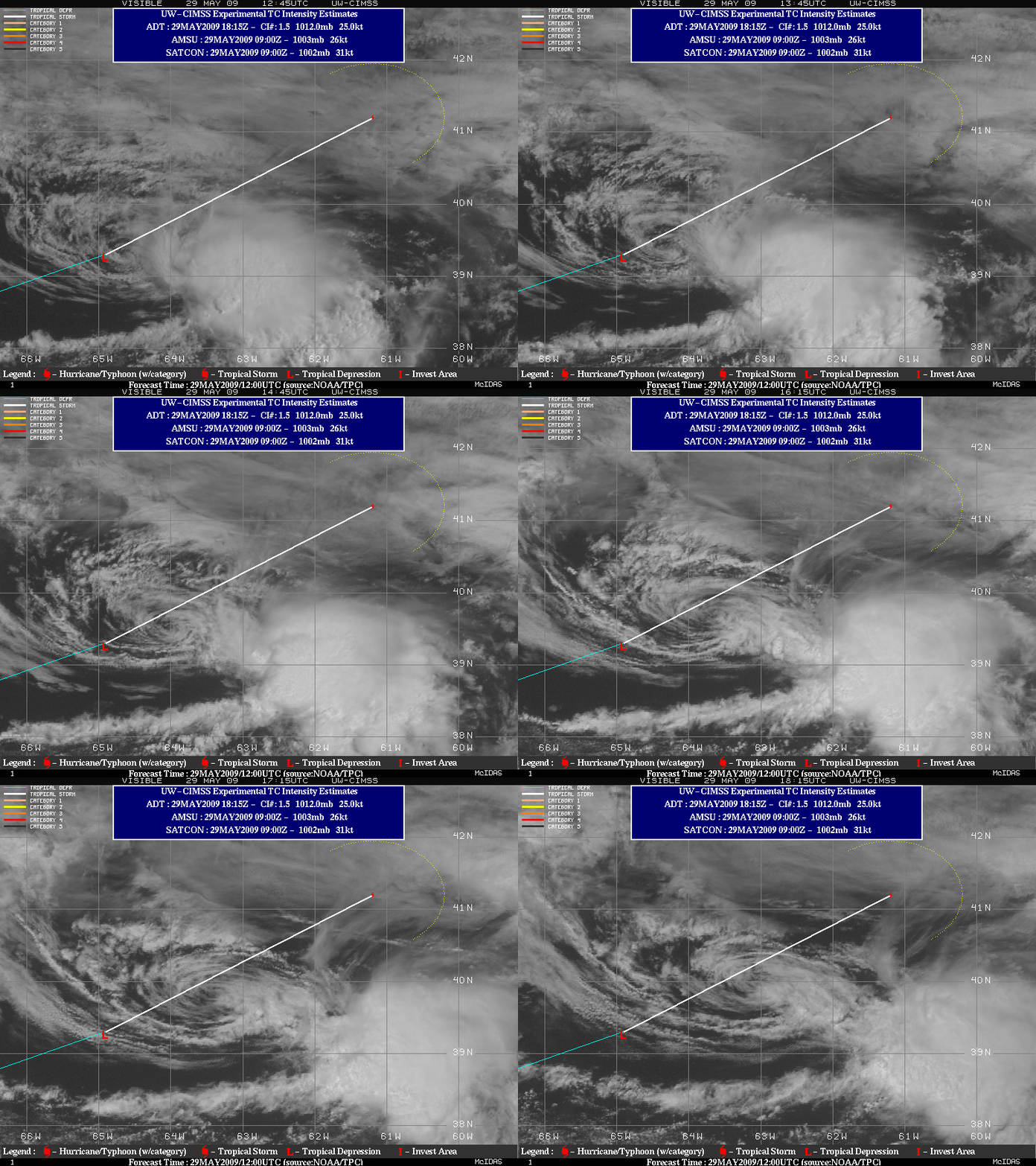
On the following day (29 May 2009), GOES-12 visible images from the CIMSS Tropical Cyclones site (below) indicated that the low-level circulation had become separated from the cluster of deep convection which was located in the southeast quadrant of the tropical depression — this was due to increasing amounts of deep layer wind shear across the region.


