Fires in Texas and Oklahoma
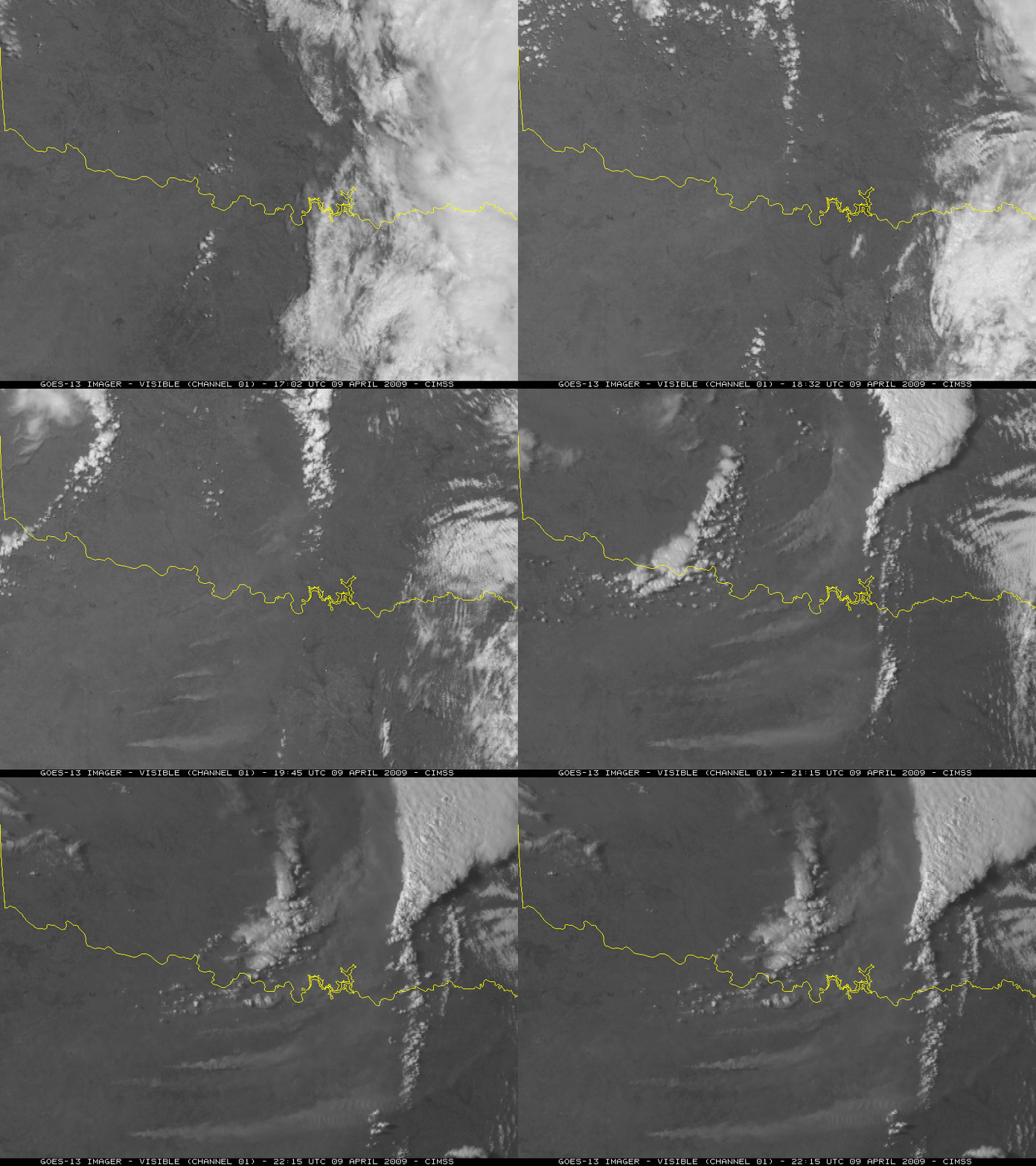
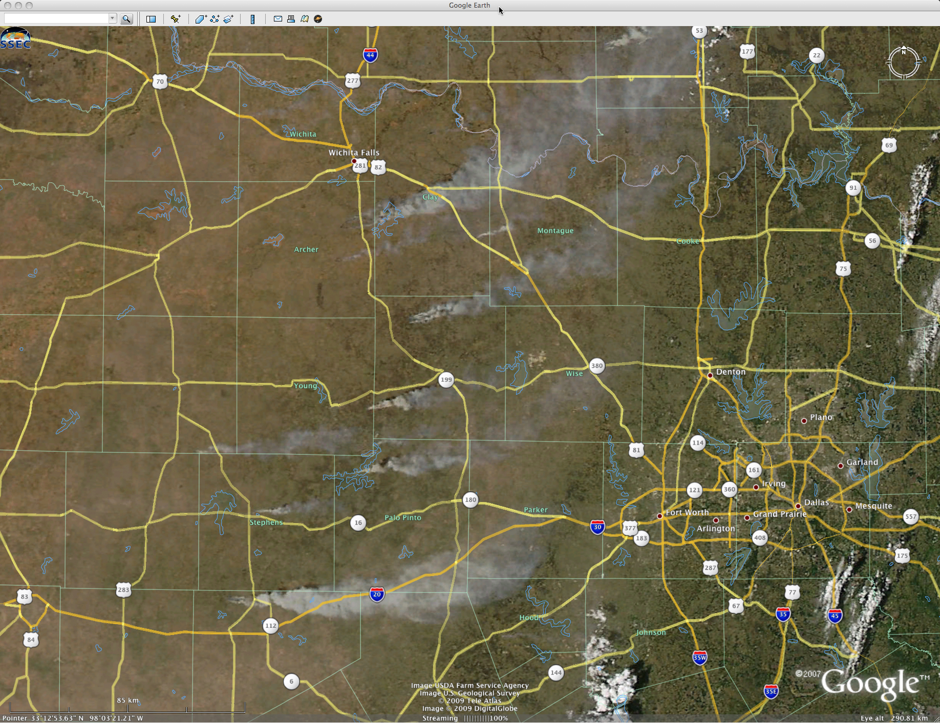
A large outbreak of wildfires occurred across parts of Texas and Oklahoma on 09 April 2009. GOES-13 visible images (above) showed several very large smoke plumes drifting eastward across far northern Texas and far southern Oklahoma during the afternoon hours. These fires burned over 145,000 acres, destroyed about 115 homes, closed roadways, and forced the evacuation of schools — and 3 deaths were reported as a direct result of these fires. In addition, the haziness associated with a large cloud of blowing dust was also evident on the visible images, moving overhead just as the fires began to grow in size and intensity. The thick smoke and blowing dust were restricting visibilities and causing air quality problems across that region.
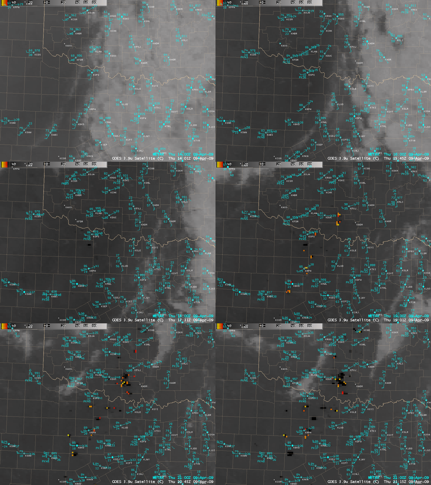
AWIPS images of the 4-km resolution GOES-12 3.9 µm shortwave IR channel (below) depicted a number of cluster of very hot pixels, which spread rapidly in areal coverage. Many of the pixel brightness temperatures exceeded the saturation temperature of the GOES-12 3.9 µm sensor — these hottest pixels showed up as dark black in color, displaying “NO DATA” using the AWIPS cursor sampling function.
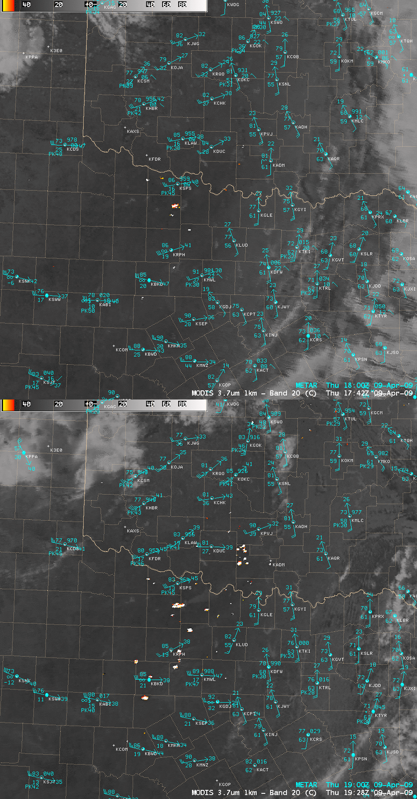
Consecutive images of the 1-km resolution MODIS 3.7 µm shortwave IR channel (below) indicated how quickly the number of fire pixels grew in size and increased in number between 17:42 and 19:28 UTC. On the MODIS images, the hottest pixels were displayed as bright white, as the color scale “wrapped around” to the cold end of the scale (displaying “-110º C” using the AWIPS cursor sampling function) due to the extremely hot temperatures of these fires.
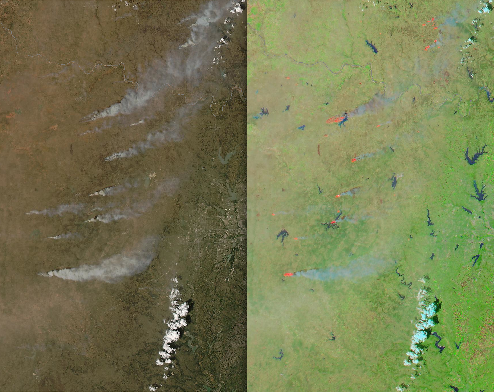
A comparison of 250-meter resolution MODIS true color and false color images from the SSEC MODIS Today site (above) offered a closer look at the smoke plumes and the fire hot spots (which appeared as the red-colored areas on the false color image) at 19:28 UTC. At that time, these smoke plumes were drifting eastward toward the Dallas/Fort Worth metro area, as seen on the MODIS true color image displayed using Google Earth (below).
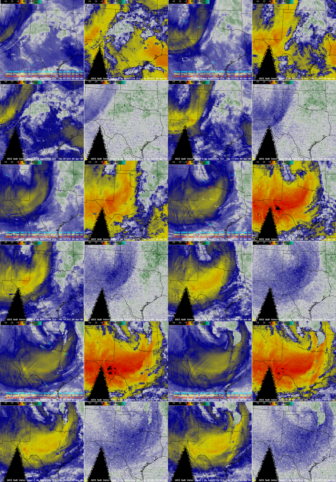
Very strong winds were seen over the entire region (gusting as high as 76 mph at Frederick, Oklahoma and 67 mph at McLean, Texas), behind a surface dry line and cold front. These strong winds — which helped the fires to grow so quickly – were aided by the downward transfer of momentum from the middle troposphere. A 4-panel display of GOES Imager and Sounder water vapor channel images (below) revealed a distinct signature of this rapidly-descending dry air (especially evident on the Sounder 7.0 µm channel imagery, lower left panel, and the Sounder 7.4 µm channel imagery, upper right panel). Since the air was so dry, all 4 of the GOES water vapor channel weighting functions peaked at the 500 hPa pressure level and below. The fact that the dew point temperature at Winston, Texas dropped from +7º F at 12:06 pm to -20º F at 3:06 pm local time (as winds gusted to 48 mph) was an indicator of how remarkably dry this air mass was on that particular day.
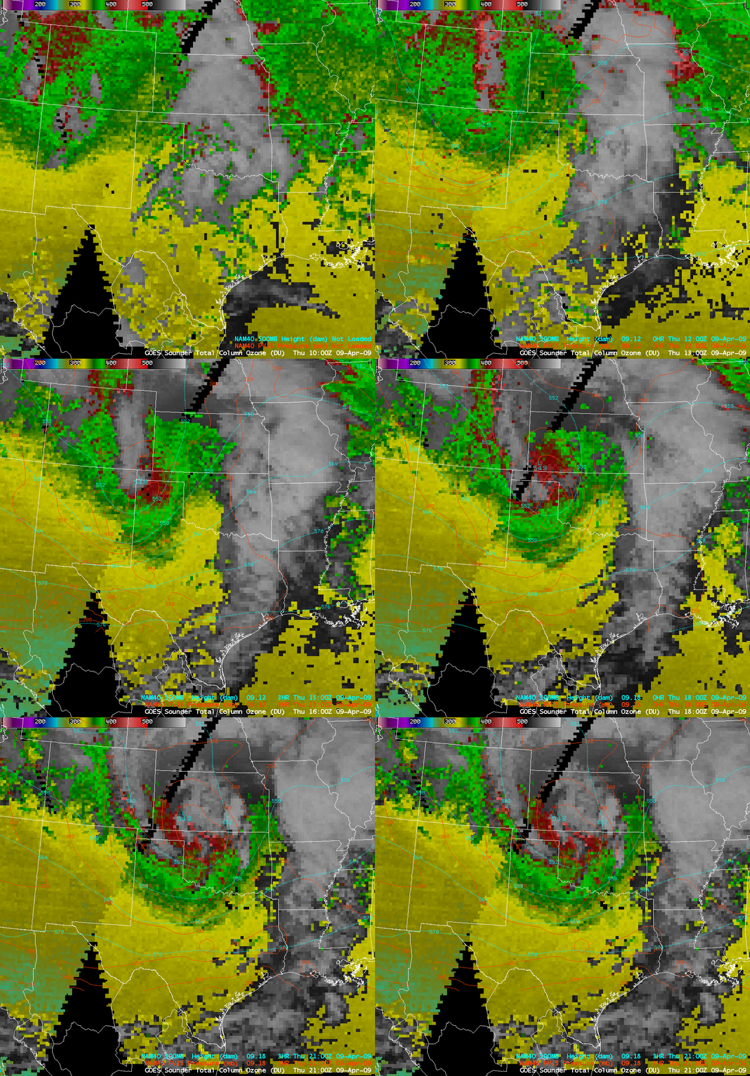
The GOES sounder Total Column Ozone product (below) indicated that a strong tropopause anomaly was moving eastward through the region — and NAM40 PV1.5 pressures showed that the dynamic tropopause was being brought downward to altitudes as low as the 500 hPa pressure level.
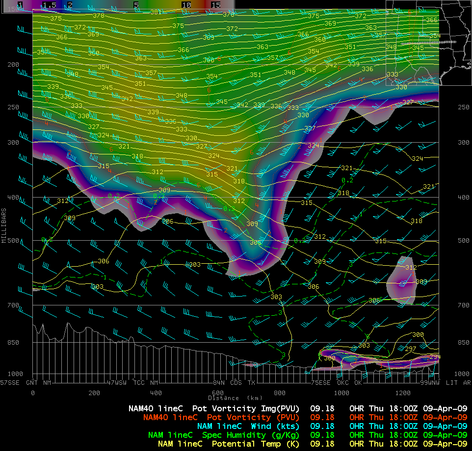
A NAM40 model cross section oriented from west to east (below) showed the strong descent of the dynamic tropopause over southern Oklahoma — the potential vorticity fields are the colored image portion of the cross section.


