Mesoscale lake-effect snow bands: the Great Salt Lake, and the Missouri River
Cold air flowing southeastward across the Great Salt Lake in Utah had enough of a fetch over the warm waters to help set up a well-defined lake-effect snow (LES) band that produced several inches of snowfall downwind of the lake at Salt Lake City on 11 November 2012. The LES band could be seen in McIDAS images of GOES-15 (GOES-West) and GOES-13 (GOES-East) 0.63 µm visible channel data (above; click image to play animation).
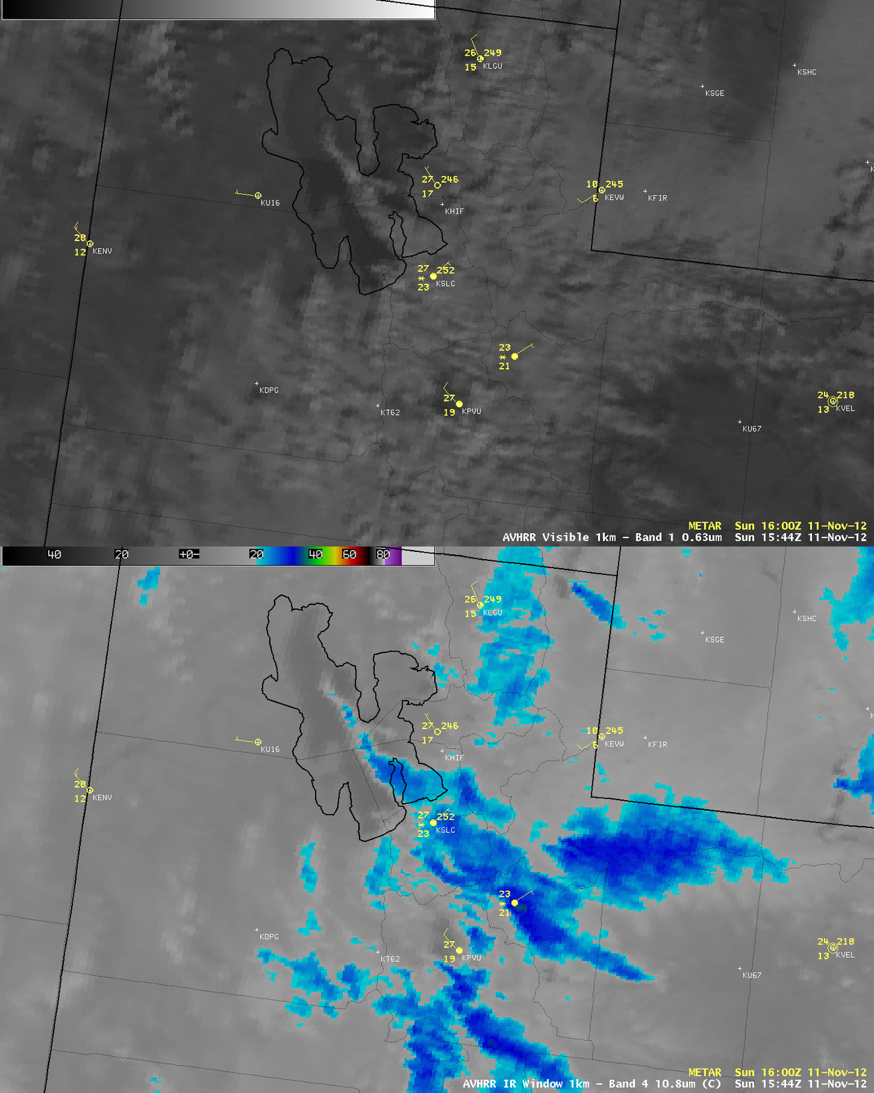
AWIPS images of POES AVHRR 0.63 µm visible channel and 10.8 µm IR channel data (below) showed that IR cloud top brightness temperatures within the LES band were as cold as -27º C (darker blue color enhancement).
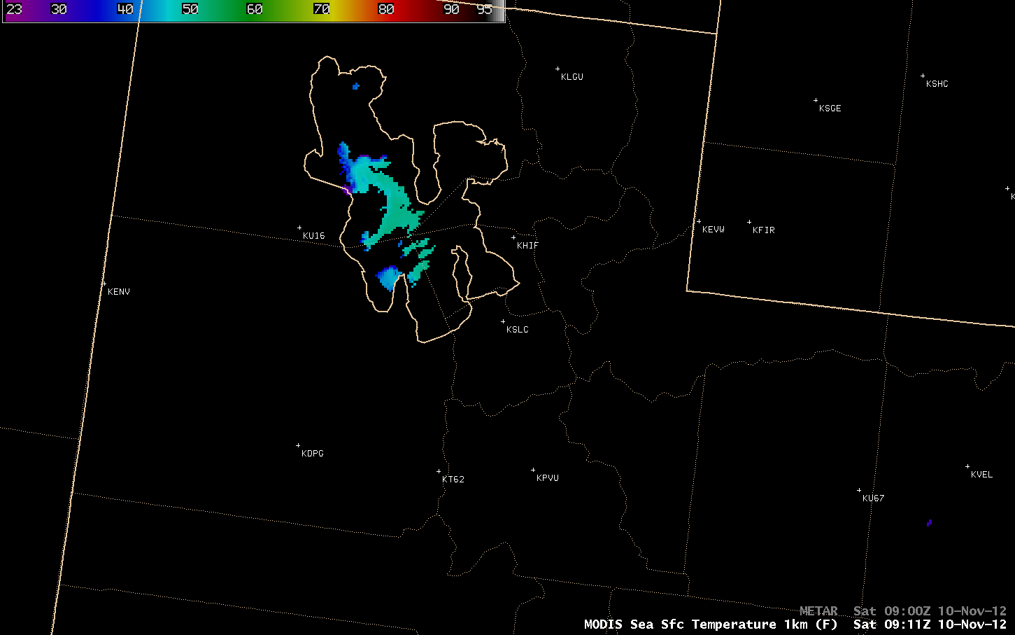
On the previous day, the MODIS Sea Surface Temperature (SST) product (below) indicated that mid-lake SST values were as warm as 51.5º F (light green color enhancement) — so the cold air flowing over the warm waters created a very unstable lower-tropospheric thermal profile that aided the development of the lake-effect snow band. For more discussion on this particular case, see a write-up on The Weather Channel site.
Meanwhile, farther to the east in South Dakota, cold arctic air was flowing southeastward across the still-unfrozen waters of the Missouri River (whose flow is controlled by several dams that create large reservoirs such as Lake Oahe and Lake Sharpe). Even though the fetch of the cold air across the water was relatively small, there were still a number of “lake-effect” or “river-effect” cloud bands seen on GOES-13 0.63 µm visible channel images (below; click image to play animation) — in particular, a long and well-defined cloud band extending downwind of the large horseshoe-shaped oxbow bend in Lake Sharpe. Such lake-effect clouds were also described in 2009 and 2008 on this blog.
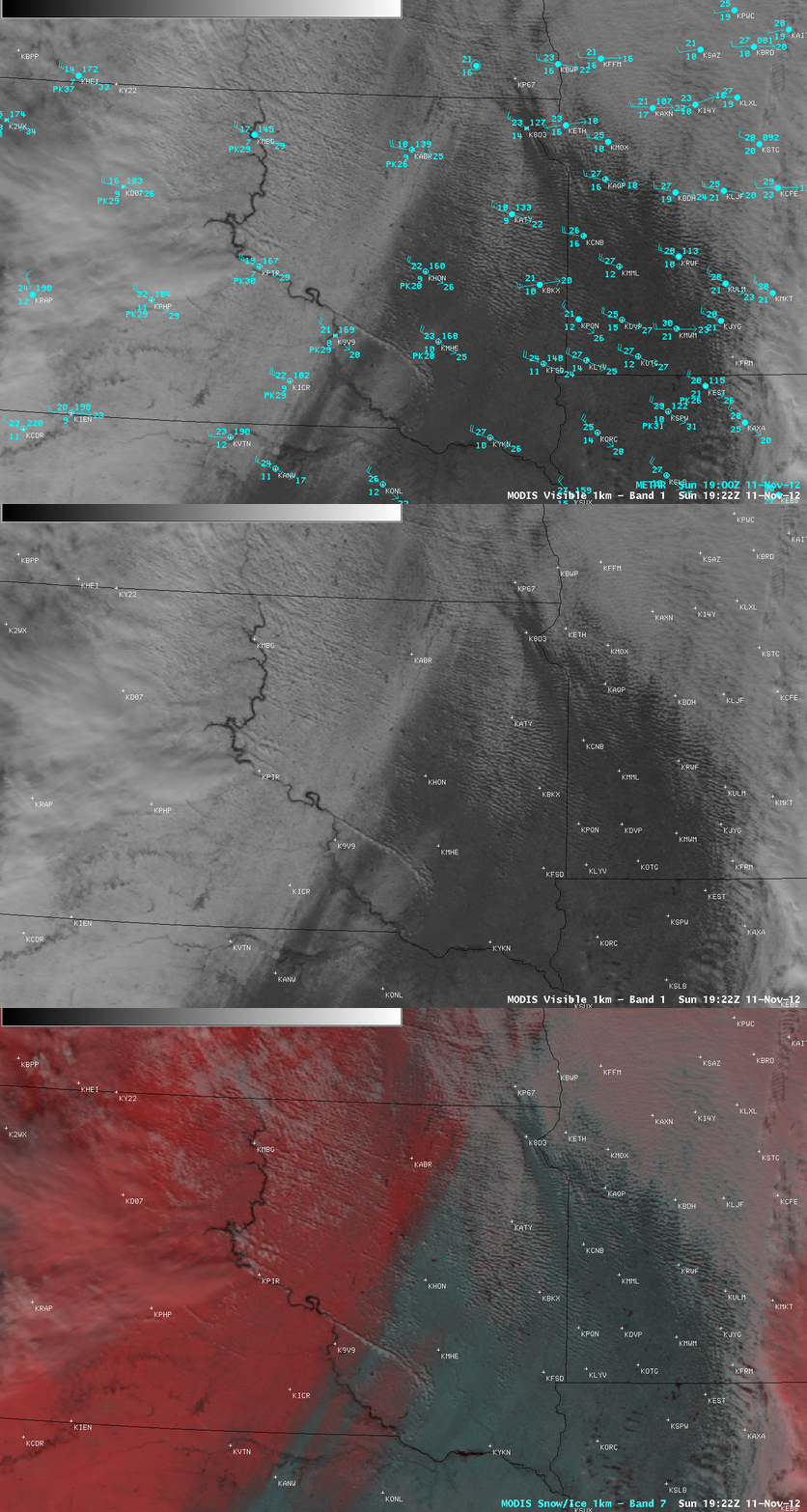
A comparison of AWIPS images of MODIS 0.65 µm visible channel and a false-color Red/Green/Blue (RGB) composite (below) demonstrated the value of using RGB imagery to help discriminate between snow cover (enhanced in darker shades of red) and supercooled water droplet clouds (which appear as varying shades of white).
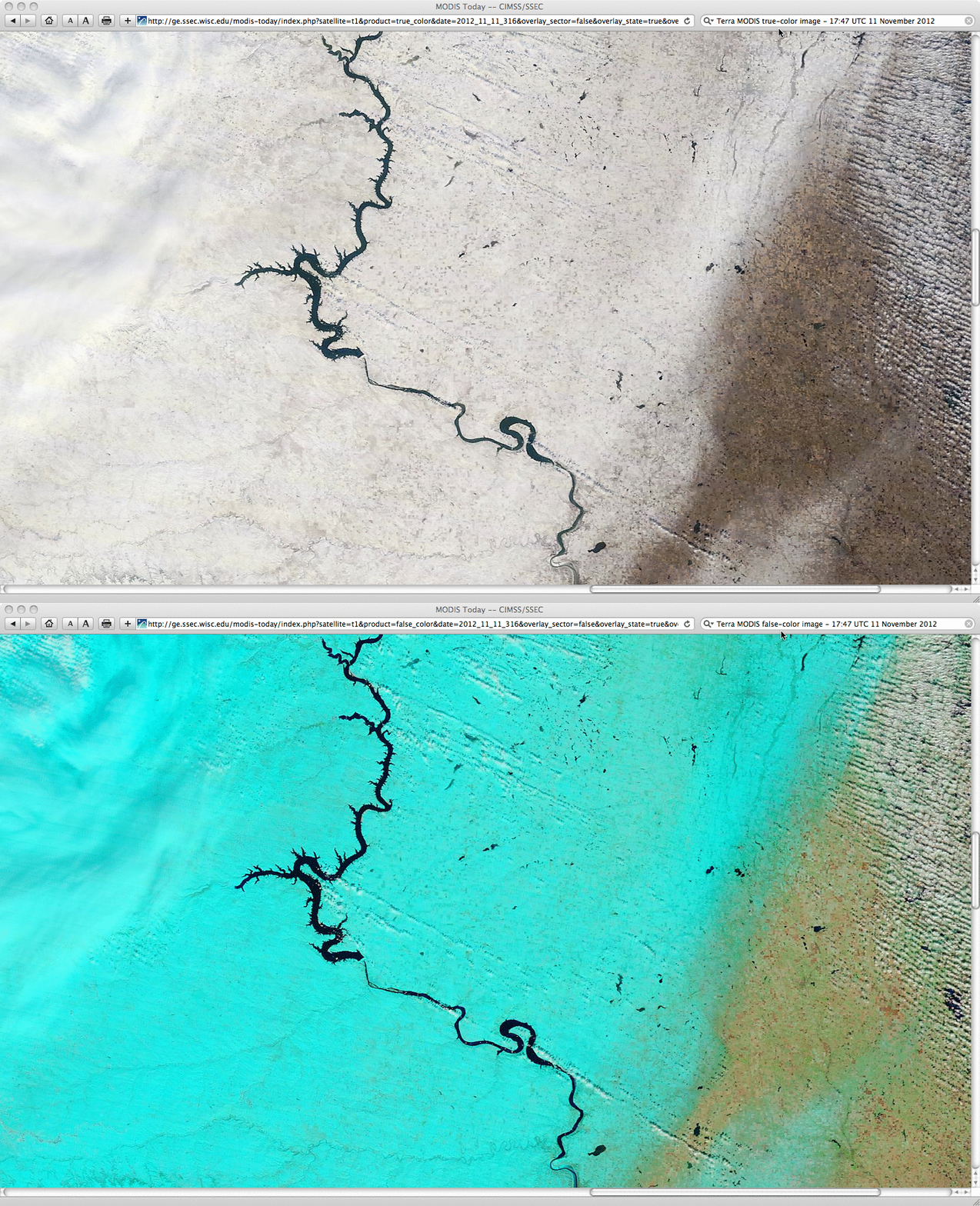
A closer view using 250-meter resolution MODIS true-color and false-color RGB images from the SSEC MODIS Today site (below) showed even greater detail in the structure of these cloud bands downwind of the Missouri River in South Dakota. In this RGB image, snow cover appeared as shades of cyan.


