Lake-effect cloud plumes in the Dakotas
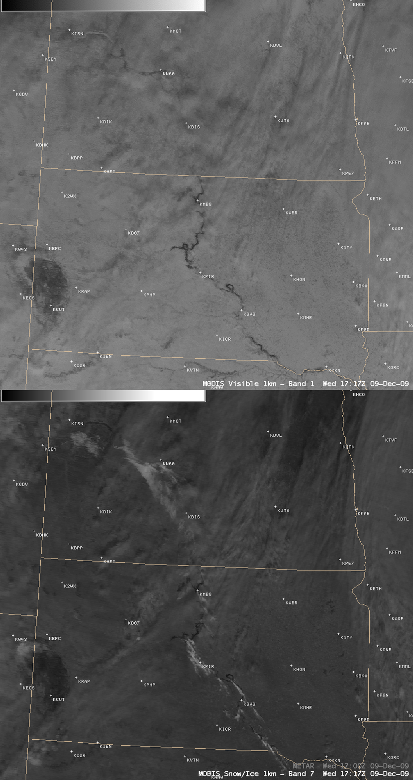
An influx of arctic air (surface plot) moved southeastward across North Dakota and South Dakota in the wake of a large and powerful Midwest blizzard on 09 December 2009. Since many sections of the Missouri river were still unfrozen — the MODIS Sea Surface Temperature product showed that water temperatures were still in the 30s F — the large difference in temperature created enough instability to allow a number of “lake-effect cloud plumes” to form. AWIPS images of the 1-km resolution MODIS visible channel and 2.1 µm near-IR “snow/ice” channel (above) showed how the snow/ice imagery can be useful for detecting supercooled water droplet clouds against a background of snow cover. Snow and ice are strong absorbers at the 2.1 µm wavelength, so they appear darker (in contrast to supercooled water droplet clouds, which appear as brighter white features). Note that these cloud features were not readily apparent on standard IR imagery, due to the lack of a good temperature contrast between the shallow cloud features and the background snow cover.
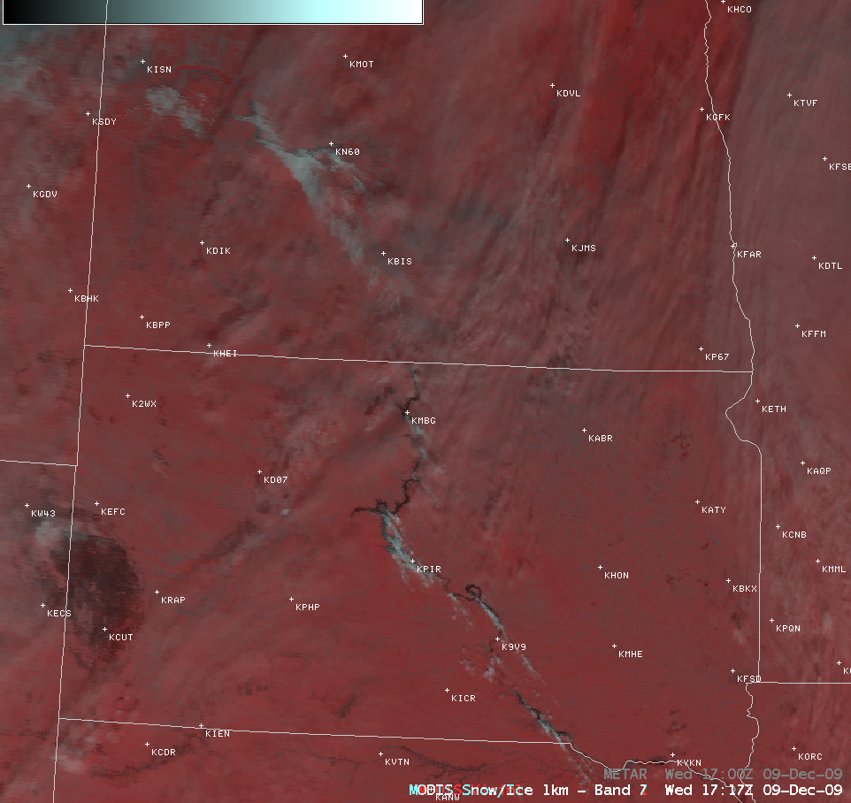
A false-color MODIS Red/Green/Blue (RGB) image (below) is another example of using the 2.1 µm data to aid in the detection of supercooled water droplet clouds — the background snow cover appears as varying shades of red, while the supercooled cloud features stand out as brighter white features. The capability create such RGB images will be available in the upcoming AWIPS II software.
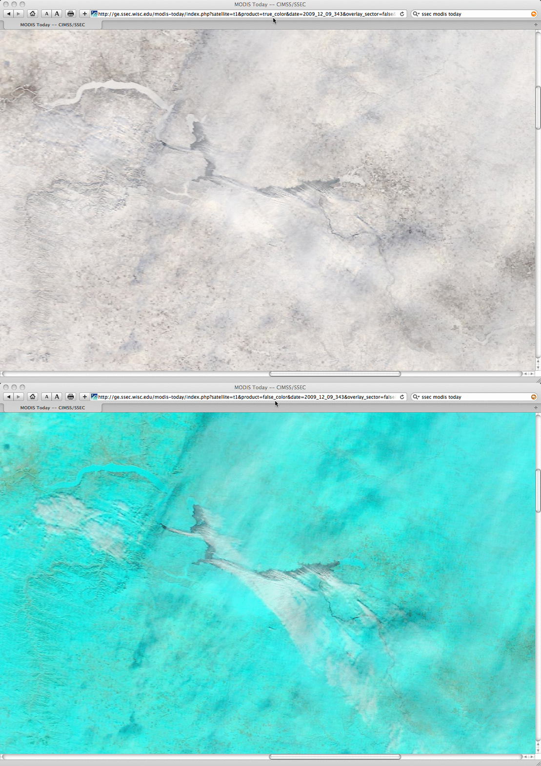
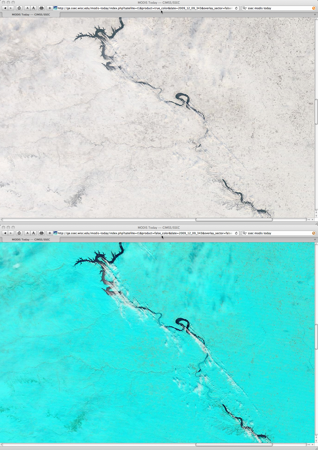
A closer view using 250-meter resolution MODIS true color and false color images from the SSEC MODIS Today site shows finer details of the lake-effect cloud plumes over North Dakota (above) and South Dakota (below). On these false-color images, the background snow cover appears as varying shades of cyan.
Similar lake-effect cloud plumes were seen on the previous day (08 December 2009) streaming southward from Fort Peck Lake in northeastern Montana.


