Heavy rainfall along the eastern Gulf Coast region
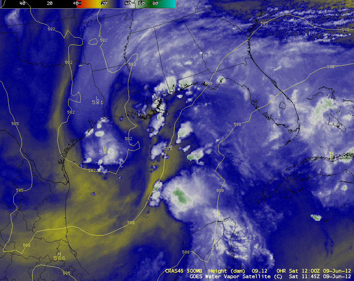
AWIPS images of GOES-13 6.5 µm water vapor channel data with overlays of CRAS model 500 hPa geopotential height (above; click image to play animation) showed the circulation of an upper-level low over the western Gulf of Mexico coastal region, with a southwesterly flow of moisture aiding the development of areas of deep convection across the eastern Gulf Coast states during the 08 June – 09 June 2012 period.
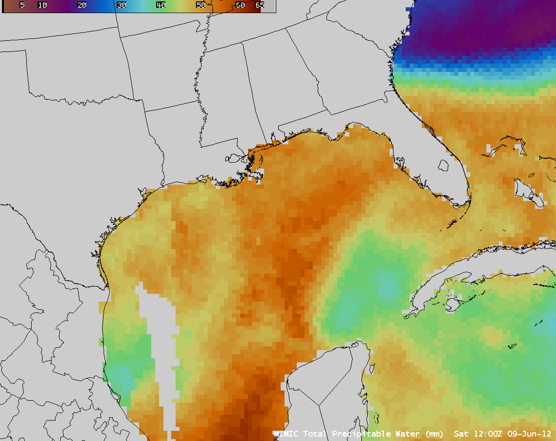
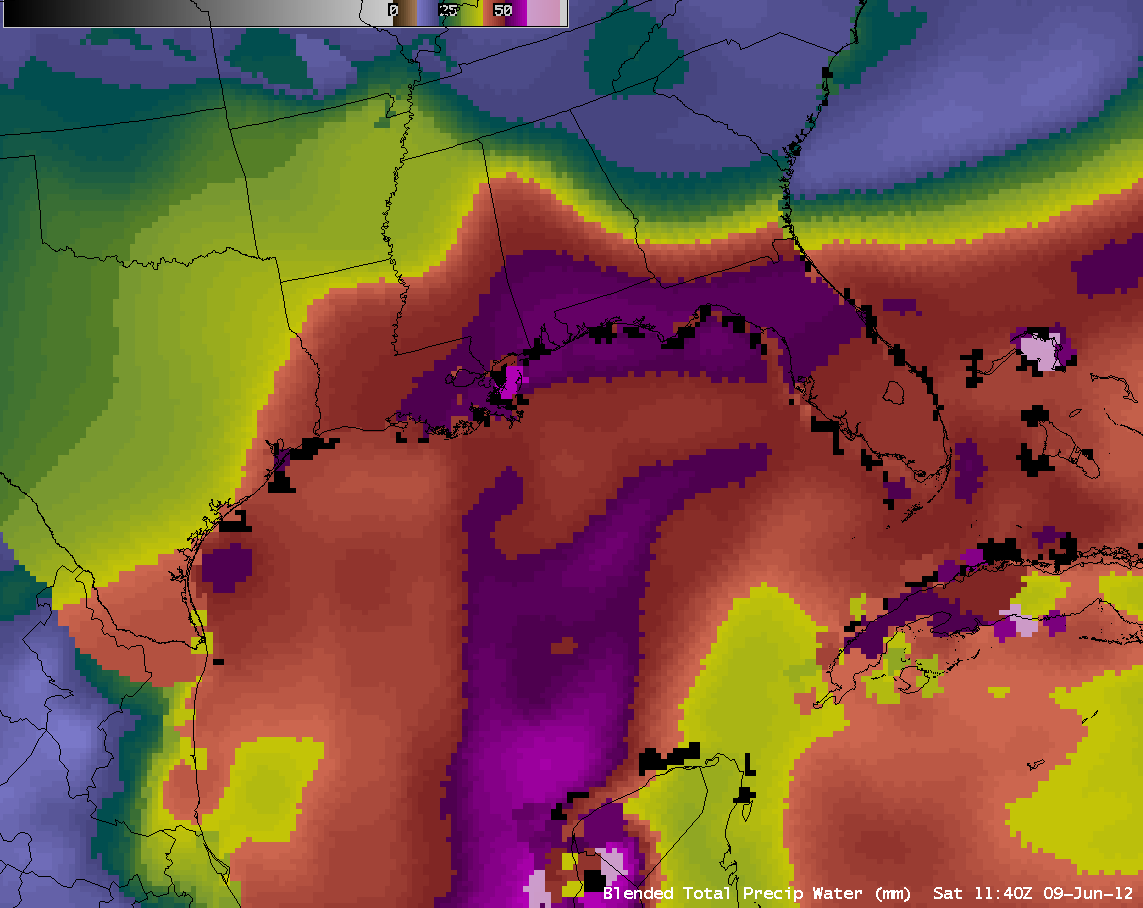
Both the MIMIC Total Precipitable Water (TPW) product (above; click image to play animation) and the Blended Total Precipitable Water product (below; click image to play animation) indicated that there was a prolonged plume of high TPW values in excess of 55 mm (2.2 inches) streaming northeastward toward the eastern Gulf Coast region during this time period. In addition, the presence of a quasi-stationary frontal boundary helped to provide a forcing mechanism for enhancing lift and focusing the development and intensification of deep convection.
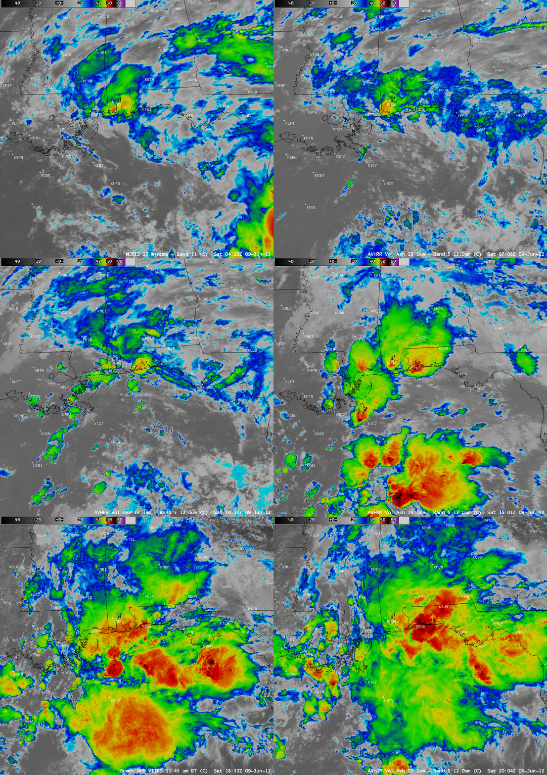
A sequence of 1-km resolution MODIS 11.0 µm IR, POES AVHRR 12.0 µm IR, and Suomi NPP VIIRS 11.45 µm IR images (below) showed some of the more well-developed areas of deep convection that moved across the region on 09 June. Very heavy rainfall resulted at some locations on that day, including 13.13 inches being recorded at Pensacola, Florida (their second-highest daily precipitation total on record). A COCORAHS station near Pensacola reported a total of 21.70 inches of rain in the 24 hours ending at 8 AM local time on 10 June. Mobile, Alabama received 5.79 inches of rainfall, setting a new daily record for 09 June.


