Record heat in parts of Texas, Oklahoma, and Kansas; large fire near Los Alamos, New Mexico
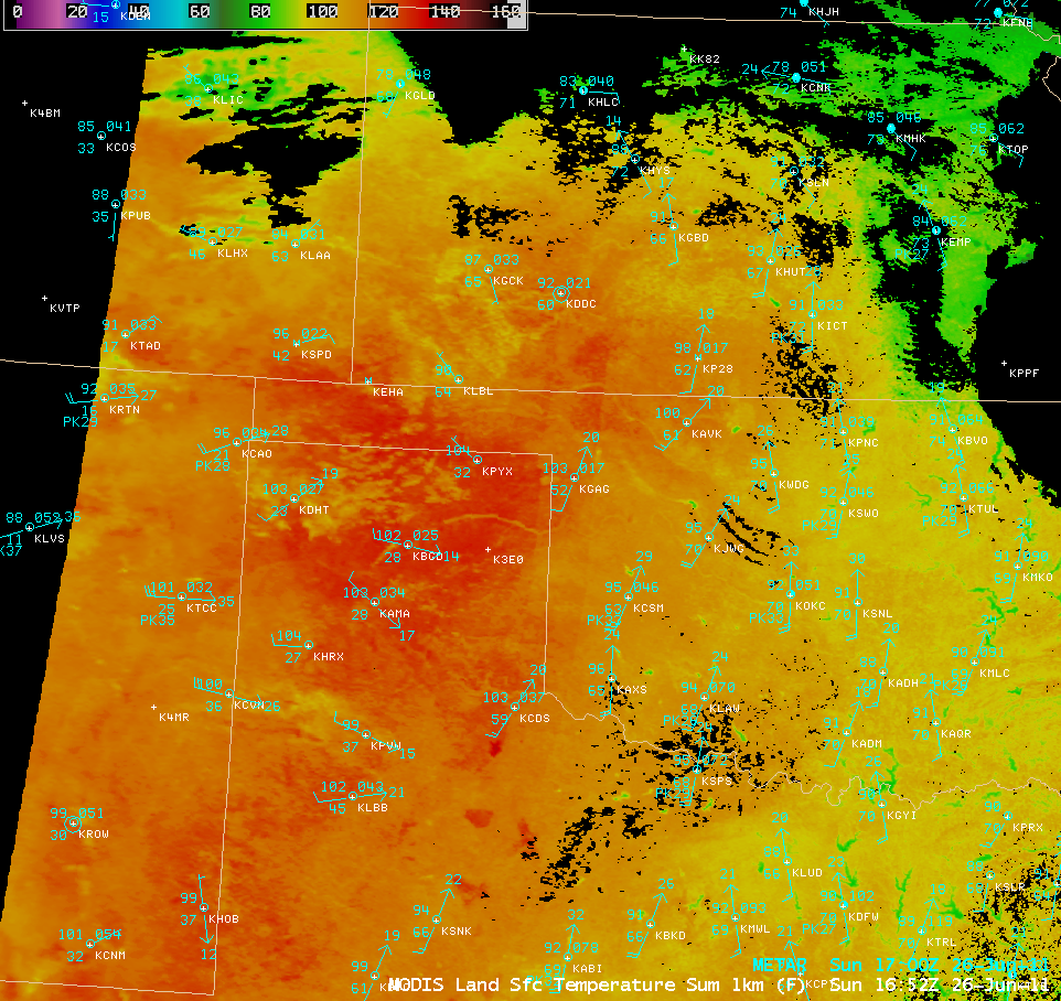
Record heat was experienced across parts of the Texas and Oklahoma panhandle regions and southwestern Kansas on 26 June 2011 — all-time record high temperatures in Texas included 117ºF at Childress (record tied), 113ºF at Borger, 111ºF at Amarillo, and 110ºF at Dalhart; in Oklahoma, 113ºF at Gage; and in Kansas 110ºF at Dodge City. An AWIPS image of the MODIS Land Surface Temperature (LST) product in the late morning at 16:52 UTC or 11:52 am local time (above) showed a large area exhibiting LST values of 125-130ºF (darker red color enhancement) at that time (although shelter air temperatures 5 feet above the surface were only in the 102ºF to 104ºF range).
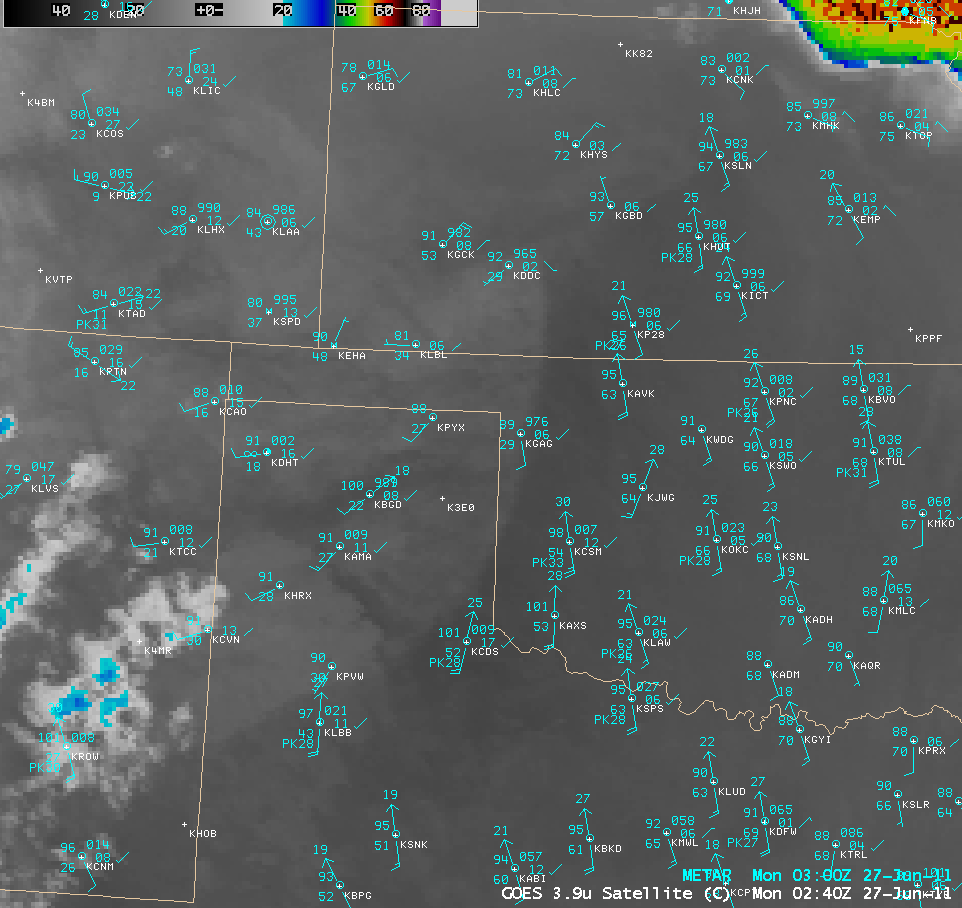
GOES-13 3.9 µm shortwave IR images (below; click image to play animation) showed how after sunset the areas with drier air (lower dew points) tended to cool off faster than adjacent areas with more moisture in the air (higher dew points).
Farther to the west, a large wildfire was burning near Los Alamos National Laboratory in New Mexico. A sequence of daytime GOES-13 0.63 µm visible channel images followed by night-time GOES-13 3.9 µm shortwave IR images (below; click image to play animation) revealed a very large smoke plume spreading northeastward during the day on 26 June, along with a very large fire “hot spot” (black to yellow pixels) on the shortwave IR images. The large smoke plume was still apparent on the first few visible images on the next morning (27 June).
GOES-13 0.63 µm visible images + GOES-13 3.9 µm shortwave IR images (click image to play animation)
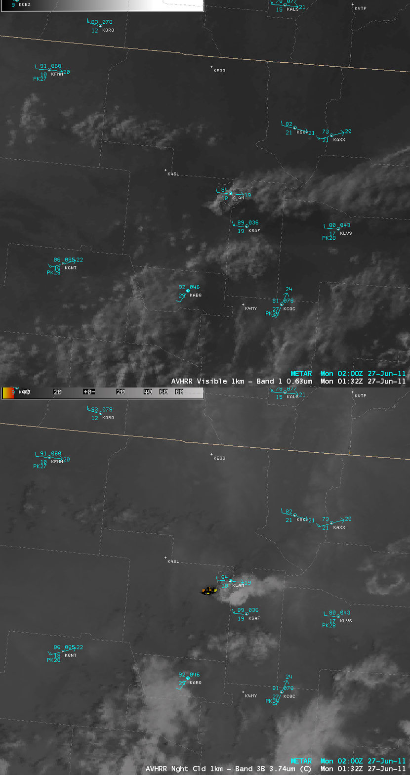
A comparison of 1-km resolution POES AVHRR 0.63 µm visible channel and 3.74 µm shortwave IR channel images (below) showed a better view of the fire hot spot and associated smoke plume at 01:32 UTC.


