Fires in the southeast United States
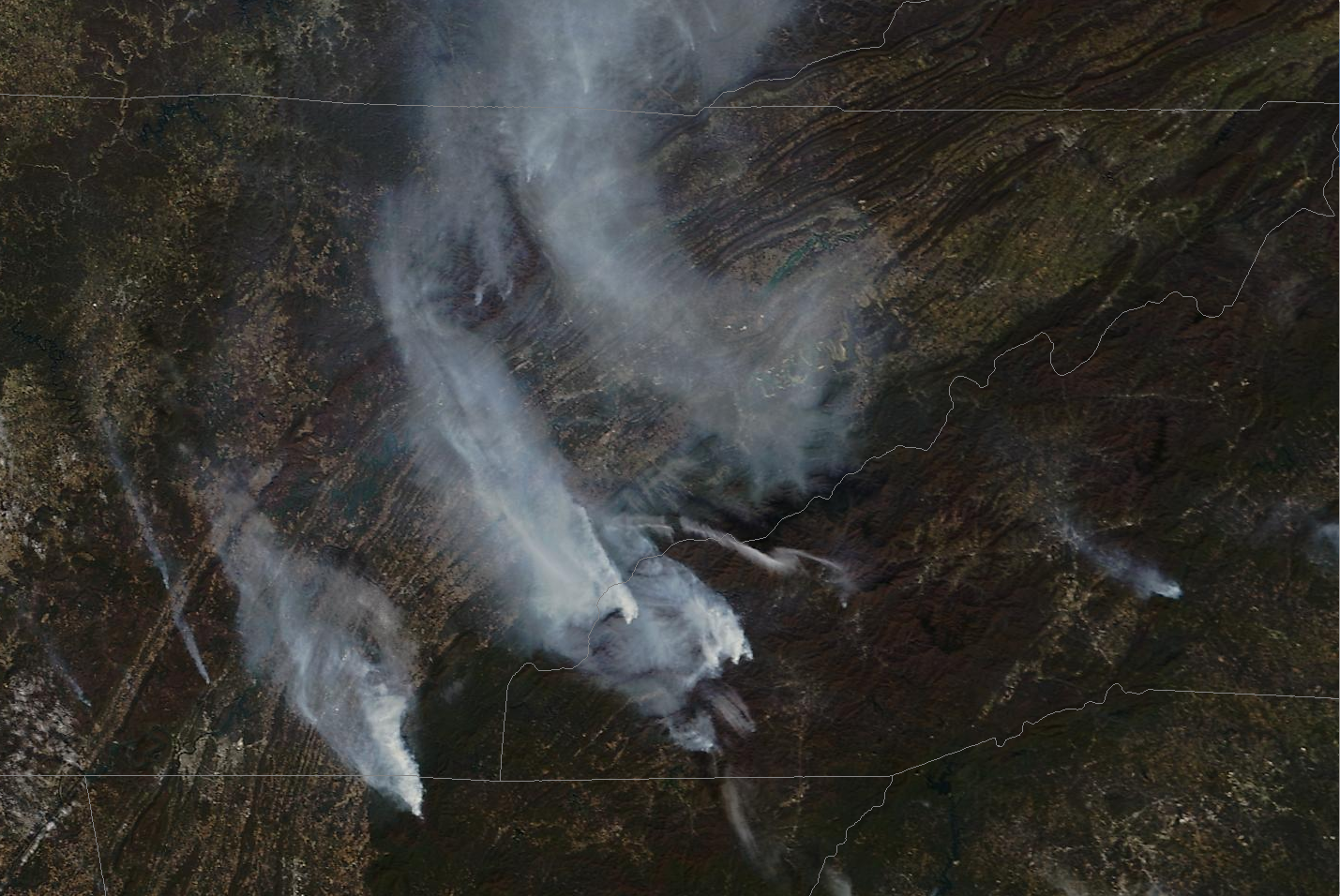
Terra MODIS True-Color Imagery over the Smoky Mountains, 7 November 2016 (Click to enlarge)
Persistent moderate to severe drought (shown here, from this site) over the southeastern United States has supported the development of fires in and around the Great Smoky Mountains on 7 November 2016. True-color imagery from Terra MODIS, above, (source: MODIS Today) showed the active fires and plumes of smoke spreading northward into the Ohio River Valley.
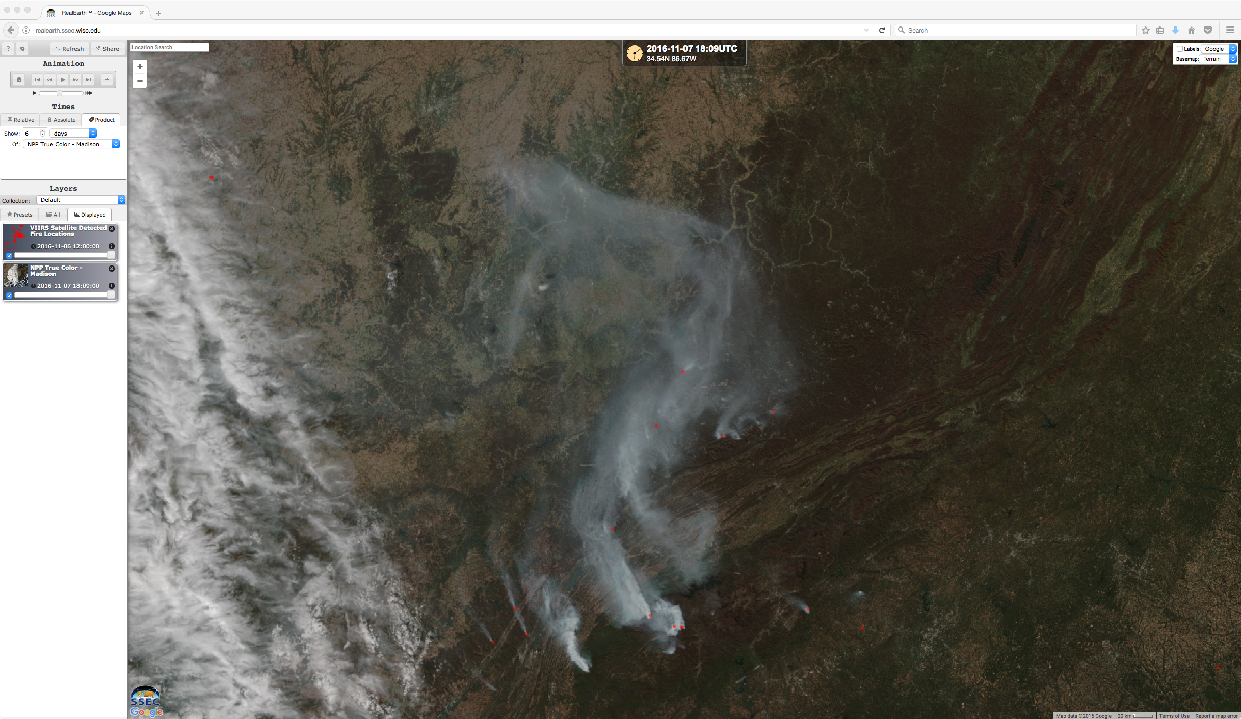
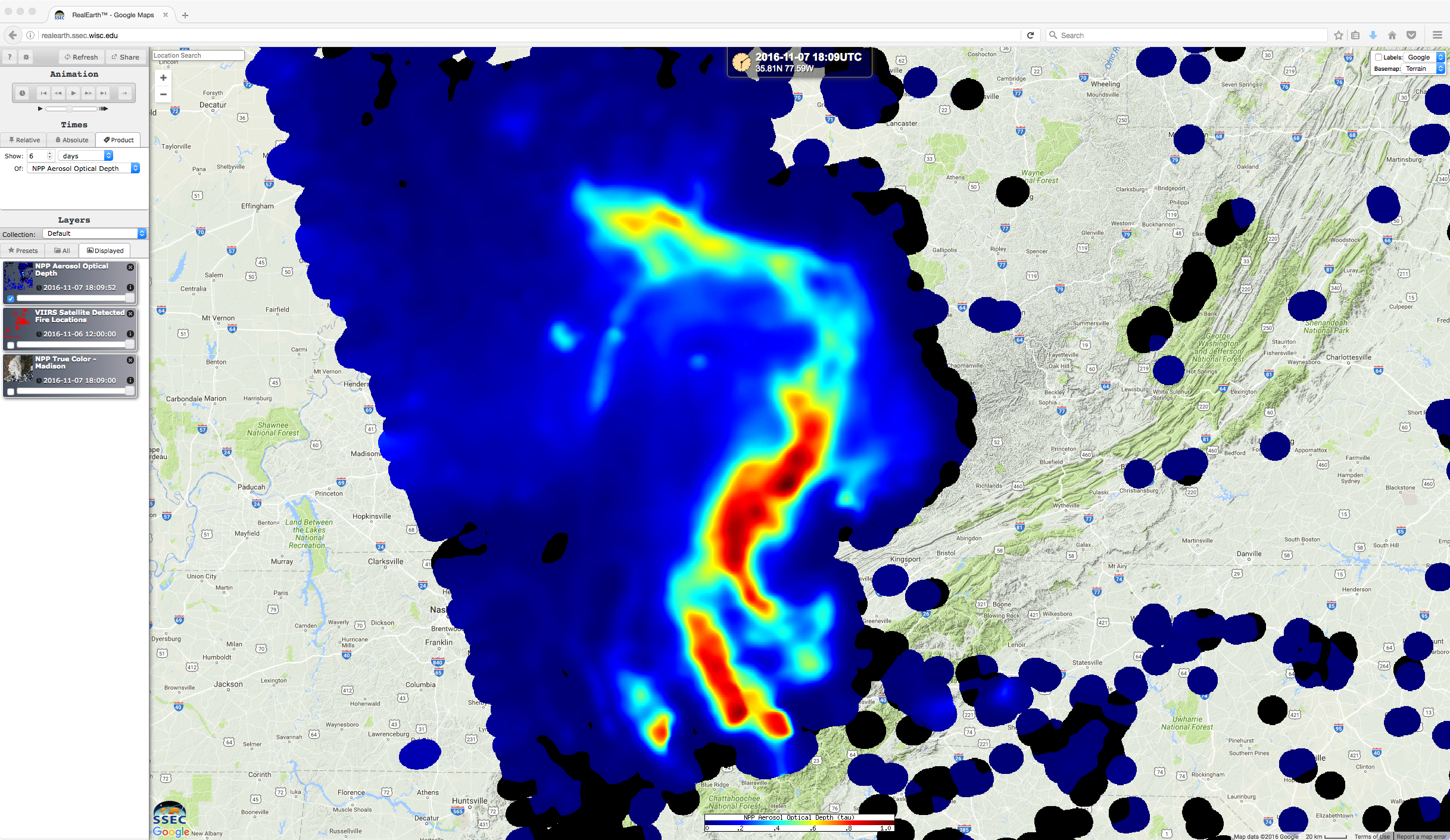
Suomi NPP VIIRS true-color imagery also captured the smoke emanating from the active fires, and the Aerosol Optical Depth product, toggled below (data sources: RealEarth) showed the extent of the thickest smoke layer (click here for an animation that does not include the RealEarth framing).
![Suomi NPP VIIRS true-color image with fire detection locations (red dots), and VIIRS Aerosol Optical Depth product [click to enlarge]](https://cimss.ssec.wisc.edu/satellite-blog/wp-content/uploads/sites/5/2016/11/161107_1809utc_suomi_npp_viirs_truecolor_fire_detection_aerosol_optical_depth_anim.gif)
Suomi NPP VIIRS true-color image with fire detection locations (red dots), and VIIRS Aerosol Optical Depth product [click to enlarge]
![Terra MODIS, Suomi NPP VIIRS and Aqua MODIS true-color images [click to enlarge]](https://cimss.ssec.wisc.edu/satellite-blog/wp-content/uploads/sites/5/2016/11/161107_modis_VIIRS_truecolor_Southeast_US_fires_anim.gif)
Terra MODIS, Suomi NPP VIIRS and Aqua MODIS true-color images [click to enlarge]
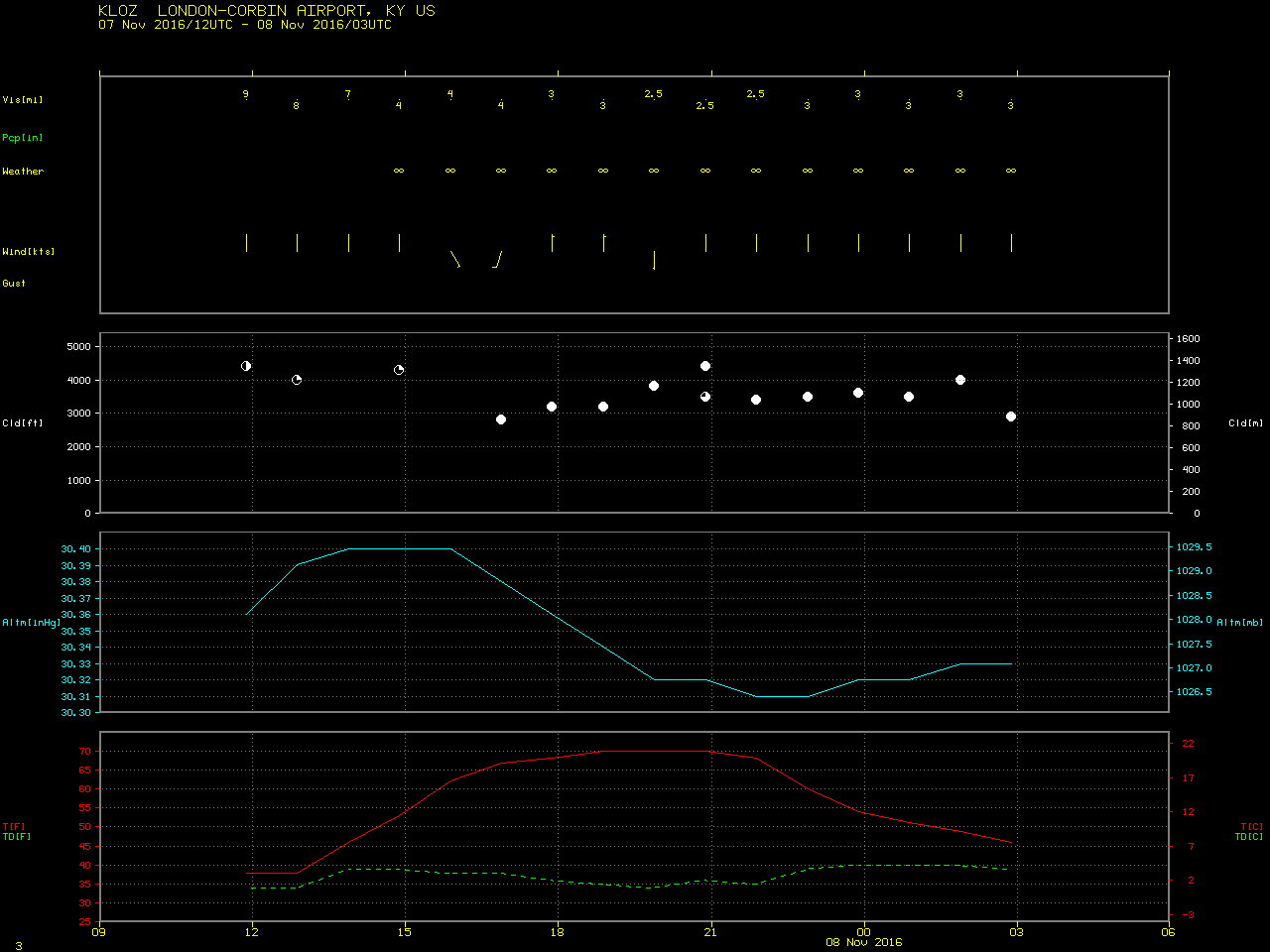
![GOES-13 Visible (0.63 µm) images; hourly surface weather symbols are plotted in yellow, with surface visibility (statute miles) plotted in cyan [click to play animation]](https://cimss.ssec.wisc.edu/satellite-blog/wp-content/uploads/sites/5/2016/11/161107_goes13_visible_surface_weather_visibility_Southeast_US_fires_anim.gif)
GOES-13 Visible (0.63 µm) images; hourly surface weather symbols are plotted in yellow, with surface visibility (statute miles) plotted in cyan [click to play animation]
===== 10 November Update =====
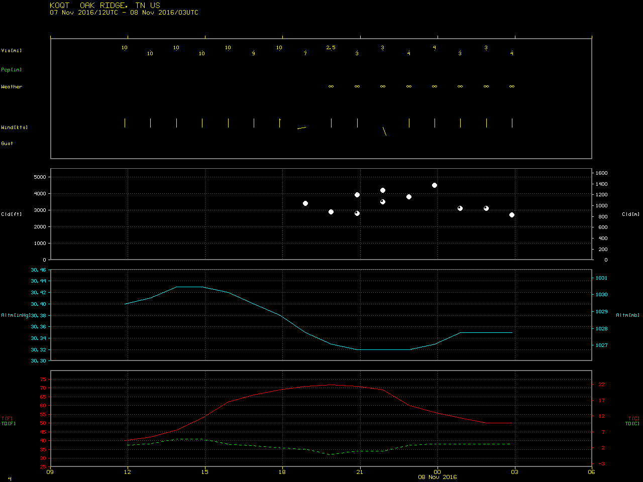
![GOES-13 Visible (0.63 µm) images; hourly surface weather symbols are plotted in yellow, with surface visibility (statute miles) plotted in cyan [click to play animation]](https://cimss.ssec.wisc.edu/satellite-blog/wp-content/uploads/sites/5/2016/11/161110_goes13_visible_surface_weather_visibility_Southeast_US_fires_anim.gif)
GOES-13 Visible (0.63 µm) images; hourly surface weather symbols are plotted in yellow, with surface visibility (statute miles) plotted in cyan [click to play animation]
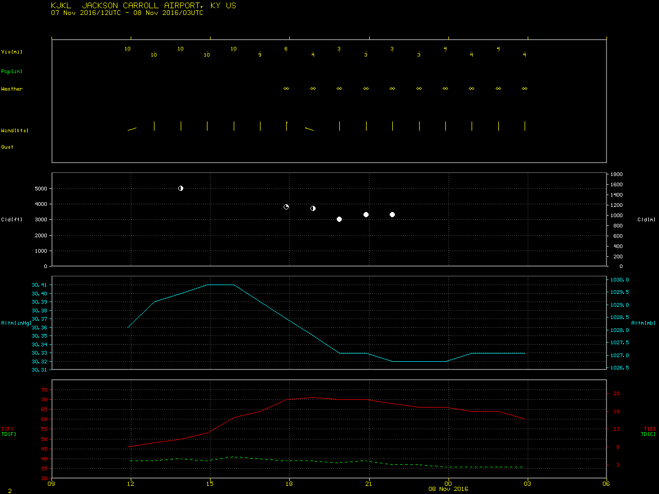
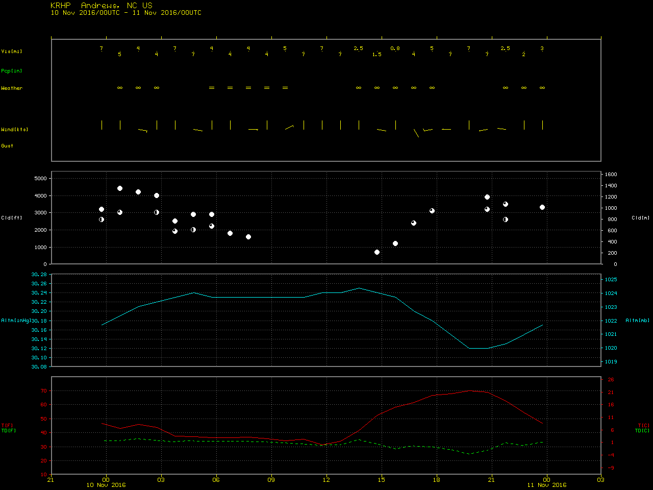
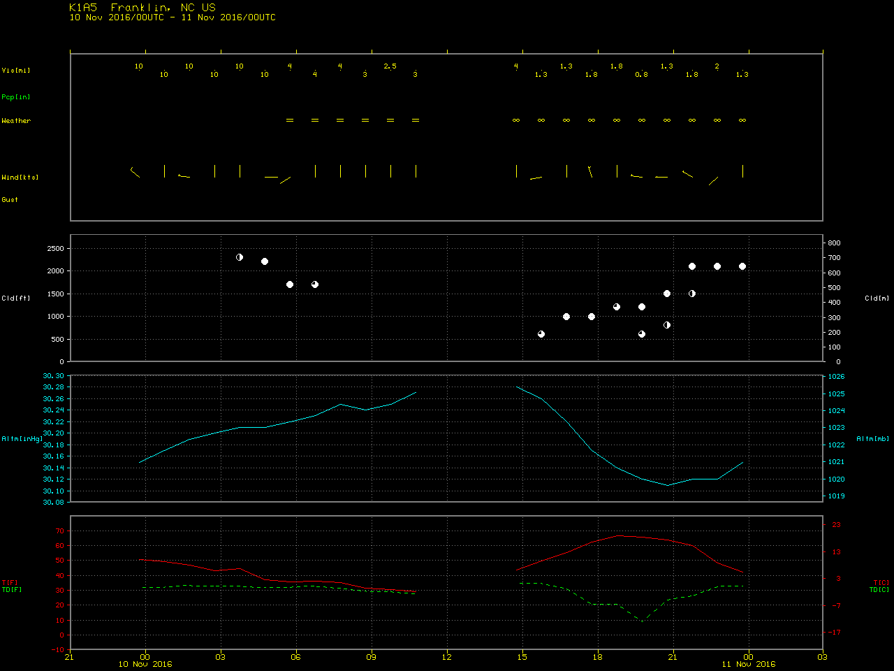
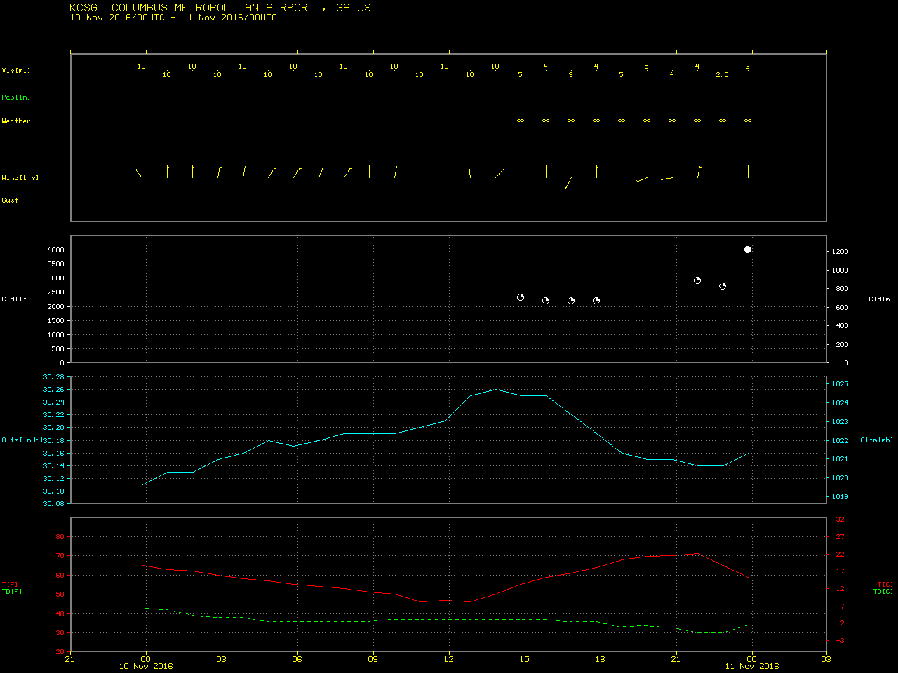
A Pilot Report (PIREP) in northern Georgia at 1530 UTC, below, indicated that the top of the smoke layer was around 3500 feet (where the Flight Visibility was 4 miles). Surface reports in the vicinity of that PIREP indicated a ceiling of 1500 to 1700 feet, suggesting that the dense smoke layer aloft was about 1800-2000 feet thick over northern Georgia.
![GOES-13 Visible (0.63 µm) image, with cloud ceiling (hundreds of feet above ground level) and visibility (statute miles) plotted in cyan and a Pilot Report in yellow [click to enlarge]](https://cimss.ssec.wisc.edu/satellite-blog/wp-content/uploads/sites/5/2016/11/161110_1545utc_goes13_visible_pirep.png)
GOES-13 Visible (0.63 µm) image, with cloud ceiling (hundreds of feet above ground level) and visibility (statute miles) plotted in cyan and a Pilot Report in yellow [click to enlarge]
![Aqua MODIS true-color image [click to enlarge]](https://cimss.ssec.wisc.edu/satellite-blog/wp-content/uploads/sites/5/2016/11/AQUA_TrueColor_10Nov2016.1000m.png)
Aqua MODIS true-color image [click to enlarge]
![Suomi NPP VIIRS true-color image (with fire detection locations in red) and Aerosol Optical Depth product [click to enlarge]](https://cimss.ssec.wisc.edu/satellite-blog/wp-content/uploads/sites/5/2016/11/161110_1858utc_suomi_npp_viirs_truecolor_fire_detections_aod_Southeast_US_fires_anim.gif)
Suomi NPP VIIRS true-color image (with fire detection locations in red) and Aerosol Optical Depth product [click to enlarge]