Dust storm in southern Nevada and California
GOES-13 (GOES-East) 0.63 µm visible channel images (click image to play animation; also available as an MP4 movie file) showed the hazy signature of a cloud of thick blowing dust moving southward across southern Nevada and parts of southern California, along and behind a strong cold frontal boundary on 14 April 2015.
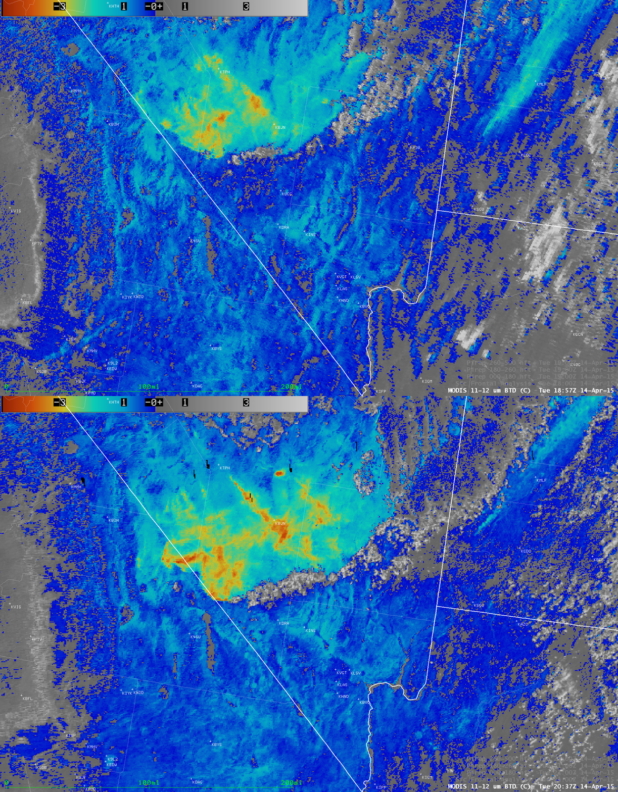
Areas where the dust cloud was more dense could be identified using the Terra and Aqua MODIS 11-12 µm IR brightness temperature difference (BTD) product (below). The 12 µm IR channel is no longer available on the imager instrument of the current series of GOES satellites — however, the ABI instrument on the upcoming GOES-R satellite will have a 12 µm IR channel, allowing the creation of such BTD products to aid in the identification and tracking of similar dust features.
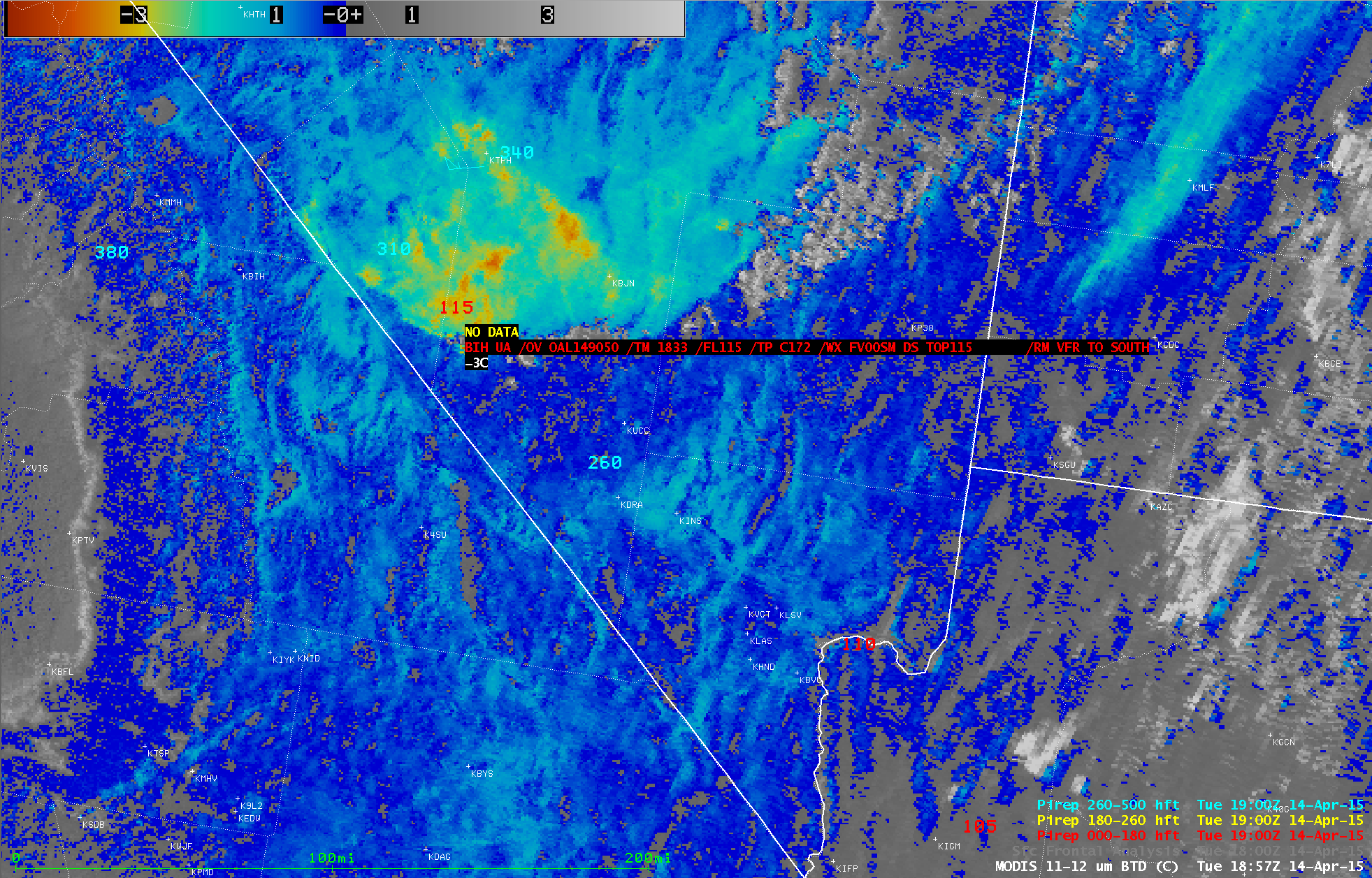
At 1833 UTC, a pilot reported that the top of the dust cloud was at 11,500 feet near its leading edge (below). Farther to the south, strong winds interacting with the terrain were causing pockets of moderate to severe turbulence.
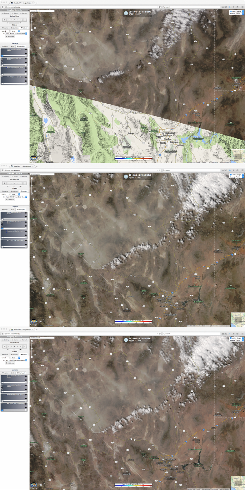
The blowing dust cloud was also evident on true-color Red/Green/Blue (RGB) images from MODIS and VIIRS, as visualized using the SSEC RealEarth web map server (below).


