The GOES-14 (GOES-O) satellite was launched on 27 June 2009, and is undergoing its Post Launch Test. The first calibrated full disk visible image (above) was received by the SSEC Data Center beginning at 17:30 UTC on 27 July 2009.A close-up view centered over central California (below) showed marine fog and stratus hugging the Pacific coast, with cumulus clouds... Read More

First GOES-14 full-disk visible image
The GOES-14 (GOES-O) satellite was launched on 27 June 2009, and is undergoing its Post Launch Test. The first calibrated full disk visible image (above) was received by the SSEC Data Center beginning at 17:30 UTC on 27 July 2009.
A close-up view centered over central California (below) showed marine fog and stratus hugging the Pacific coast, with cumulus clouds developing inland over the higher terrain of the Sierra Nevada.
")
GOES-14 visible image (centered over central California)
Farther to the west, a pattern of ship tracks was evident in the marine layer stratocumulus clouds over the North Pacific Ocean (below).
")
GOES-14 visible image (ship tracks over the North Pacific Ocean)
A nice series of von Karman vorticies was seen streaming southward from Guadalupe Island off the west coast of Baja California (below).
")
GOES-14 visible image (von Karmann vorticies off Baja California)
A view centered over southern Florida (below) showed the development of numerous thunderstorms over that region.
")
GOES-14 visible image (centered over southern Florida)
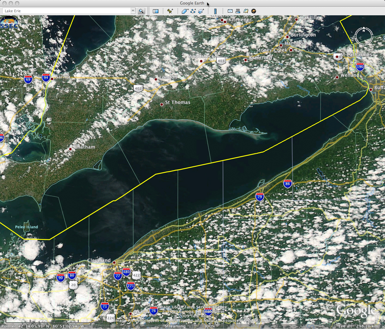
A view centered over Lake Erie (below) showed widespread cumulus cloud development surrounding the lake (with some bands of billow clouds evident in the eastern portion of the scene). There was also a hint of a sediment plume south of Long Point, which extends into the northeastern portion of the lake from Ontario — this sediment plume could also be seen on MODIS true color imagery.
")
GOES-14 visible image (centered over Lake Erie)
Looking to the south of the Equator, a view centered over central Chile in South America (below) showed a small cyclonic (clockwise in the Southern Hemisphere) vortex in the marine layer clouds off the coast, with snow cover inland over the higher terrain of the Andes.
")
GOES-14 visible image (centered over central Chile)
Over the South Pacific Ocean, some interesting cloud structure suggesting the formation of actinae was apparent (below).
")
GOES-14 visible image (actinae over the South Pacific Ocean)
An image centered over the Amazon River in central Brazil (below) showed how the wide waterway was suppressing the formation of cumulus clouds (since the water surfaces were not heating up as quickly as the adjacent land surfaces). The Amazon River was still abnormally wide after record rainfall across parts of Brazil during May-June 2009 — in fact, at the mouth of the Amazon River a large sediment plume was seen fanning outward into the Atlantic Ocean on MODIS true color imagery.
")
GOES-14 visible image (centered over the Amazon River in Brazil)
View only this post
Read Less

")


