This website works best with a newer web browser such as Chrome, Firefox, Safari or Microsoft Edge. Internet Explorer is not supported by this website.

Satellite signatures of the Mississippi Alluvial Valley

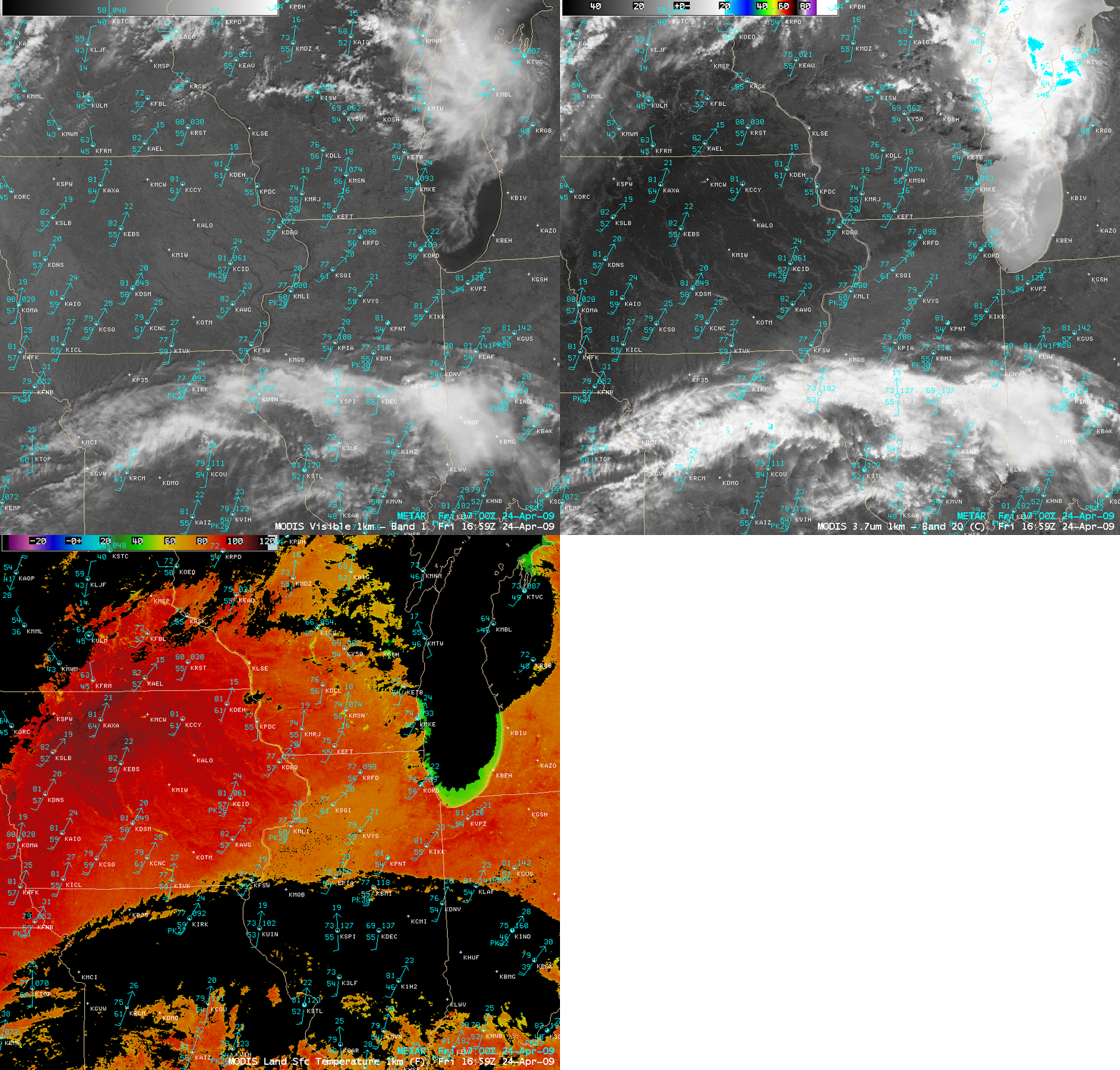
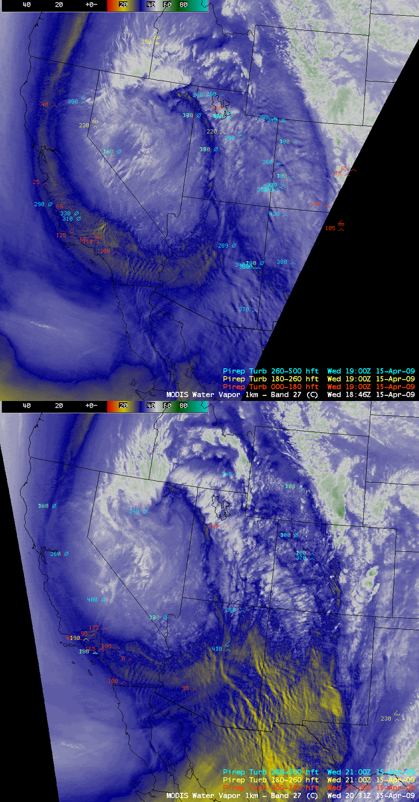
AWIPS images of the MODIS visible channel along with the Normalized Difference Vegetation Index (NDVI) and Land Surface Temperature (LST) products (above) depicted the areal extent of the Mississippi Alluvial Valley (MAV) on 12 May 2008. This physiographic feature represents the historical flood plain of the lower Mississippi River, which stretches from... Read More

MODIS images (Animated GIF)

AWIPS images of the MODIS visible channel along with the Normalized Difference Vegetation Index (NDVI) and Land Surface Temperature (LST) products (above) depicted the areal extent of the Mississippi Alluvial Valley (MAV) on 12 May 2008. This physiographic feature represents the historical flood plain of the lower Mississippi River, which stretches from the confluence of the Ohio River to the Gulf of Mexico. Much of this land has been converted to agricultural use during the past century — because of the marked differences in soil composition and vegetation density between the MAV and the surrounding forest-covered areas, the MAV shows up as a lighter shade of gray on the visible image, with significantly lower NDVI values around 0.2 to 0.3. In addition, significantly warmer LST values were seen in the MAV, which were 20-30 degrees F warmer (darker red colors) compared to the surrounding forested areas (similar warm LST values were also noted over cities and other heavily urbanized locations).

View only this post Read Less
Classic enhanced-V and anvil plume signatures

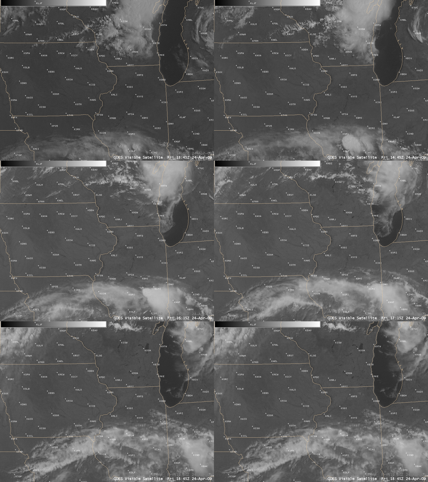
The severe thunderstorm that was producing a significant long-track tornado (approximately 75 miles long, and around 1 mile wide at times) across parts of northeastern Oklahoma and southwestern Missouri on 10 May 2008 exhibited a classic “enhanced-v” signature on both GOES-12 and NOAA-16 IR imagery. The coldest cloud top brightness temperature values... Read More

GOES-12 + NOAA-16 IR and visible images (Animated GIF)

The severe thunderstorm that was producing a significant long-track tornado (approximately 75 miles long, and around 1 mile wide at times) across parts of northeastern Oklahoma and southwestern Missouri on 10 May 2008 exhibited a classic “enhanced-v” signature on both GOES-12 and NOAA-16 IR imagery. The coldest cloud top brightness temperature values in the region of the enhanced-v were -79 C on the 1-km resolution NOAA-16 AVHRR data, compared to -67 C on the 4-km resolution GOES-12 IR data. In addition, the visible imagery revealed a well-defined anvil plume spreading northeastward from the overshooting top region. Large hail (up to 2.75 inches in diameter) and wind gusts to 65 mph were reported around or just after the time of these images at Joplin, Missouri (station identifier KJLN). The long-track tornado produced EF-4 damage, and was responsible for at least a dozen fatalities in the Picher, Oklahoma and the Seneca/Racine, Missouri areas (SPC storm reports | Tulsa OK NWS summary | Springfield MO NWS summary).

View only this post Read Less
Sharp cloud boundary: evidence of a hydraulic jump?

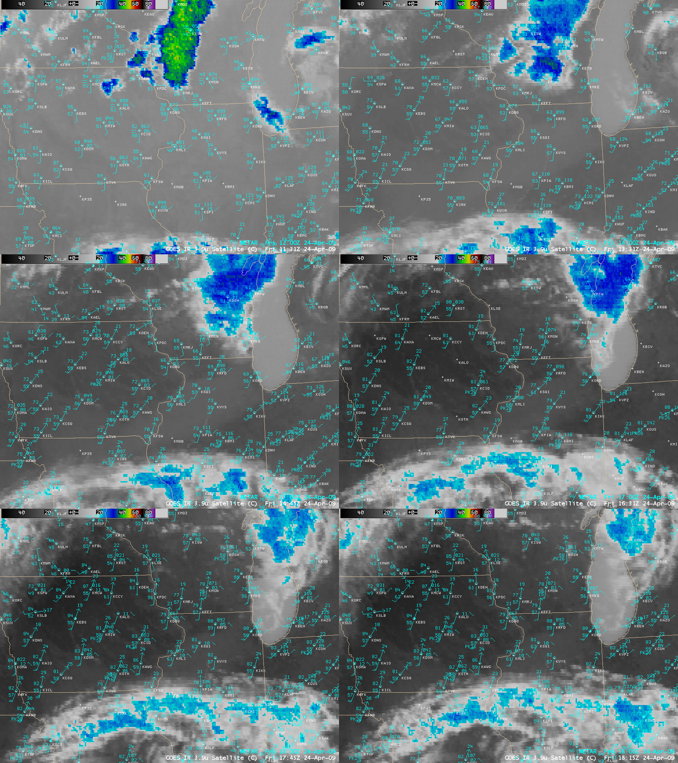
On the morning of 08 May 2008, we received the following email from David Zaff, Science and Operations Officer at the National Weather Service Forecast Office at Buffalo NY:The NWS BUF office was marveling over the fine line starting from below the thumb of MI through Toronto and along the northern edge... Read More

GOES-12 visible images (Animated GIF)

On the morning of 08 May 2008, we received the following email from David Zaff, Science and Operations Officer at the National Weather Service Forecast Office at Buffalo NY:

The NWS BUF office was marveling over the fine line starting from below the thumb of MI through Toronto and along the northern edge of Lake Ontario, but we had a hard time describing why it was there. A cold front had moved through overnight with widespread rain and this boundary appeared as the main synoptic event passed. It doesn’t appear to be tied to land/lake interactions or terrain. It’s clearly drier on one side and more moist on the other with a cap in place. There are also some neat gravity waves that pass into lake Ontario as the flow passes over the boundary when looping the vis earlier in the day.

Great question Dave, and a very interesting satellite imagery example! After some initial pondering, the satellite geeks at CIMSS came to the consensus that the sharp quasi-stationary cloud boundary seen on GOES-12 visible channel images (above, oriented WSW to ENE across lower Michigan,  southern Ontario, and northern Lake Ontario) was possibly due to an atmospheric hydraulic jump. A hydraulic jump can occur when fluid flow at a higher velocity discharges into a zone of lower velocity — a thinner layer of faster, laminar flow abruptly transitions to a deeper layer of slower, more turbulent flow.

But why would a hydraulic jump cause the sharp clearing line seen in the field of cumulus clouds? The answer might lie in the vertical structure of the atmosphere over that region; rawinsonde data plotted for Gaylord, Michigan, Detroit, Michigan and Buffalo, New York (below) revealed that a very strong subsidence inversion existed over lower Michigan that morning. The base of the temperature inversion (which was most dramatic at Detroit, yellow sounding plot) was around 900 hPa, with very dry air in place above that level — if turbulent flow associated with the hydraulic jump acted to rapidly entrain some of that very dry air to lower altitudes, such a marked cloud clearing could result.

rawinsonde reports

GFS40 model fields (below) indicated that there was a weak post-frontal trough at 850 hPa, with a band of convergence just ahead of the trough axis that seemed to correspond to the sharp cloud boundary on the GOES-12 visible imagery. Such a band of convergence is consistent with the idea of “higher-velocity flow discharging into a zone of lower velocities” — the slowing of the flow would effectively create convergence.

GOES-12 visible image + model 850 hPa divergence

A vertical cross section using initial condition (0-hour forecast) fields from the GFS40 model (below) showed the very low relative humidity values that existed above the low-level temperature inversion (over the northern 2/3 of the cross section area). Both the model ageostrophic vertical circulation and the omega fields suggested that there was a shallow region of boundary layer downward motion over  southern Ontario, approximately where the hydraulic jump and cloud clearing line were located around 12 UTC.

GFS model cross sections (Animated GIF)

In addition to the hydraulic-jump-induced sharp cloud clearing line seen on GOES-12 visible imagery, there was also evidence of a downstream undular bore; parallel cloud bands were apparent on 250-meter resolution MODIS true color imagery (from the SSEC MODIS Today site) centered over western Lake Ontario (below), as well as farther to the west over Lower Michigan.

MODIS true color image

Another question that remains is: what role (if any) did topography play in the formation and/or maintenance of such a hydraulic jump? An AWIPS topography image (below) shows that there is some slightly higher terrain over  southern Ontario, but the general orientation of the topography does not match that of the sharp clearing line seen on satellite imagery.

AWIPS topography image

View only this post Read Less
Chaiten Erupts

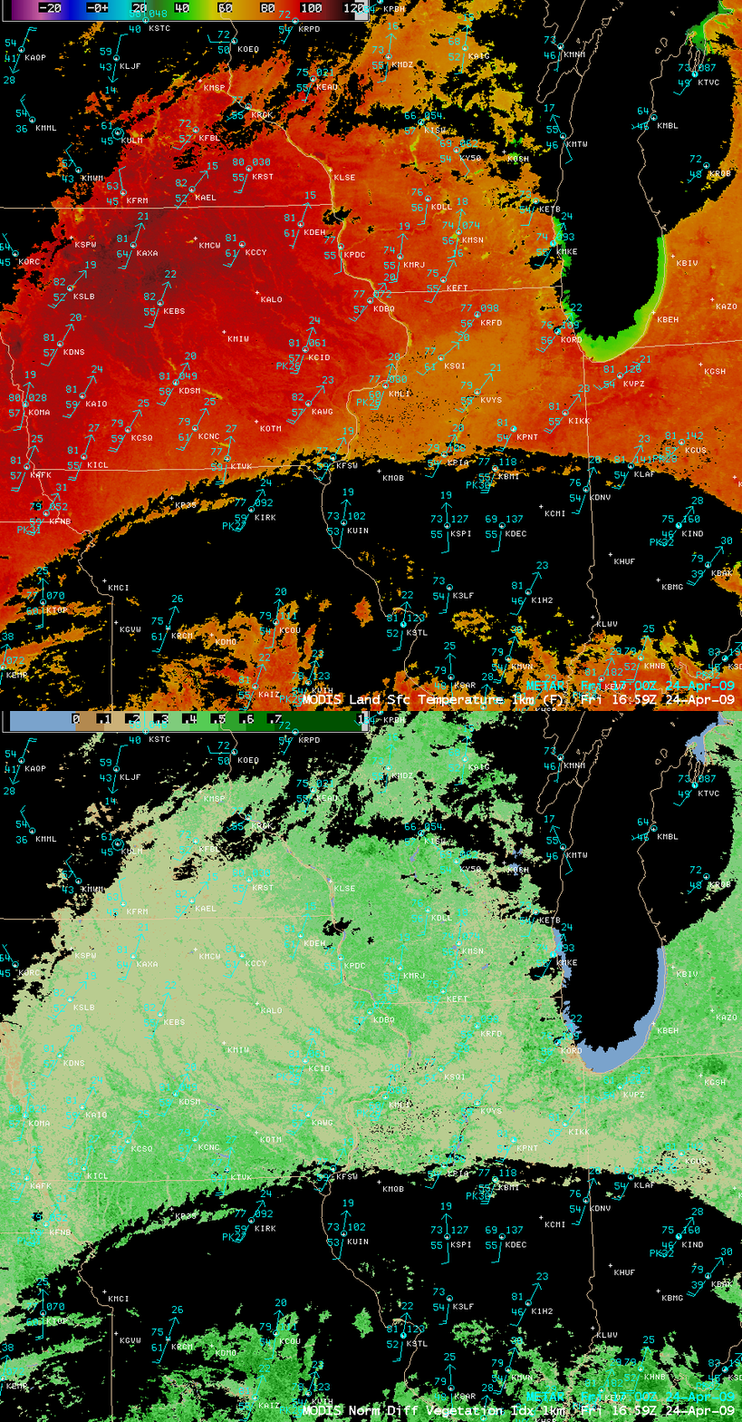
Chile is one of the most volcanically active countries on Earth. The latest volcano to erupt is Chaiten, which had previously lain dormant for at least 1000 years. Chaiten is at approximately 42 degrees South latitude, 72 degrees west longitude, close to Golfo de Ancud. A series of eruptions, starting... Read More

Channel Difference 11-12 microns

Chile is one of the most volcanically active countries on Earth. The latest volcano to erupt is Chaiten, which had previously lain dormant for at least 1000 years. Chaiten is at approximately 42 degrees South latitude, 72 degrees west longitude, close to Golfo de Ancud. A series of eruptions, starting on May 2, has prompted the evacuation of Chaiten, a provincial capital with a population of 4000.

GOES-10 captured the plume of an eruption that started near 12 UTC on 6 May. Volcanic ash does not have an emissivity of 1; that is, it does not emit as a blackbody. The emissivity at 10.7 microns is smaller than the emissivity at 12 microns. The smaller signal received at 10.7 microns (relative to the assumed blackbody) is interpreted as a cooler emitting surface. If the blackbody temperatures at 10.7 and 12.0 microns are compared, then, values at 12.0 microns are warmer. A channel difference can be used to highlight the horizontal extent of the volcanic ash. In the loop shown, the bluest pixels correspond to a blackbody temperature difference of nearly 10 K. That is, the 12 micron blackbody temperature is 10 K warmer than the 11 micron blackbody temperature. The remnants of an older eruption are also noted near the Atlantic Coast of Argentina.

A sequence of GOES-10 imager and sounder IR difference products during the 02-08 May period (below) shows evidence of plumes from multiple eruptions of the Chaiten Volcano. The GOES-10 Imager can provide nearly continuous (15 minute) coverage of the evolving ash cloud, while the GOES-10 Sounder can provide details on the upper-level SO2 plumes once every four hours. The former is derived utilizing the 11.0 micrometer and 12.0 micrometer bands from the Imager. SO2 plumes are revealed by differencing the 7.4 micrometer and 13.3 micrometer bands from the Sounder.

GOES-12 imager and sounder difference products (Animated GIF)

Click here to see an animated gif every from every four hours — that is, each hour for when sounder data are available.

An AVHRR false color image from 05 May (below, viewed using Google Earth) revealed a long plume from the Chaiten volcano, which stretched eastward across Argentina and then southeastward over the South Atlantic Ocean.

AVHRR false color image

View only this post Read Less