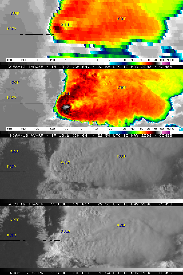
Classic enhanced-V and anvil plume signatures
The severe thunderstorm that was producing a significant long-track tornado (approximately 75 miles long, and around 1 mile wide at times) across parts of northeastern Oklahoma and southwestern Missouri on 10 May 2008 exhibited a classic “enhanced-v” signature on both GOES-12 and NOAA-16 IR imagery. The coldest cloud top brightness temperature values in the region of the enhanced-v were -79 C on the 1-km resolution NOAA-16 AVHRR data, compared to -67 C on the 4-km resolution GOES-12 IR data. In addition, the visible imagery revealed a well-defined anvil plume spreading northeastward from the overshooting top region. Large hail (up to 2.75 inches in diameter) and wind gusts to 65 mph were reported around or just after the time of these images at Joplin, Missouri (station identifier KJLN). The long-track tornado produced EF-4 damage, and was responsible for at least a dozen fatalities in the Picher, Oklahoma and the Seneca/Racine, Missouri areas (SPC storm reports | Tulsa OK NWS summary | Springfield MO NWS summary).


