Fire hotspot detection: a comparison of GOES-11, GOES-12, and GOES-14
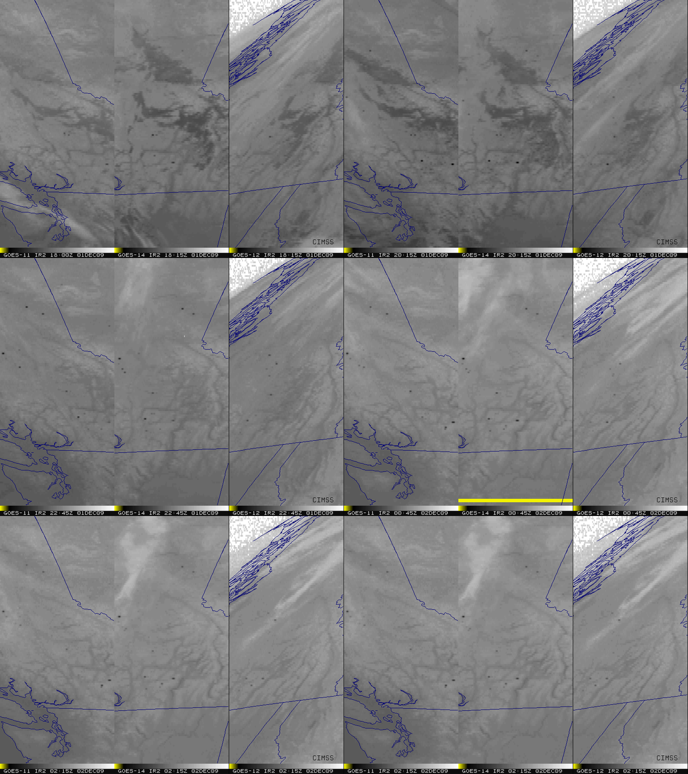
A comparison of GOES-11 (GOES West), GOES-14, and GOES-12 (GOES East) 3.9 µm shortwave IR images (above) indicated that there were a number of fires burning across parts of southern British Columbia, Canada on 01 December 2009, as confirmed by the NOAA Hazard Mapping System. The 3 sets of images are displayed in the native projection of their respective satellites. The fire “hotspots” showed up as warmer (darker black enhancement) pixels.
The plot below shows that the warmest 3.9 µm IR brightness temperature on the GOES-14 imagery was 325.8º K at 22:15 UTC, compared to 317.7º K on GOES-11 at 20:15 and 304.9º K on GOES-12 at 19:45 UTC. This difference in maximum fire pixel brightness temperature and time was due to such factors as different satellite viewing angles (compounded by the steep slopes of the mountainous terrain) and possible brief obscuration by clouds and/or smoke.
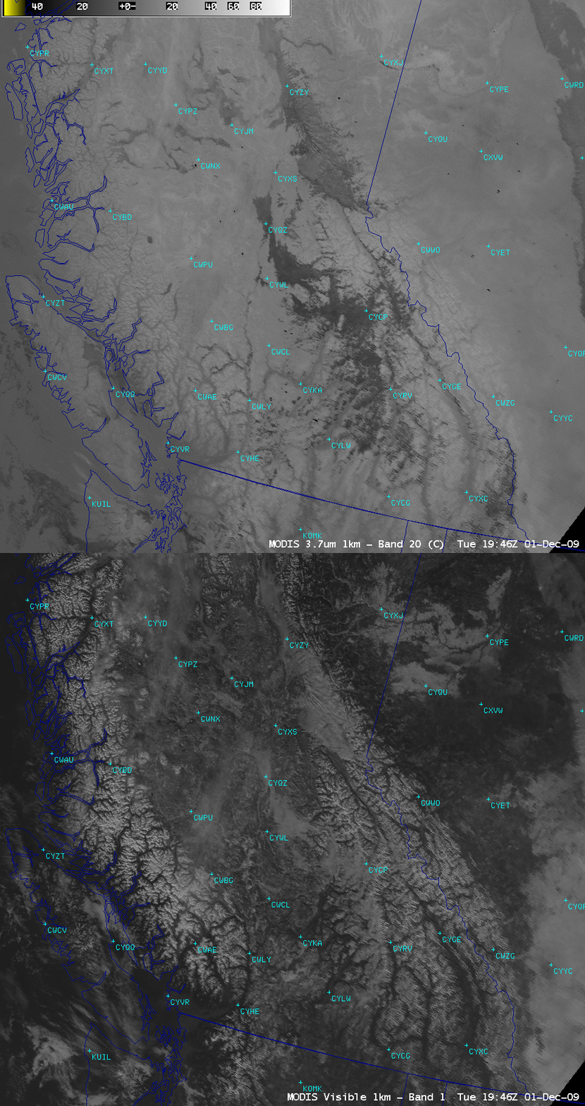
AWIPS images of the MODIS visible and 3.7 µm shortwave IR channel data from 19:46 UTC are shown below; again, a number of darker black fire hot spots can be seen on the shortwave IR image across parts of southern British Columbia (as well as to the east across southern Alberta). The visible image revealed that there was a great deal of snowpack in the mountains of the region — however, there were also a few patches of supercooled water droplet cloud and/or fog in the higher terrain, which showed up as darker gray features on the shortwave IR image (due to solar reflection off the tops of the supercooled clouds/fog).


