GOES-14: improved Image Navigation and Registration (INR)
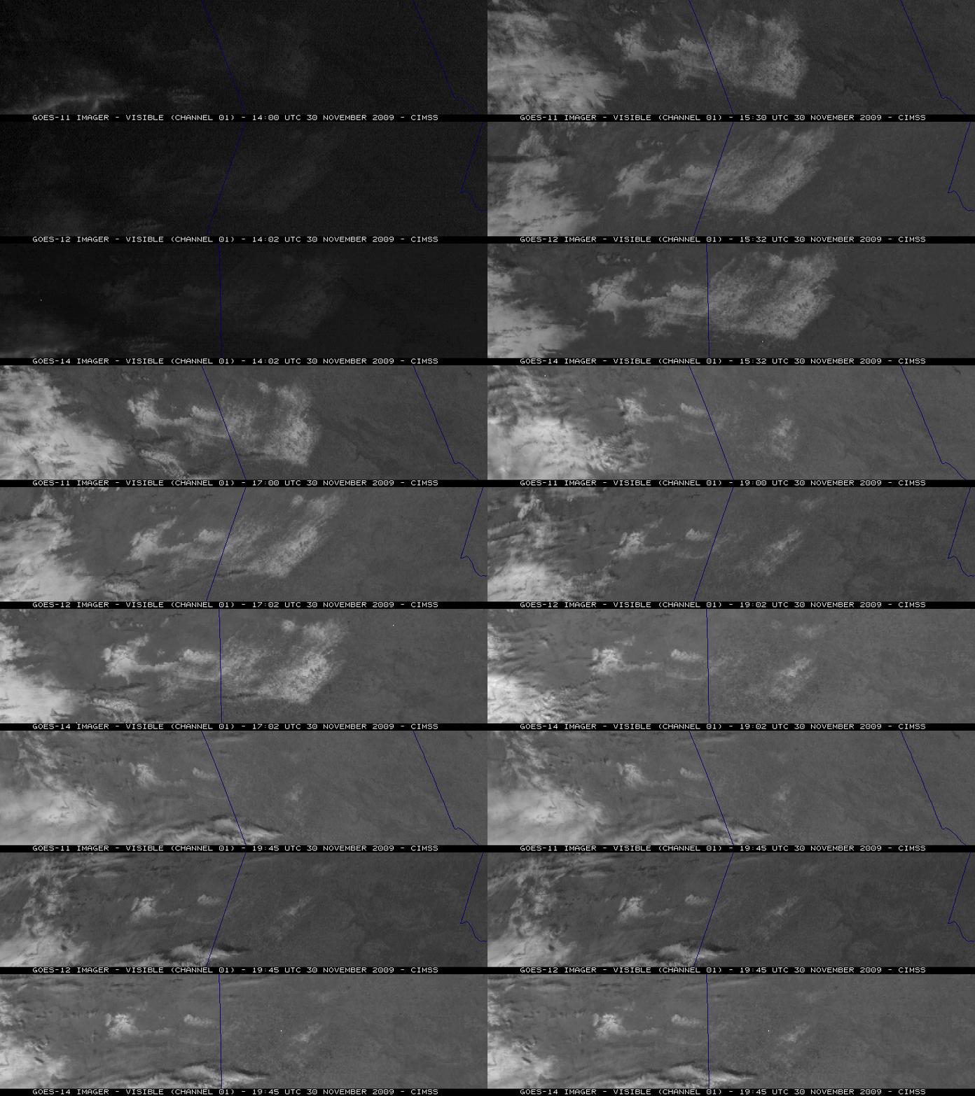
GOES-14 (launched on 27 June 2009) began its NOAA Science Test on 30 November 2009 — and McIDAS images of the GOES-11, GOES-12, and GOES-14 visible channel data (above) showed an area of melting snow cover across the Texas / New Mexico border region. This area (southwest of Amarillo, Texas) had received 1-3 inches of new snowfall on 29 November, which then rapidly melted under full sun on the following day. Note the improvement in Image Navigation and Registration (INR) on the GOES-14 images — there is much less image-to-image wobble compared to the GOES-11 (GOES West) and GOES-12 (GOES East) images. The 3 sets of images are displayed in the native projection of their respective satellites.
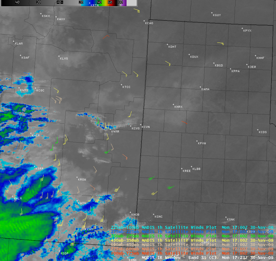
Better INR performance is critical to improving the accuracy of such satellite-derived products as the 1-hourly MADIS atmospheric motion vectors, seen overlaid on an AWIPS image of the MODIS 11.0 µm IR channel data (below).
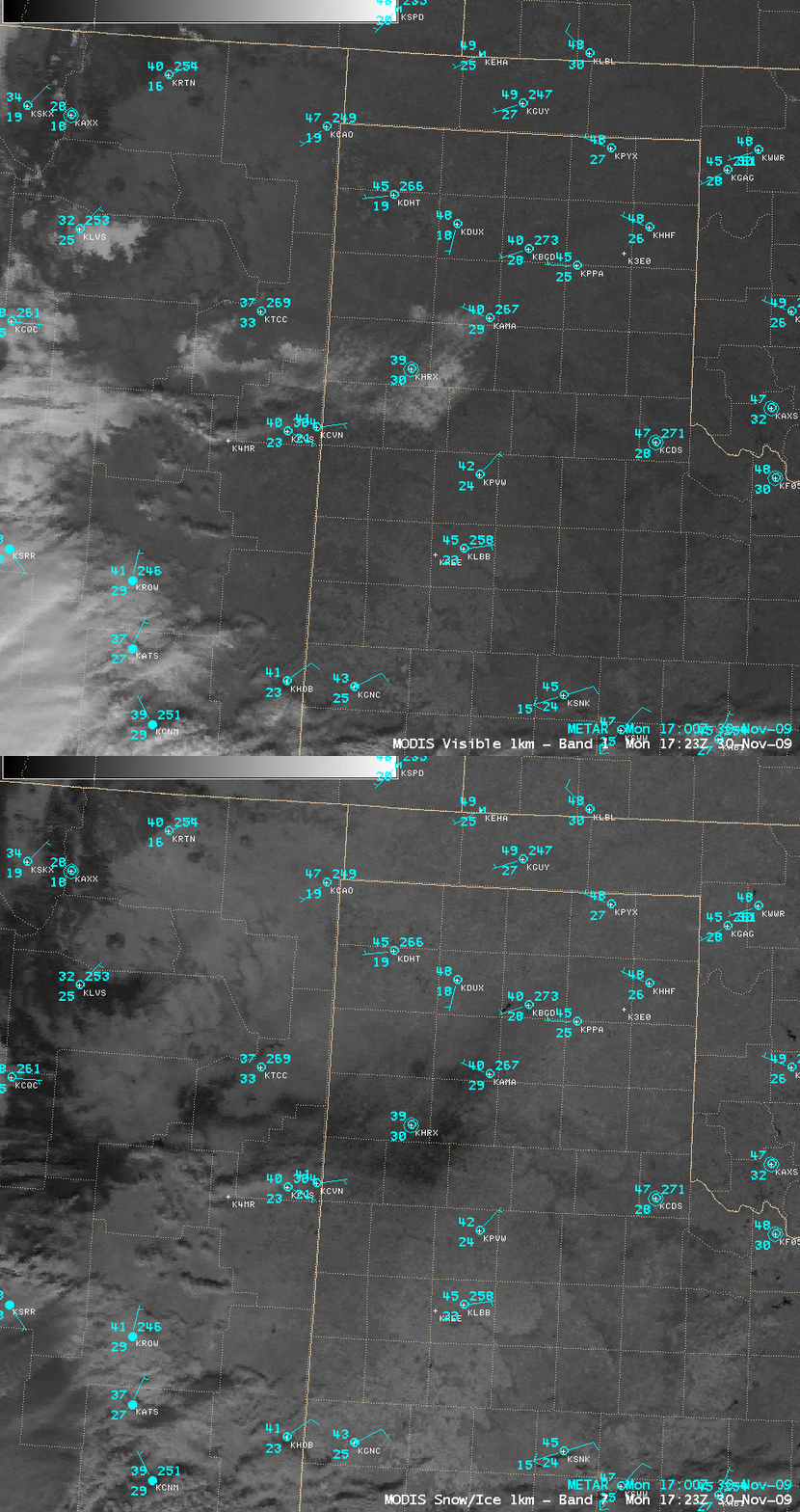
A comparison of the MODIS visible and 2.1 µm near-IR “snow/ice channel” images (below) confirms that this feature was indeed snow — snow and ice are strong absorbers at the 2.1 µm wavelength, and appear as very dark features on the snow/ice image.
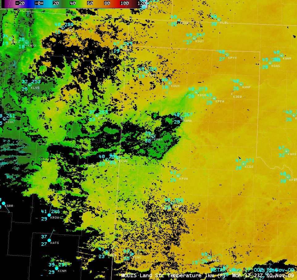
Note how the MODIS Land Surface Temperature (LST) product (below) was showing LST values in the upper 30s to low 40s F (green colors) over the snow-covered areas, in contrast to much warmer LST values in the middle 50s to low 60s F (yellow colors) over the surrounding bare ground. The surface air temperatures were also being held down into the upper 30s to low 40s F over the melting snow cover.


