")
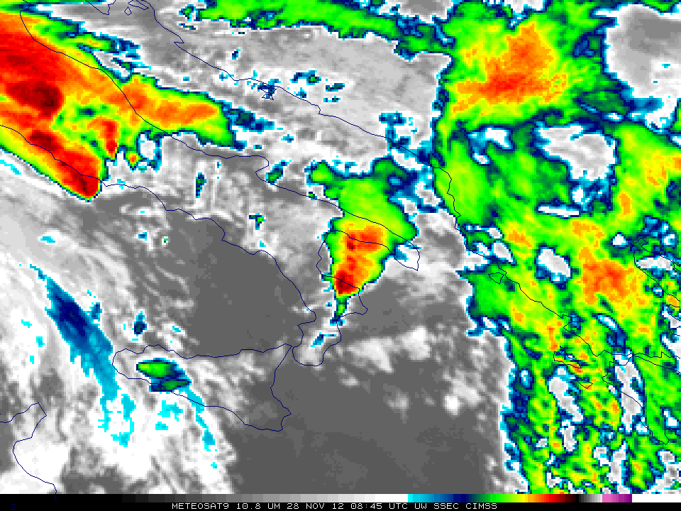
Meteosat-9 10.8 µm infrared channel images (click image to play animation)
A rare November tornado moved through Taranto, (YouTube video, AccuWeather blog entry) in southern Italy, on Wednesday November 28th. A loop of 10.8 µm Meteosat-9 imagery (above) shows the development of an overshooting top in a thunderstorm that is moving over Taranto between 0900 and 0915 UTC (Note that the time indicated on the satellite image is the nominal time — the time that the satellite starts scanning. The actual scan time over southern Italy is approximately 10 minutes later than the nominal time). Such cloud-top features are frequently associated with severe weather. A faint suggestion of an enhanced-V/thermal couplet is apparent in the later imagery as the strong thunderstorm moves northward across the Salento peninsula and then into the Adriatic Sea. METOP-A infrared imagery (below) shows the thunderstorm complex about an hour before a tornadic storm moved inland from the Ionian Sea. The corresponding Meteosat-9 image is here. The higher spatial resolution of the polar orbiter METOP-A allows the discernment of much finer detail in the cloud-top features.

METOP-A 10.8 µm IR imagery
")
Meteosat-9 0.6 µm visible channel images (click image to play animation)
Visible imagery from Meteosat-9, above, also shows the development of the overshooting top associated with the tornadic cell. A higher-resolution visible imager from METOP-B, below, showed the line of thunderstorms in which the tornadic cell, indicated by the yellow arrow, was embedded.

METOP-B 0.63 µm Visible imagery
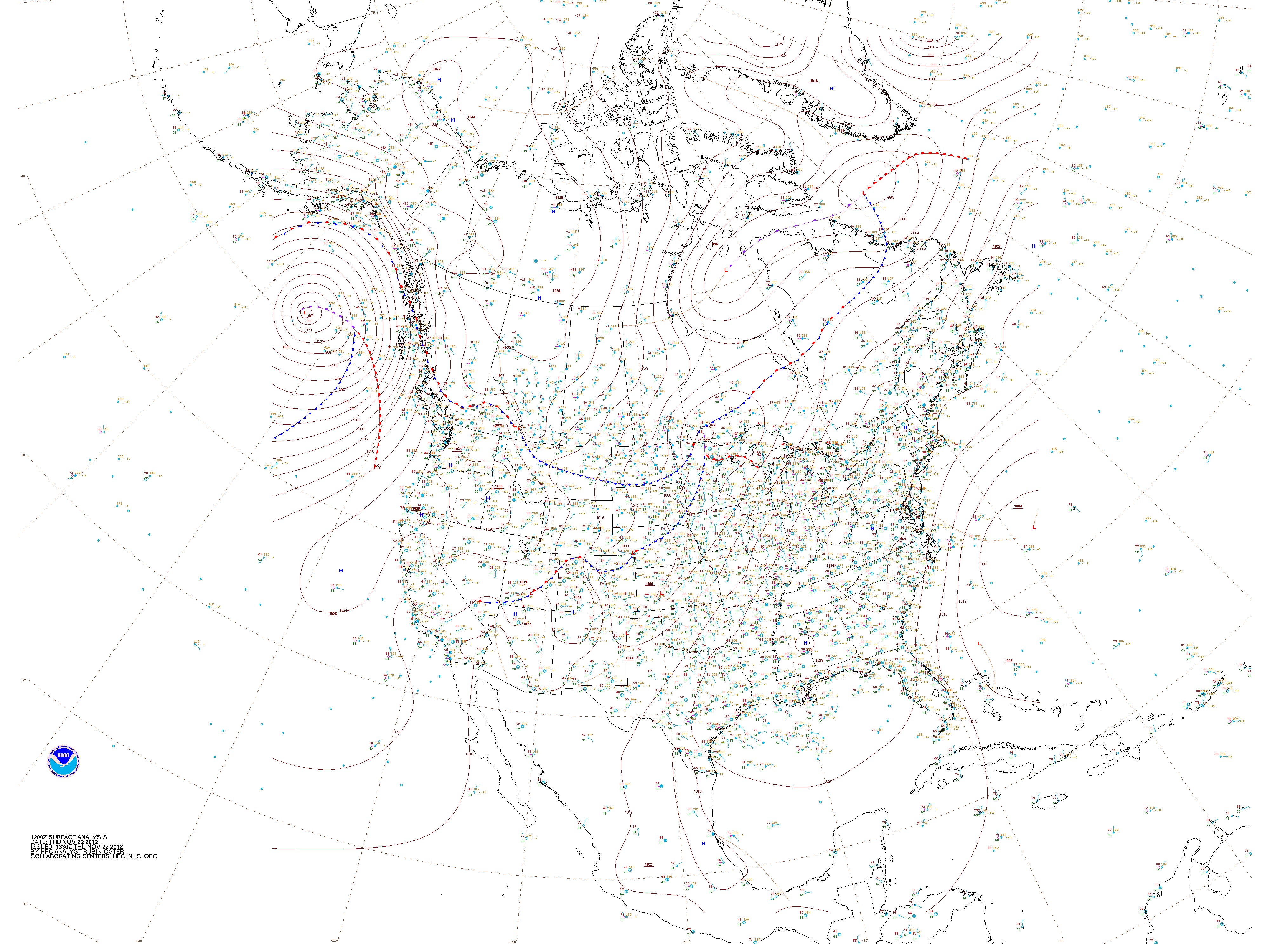
The tornadic weather was associated with an exceptionally deep extratropical cyclone. On Monday, that system was over the northwestern Mediterranean (see below), with ample evidence of exceptionally cold upper-level air over the Bay of Biscay. This storm also had a history of producing supercellular thunderstorms, as evidenced by the storm development just south of France in the animation below.
 (click image to play animation)")
Meteosat-9 Visible imagery (0.6 µm) (click image to play animation)
A multi-day loop of the Meteosat-9 infrared window channel imagery is below. It shows the strong extratropical cyclone moving across southern Europe.
")
Meteosat-9 10.8 µm infrared channel images (click image to play animation)
View only this post Read Less
")


")


")
")
")


