Long-range transport of wildfire smoke arriving over Wisconsin
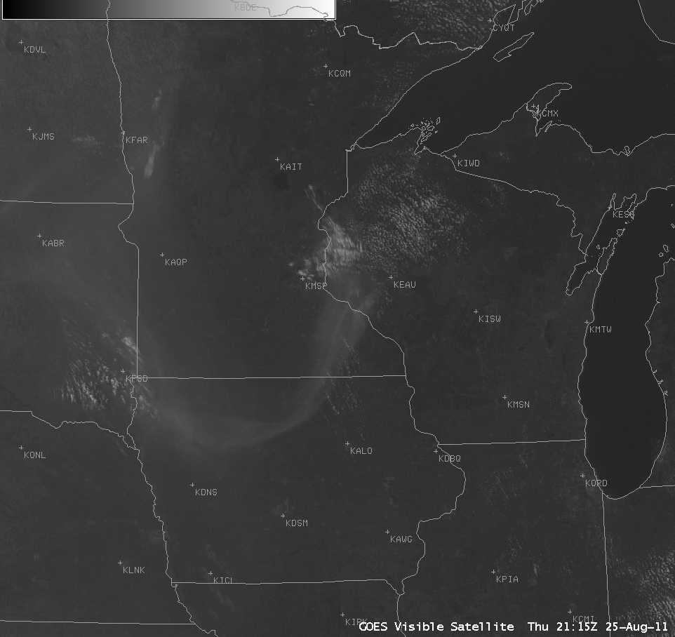
AWIPS images of GOES-13 0.63 µm visible channel data (above; click image to play animation) showed an interesting swirl of smoke aloft which moved eastward across the Upper Midwest region during the late afternoon hours on 25 August 2011.
The curved shape of the smoke feature was due to the cyclonic circulation associated with a transient potential vorticity (PV) anomaly, which was lowering the dynamic tropopause (taken to be the pressure level of the PV1.5 surface) as it moved eastward. A comparison of 1-km resolution MODIS 0.65 µm visible channel, 1-km resolution MODIS 6.7 µm water vapor channel, and 10-km resolution GOES-13 Total Column Ozone product images (below) showed that the PV anomaly was lowering the tropopause to about the 375 hPa pressure level. Upward vertical motion ahead of the PV anomaly was producing a “moist signal” on the MODIS water vapor image (but no clouds were yet seen on the corresponding MODIS visible image). In addition, GOES sounder Total Column Ozone levels were slightly elevated in the vicinity of this PV anomaly (as high as 340 Dobson Units, green color enhancement), compared to the background ozone levels of 100-110 Dobson Units.
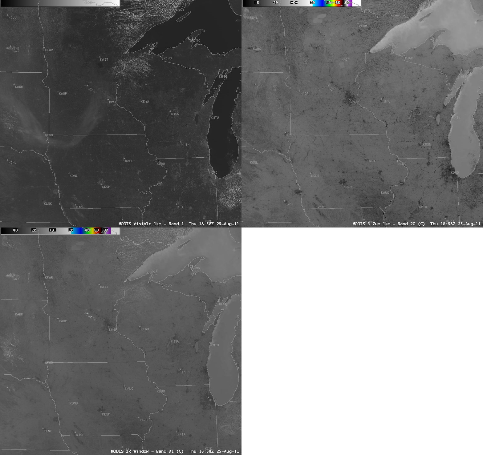
It is interesting to note that the smoke feature did not exhibit any signal on the 1-km resolution MODIS 3.7 µm shortwave IR or 11.0 µm IR window images (below) — such thin smoke layers are effectively transparent to the warmer thermal radiation reaching the satellite from below. On the other hand, the hot signatures of cities and urban areas (showing up as darker black pixels) were quite obvious on the IR images.
However, the smoke feature did exhibit a well-defined signature on the MODIS 1.4 µm near-IR “cirrus detection channel” image (below) — this channel is sensitive to any airborne particles that are efficient scatters of light (such as ice crystals, smoke, dust, volcanic ash, etc).
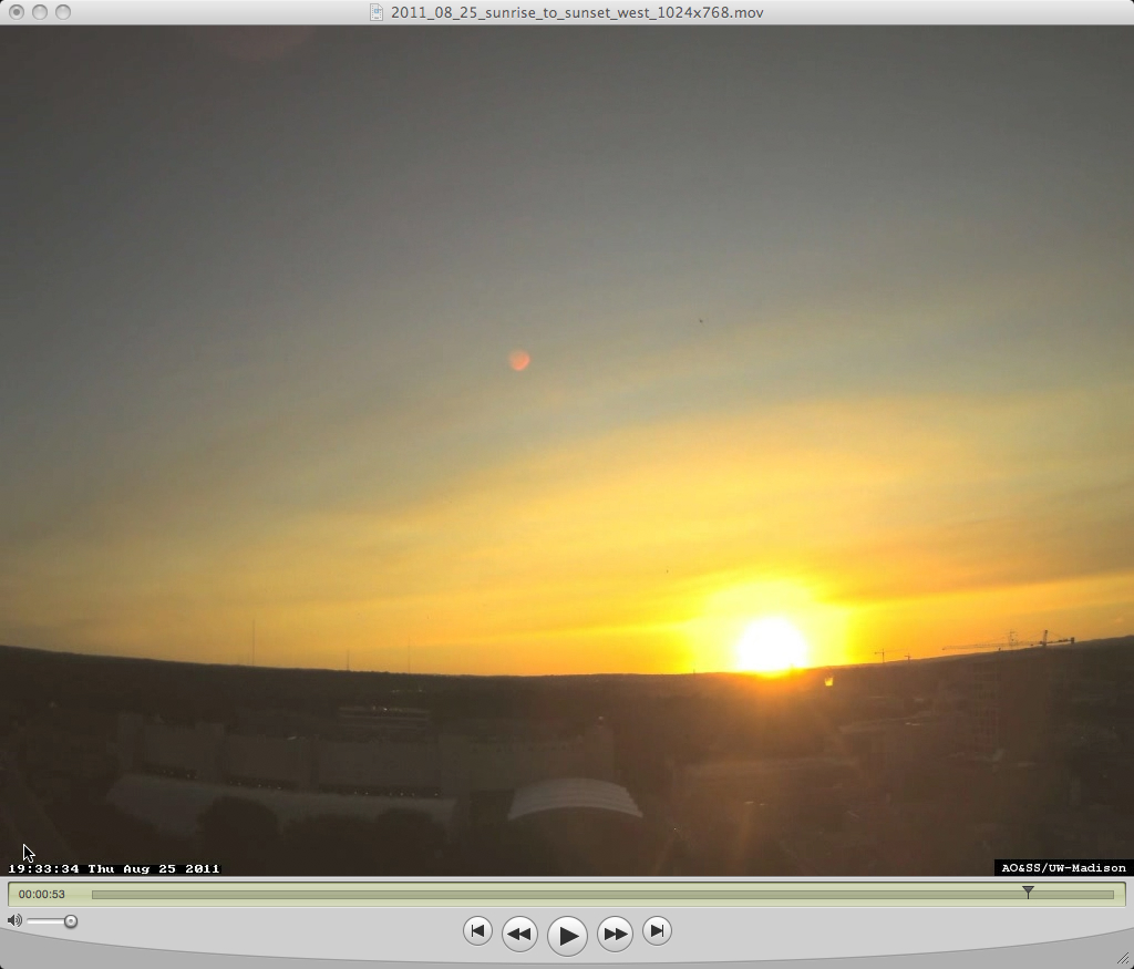
As the smoke aloft began to approach Madison (station identifier KMSN on the satellite images) the feature was captured by the west-facing camera on top of the Atmospheric, Oceanic, and Space Sciences building on the University of Wisconsin campus (below; click image to play QuickTime animation). The airborne smoke layer contributed to a colorful yellow/orange sunset.
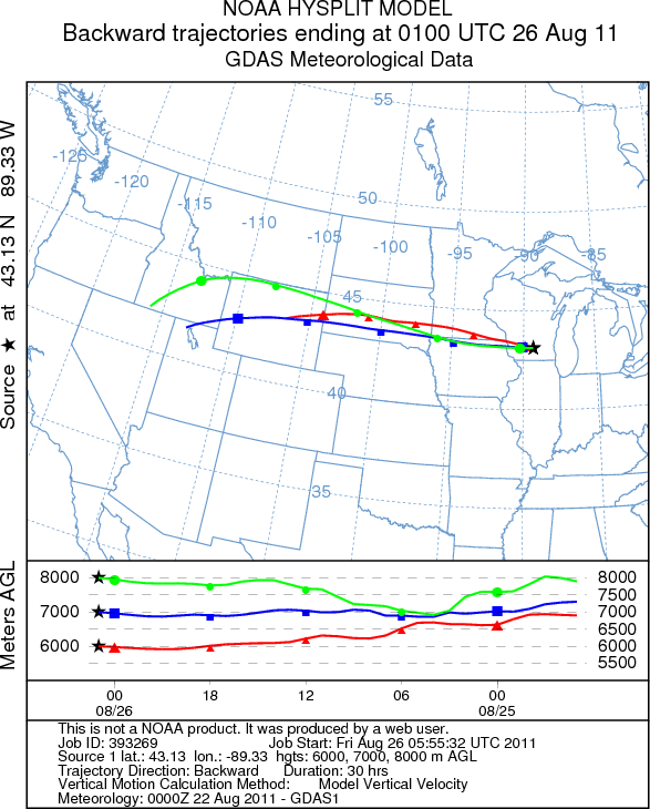
NOAA ARL HYSPLIT model backward trajectories (below) showed that air parcels arriving over Madison (around the time that the leading edge of the smoke aloft moved overhead) had likely originated over Idaho and Wyoming, where several large wildfires had been burning during the previous days. Other fires burning across southeastern Montana may have also contributed to this smoke.


