Overshooting Tops in Hurricane Irene
")
GOES-13 10.7 µm IR channel images (click image to play animation)
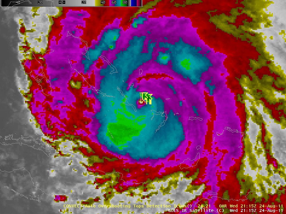
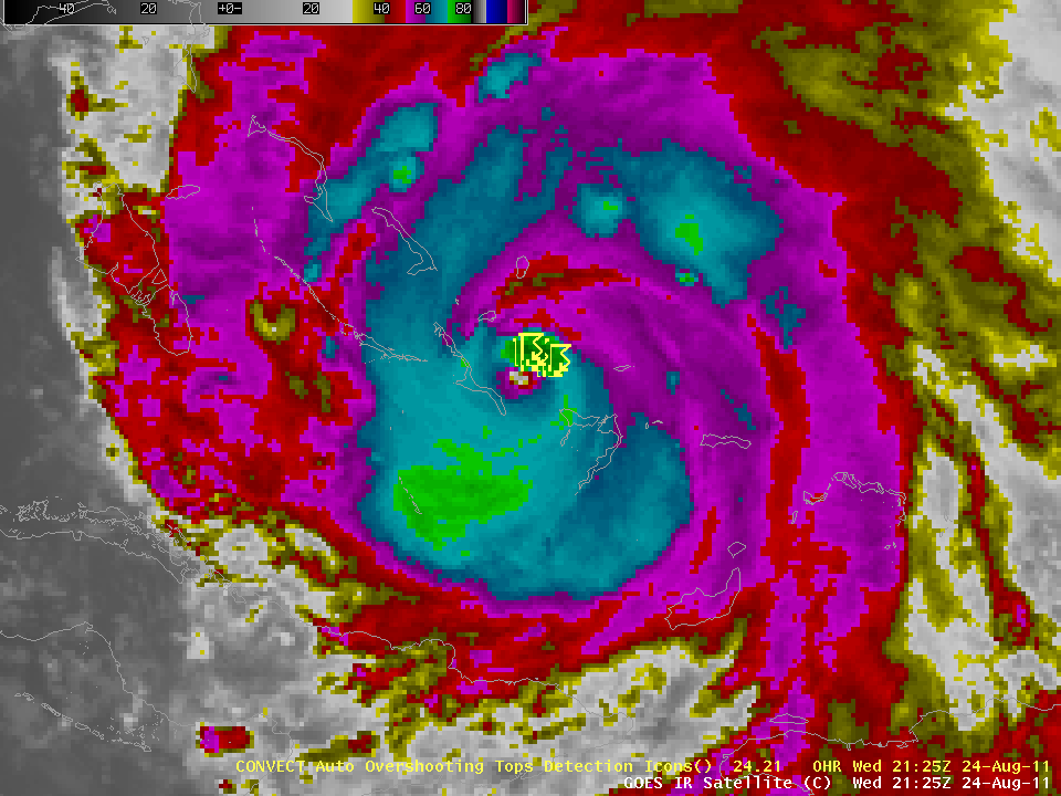
Automated detection of overshooting tops allows identification of regions of intense convective updrafts that penetrate into the stratosphere. Overshooting tops correlate well with regions of intense rainfall and with severe weather. In tropical systems, overshooting tops are most frequent during intensification. The loop above shows overshooting tops (identified as the yellow thunderstorm symbol) superimposed on GOES-13 10.7 µm IR channel imagery as Hurricane Irene moved over the southern Bahamas. This is during a time when the hurricane was slowly strengthening.
The automatic detection of overshooting tops is done using a GOES-R Proving Ground algorithm, developed in preparation for GOES-R that is scheduled to be launched in late 2015 or early 2016. Overshooting tops that are detected over the Continental United States using data from GOES-East (GOES-13) are available at this website. As Irene moves northward over the Atlantic south of Cape Hatteras and east of Georgia and South Carolina on August 25th through the 27th, overshooting tops, if they are present, will be indicated; their presence suggests a vigorous hurricane. This website shows overshooting tops (automatically detected using Meteosat data) over the tropical Atlantic west of Africa; there is a correlation between tropical wave intensification and OT frequency.
 GOES-13 IR/WV Difference image |
 GOES-13 Overshooting Tops |
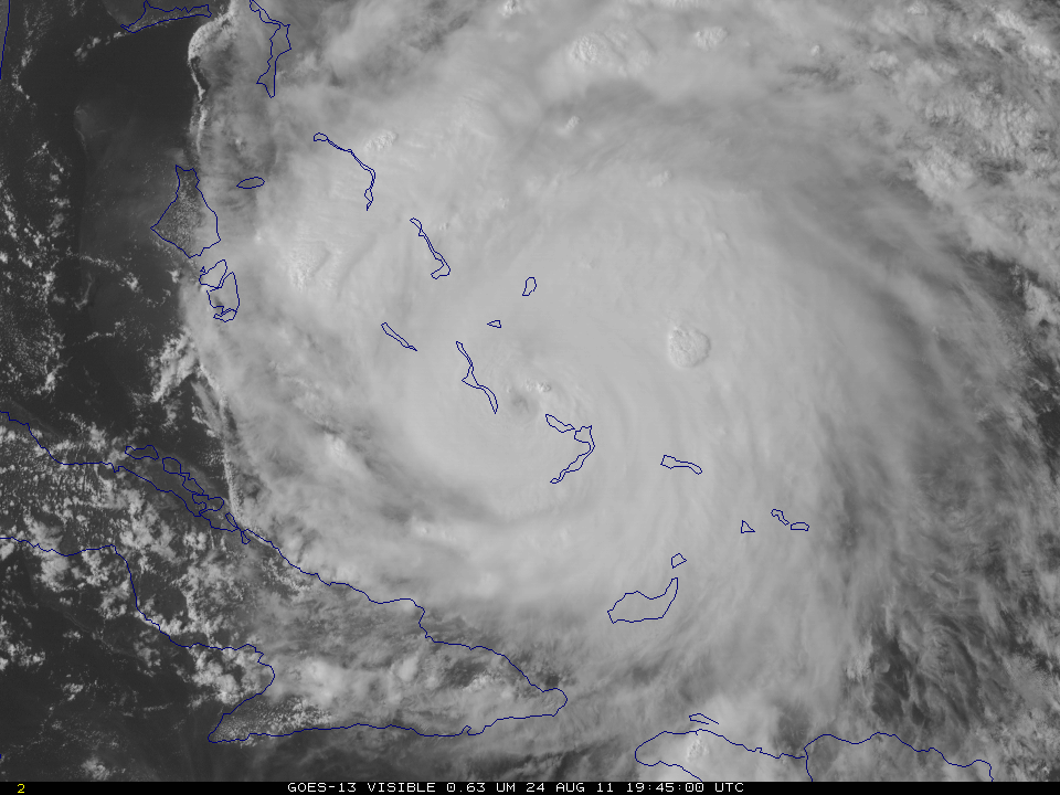
Overshooting tops can also be detected by subtracting the GOES-13 10.7 µm and 6.5 µm imagery (that is, IR – Water Vapor brightness temperatures). Overshooting tops inject water vapor into the stratosphere where it is more readily detected and therefore produces a larger signal on the difference product. For example, this image, also above, left, (taken from the CIMSS Tropical Cyclones site) shows the WV/IR difference at 1945 UTC on 24 August. Compare it to this image (also above, right) that shows the auto-detected tops at 1932 UTC (None were detected at 1945 UTC). (Click for Visible imagery for 1932 UTC and 1945 UTC) Note that the difference field shows a very large region where overshooting tops are indicated to the west of the hurricane eye — this is more likely a cirrus shield than a region of many overshoots which are brief in nature — and a region to the northeast of the hurricane eye is in a region where an overshoot was detected at 1932 UTC. By 1945 UTC, the initial overshoot may be collapsing, but the high cirrus shield will still be present, and the difference field detects it.
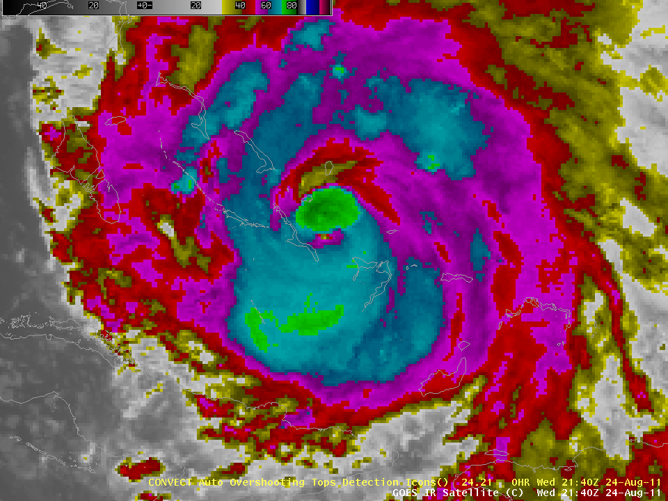
Overshooting tops continue to be detected in Irene’s eyewall at 2115 UTC, 2125 UTC and 2132 UTC. The burst of overshoot production seems to end by 2140 UTC, however.
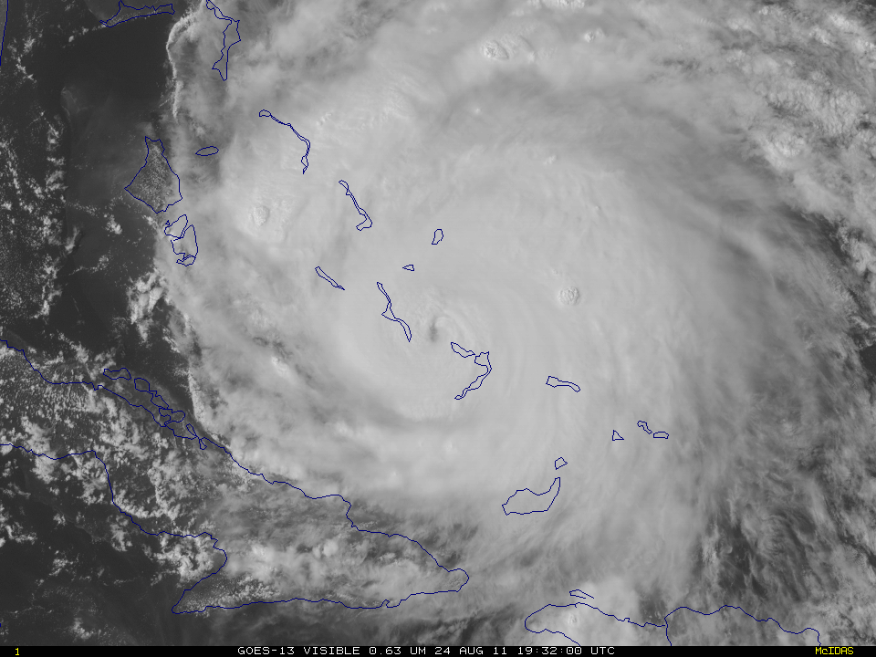
Some of the convective bursts that were producing the overshooting tops can be seen in an animation of GOES-13 0.63 µm visible channel images (below; click image to play animation; also available as a QuickTime movie). The GOES-13 satellite continued to be in Rapid Scan Operations mode, providing images as frequently as every 5-10 minutes. It is interesting to note the “trochoidal motion” (or wobble) of the eye of Hurricane Irene as it moved northwestward across the Bahamas during the day.
")
GOES-13 0.63 µm visible channel images (click image to play animation)
A sequence of 1-km resolutiion POES AVHRR 12.0 µm IR images (below) revealed a number of areas which exhibited cloud top IR brightness temperatures of -80ºC or colder (purple color enhancement) — the coldest seen was -87ºC at 12:30 UTC.

POES AVHRR 12.0 µm IR images