")
GOES-12 3.9 µm shortwave IR channel images (click image to play animation)
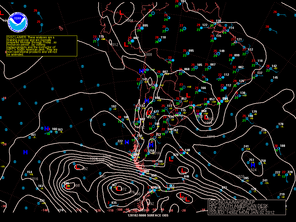
As a result of prolonged drought and a mid-summer heat wave across southern Chile, a number of wildfires were burning in parts of the region on 01 January – 02 January 2012 (surface analysis). GOES-12 3.9 µm shortwave IR images (above; click image to play animation) showed a number of fire “hot spots” (yellow to red color enhancement) between Concepcion (station identifier SCIE) and Chillan (station identifier SCCH) from the late afternoon on 01 January until the early morning hours on 02 January.
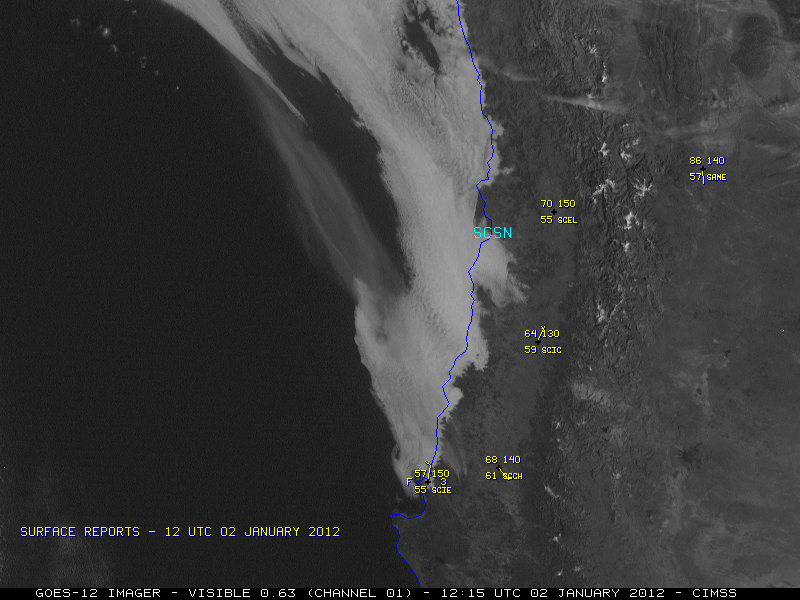
During the subsequent daytime hours, GOES-12 0.63 µm visible channel images (below; click image to play animation) revealed a long hazy smoke plume that was drifting northwestward out over the adjacent Pacific Ocean. As daytime heating increased, cumulus clouds with a few thunderstorms could also be seen developing farther inland over the higher terrain of the Andes Mountains.
")
GOES-12 0.63 µm visible channel images (click image to play animation)
Rawinsonde data from Santo Domingo (station identifier SCSN) at 12 UTC indicated that southeasterly winds existed near the top of the deep temperature inversion, between 741 hPa (2.6 km) and 700 hPa (3.1 km) — so this is likely the approximate altitude of the smoke plume seen drifting toward the northwest on the GOES-12 visible satellite imagery.

Santo Domingo, Chile rawinsonde data plot
A high-resolution MODIS true color image of the fire smoke plume can be seen on the NASA Earth Observatory site.
View only this post Read Less
 images")

 surface reports")


 and GOES-13 (GOES-East) 6.5 µm water vapor channel images (click image to play animation)")


