Strong winds in Scotland associated with the passage of a warm seclusion cyclone
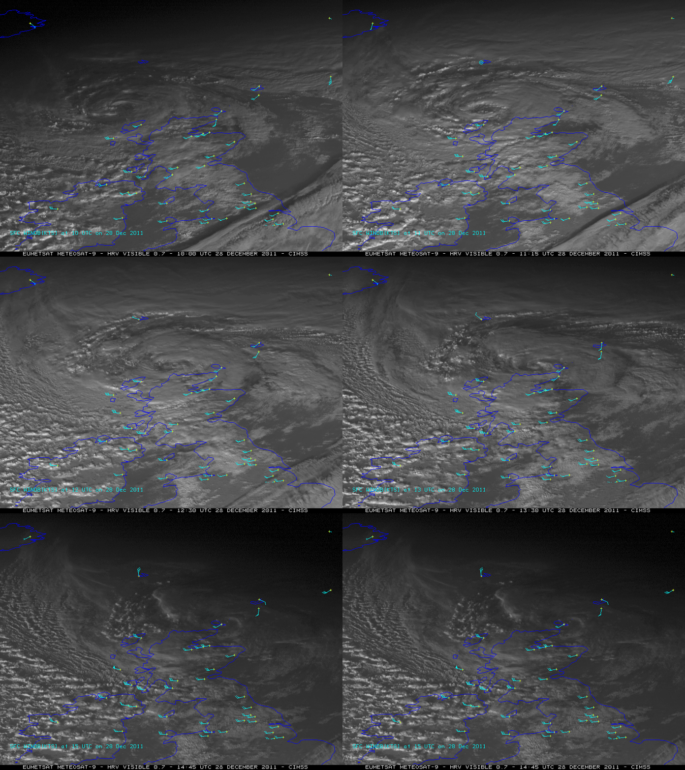
EUMETSAT Meteosat-9 High Resolution Visible (HRV) images (above) showed the classic signature of a “warm seclusion“: a nearly cloud free eye-like structure at the center of the circulation. Surface station wind barbs (in knots) are also plotted in cyan on the images.
A similar eye-like appearance was seen on Meteosat-9 water vapor channel images (below) as the mature cyclone moved just north of the British Isles on 28 December 2011.
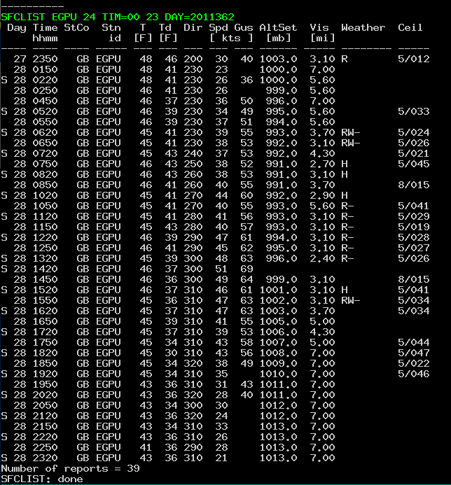
Hurricane force wind gusts were observed at Tiree, Scotland (station identifier EGPU), with a peak gust of 69 knots (79 mph) at 14:20 UTC (below).
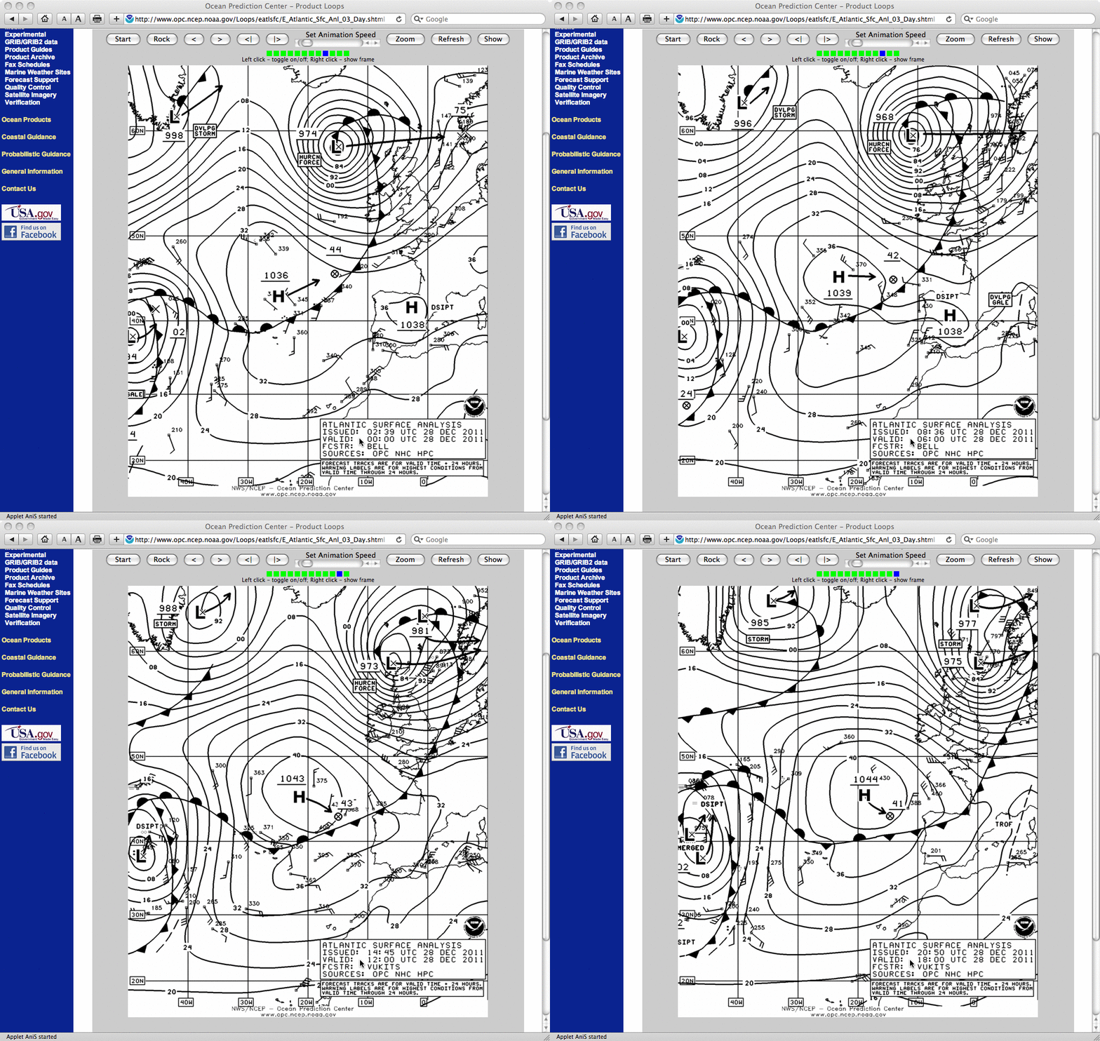
Surface analyses from the NWS/NCEP Ocean Prediction Center (below) showed the intensification and evolution of the cyclone during the day.
Warm seclusions are also sometimes observed with intense cyclones along the East Coast of the US, as in this 20 December 2009 case.


