Tropical Storm Thane (06B) in the Bay of Bengal, and Tropical Storm Benilde (04S) in the South Indian Ocan
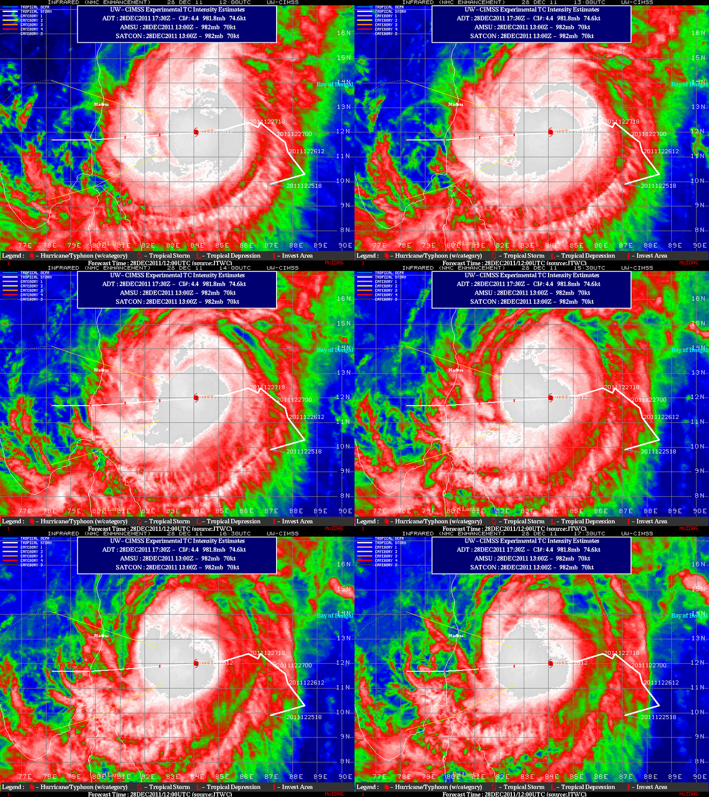
MTSAT-1R 10.8 µm IR channel images from the CIMSS Tropical Cyclones site (above) showed Category 1 Tropical Storm Thane (06B) in the Bay of Bengal, moving toward the east coast of India on 28 December 2011.
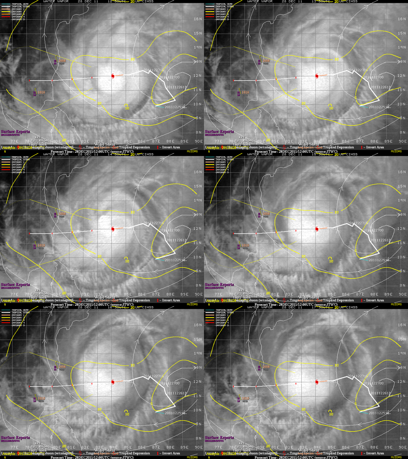
Contours of 850-200 hPa satellite-derived deep layer wind shear overlaid on MTSAT-1R 6.75 µm water vapor channel images (below) indicated that Thane was in an environment of low wind shear, which favored some intensification prior to making landfall.
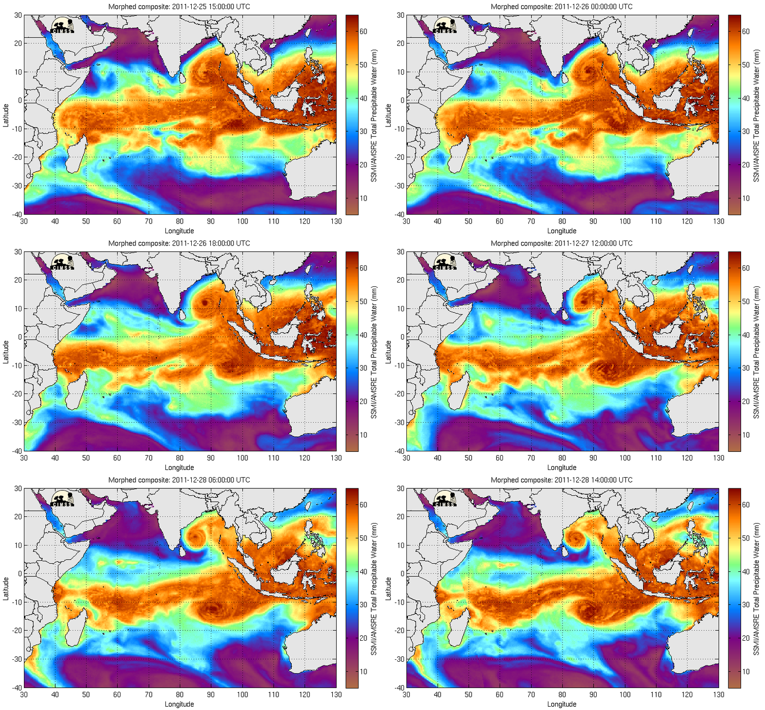
It is interesting to note that the MIMIC Total Precipitable Water product (below) showed the northern counterclockwise circulation of Tropical Storm Thane and the southern clockwise circulation of Tropical Storm Four (04S) — each drawing moisture from the Inter-Tropical Convergence Zone (ITCZ).
===== 30 December Update =====
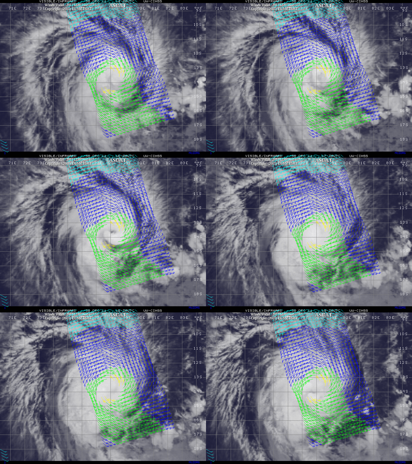
Tropical Storm 04 S intensified in a similar low wind shear environment, becoming Tropical Cyclone Benilde in the South Indian Ocean. Benilde was forecast to intensify, with wind gusts up to 140 knots. Meteosat-7 visible/shortwave IR images with an overlay of ASCAT scatterometer surface winds (below) showed the structure of Benilde.


