East Coast winter storm
An intense winter storm impacted a large portion of the mid-Atlantic and Northeast regions of the US on 18 December – 19 December 2009, creating blizzard conditions and setting a number of snowfall records (listing of snowfall totals). As a part of its ongoing NOAA Science Test, the GOES-14 satellite was placed into Super Rapid Scan Operations (SRSO) mode, supplying imagery at 1-minute intervals during much of the storm life cycle. McIDAS images of the GOES-14 10.7 µm IR channel data (above; click image for a 61 MB QuickTime animation) showed the formation of a large, cold cloud shield early in the period, followed by the development of a number of convective bands after about 03:00 UTC on 19 December which then helped to further enhance snowfall rates.
As the storm center was moving across the northern Gulf of Mexico on 18 December, it even exhibited an eye-like appearance on GOES-14 visible channel images (below; click image for a QuickTime animation), which is suggestive of a warm seclusion.
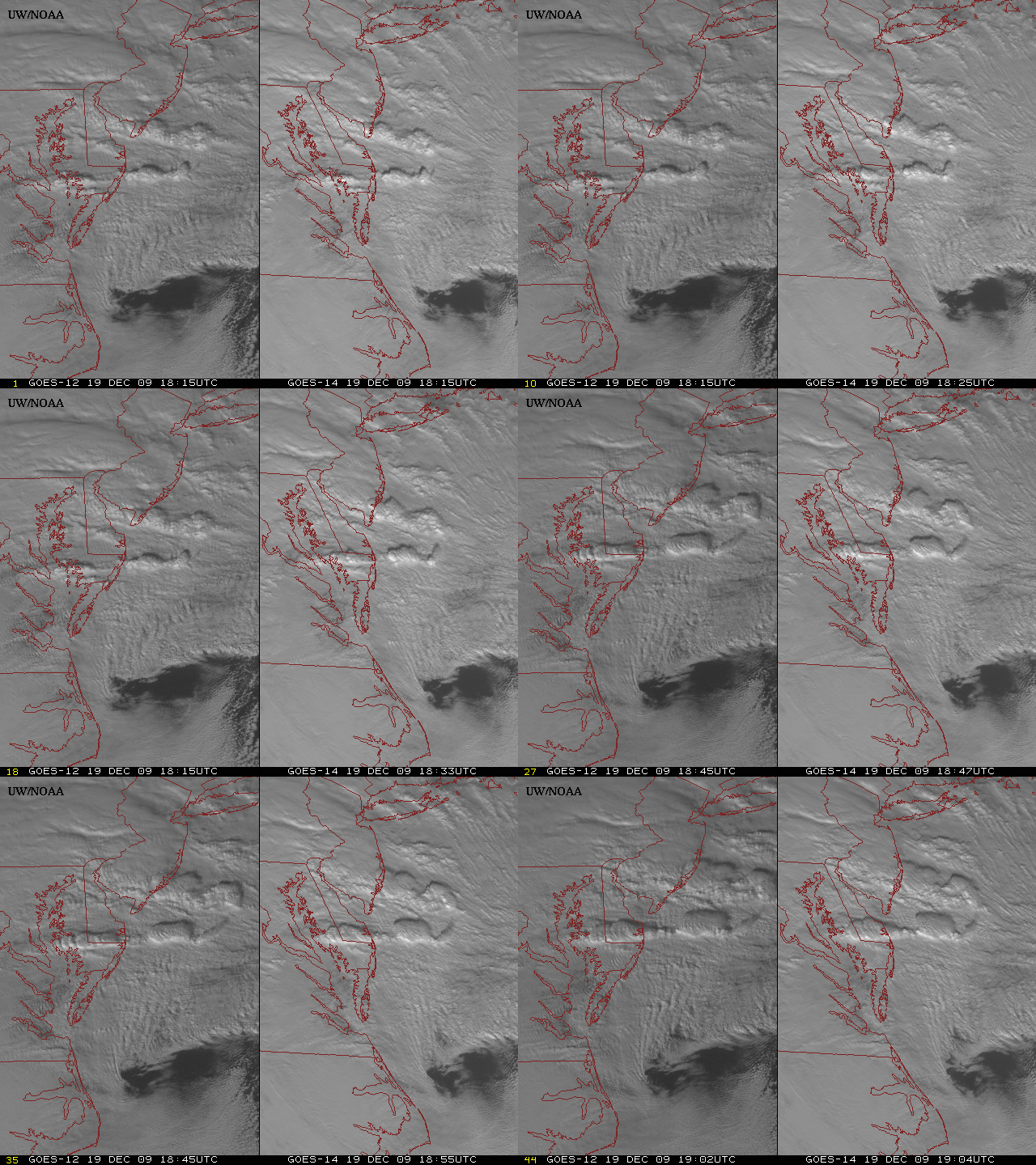
On 19 December, a comparison of 15-minute interval GOES-12 and 1-minute interval GOES-14 visible images centered off the east coast of the Delmarva Peninsula (below; courtesy of Tim Schmit, NOAA/ASPB) offers a compelling demonstration of the value of more frequent imaging for monitoring the development and evolution of cloud features. During this 18:15 – 19:04 UTC time period, there were only 3 images available from GOES-12, compared to 44 images using GOES-14. A longer animation of GOES-14 SRSO visible imagery during the afternoon hours on 19 December can be seen here.
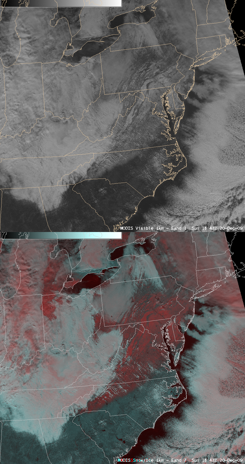
On the day following the storm (20 December), a comparison of AWIPS images of the MODIS visible channel and a false-color Red/Green/Blue (RGB) image (below) demonstrates the value of using RGB imagery to help discriminate between snow cover (red-enhanced features) and supercooled water droplet clouds (brighter white features) across the mid-Atlantic states. This also offers a glimpse at the type of RGB image capability that should be available with the upcoming AWIPS-2 software.


