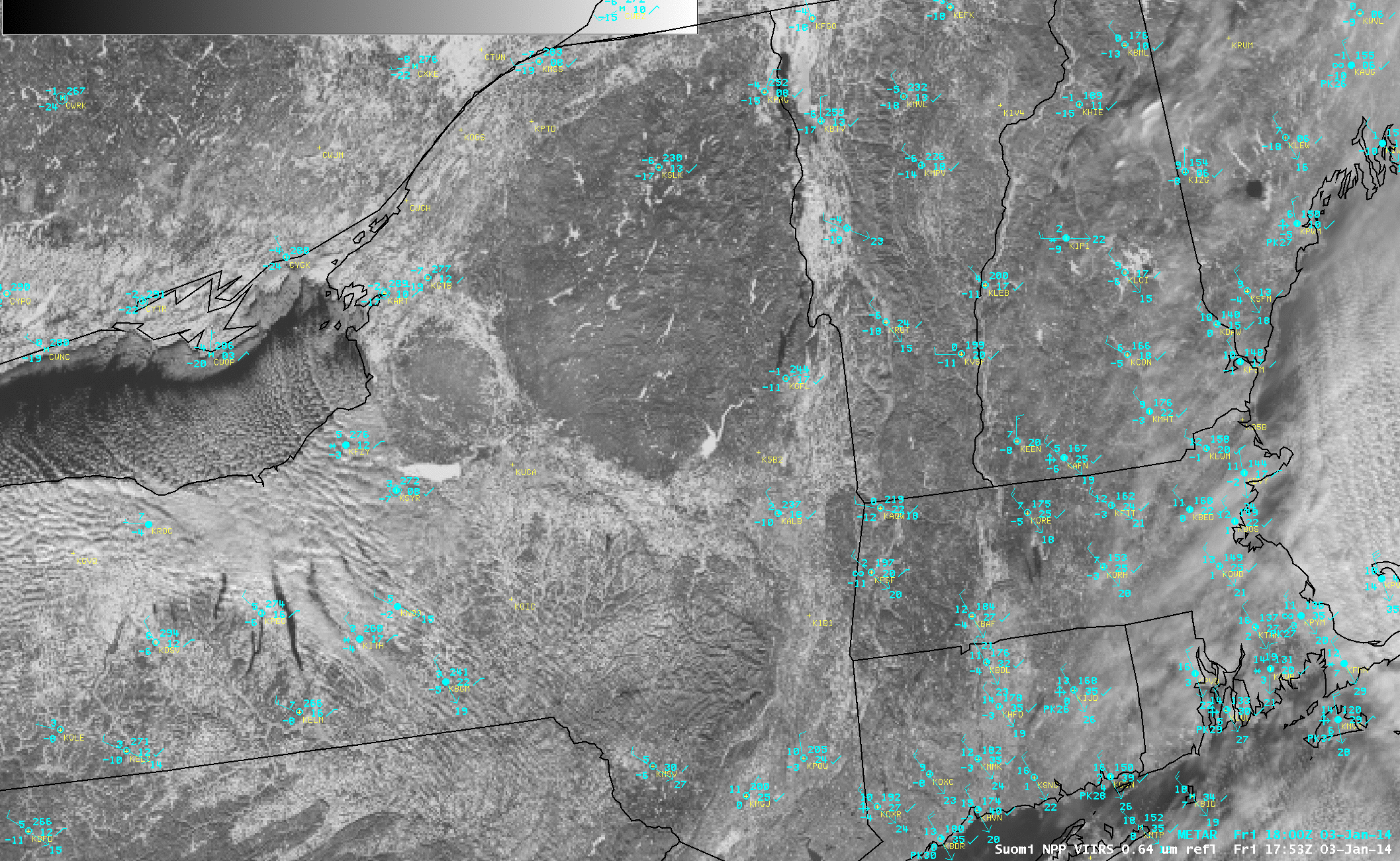
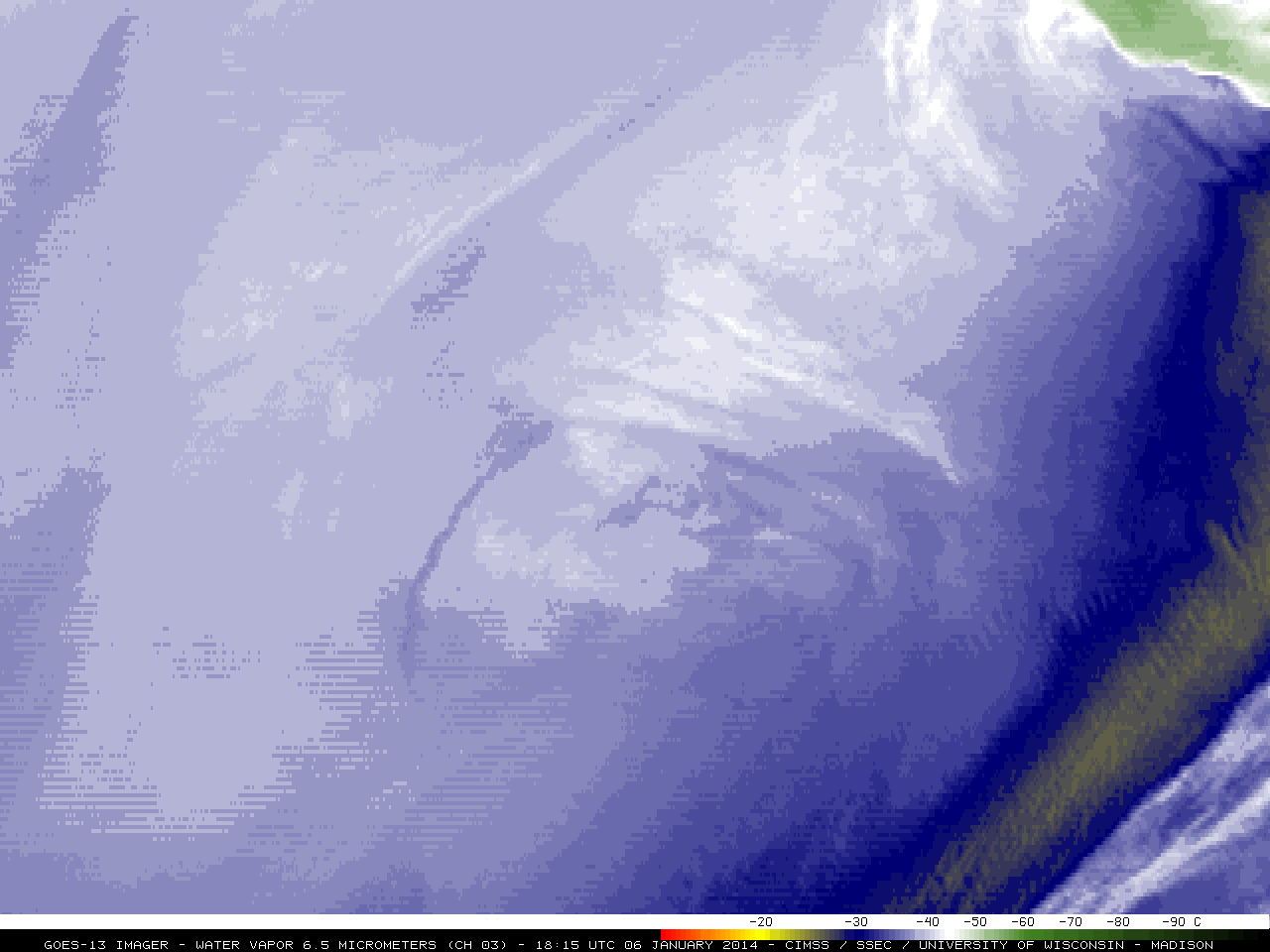
This website works best with a newer web browser such as Chrome, Firefox, Safari or Microsoft Edge. Internet Explorer is not supported by this website.

Radiation Fog in River Valleys in Pennsylvania and New York

Clear skies and light winds allowed for the formation of fog in river valleys of Pennsylvania and New York in the early morning of 20 September 2012. The animation above shows the traditional method of detecting fog or low stratus from satellite (GOES-East, MODIS on Aqua and VIIRS on Suomi/NPP):... Read More

Brightness Temperature Difference between Shortwave and Longwave IR Channels on GOES (10.7 µm and 3.9 µm channels), MODIS (11 µm and 3.7 µm channels), and VIIRS (11.35 µm and 3.74 µm channels)

Brightness Temperature Difference between Shortwave and Longwave IR Channels on GOES (10.7 µm and 3.9 µm channels), MODIS (11 µm and 3.7 µm channels), and VIIRS (11.35 µm and 3.74 µm channels)

Clear skies and light winds allowed for the formation of fog in river valleys of Pennsylvania and New York in the early morning of 20 September 2012. The animation above shows the traditional method of detecting fog or low stratus from satellite (GOES-East, MODIS on Aqua and VIIRS on Suomi/NPP): the brightness temperature difference between the shortwave infrared (between 3.7 and 3.9 µm) and longwave infrared (near 11 µm) channels. Liquid clouds do not emit radiation as a blackbody at shortwave IR wavelengths but they do emit radiation more nearly as a blackbody at longwave IR wavelengths. Consequently, inferred blackbody temperatures based on the radiation detected by the satellite (the temperature conversion assumes blackbody emissions) are cooler for shortwave radiation than for longwave radiation, and a difference field will highlight regions of low clouds comprised of water droplets, such as fog or stratus.

The image loop above demonstrates the importance of resolution in correctly describing the dendritic features of fog in river valleys. MODIS and VIIRS infrared channels have resolutions near 1.0 km; GOES has a nominal sub-satellite point resolution of 4 kilometers. Consequently, the GOES brightness temperature difference field cannot accurately detect the sharp edges to the valley fog features.

Day/Night Band image from VIIRS on Suomi/NPP

Day/Night Band image from VIIRS on Suomi/NPP

Fog in valleys can also be detected using the Day/Night band that is on board Suomi/NPP, as shown above. The light source for this image is emitted light from the surface (that is, city lights) and reflected lunar illumination. Lunar illumination is a function of phase, and the moon on 20 September is nearly new. Despite the lack of lunar light, clouds are observed in valleys in New York and Pennsylvania.

MODIS-based GOES-R IFR Probabilities

MODIS-based GOES-R IFR Probabilities

Fog and low stratus in a river valley is not necessarily an obstruction to aviation. The GOES-R IFR probability product can help determine how likely IFR conditions are. This product is currently produced from MODIS data and from GOES-East and GOES-West data. The product uses both the brightness temperature difference field and Rapid Refresh moisture profiles to assign probabilities of IFR conditions. MODIS IFR Probabilities are highest along the Chemung and Susquehanna Rivers in southern Upstate NY; at 0700 UTC, Elmira NY was reporting visibility of 1/4 mile in Fog. No other stations in the Susquehanna River watershed had visibilities that low. Note that the character of the IFR Probability field is different over Steuben County compared to elsewhere. High clouds that are apparent in the brightness temperature difference field (and in the longwave infrared radiation field) mean that satellite data cannot be used to compute IFR probabilities, so only model fields are used, and the model fields have lower resolution than the MODIS data.

The 0700 UTC GOES-R IFR Probability field computed using GOES-East imager data is shown below. Because of the coarser resolution of the GOES Imager pixel, the small valleys cannot be resolved. Nevertheless, higher probabilities are present near the valleys because sub-pixel scale cloud features do have an impact on the emitted shortwave and longwave radiation. GOES-R IFR Probabilities increased over the course of the night, so that by 1100 UTC, there were signals over most of north-central Pennsylvania and in most river valleys of central Pennsylvania, and airports in those valleys — Williamsport (KIPT), Selinsgrove (KSEG), Clearfield (KFIG), for example — all reported IFR conditions.

GOES Imager-based GOES-R IFR Probabilities

GOES Imager-based GOES-R IFR Probabilities

Note that these products are available in WFOs. From the 0958 UTC AFD in State College, PA:

.NEAR TERM /UNTIL 6 PM THIS EVENING/…

EARLY AM MODIS 11-3.7UM IMAGERY SHOWING DENDRITIC PATTERN OF FOG IN THE VALLEYS…THE RESULT OF A COOL…CALM MORNING AND RELATIVELY WARM RIVER/STREAM WATERS. LATEST 3KM HRRR SFC RH FIELDS SUGGEST THE MOST PERSISTENT FOG WILL BE UNDER SFC RIDGE AXIS ACROSS THE SUSQ VALLEY…WHERE PATCHES COULD LINGER UNTIL 14Z-15Z.

View only this post Read Less

Noise in the Shortwave GOES-13 Sounder Channels

The shortwave infrared channels on the GOES-13 sounder have displayed increasing amounts of noise over the past months. The multi-channel display, above, shows distinct noise in the channels at 4.57 µm, 4.53 µm, 4.45 µm and 4.13 µm. Animations of the GOES-13/GOES-15 imagery from AWIPS shows that the noise is... Read More

Multipanel display of GOES-East Sounder Channels

Multipanel display of GOES-East Sounder Channels

The shortwave infrared channels on the GOES-13 sounder have displayed increasing amounts of noise over the past months. The multi-channel display, above, shows distinct noise in the channels at 4.57 µm, 4.53 µm, 4.45 µm and 4.13 µm. Animations of the GOES-13/GOES-15 imagery from AWIPS shows that the noise is far more obvious in the GOES-13 channel. It is especially noteworthy in the 4.45 µm channel (called the 4.5 µm channel in AWIPS) but also readily apparent in the 4.13 µm channel (called the 4.0 µm channel in AWIPS).

Data from these noisy channels are used in the computation of derived products. The effect of the noise is manifest as small-scale noise in the derived fields of total precipitable water, for example, and the bad data is most noticeable at night, because the shortwave data are used to identify cloudy pixels; during the day, visible imagery identifies cloudy pixels. Thus, maps of, for example, lifted index have too many pixels flagged as cloudy at night compared to during the day. Also compare the 0600 UTC Total Precipitable Water (TPW) image to the 1900 UTC image.

Sounder Cloud-Top Pressure From GOES-13 and GOES-14 (click image to toggle between images)

Sounder Cloud-Top Pressure From GOES-13 and GOES-14 (click image to toggle between images)

Because the shortwave data are used to identify cloudy pixels, night-time estimates of cloud-top pressure as also impacted, as shown above. The GOES-13 Sounder-derived cloud-top pressure includes several regions that are indicated as cloudy because of the noisy shortwave data. A similar field derived from GOES-14 sounder data does not include the cloudy pixels. Data from 1800 UTC — when visible imagery can be used to screen out clear pixels with more efficacy — shows less contamination that can be traced to the shortwave fields. That is, the fields derived from the GOES-13 and GOES-14 Sounder look more similar.

NESDIS scientists are evaluating how the shortwave bands can be excluded from the GOES-13 Sounder computation to reduce night-time noise in the output fields. Real-time GOES Sounder imagery is available at this link. Derived products, including Convective Available Potential Energy (CAPE), TPW, Lifted Index and cloud-top properties can also be viewed at that link.

(Some imagery in this blog post courtesy of Tim Schmit, NOAA/NESDIS)

This plot, courtesy of Mat Gunshor, CIMSS, shows the standard deviation of the difference between observed brightness temperature and forward-calculated brightness temperatuers. A big jump in noise occurred in late August.

View only this post Read Less

Thick smoke over the Upper Midwest region

McIDAS images of GOES-13 0.63 µm visible channel data (above; click image to play animation) showed an unusually thick veil of smoke  moving eastward across much of the Upper Midwest region of the US on 16 September 2012.This thick layer of airborne smoke contributed to a colorful sunset, as seen by the... Read More

GOES-13 0.63 µm visible channel images (click image to play animation)

GOES-13 0.63 µm visible channel images (click image to play animation)

McIDAS images of GOES-13 0.63 µm visible channel data (above; click image to play animation) showed an unusually thick veil of smoke  moving eastward across much of the Upper Midwest region of the US on 16 September 2012.

This thick layer of airborne smoke contributed to a colorful sunset, as seen by the west-facing camera on top of the SSEC / AOS building at the University of Wisconsin – Madison (below; click image to play animation). Note the appearance of a number of very short aircraft contrails: an indication that the air aloft at flight altitude was very dry.

West-facing SSEC/AOS rooftop camera images (click image to play animation)

West-facing SSEC/AOS rooftop camera images (click image to play animation)

SSEC lidar aerosol backscatter and particulate circular depolarization ratio data (below) indicated that the smoke layer occupied a very deep portion of the middle troposphere (primarily between 2 km and 8 km in altitude) by the end of the day.

Lidar aerosol backscatter and particualte circular depolarization ratio

Lidar aerosol backscatter and particualte circular depolarization ratio

Backward air parcel trajectories using the NOAA ARL HYSPLIT model (below) suggested a long-range transport of smoke from the extensive wildfires which had been burning in Idaho and adjacent states during the previous days.

NOAA ARL HYSPLIT backward air parcel trajectories

NOAA ARL HYSPLIT backward air parcel trajectories

View only this post Read Less

Pyrocumulus clouds associated with wildfires in Wyoming

McIDAS images of GOES-15 (GOES-West) and GOES-13 (GOES-East) 0.63 µm visible channel data (above; click image to play animation) revealed smoke plumes and pyrocumulus clouds associated with a pair of large wildfires that were burning in western Wyoming on 15 September 2012. Because... Read More

GOES-15 (left) and GOES-13 (right) 0.63 µm visible images (click image to play animation)

GOES-15 (left) and GOES-13 (right) 0.63 µm visible images (click image to play animation)

McIDAS images of GOES-15 (GOES-West) and GOES-13 (GOES-East) 0.63 µm visible channel data (above; click image to play animation) revealed smoke plumes and pyrocumulus clouds associated with a pair of large wildfires that were burning in western Wyoming on 15 September 2012. Because of difference in viewing angle between the two satellites, the pyrocumulus clouds appeared brighter white on the GOES-15 images (due to more direct reflection of sunlight off the western edges of the clouds), while on the GOES-13 images the “overshooting” clouds cast more well-defined shadows on top of the smoke layer below.

A comparison of AWIPS images of Suomi NPP VIIRS 0.64 µm visible channel and 11.45 µm IR channel data at 19:36 UTC or 1:36 PM local time (below) showed that the southernmost fire burning along the eastern slopes of the Wind River Range had already developed a pronounced pyrocumulus cloud, which exhibited an IR brightness temperature as cold as -40º C (green color enhancement).

Suomi NPP VIIRS 0.64 µm visible channel and 11.45 µm IR channel images

Suomi NPP VIIRS 0.64 µm visible channel and 11.45 µm IR channel images

According to 12 UTC rawinsonde data from nearby Riverton, Wyoming (station identifier KRIW), the -40 C IR cloud top brightness temperature roughly corresponded to an altitude just over 31,000 feet or 9.6 km (below).

Riverton, Wyoming rawinsonde data at 12 UTC

Riverton, Wyoming rawinsonde data at 12 UTC

View only this post Read Less