Thick smoke over the Upper Midwest region
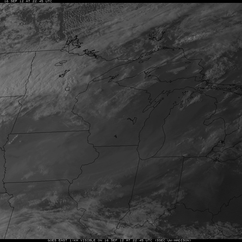
McIDAS images of GOES-13 0.63 µm visible channel data (above; click image to play animation) showed an unusually thick veil of smoke moving eastward across much of the Upper Midwest region of the US on 16 September 2012.
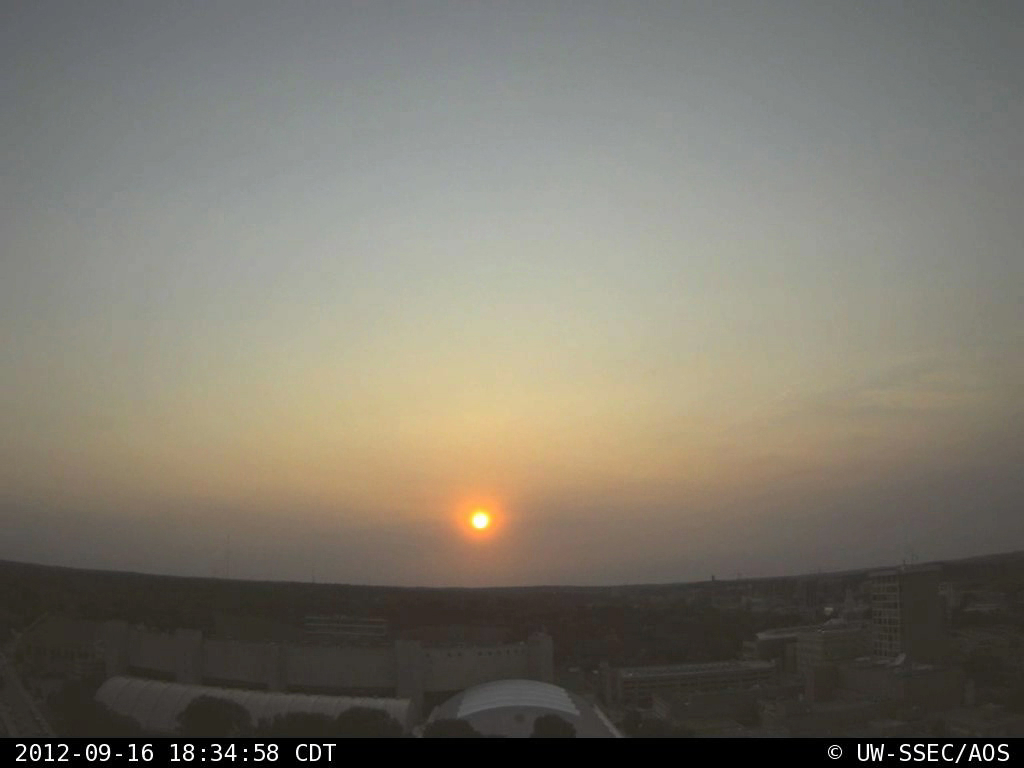
This thick layer of airborne smoke contributed to a colorful sunset, as seen by the west-facing camera on top of the SSEC / AOS building at the University of Wisconsin – Madison (below; click image to play animation). Note the appearance of a number of very short aircraft contrails: an indication that the air aloft at flight altitude was very dry.
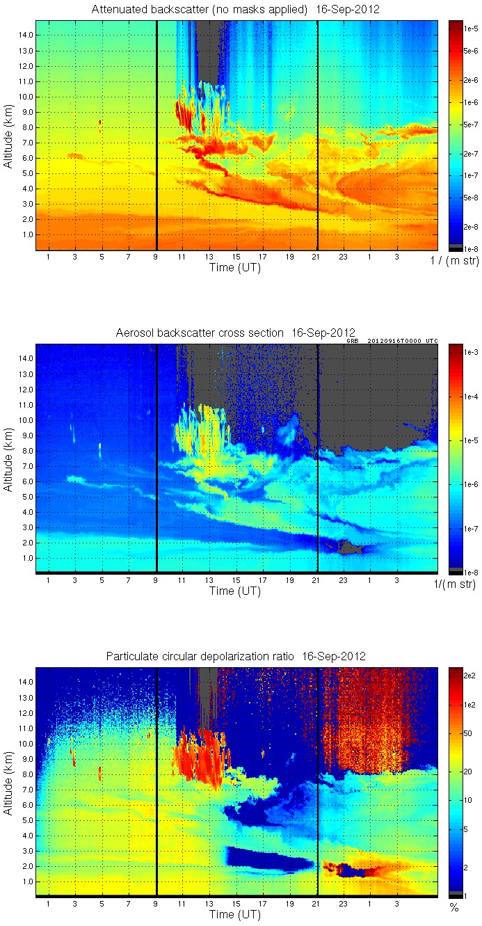
SSEC lidar aerosol backscatter and particulate circular depolarization ratio data (below) indicated that the smoke layer occupied a very deep portion of the middle troposphere (primarily between 2 km and 8 km in altitude) by the end of the day.
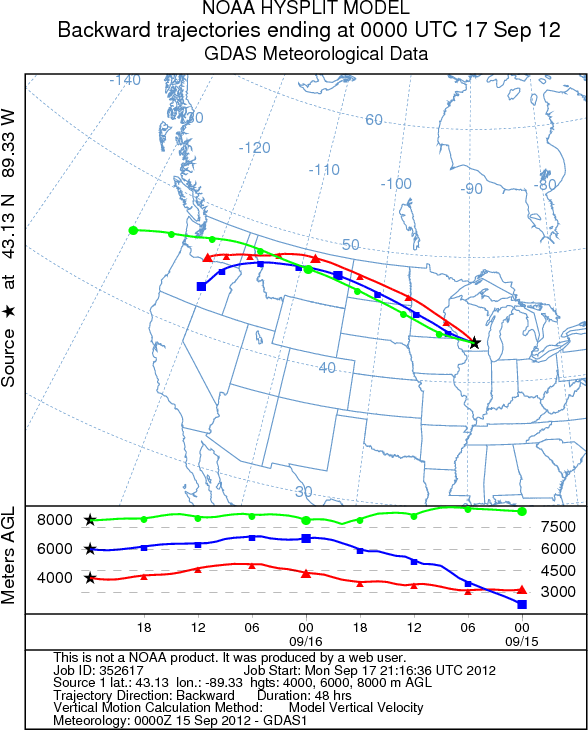
Backward air parcel trajectories using the NOAA ARL HYSPLIT model (below) suggested a long-range transport of smoke from the extensive wildfires which had been burning in Idaho and adjacent states during the previous days.


