
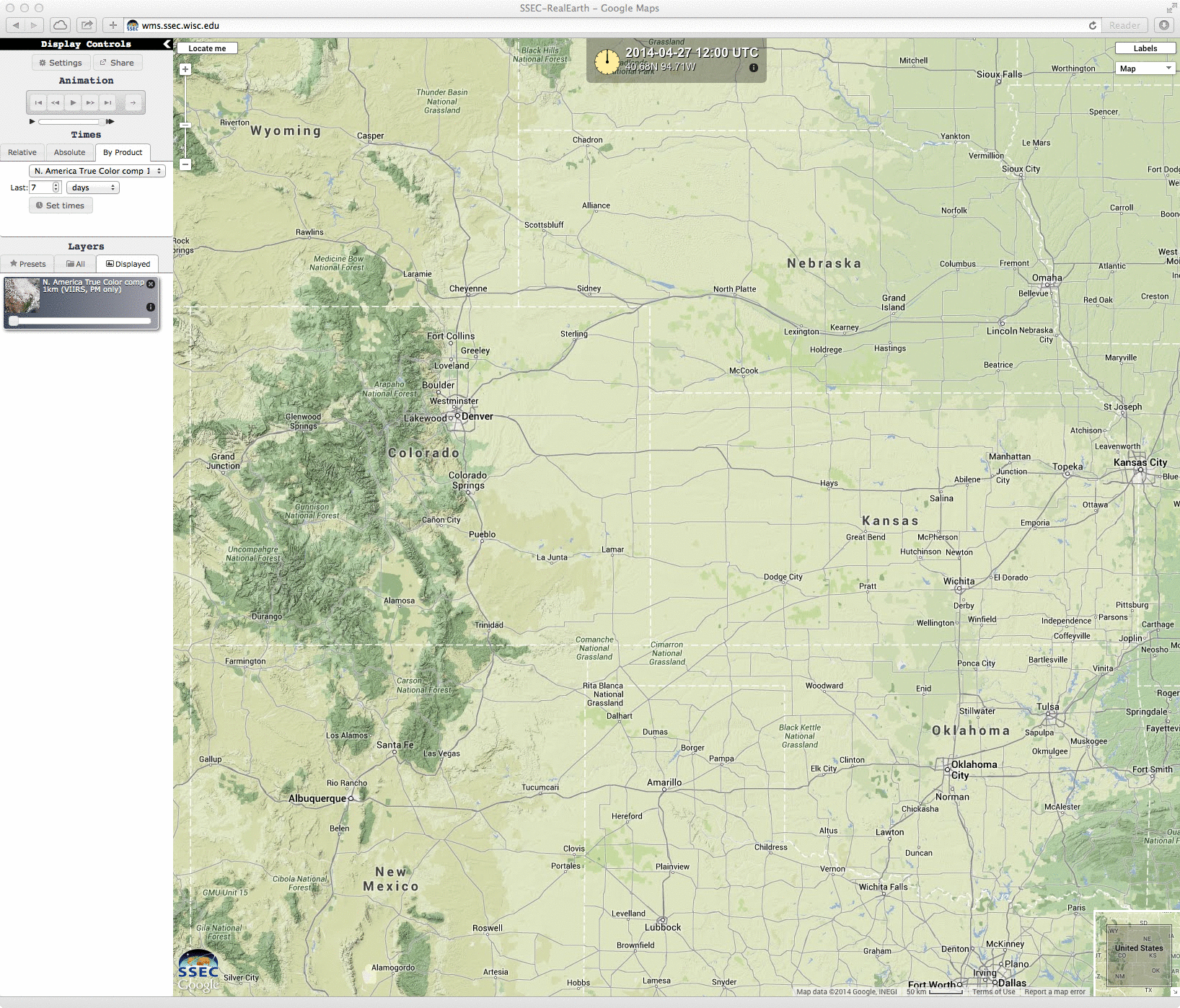
Suomi NPP VIIRS true-color RGB image
A Suomi NPP VIIRS true-color Red/Green/Blue (RGB) image visualized using the SSEC RealEarth web map server (above) showed large areas of blowing dust across parts of the central Plains states on the afternoon of 27 April 2014. Surface winds were gusting in excess of 60 mph at some locations.
McIDAS images of 1-km resolution GOES-13 0.63 µm visible channel data (below; click image to play animation) displayed the formation of a well-defined “blowing dust front” that moved eastward across Kansas.
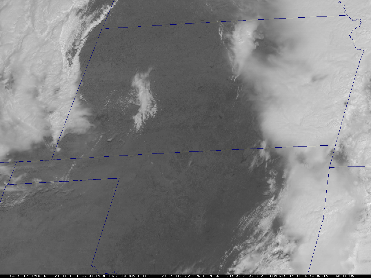
GOES-13 0.63 µm visible channel images (click to play animation)
AWIPS images of 4-km resolution GOES-13 10.7 µm IR channel data with overlays of SPC storm reports (below; click image to play animation) showed the cold cloud top IR brightness temperatures (as cold as -81º C, violet color enhancement) associated with severe thunderstorms that produced widespread hail, damaging winds, and tornadoes (which were responsible for 16 fatalities).

GOES-13 10.7 µm IR channel images, with overlays of SPC storm reports (click to play animation)
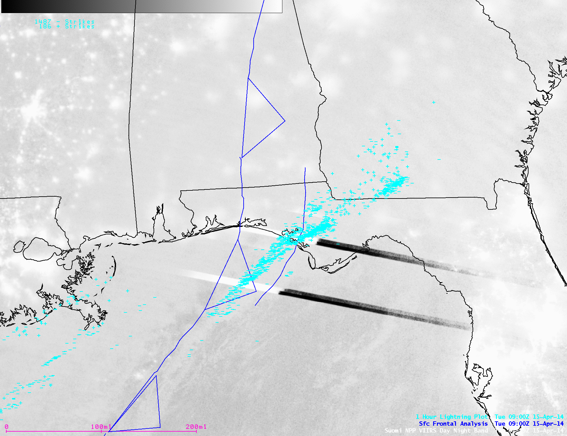
A 1-km resolution POES AVHRR 12.0 µm IR channel image with SPC storm reports at 02:13 UTC or 9:23 PM local time (below) showed the large mesoscale convective system that was responsible for a number of tornadoes in Arkansas a few hours earlier. Note the appearance of subtle cloud-top gravity waves propagating northwestward away from the storm center.
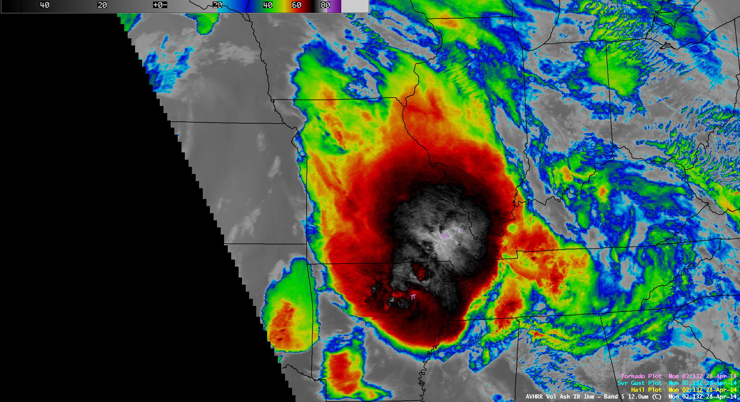
POES AVHRR 12.0 µm IR channel image, with overlay of SPC storm reports
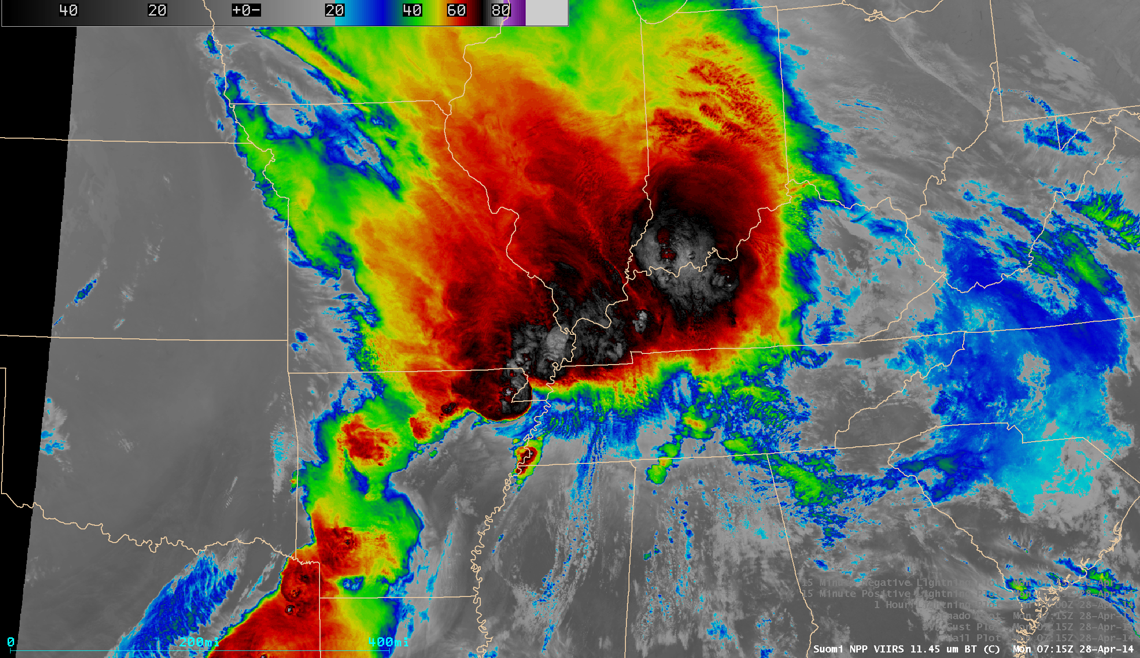
Several hours later, a comparison of Suomi NPP VIIRS 0.7 µm Day/Night Band (DNB) and 11.45 µm IR channel images at 07:15 UTC or 2:15 AM local time (below) revealed the presence of ripples of mesospheric airglow waves propagating northeastward across Missouri and far southern Illinois and Indiana. These mesospheric airglow waves were likely caused by intense overshooting cloud tops associated with the severe thunderstorms as they were producing tornadoes over Arkansas. Several bright “lightning streaks” could also been seen on the VIIRS DNB image, as these electrically-active thunderstorms were responsible for over 2000 cloud-to-ground (CG) lightning strikes in the 15-minute period and over 8000 CG lightning strikes in the 1-hour period preceding the VIIRS images. The SPC storm reports plotted on the IR image cover the 5.5 hour span from 02:00 to 07:30 UTC.
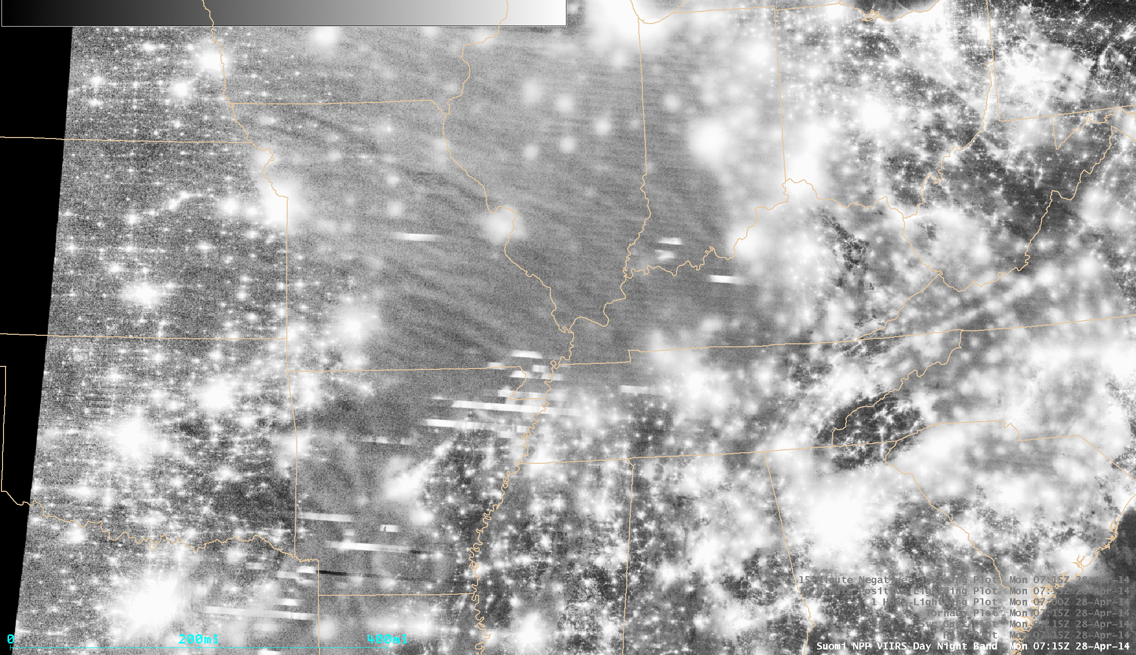
Suomi NPP VIIRS 0.7 µm Day/Night Band and 11.45 µm IR channel images
===== 28 April Update ======
A comparison of “before” (25 April) and “after” (28 April) 250-meter resolution Aqua MODIS true-color RGB images from the SSEC MODIS Today site (below) showed much of the southwest-to-northeast oriented damage path resulting from the EF-4 rated Mayflower/Vilonia/El Paso tornado in Arkansas (NWS Little Rock storm summary).
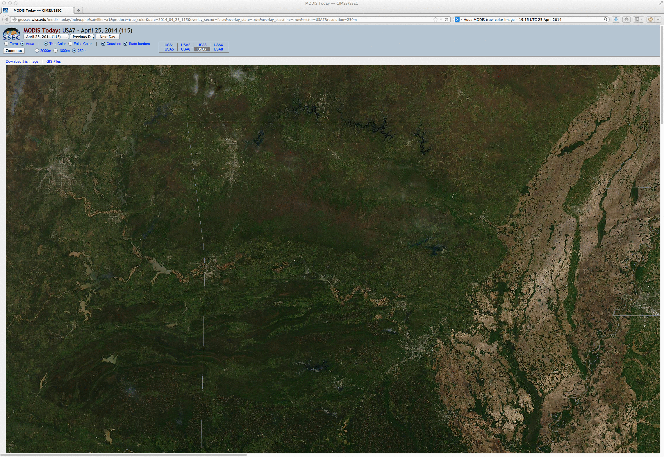
Before (25 April) and after (28 April) Aqua MODIS true-color RGB images showing the damage path from the Vilonia, Arkansas tornado
View only this post Read Less

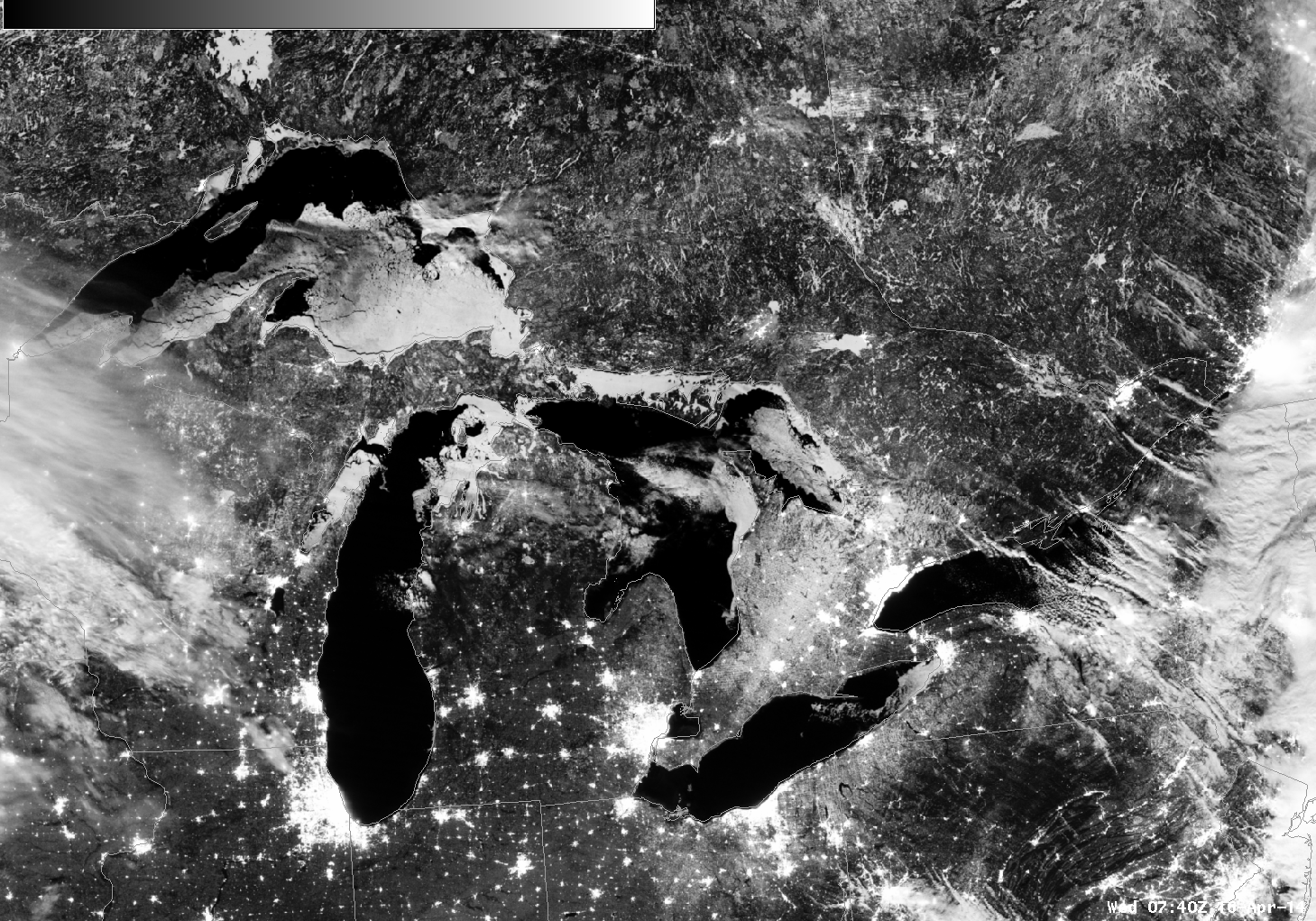
![Suomi/NPP VIIRS Day Night Band imagery, 0740 UTC on 16 April 2014 [Click to enlarge]](https://cimss.ssec.wisc.edu/satellite-blog/wp-content/uploads/sites/5/2014/04/VIIRS_DNB__REF_20140416_0740.png "Suomi/NPP VIIRS Day Night Band imagery, 0740 UTC on 16 April 2014 [Click to enlarge]")


