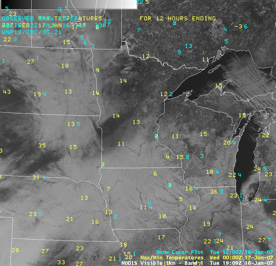
An AWIPS image of the MODIS visible channel (above) shows fresh snow cover over much of the Upper Midwest region on the afternoon of 16 January 2007, following a winter storm that moved through the area 1-2 days earlier. This satellite scene... Read More

An AWIPS image of the MODIS visible channel (above) shows fresh snow cover over much of the Upper Midwest region on the afternoon of 16 January 2007, following a winter storm that moved through the area 1-2 days earlier. This satellite scene is cloud-free for the most part, so the variation in visible “brightness” is due to differences in snow cover and/or density of forest vegetation (areas with a dense tree population will still aprear darker, even if there is a deep snow cover on the ground). Cooperative observer reports of new snow depth that morning (not shown; only first-order climate station data are plotted) were greatest across eastern Nebraska (5 inches), northern Iowa and southern Minnesota (8 inches), and southern Wisconsin (6 inches), while lake-effect snow had contributed to even greater snow depths farther to the north (17 inches in northern Wisconsin, and 13 inches in the Upper Peninsula of Michigan).

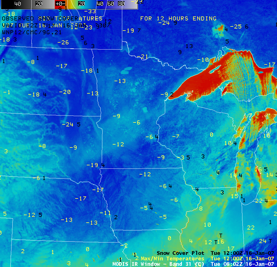
The swath of fresh snow cover had an important effect on the nocturnal radiational cooling of the surface, and therefore on the minimum temperatures that were reported that morning. An AWIPS image of the MODIS 11.0 µm InfraRed (IR) channel at 08:02 UTC (above) reveals significant variability in the regional “surface temperatures” that were sensed by the satellite — colder IR brightness temperatures (-30 to -40 C, -22 to -40 F) are shown by the darker blue colors on this enhancement. The coldest morning minimum temperatures that were reported by cooperative observers on 16 January included -37 C/-34 F at Embarrass, Minnesota, -32 C/-25 F at Minong, Wisconsin, -31 C/-23 F at Spencer, Iowa, and -30 C/-22 F at Wayne, Nebraska. Note how the larger lakes in northern Minnesota exhibited slightly warmer IR brightness temperatures (near -20 C/-4 F, cyan enhancement) compared to the surrounding land areas; while these lakes were frozen and snow-covered, the satellite was able to sense warmer radiation coming from the lake water below the ice surface.

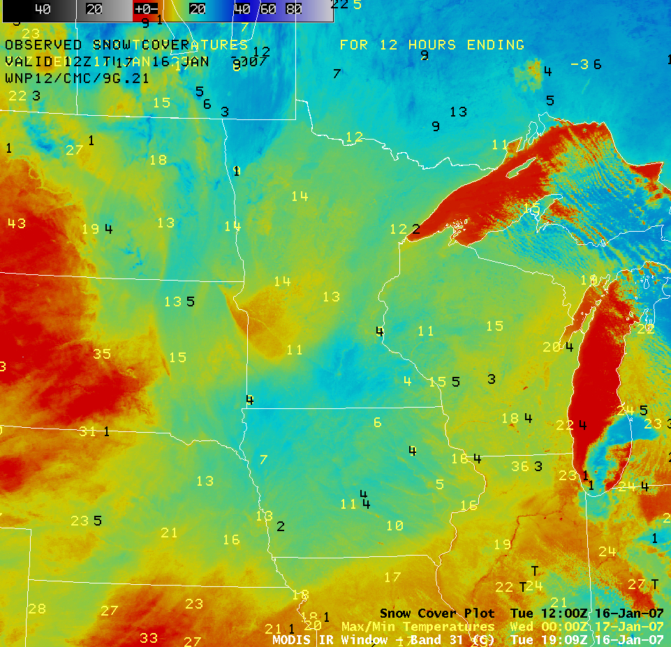
An AWIPS image of the MODIS IR image at 19:09 UTC (above) shows a similar variability in the regional afternoon IR brightness temperatures. This IR image was near the time of the daily maximum temperatures — areas having little or no snow cover exhibited warmer IR brightness temperatures (0 to +5 C/32 to 41 F, red enhancement), while those locations having deeper snow cover had colder IR brightness temperatures (near -15 to -20 C/+5 to -4 F, green to cyan enhancement). The actual reported maximum air temperatures showed a similar pattern to the deepest snow cover and the colder IR temperatures; the daytime high was only -17 C/+1 F at Mankato, Minnesota, while temperatures reached a balmy +6 C/+43 F at Dickinson, North Dakota (where there was no snow cover). The warmer, unfrozen waters of Lake Superior and Lake Michigan also stand out with their warmer red enhancement (some colder lake-effect snow bands were still seen over parts of the Great Lakes). Use this handy Java image fader to interactively fade between the MODIS visible and IR images shown above (1280 x 1024 screen resolution required). Speaking of warm, unfrozen waters…due in no small part to the 13th warmest December on record, the larger lakes in the vicinity of Madison, Wisconsin were still not frozen (MODIS true color image).
View only this post
Read Less


