This website works best with a newer web browser such as Chrome, Firefox, Safari or Microsoft Edge. Internet Explorer is not supported by this website.

Test of GOES-15 (GOES-West) Rapid Scan Operations (RSO) sectors for the Alaska Region

During a 4-hour period on 17 March 2015, NOAA/NESDIS conducted a test of two special GOES-15 (GOES-West) Rapid Scan Operations (RSO) sectors for the Alaska Region. From 16:00 to 18:00 UTC, the test was conducted for the “Sitka” sector (above) — and GOES-15 0.63 µm visible channel images over a... Read More

GOES-15

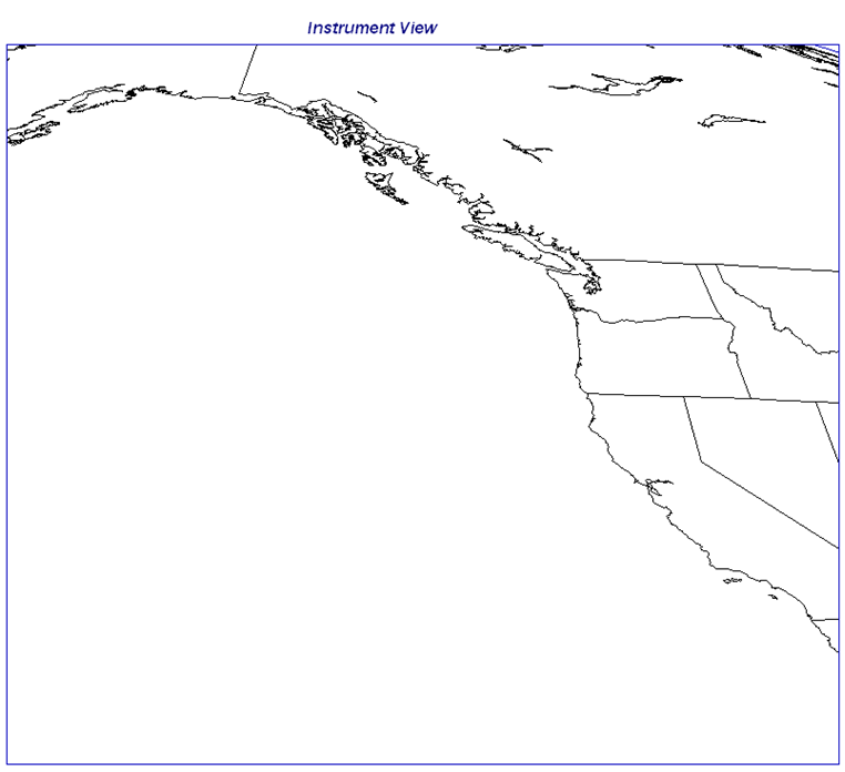
GOES-15 “Sitka” RSO Sector

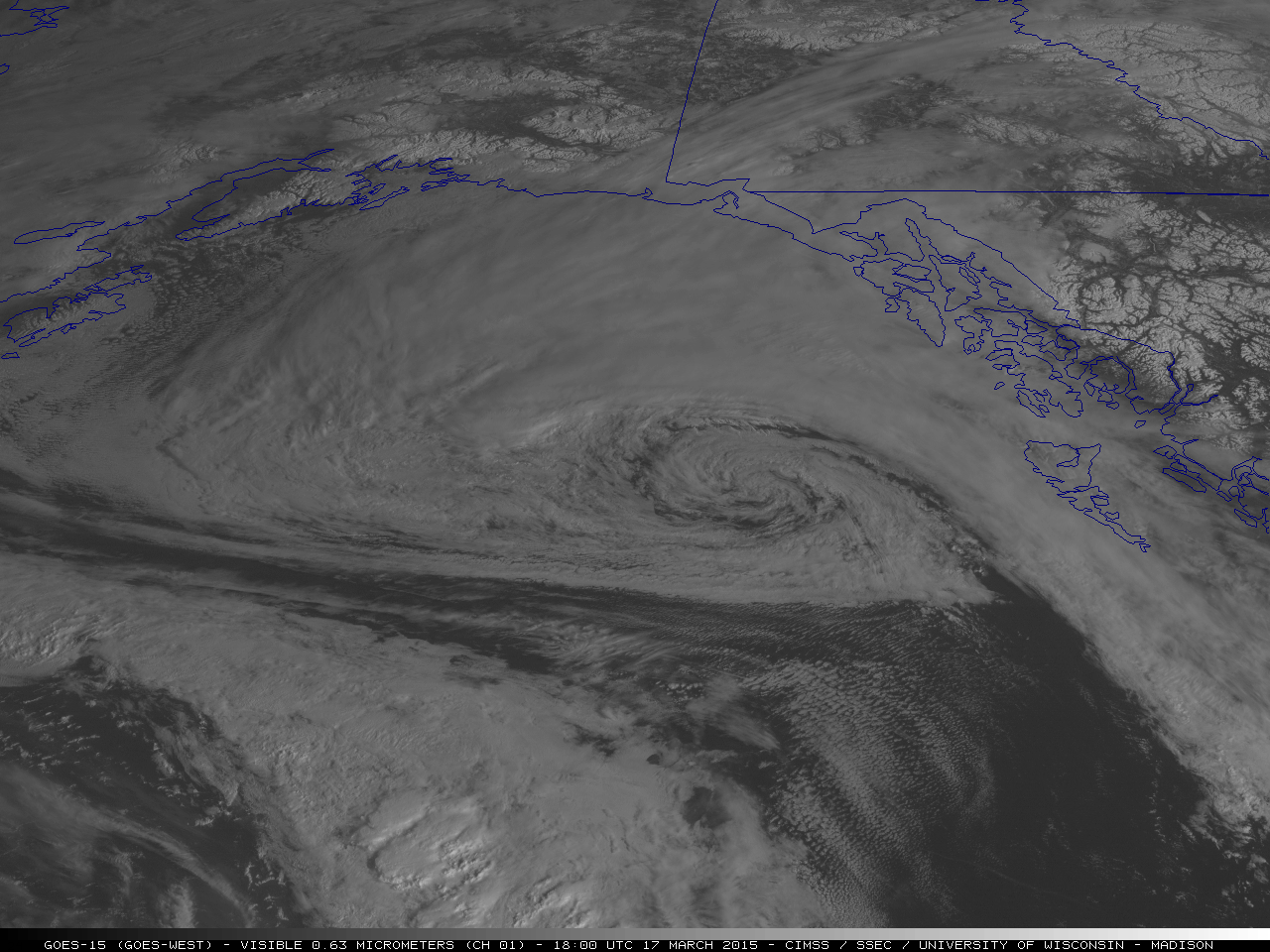
During a 4-hour period on 17 March 2015, NOAA/NESDIS conducted a test of two special GOES-15 (GOES-West) Rapid Scan Operations (RSO) sectors for the Alaska Region. From 16:00 to 18:00 UTC, the test was conducted for the “Sitka” sector (above) — and GOES-15 0.63 µm visible channel images over a portion of that sector (below; click image to play animation) showed the circulation of a mid-latitude cyclone that was producing gale force winds in the eastern portion of the Gulf of Alaska (IR image with surface analysis), as well as clusters of deep convection which were forming along an occluded front approaching from the south.

GOES-15 0.63 µm visible images -

GOES-15 0.63 µm visible images – “Sitka” sector (click to play animation)

———————————————————————————————————————–

GOES-15

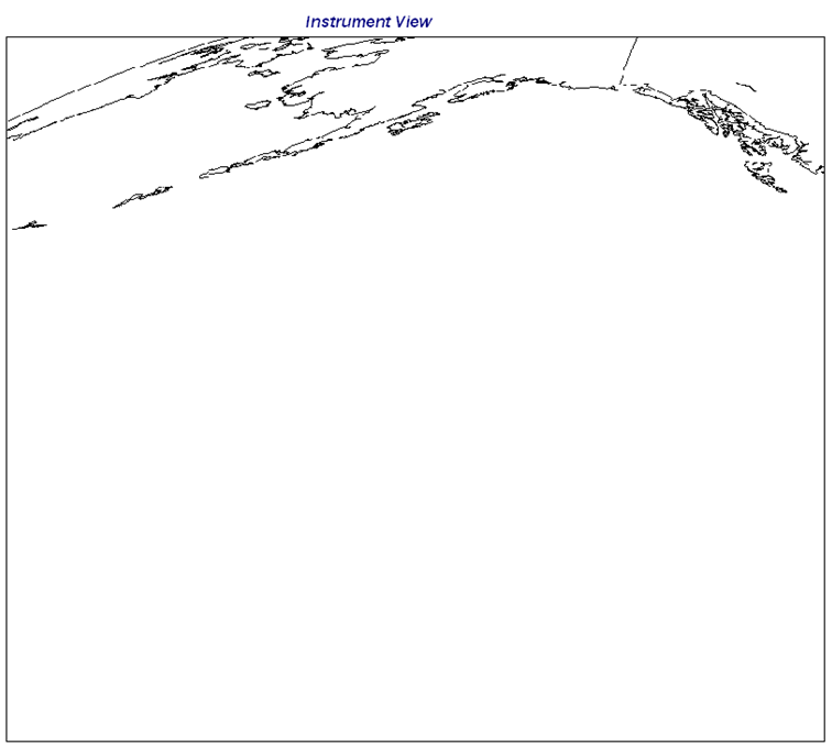
GOES-15 “TPARC” RSO sector

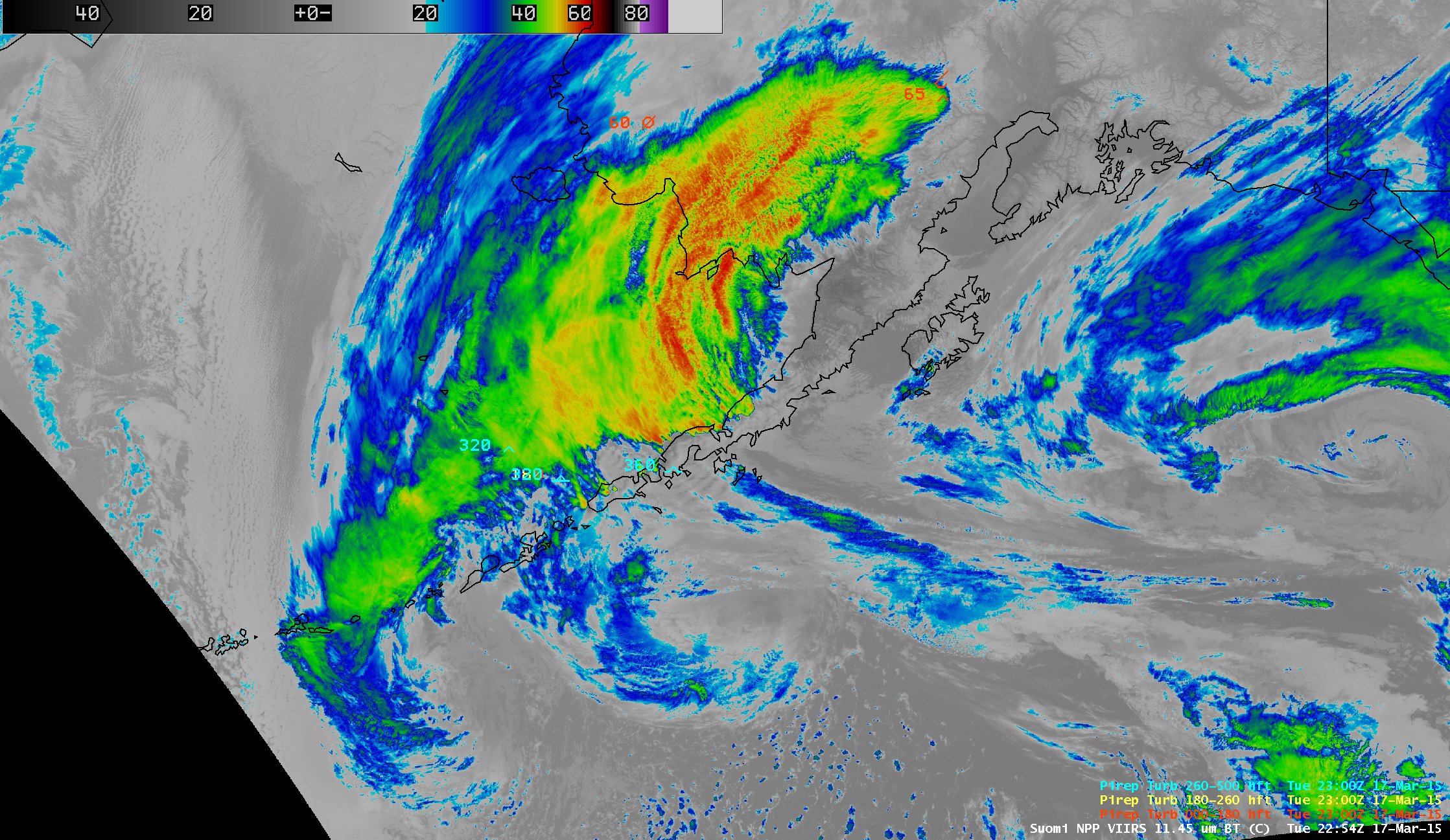
Then from 18:00 to 20:00 UTC, the RSO test was conducted for the “TPARC” sector (above) — and GOES-15 0.63 µm visible channel images (below; click image to play animation) showed the circulation of two cyclones south of the Aleutian Islands, in addition to a large “banner cloud” and a few mountain waves which had formed downwind (to the north) of the rugged terrain of the Alaska Peninsula and the Aleutian Islands. GOES-15 IR brightness temperatures associated with the banner cloud were as cold as -65 C, which according to the nearby Bethel, Alaska rawinsonde data at 12 UTC corresponded to an altitude of around 27,700 feet (IR image with Bethel Skew-T and surface analysis).

GOES-15 0.63 µm visible channel images -

GOES-15 0.63 µm visible channel images – “TPARC” sector (click to play animation)

Regarding the Alaska Peninsula banner cloud seen on the GOES-15 visible images, a sequence of Terra/Aqua MODIS 11.0 µm and Suomi NPP VIIRS 11.45 µm IR images (below; click image to play animation) showed the evolution of this feature several hours before and after the RSO test. There were a few pilot reports of moderate turbulence, at altitudes as high as 36,000 feet – and some of these pilot reports specifically mentioned “MNT WAVE” in their remarks.

Suomi NPP VIIRS 11.45 µm IR image (click to play animation of VIIRS and MODIS IR images)

Suomi NPP VIIRS 11.45 µm IR image (click to play animation of VIIRS and MODIS IR images)

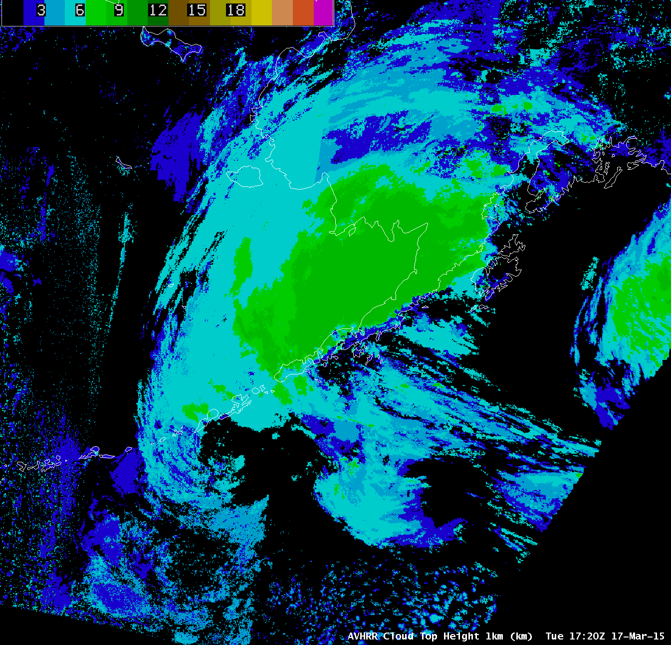
The CLAVR-x POES AVHRR Cloud Top Height product (below; click image to play animation) indicated that the banner cloud reached heights of 9 km (darker green color enhancement).

POES AVHRR Cloud Top Height product (click to play animation)

POES AVHRR Cloud Top Height product (click to play animation)

View only this post Read Less
Category 5 Cyclone Pam in the South Pacific

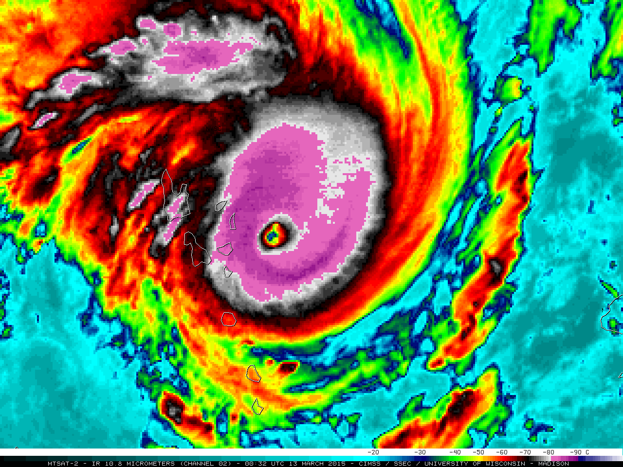
Cyclone Pam in the South Pacific Ocean was rated at Category 5 intensity by the Joint Typhoon Warning Center at 18 UTC on 12 March 2015. MTSAT-2 10.8 µm IR channel images (above; click image to play animation; also available as an MP4 movie file) showed... Read More

MTSAT-2 10.8 µm IR images (click to play animation)

MTSAT-2 10.8 µm IR images (click to play animation)

Cyclone Pam in the South Pacific Ocean was rated at Category 5 intensity by the Joint Typhoon Warning Center at 18 UTC on 12 March 2015. MTSAT-2 10.8 µm IR channel images (above; click image to play animation; also available as an MP4 movie file) showed the well-defined eye as the storm moved southwestward across the Vanuatu archipelago during the 12-13 March time period.

The corresponding MTSAT-2 0.7 µm visible channel images (below; click image to play animation) revealed a complex structure of gravity waves and transverse banding surrounding the eye.

MTSAT-2 0.7 µm visible channel images (click to play animation)

MTSAT-2 0.7 µm visible channel images (click to play animation)

A comparison of the 12 March 21:32 UTC MTSAT-2 visible image and the 21:44 UTC Metop ASCAT surface scatterometer winds from the CIMSS Tropical Cyclones site is shown below.

MTSAT-2 visible image and Metop ASCAT surface scatterometer winds

MTSAT-2 visible image and Metop ASCAT surface scatterometer winds

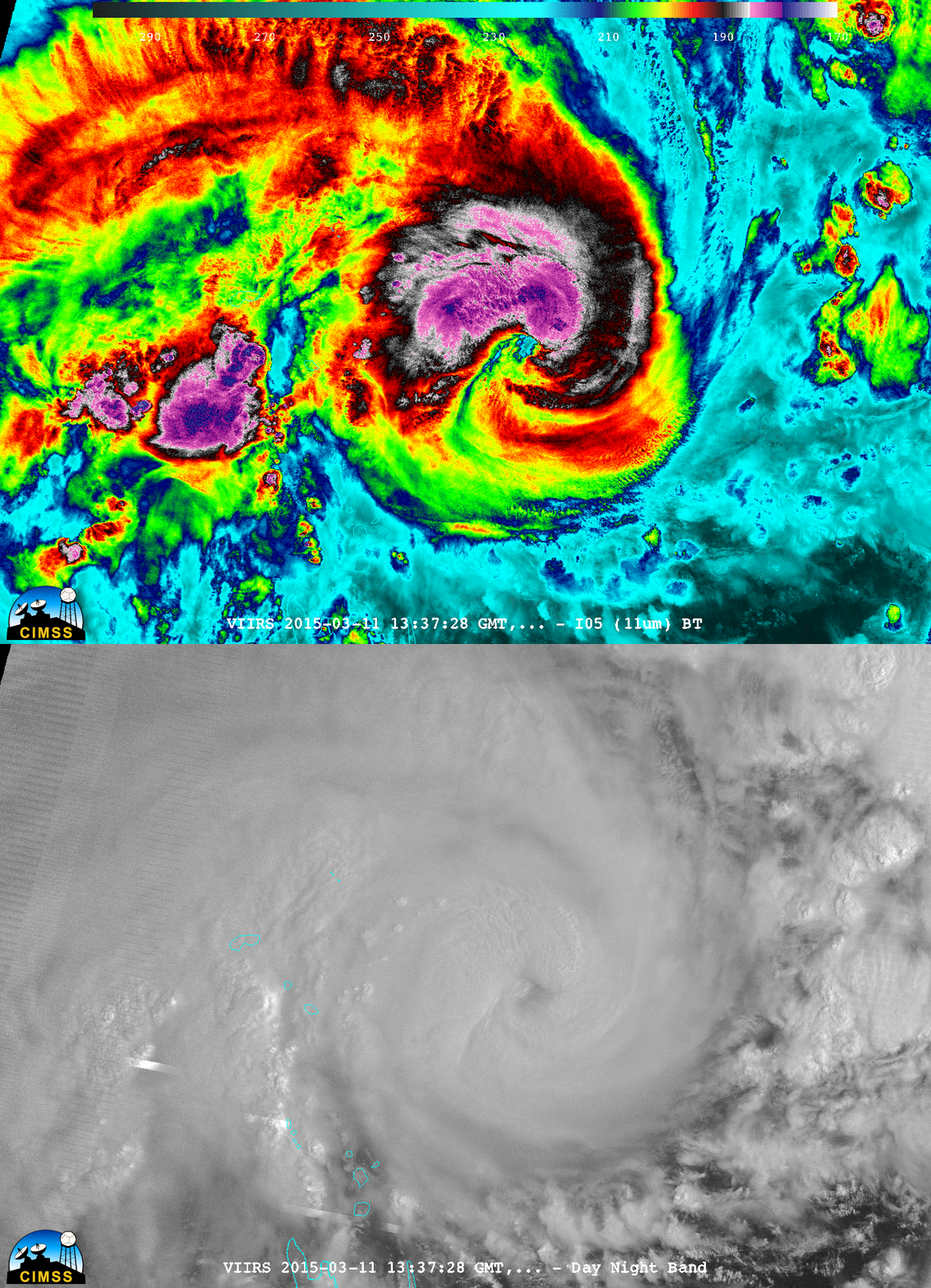
Just prior to the time when Pam was beginning to enter a period of rapid intensification (ADT intensity estimate plot), a nighttime comparison of Suomi NPP VIIRS 0.7 µm Day/Night Band and 11.45 µm Infrared images at 13:37 UTC on 11 March is shown below.

Suomi NPP VIIRS 0.7 µm Day/Night Band and 11.45 µm Infrared images

Suomi NPP VIIRS 0.7 µm Day/Night Band and 11.45 µm Infrared images

View only this post Read Less
Satellite detection of ice-glazed snow cover

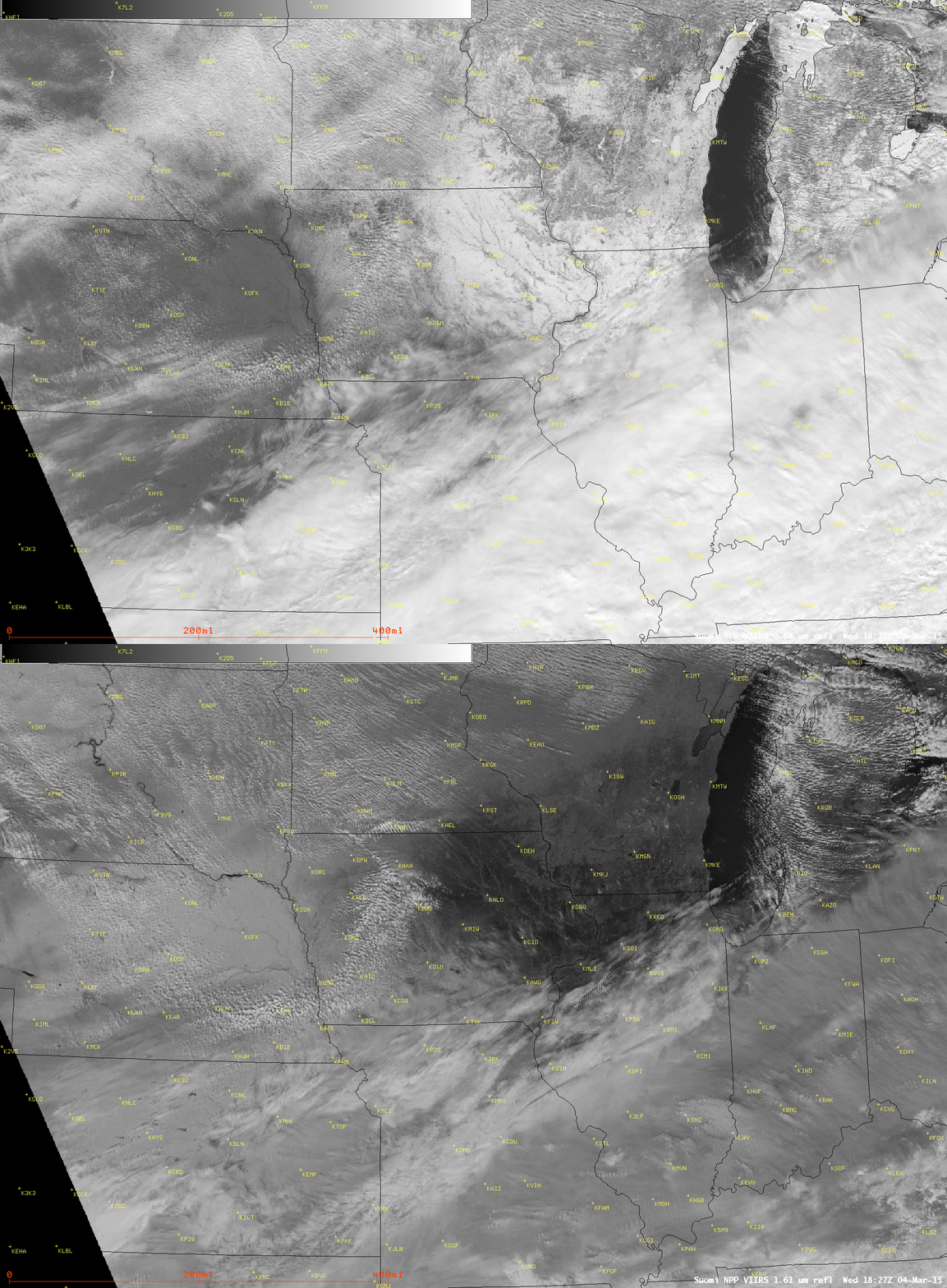
Comparisons of Suomi NPP VIIRS 0.64 µm visible channel and 1.61 µm near-IR “snow/ice channel” images on 04 March 2015 (above) and 05 March 2015 (below) revealed a large area of ice-glazed snow cover in the... Read More

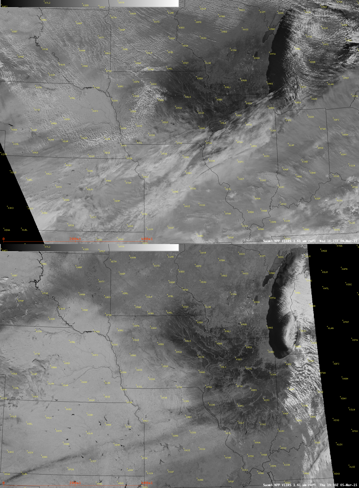
Suomi NPP VIIRS 0.64 µm visible and 1.61 µm near-IR

Suomi NPP VIIRS 0.64 µm visible and 1.61 µm near-IR “snow/ice channel” images (04 March)

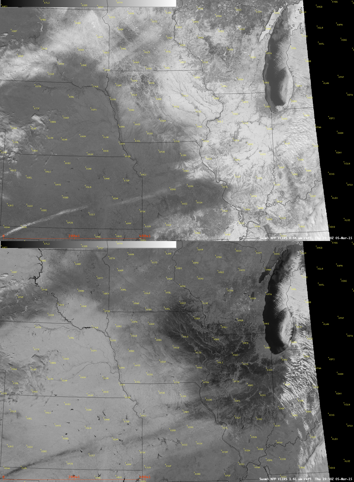
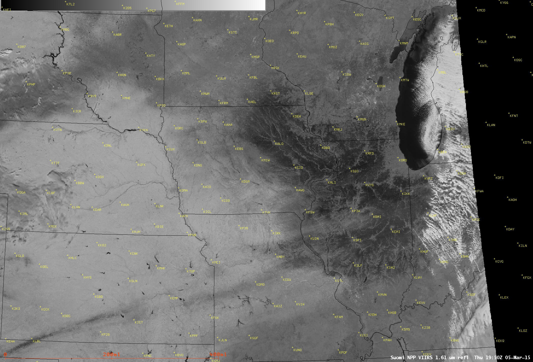
Comparisons of Suomi NPP VIIRS 0.64 µm visible channel and 1.61 µm near-IR “snow/ice channel” images on 04 March 2015 (above) and 05 March 2015 (below) revealed a large area of ice-glazed snow cover in the Upper Midwest. On 03 March, a northeastward surge of moisture ahead of an approaching strong arctic cold front produced areas of light snow, freezing rain, freezing drizzle, and fog across parts of southeastern Minnesota, eastern Iowa, southern and central Wisconsin, and northern Illinois — and farther to the south from northeastern Missouri into central Illinois it was warm enough for rain as the precipitation type. This precipitation fell onto a pre-existing snow cover (NOHRSC 03 March snow depth), making the skin of the snow cover icy and/or wet (depending on the air temperature); with the passage of the strong arctic cold front,  this icy and/or wet snow surface quickly froze, creating a large area of ice-glazed snow cover.

At the 1.61 µm wavelength, since ice is a stronger absorber of radiation than snow, the ice-glazed snow areas appeared darker black compared to the surrounding snow cover; areas with a dense concentration of trees (cities; river valleys) tended to diminish this darker black signal.

Suomi NPP VIIRS 0.64 µm visible and 1.61 µm

Suomi NPP VIIRS 0.64 µm visible and 1.61 µm “snow/ice channel” images (05 March)

A toggle between the 04 March and 05 March 1.61 µm snow/ice channel images (below) showed more of the darker ice-glazed snow cover area as the clouds began to clear the region on 05 March (NOHRSC snow depth: 04 March | 05 March).

Suomi NPP VIIRS 1.61 µm near-IR

Suomi NPP VIIRS 1.61 µm near-IR “snow/ice channel” images (04/05 March)

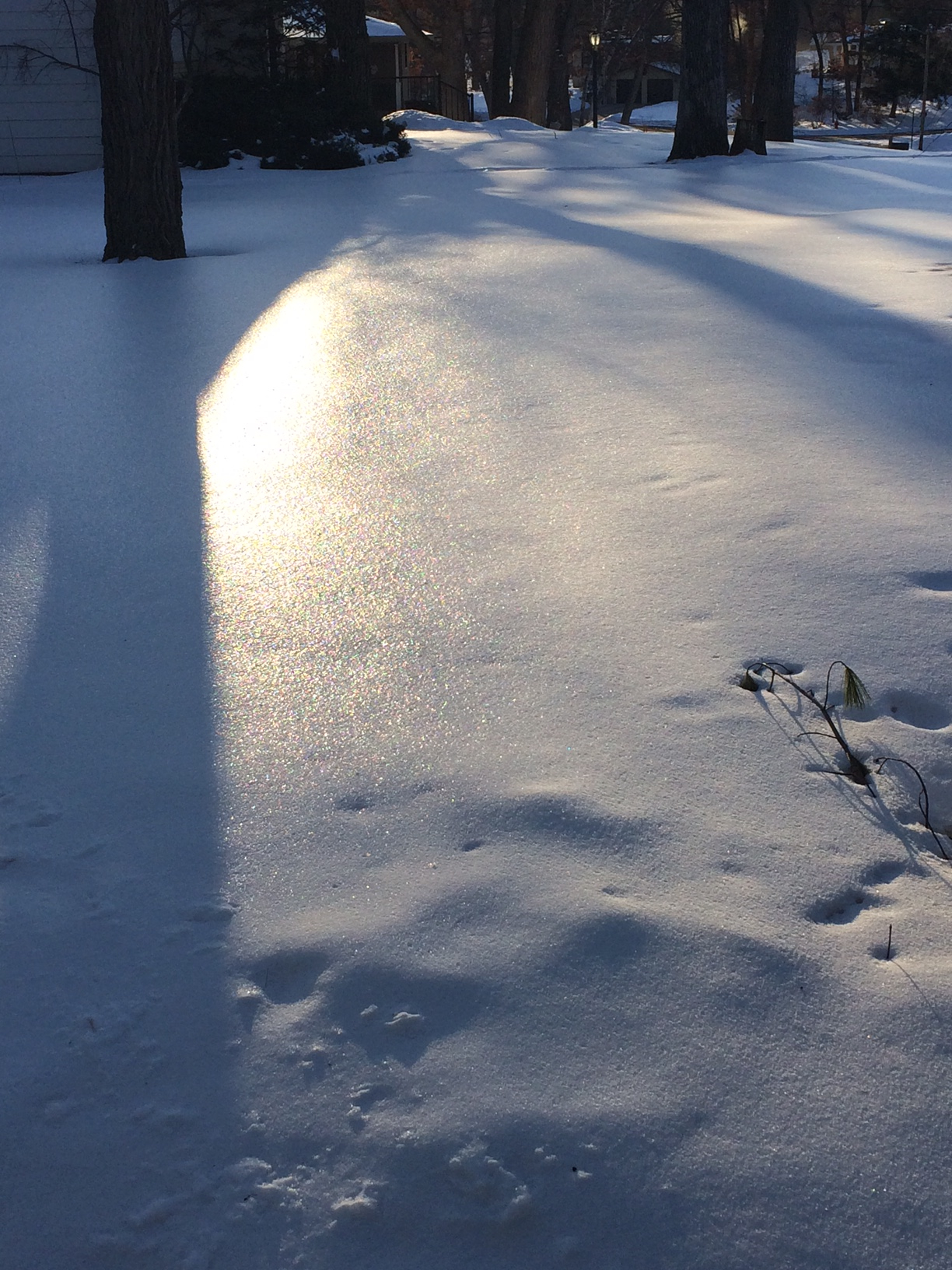
A photo of the ice-glazed snow cover in Middleton, Wisconsin (a western suburb of Madison) on 05 March is shown below.

Photo of ice-glazed snow cover in Middleton, Wisconsin (05 March)

Photo of ice-glazed snow cover in Middleton, Wisconsin (05 March)

View only this post Read Less
Rapidly-melting snow in the south-central US

GOES-13 (GOES-East) 0.63 µm visible channel images (above; click image to play animation; also available as an MP4 movie file) showed how rapidly the streaks and patches of snow cover melted across parts of the south-central US (primarily Kansas, Oklahoma, Texas, and adjacent states) on Read More

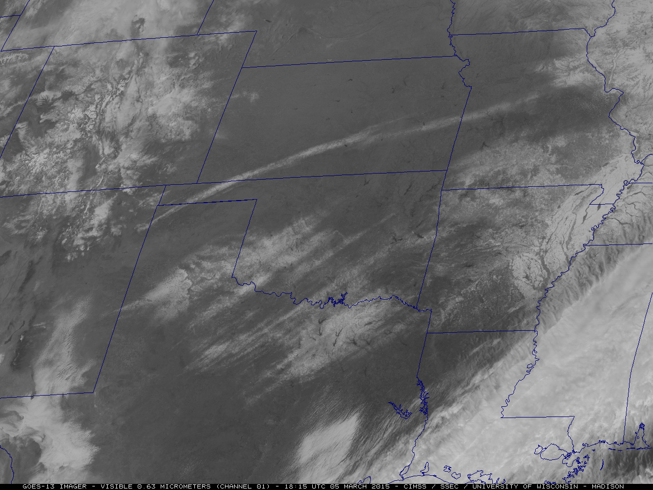
GOES-13 0.63 µm visible channel images (click to play animation)

GOES-13 0.63 µm visible channel images (click to play animation)

GOES-13 (GOES-East) 0.63 µm visible channel images (above; click image to play animation; also available as an MP4 movie file) showed how rapidly the streaks and patches of snow cover melted across parts of the south-central US (primarily Kansas, Oklahoma, Texas, and adjacent states) on 05 March 2015. According to NOHRSC, morning snow depths (contour map | numerical snow depth values) were generally in the 2-4 inch range, with some sites reporting 5 inches on the ground.

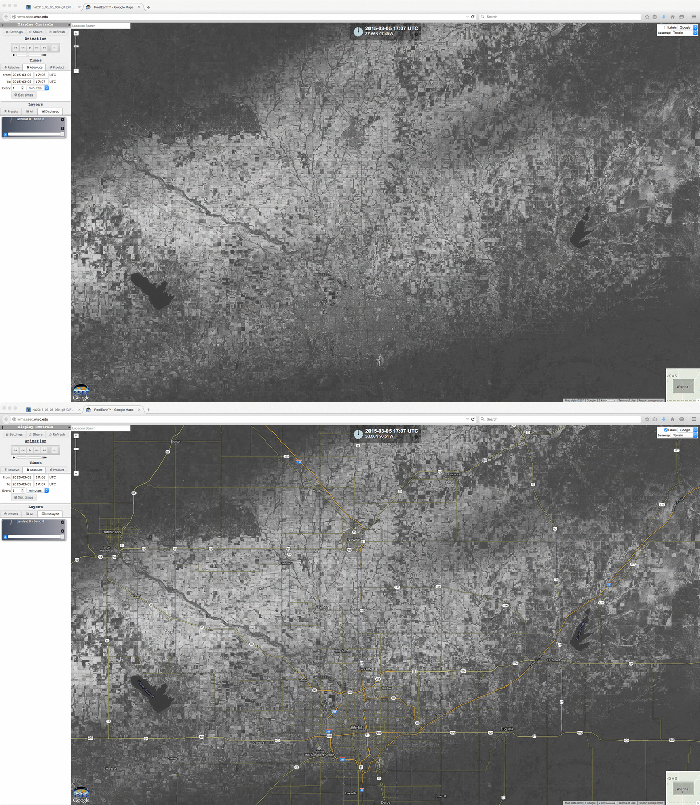
The narrow snow band in Kansas went through the Witchita area; a 15-meter resolution Landsat-8 0.59 µm panochromatic visible image from the SSEC RealEarth web map server (below) provided a very detailed view of the snow cover in that area.

Landsat-8 0.59 µm panochromatic visible image (with and without Google Maps labels)

Landsat-8 0.59 µm panochromatic visible image (with and without Google Maps labels)

View only this post Read Less