Satellite detection of ice-glazed snow cover
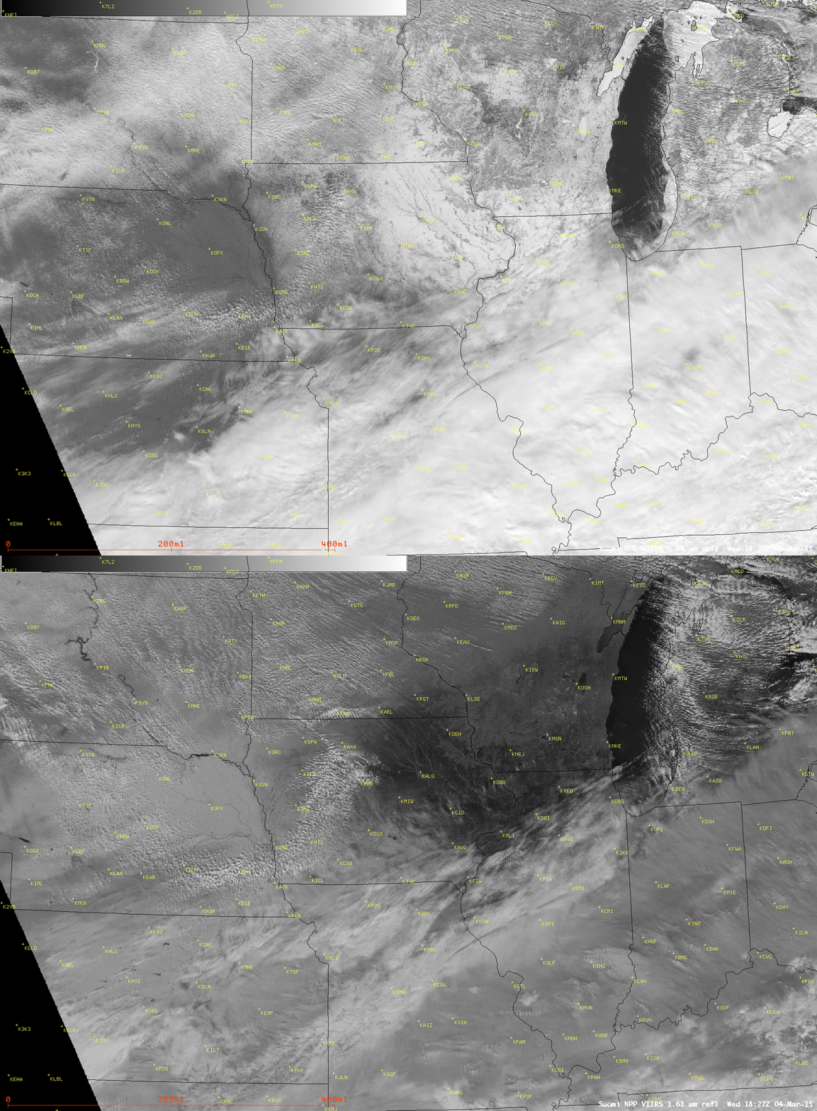
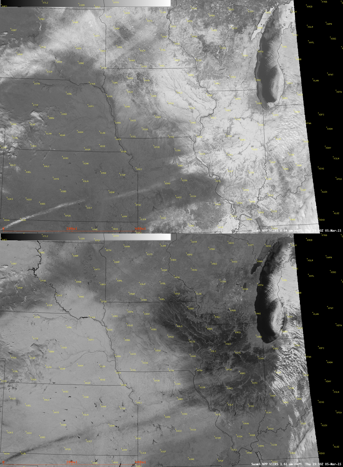
Comparisons of Suomi NPP VIIRS 0.64 µm visible channel and 1.61 µm near-IR “snow/ice channel” images on 04 March 2015 (above) and 05 March 2015 (below) revealed a large area of ice-glazed snow cover in the Upper Midwest. On 03 March, a northeastward surge of moisture ahead of an approaching strong arctic cold front produced areas of light snow, freezing rain, freezing drizzle, and fog across parts of southeastern Minnesota, eastern Iowa, southern and central Wisconsin, and northern Illinois — and farther to the south from northeastern Missouri into central Illinois it was warm enough for rain as the precipitation type. This precipitation fell onto a pre-existing snow cover (NOHRSC 03 March snow depth), making the skin of the snow cover icy and/or wet (depending on the air temperature); with the passage of the strong arctic cold front, this icy and/or wet snow surface quickly froze, creating a large area of ice-glazed snow cover.
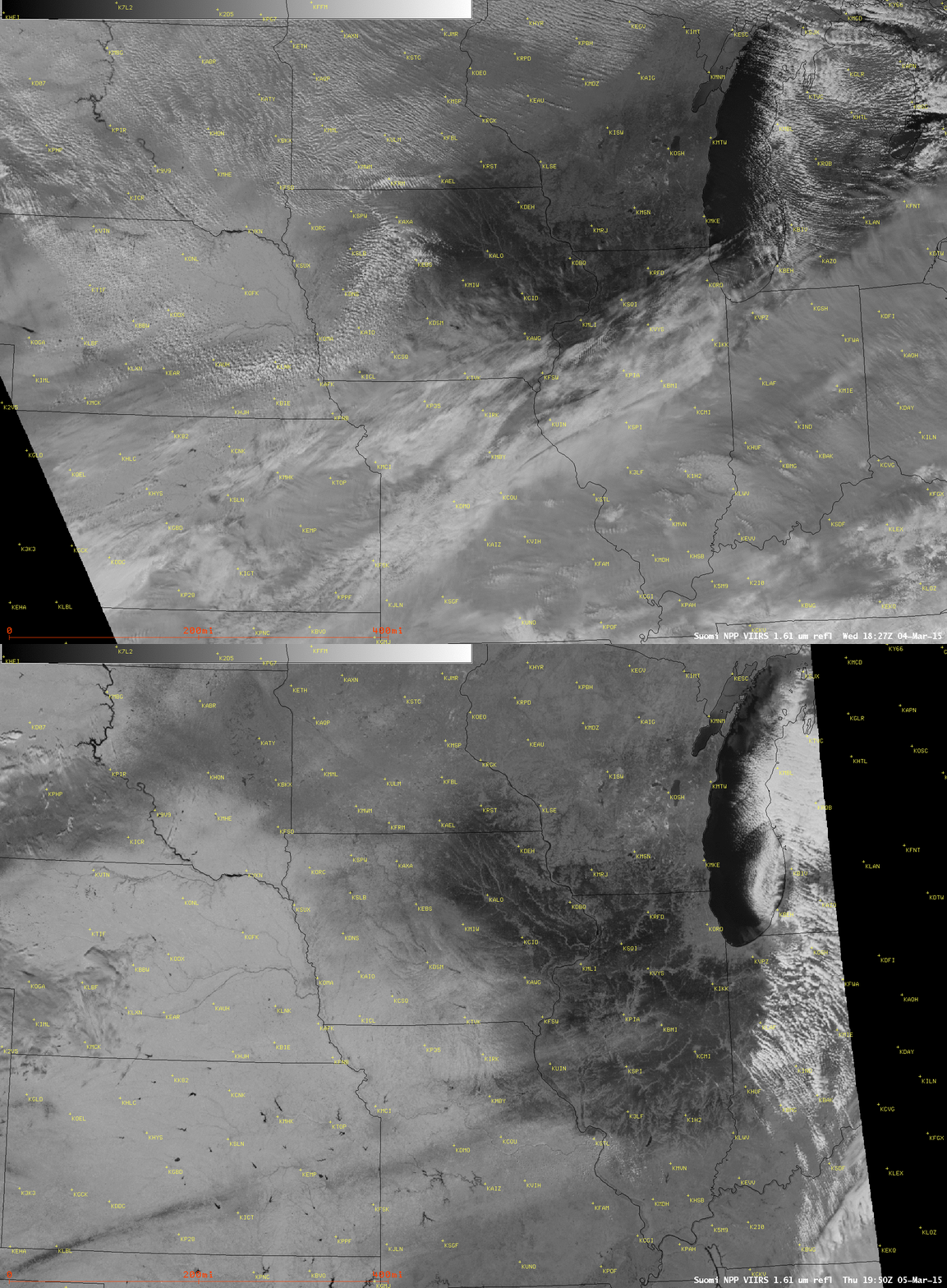
At the 1.61 µm wavelength, since ice is a stronger absorber of radiation than snow, the ice-glazed snow areas appeared darker black compared to the surrounding snow cover; areas with a dense concentration of trees (cities; river valleys) tended to diminish this darker black signal.
A toggle between the 04 March and 05 March 1.61 µm snow/ice channel images (below) showed more of the darker ice-glazed snow cover area as the clouds began to clear the region on 05 March (NOHRSC snow depth: 04 March | 05 March).
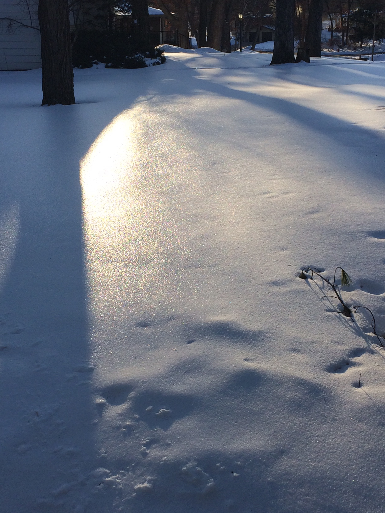
A photo of the ice-glazed snow cover in Middleton, Wisconsin (a western suburb of Madison) on 05 March is shown below.


