Category 5 Cyclone Pam in the South Pacific
Cyclone Pam in the South Pacific Ocean was rated at Category 5 intensity by the Joint Typhoon Warning Center at 18 UTC on 12 March 2015. MTSAT-2 10.8 µm IR channel images (above; click image to play animation; also available as an MP4 movie file) showed the well-defined eye as the storm moved southwestward across the Vanuatu archipelago during the 12-13 March time period.
The corresponding MTSAT-2 0.7 µm visible channel images (below; click image to play animation) revealed a complex structure of gravity waves and transverse banding surrounding the eye.
A comparison of the 12 March 21:32 UTC MTSAT-2 visible image and the 21:44 UTC Metop ASCAT surface scatterometer winds from the CIMSS Tropical Cyclones site is shown below.
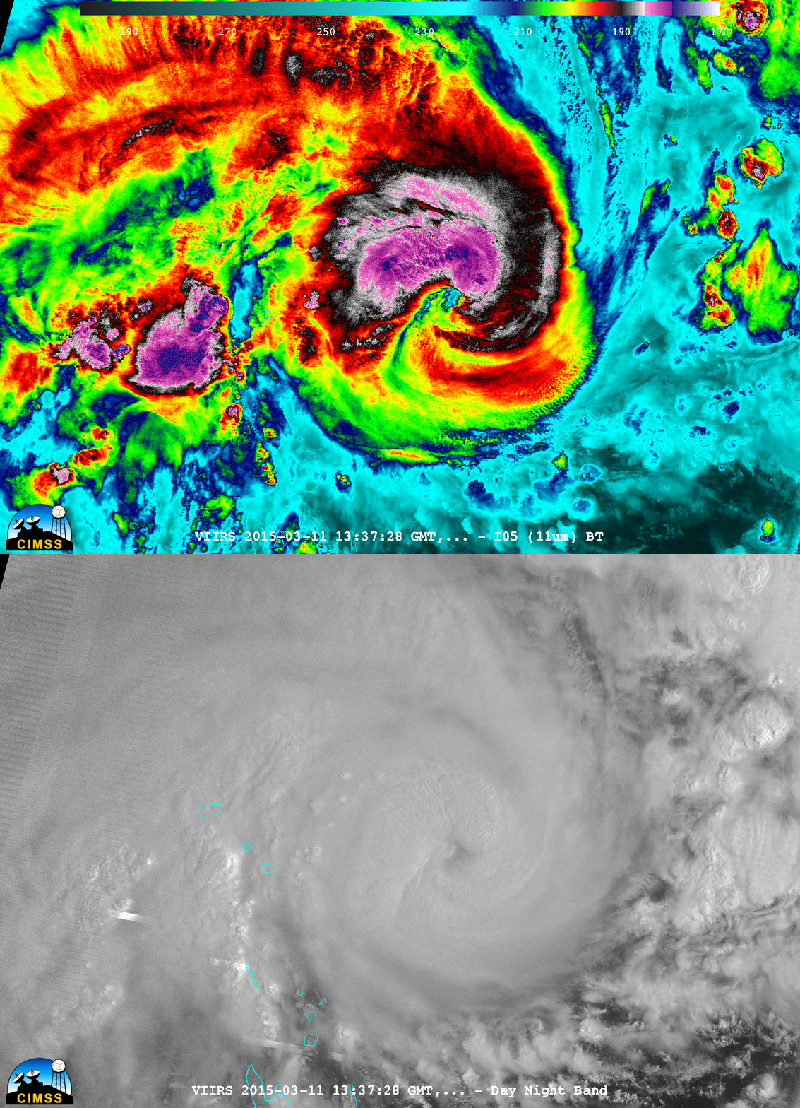
Just prior to the time when Pam was beginning to enter a period of rapid intensification (ADT intensity estimate plot), a nighttime comparison of Suomi NPP VIIRS 0.7 µm Day/Night Band and 11.45 µm Infrared images at 13:37 UTC on 11 March is shown below.


