This website works best with a newer web browser such as Chrome, Firefox, Safari or Microsoft Edge. Internet Explorer is not supported by this website.

Tornado-producing severe thunderstorm in northern Italy

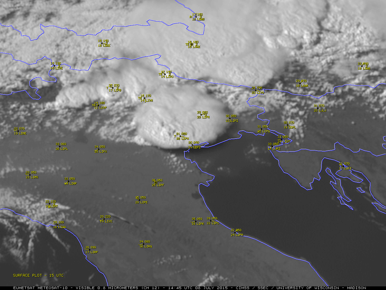
EUMETSAT Meteosat-10 SEVIRI High Resolution Visible (0.8 µm) images (above; click to play animation) showed the development of an isolated supercell thunderstorm that produced large hail and a violent tornado (1 fatality; estimated EF3 damage) near Venice, Italy (station identifier LIPZ) around 1530 UTC on 08 July 2015. Additional information... Read More

Metoesat-10 High Resolution Visible (0.8 µm) images (click to play animation)

Metoesat-10 High Resolution Visible (0.8 µm) images (click to play animation)

EUMETSAT Meteosat-10 SEVIRI High Resolution Visible (0.8 µm) images (above; click to play animation) showed the development of an isolated supercell thunderstorm that produced large hail and a violent tornado (1 fatality; estimated EF3 damage) near Venice, Italy (station identifier LIPZ) around 1530 UTC on 08 July 2015. Additional information and imagery is available from meteonetwork.

The corresponding Meteosat-10 Infrared (10.8 µm) images (below; click to play animation) revealed the development of a very cold overshooting top prior to the development of the tornado (1430-1500 UTC) — the minimum cloud-top IR brightness temperature was -70º C (darker black enhancement) on the 1445 UTC image. The overshooting top then rapidly collapsed, as seen by the warming cloud-top IR brightness temperatures on the 1515 and 1530 UTC images. Such an overshooting top collapse sometimes occurs prior to tornado formation in a supercell thunderstorm.

Meteosat-10 Infrared (10.8 µm) images (click to play animation)

Meteosat-10 Infrared (10.8 µm) images (click to play animation)

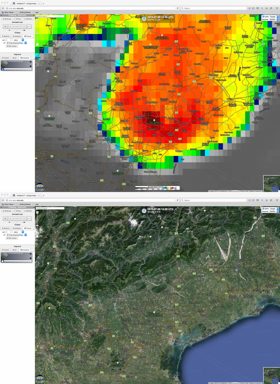
A close-up view of the 1500 UTC Metosat-10 Infrared (10.8 µm) image is shown below, as displayed using SSEC RealEarth.

Meteosat-10 Infrared (10.8 µm) image, displayed using RealEarth

Meteosat-10 Infrared (10.8 µm) image, displayed using RealEarth

View only this post Read Less

Typhoons Chan-Hom and Nangka in the same Suomi NPP VIIRS Overpass

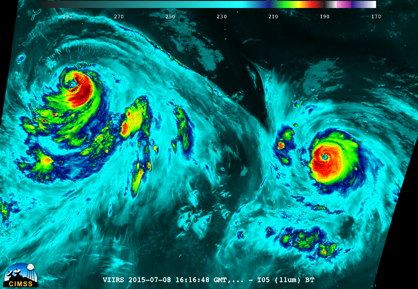
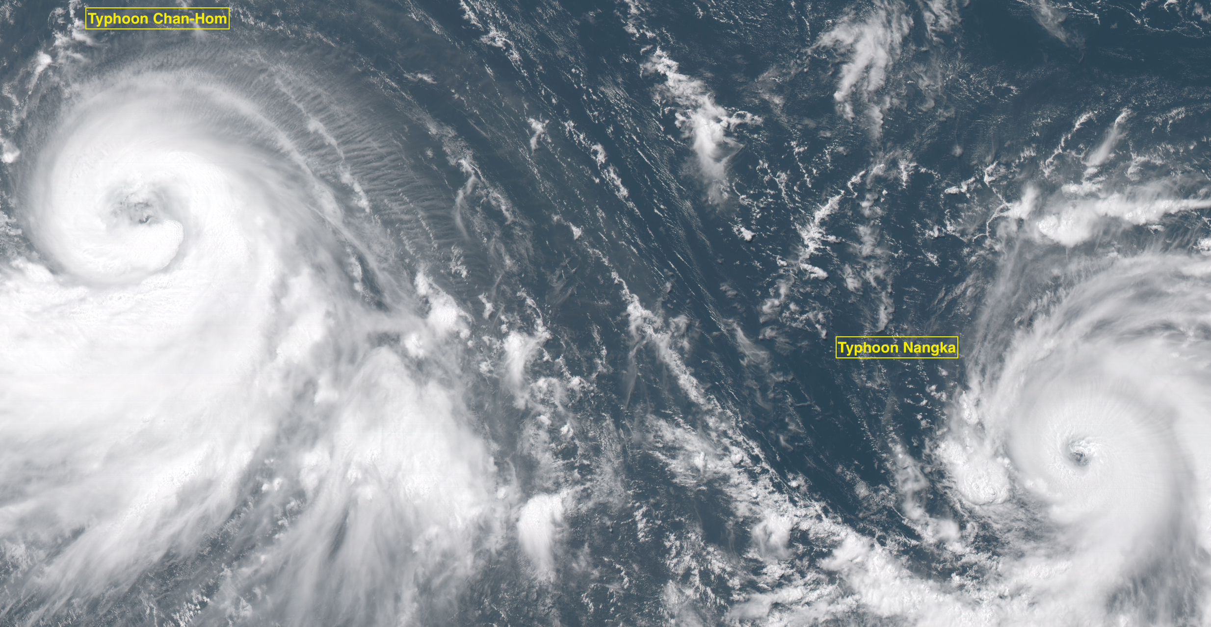
The toggle above shows Suomi NPP VIIRS 0.7 µm Day/Night Band and the 11.45 µm Infrared images (courtesy of William Straka, SSEC). It is unusual because two strong tropical cyclones (Category 2 Typhoon Chan-Hom on the left, and Category 4 Typhoon Nangka on the right) are captured in one satellite overpass.The Day/Night Band (DNB) image... Read More

Suomi NPP Day/Night Band (0.70 µm) and Infrared Window Channel (11.45 µm) images at 1616 UTC 8 July 2015 (Click to animate)

Suomi NPP Day/Night Band (0.70 µm) and Infrared Window Channel (11.45 µm) images at 1616 UTC on 8 July 2015 (click to enlarge)

The toggle above shows Suomi NPP VIIRS 0.7 µm Day/Night Band and the 11.45 µm Infrared images (courtesy of William Straka, SSEC). It is unusual because two strong tropical cyclones (Category 2 Typhoon Chan-Hom on the left, and Category 4 Typhoon Nangka on the right) are captured in one satellite overpass.

The Day/Night Band (DNB) image shows little evidence of lightning (bright white streaks) with either storm; due to ample illumination from a Third Quarter Moon (at 54% of Full),  the DNB was able to provide a “visible image at night”. Both images show Nangka to be the stronger storm: the eye is more pronounced, and is more symmetric. More information on these storms is available here.

View only this post Read Less

Himawari-8 is now operational over the western Pacific

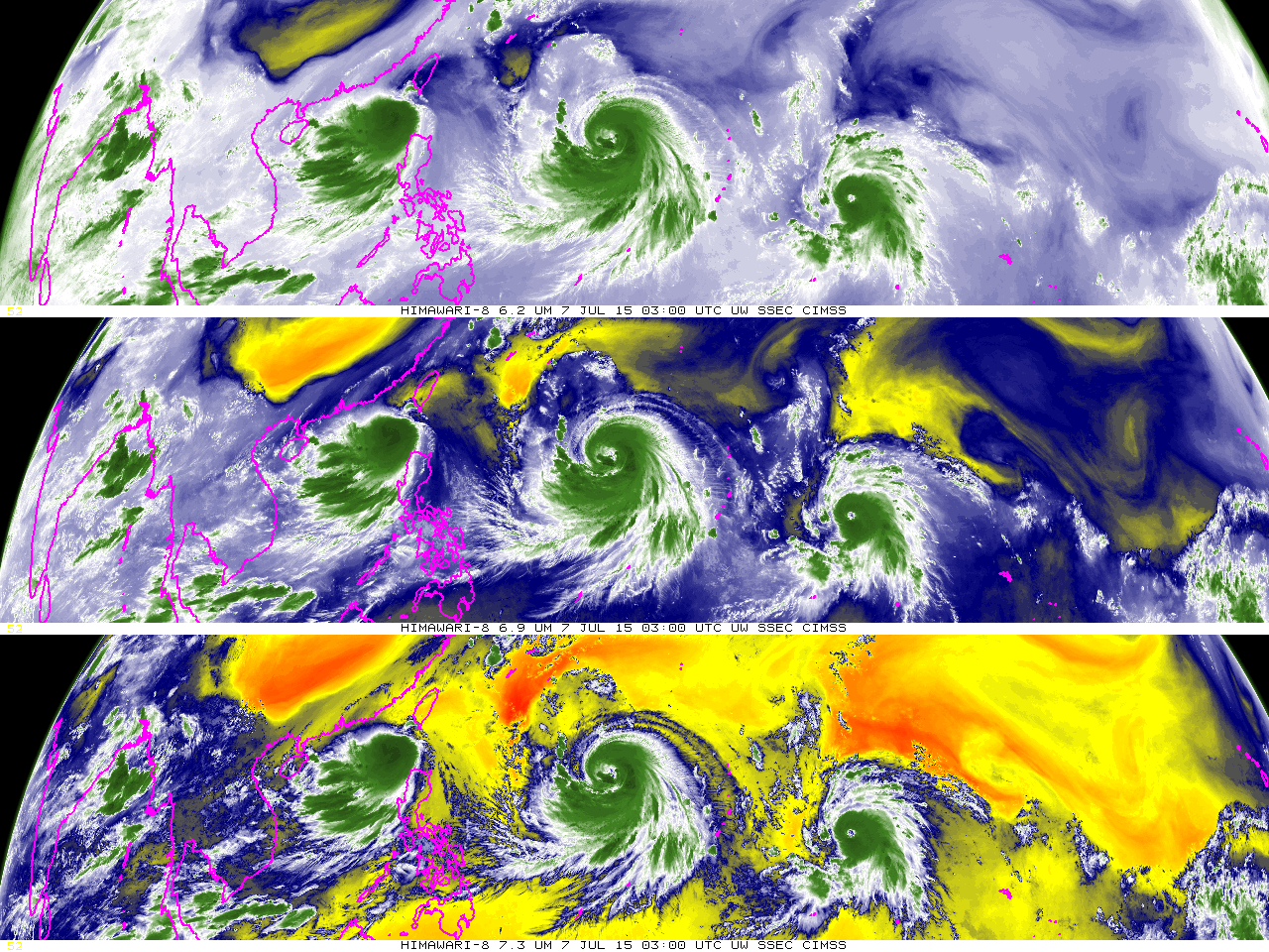
The Japanese Meteorological Agency is using Himawari-8 as its operational satellite, effective 0200 UTC on 7 July 2015. The animation above shows two days of water vapor imagery from Himawari-8 (6.2 µm, top, 6.9 µm, middle and 7.3 µm, bottom) over the tropical Pacific, revealing the train of three tropical cyclones moving... Read More
Himawari-8 10.35 µm infrared imagery, 1447-2002 UTC on 6 July 2015 (Click to animate)

Himawari-8 6.2 µm (top), 6.9 µm (middle) and 7.3 µm (bottom) water vapor infrared imagery, 0000 UTC 5 July 2015 – 1200 UTC 7 July 2015 (click to animate)

The Japanese Meteorological Agency is using Himawari-8 as its operational satellite, effective 0200 UTC on 7 July 2015. The animation above shows two days of water vapor imagery from Himawari-8 (6.2 µm, top, 6.9 µm, middle and 7.3 µm, bottom) over the tropical Pacific, revealing the train of three tropical cyclones moving westward towards Asia (testimony to why satellite data are important!). Typhoon Nangka, on the right, has developed an eye. Himawari-8 samples a full-disk image every 10 minutes, with nominal 2-km resolution in the infrared channels. Moveable sectors are also available at 2.5-minute intervals, such as shown in this animation from here.

Himawari-8 has 0.5-km resolution in the 0.64 µm visible channel. A 3-hour animation over Typhoon Nangka, at routine 10-minute time-steps, is shown below.
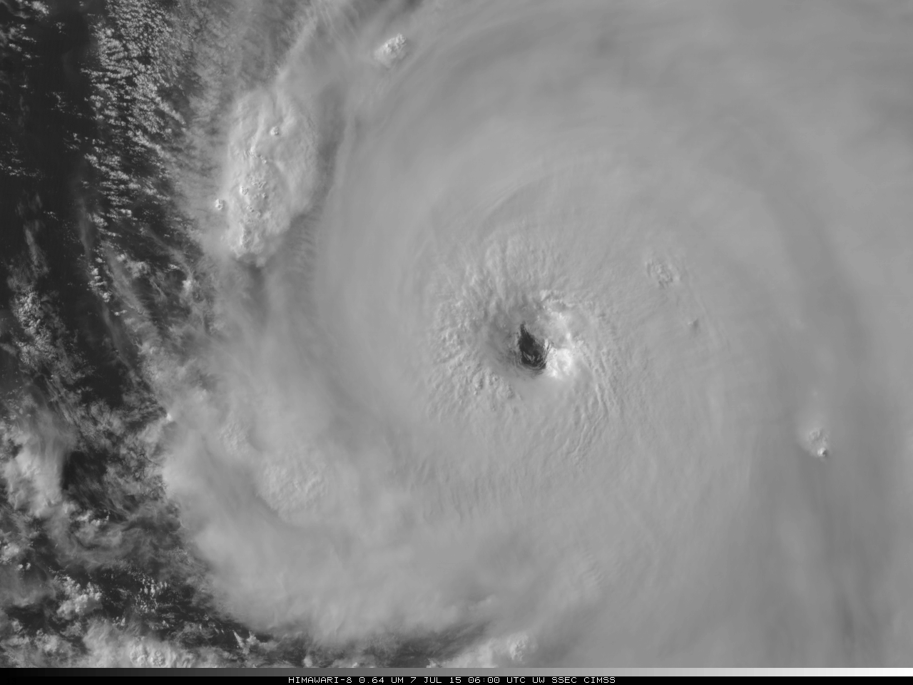
Himawari-8 0.64 µm visible imagery, 0400 UTC 5 July 2015 - 0700 UTC 7 July 2015, showing Typhoon Nangka (Click to animate)

Himawari-8 0.64 µm visible imagery, 0400 UTC 5 July 2015 – 0700 UTC 7 July 2015, showing Typhoon Nangka (click to animate)

The sixteen channels on the AHI instrument onboard Himawari-8 are similar to those that will be found on the ABI instrument onboard GOES-R, which is scheduled for launch in March of 2016. The animation below shows all 16 channels of the Himawari-8 AHI.
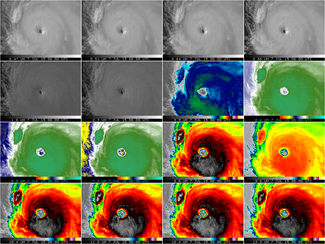
Himawari-8 data, all AHI channels, over Typhoon Nangka, 0400 UTC 5 July 2015 - 0810 UTC 7 July 2015, (Click to animate)

Himawari-8 data, all AHI channels, over Typhoon Nangka, 0400 UTC 5 July 2015 – 0810 UTC 7 July 2015 (click to animate)

A very large (74 MegaByte) Himawari-8 true-color Red/Green/Blue (RGB) full-disk image at 0340 UTC is shown below (courtesy of Jerrold Robaidek, SSEC).
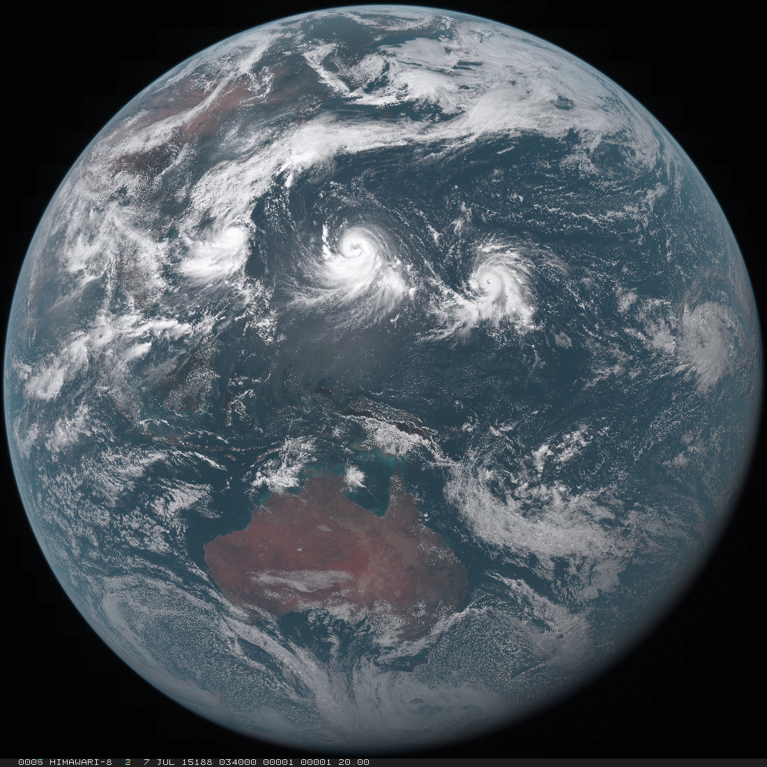
Himawari-8 true-color image

Himawari-8 true-color image

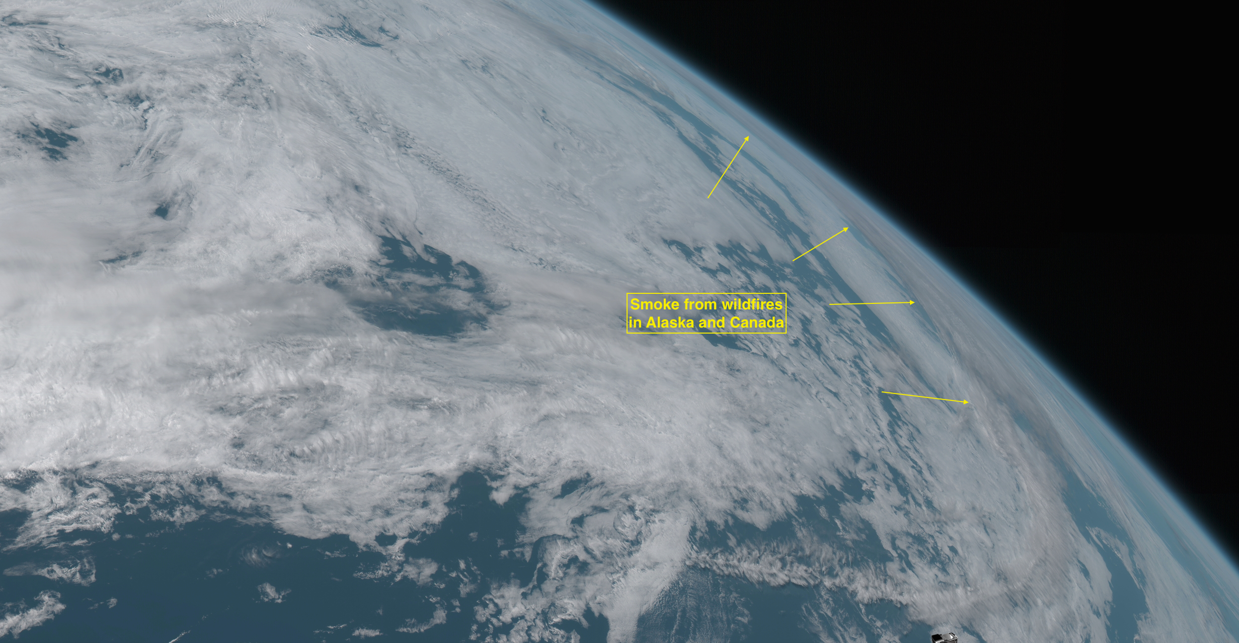
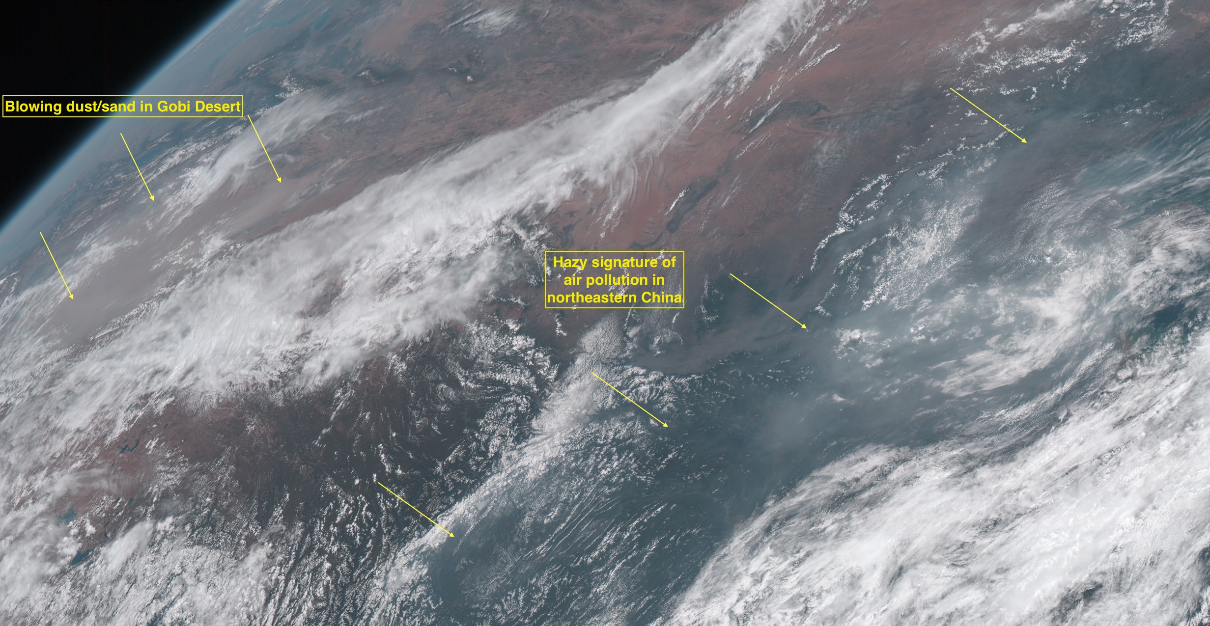
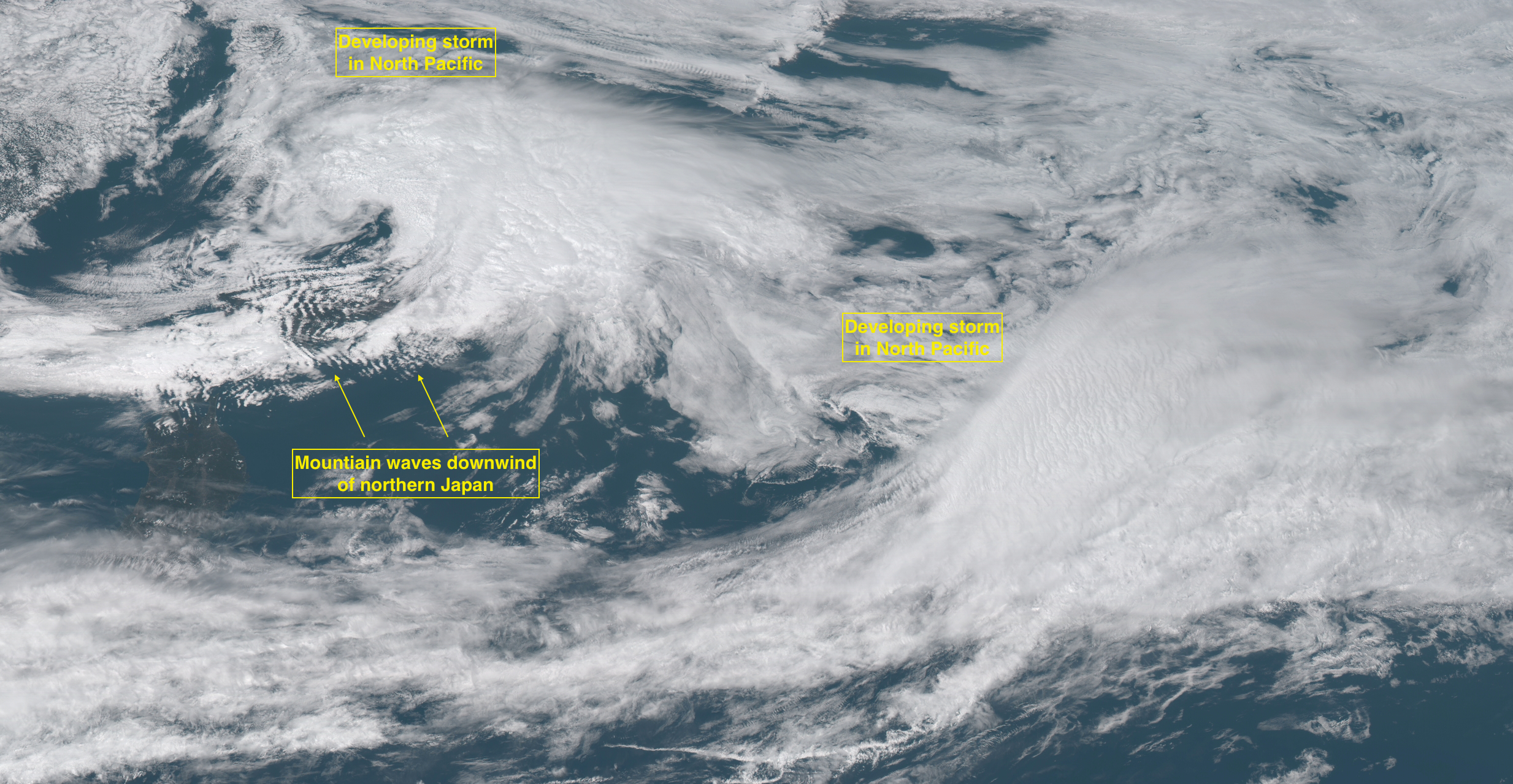
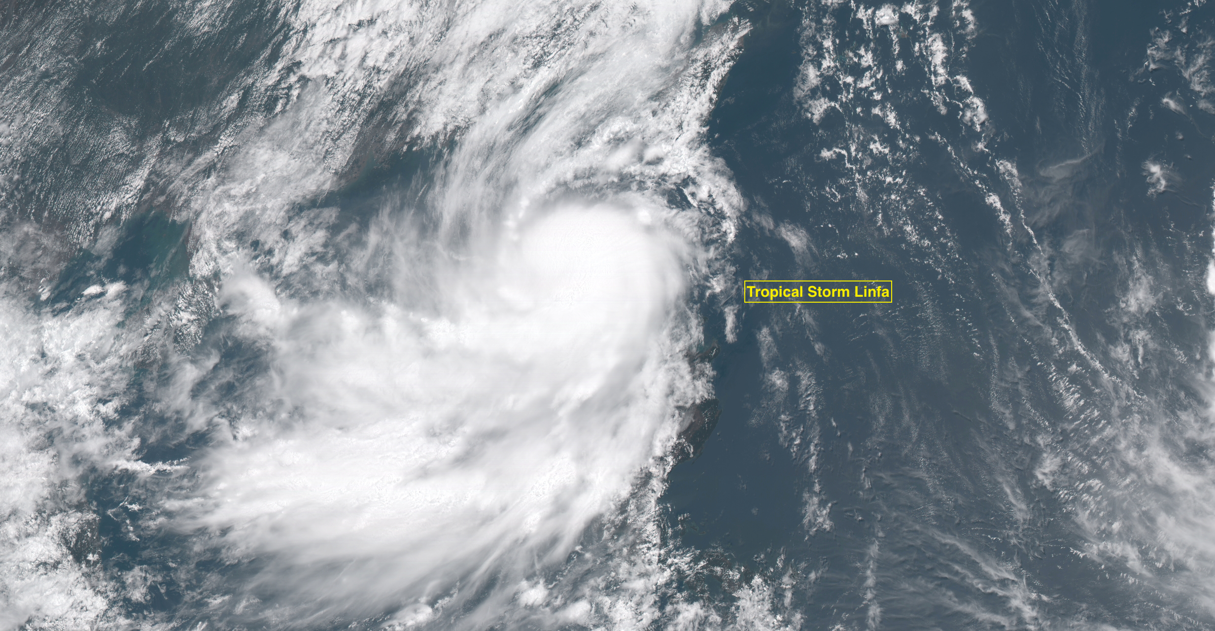
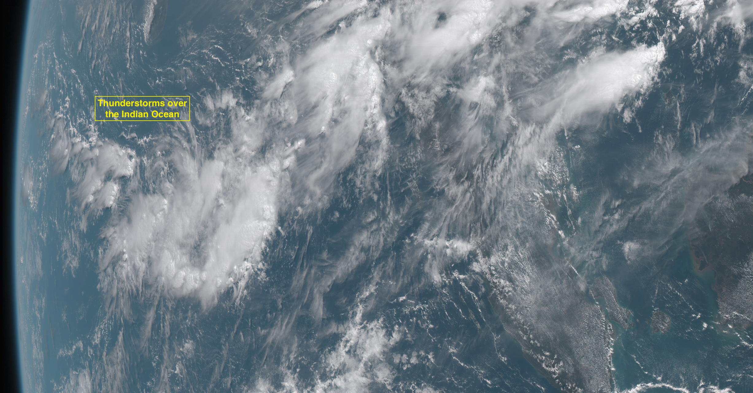
A few interesting features to point out on the full-disk image are shown below (courtesy of Scott Bachmeier, CIMSS) — from north to south:
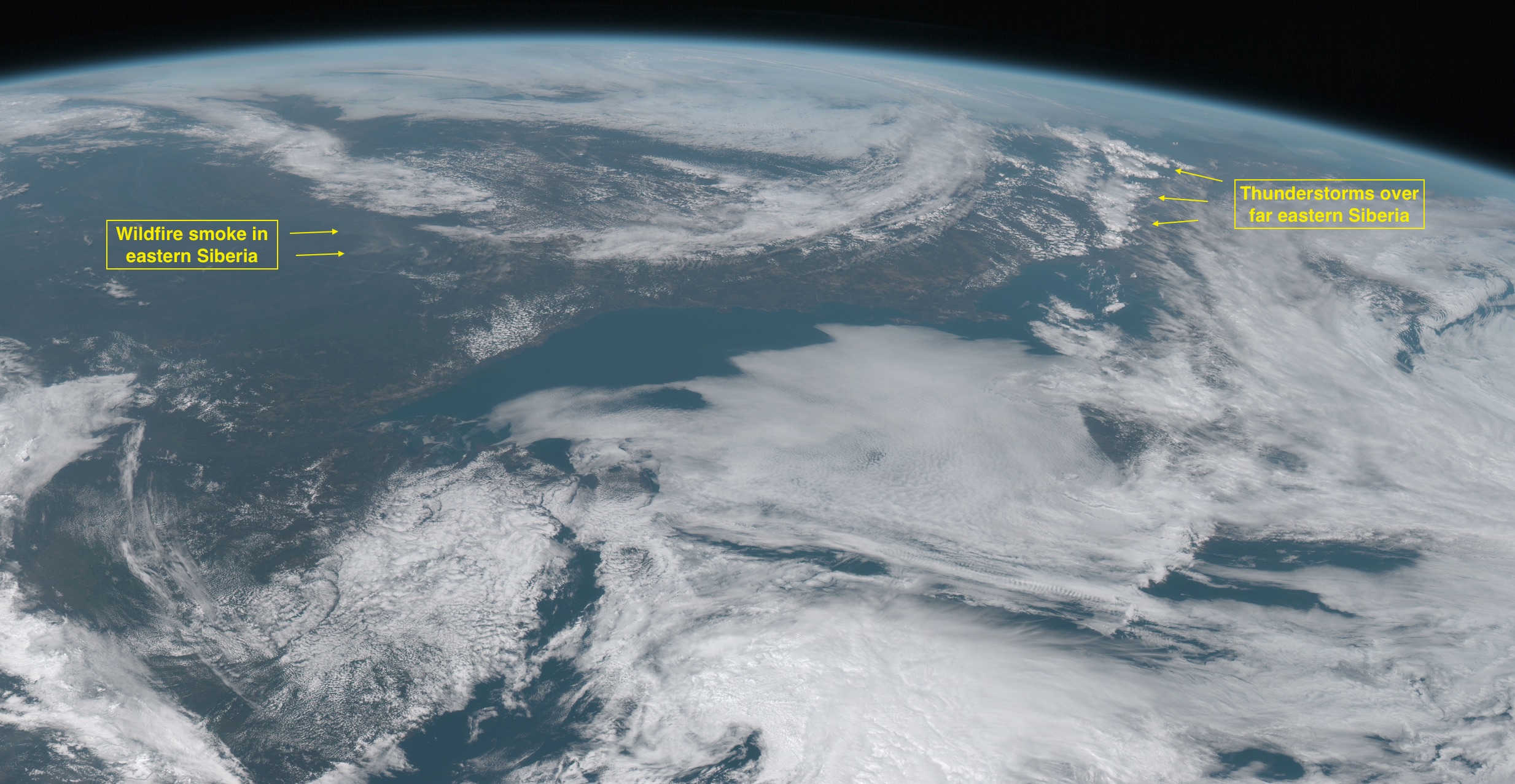
Wildfire smoke and thunderstorms in Siberia
Wildfire smoke and thunderstorms in Siberia

Smoke from fires in Alaska and Canada
Smoke from fires in Alaska and Canada

Blowing dust/sand in the Gobi Desert, and air pollution in northeastern China
Blowing dust/sand in the Gobi Desert, and air pollution in northeastern China

Mountain waves downwind of Japan, and developing storms in the North Pacific Ocean
Mountain waves downwind of Japan, and developing storms in the North Pacific Ocean

Tropical Storm Linfa off the coast of China
Tropical Storm Linfa off the coast of China

Typhoons Chan-Hom and Nangka in the West Pacific Ocean
Typhoons Chan-Hom and Nangka in the West Pacific Ocean

Thunderstorms over the Indian Ocean
Thunderstorms over the Indian Ocean

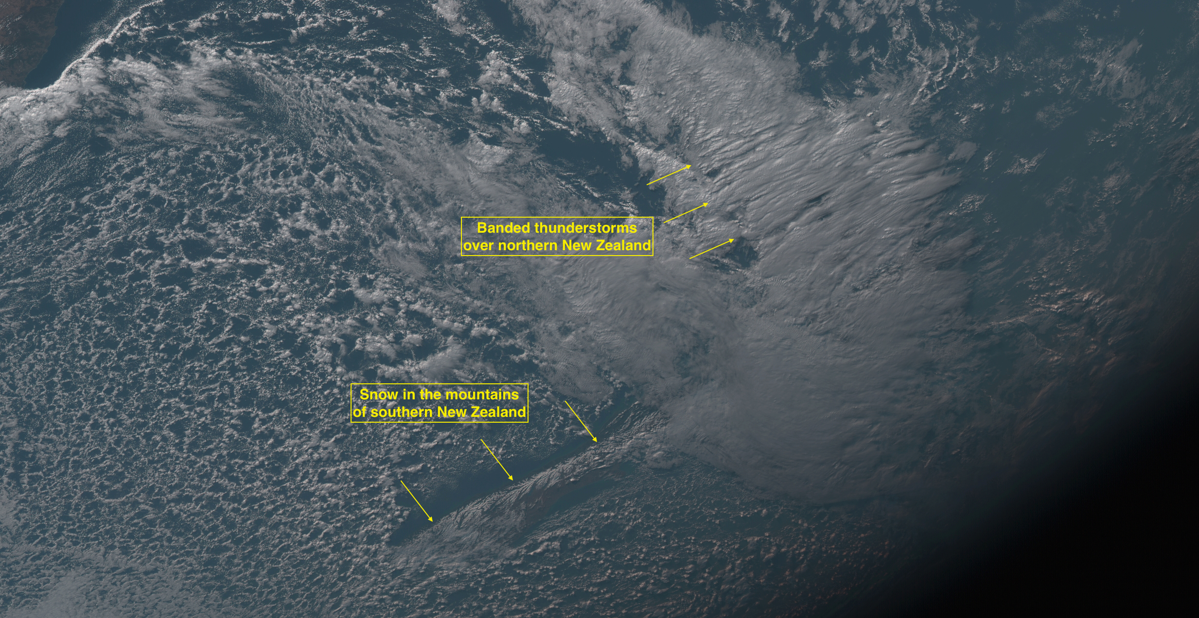
Banded thunderstorms over northern New Zealand, and snow cover in the mountains of southern New Zealand
Banded thunderstorms over northern New Zealand, and snow cover in the mountains of southern New Zealand

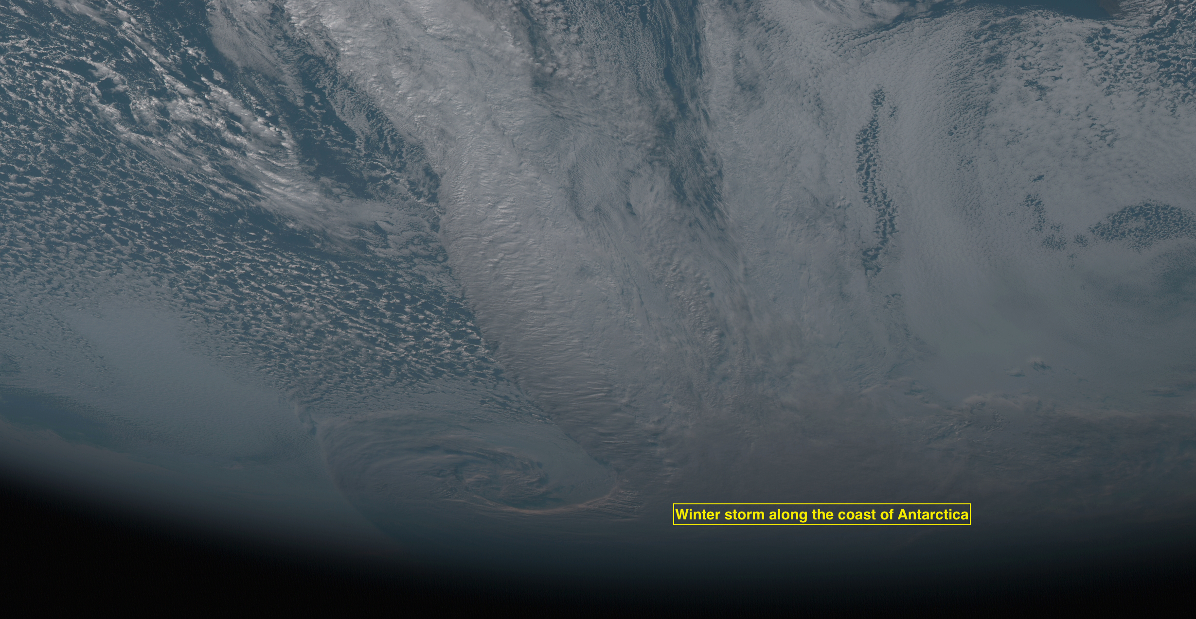
Winter storm along the coast of Antarctica

Winter storm along the coast of Antarctica

View only this post Read Less

Chan-Hom in the western Pacific Ocean

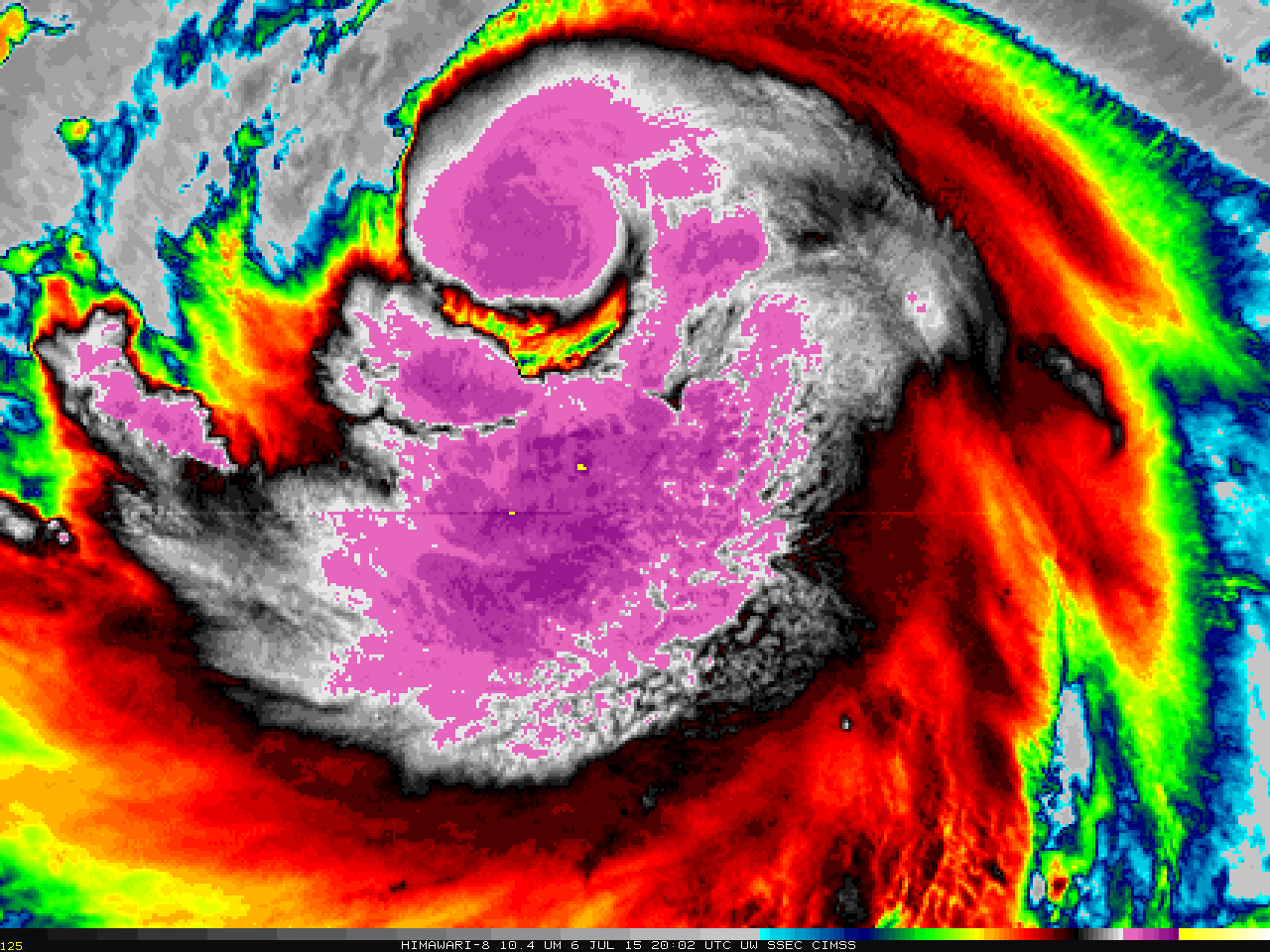
Typhoon Chan-Hom in the western Pacific Ocean is forecast to strengthen and move towards Taiwan later this week. A Himawari-8 target sector is viewing the storm today, and a 5-hour animation with a 2.5-minute time step (10.35 µm infrared imagery) is shown above. Very cold overshooting tops (the yellow enhancement... Read More

Himawari-8 10.35 µm infrared imagery, 1447-2002 UTC on 6 July 2015 (Click to animate)

Himawari-8 10.35 µm infrared imagery, 1447-2002 UTC on 6 July 2015 (click to animate)

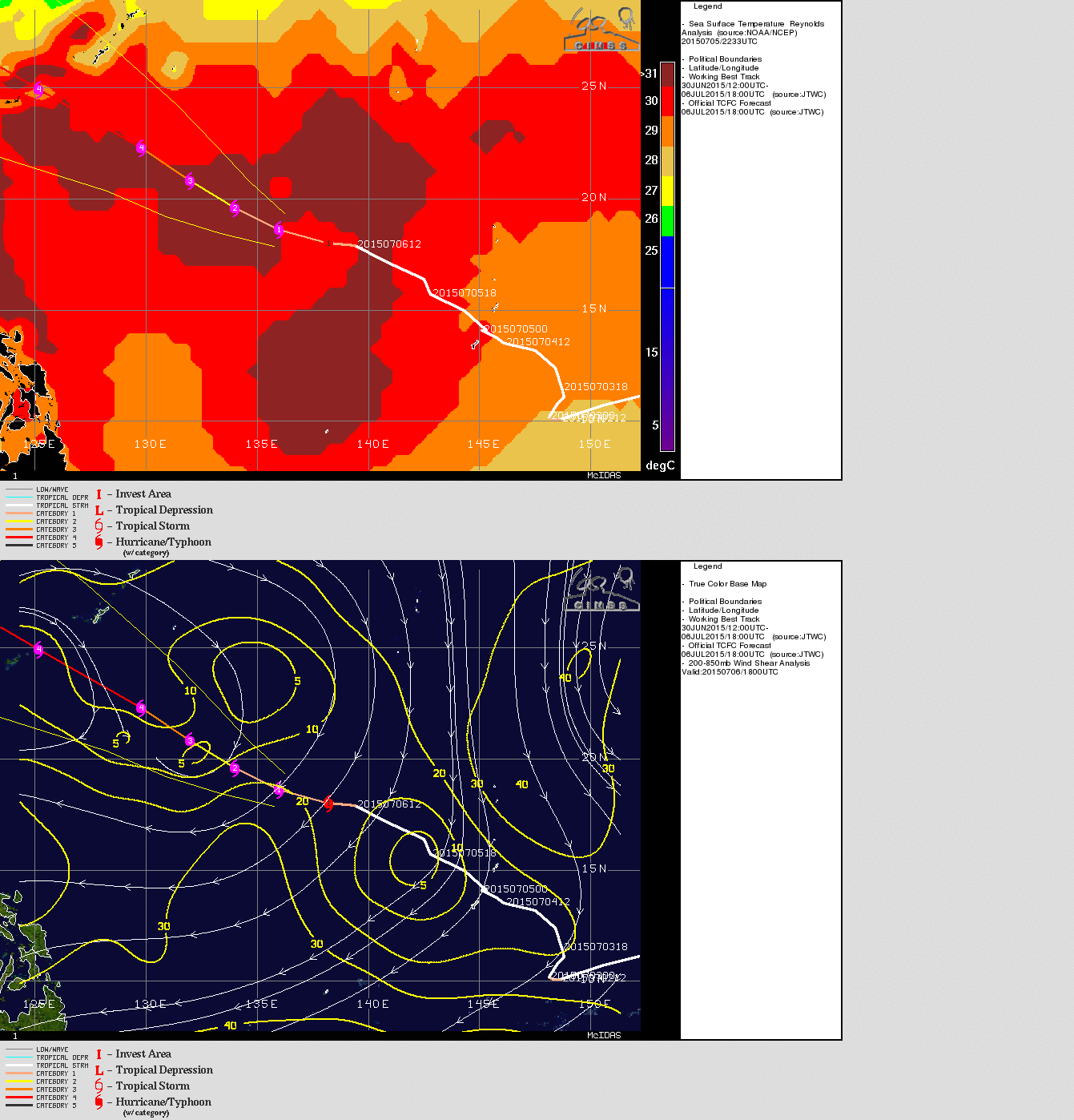
Typhoon Chan-Hom in the western Pacific Ocean is forecast to strengthen and move towards Taiwan later this week. A Himawari-8 target sector is viewing the storm today, and a 5-hour animation with a 2.5-minute time step (10.35 µm infrared imagery) is shown above. Very cold overshooting tops (the yellow enhancement show tops colder than -90º C) periodically develop. The toggle below of Sea Surface Temperature and Wind Shear (taken from the CIMSS Tropical Cyclones site) shows conditions — very warm sea-surface temperatures and low values of deep-layer wind shear — favorable for strengthening.

Suomi NPP VIIRS 0.70 µm visible Day/Night Band and 11.45 µm - 3.74 µm Brightness Temperature Difference images, and Ceilings and Visibilities, ~0800 UTC (click to enlarge)

SSTs and Wind Shear superimposed on the forecast track of Typhoon Chan-Hom (click to enlarge)

The three water vapor images shown below, also from Himawari-8, show that Chan-Hom is the 2nd of three tropical systems in a row. Linfa is west of the Philippines and approaching the coast of China; Nangka is east of Chan-Hom. Note that the 6.2 µm imagery is more sensitive to water vapor higher in the troposphere: Cirrus shields are apparent. The 7.3 µm imagery is not so sensitive to upper-level moisture and can therefore detect cumulus fields underneath cirrus.

Himawari-8 6.2 µm, 6.9 µm and 7.3 µm infrared water vapor images, 2040 UTC on 6 July 2015 (Click to enlarge)

Himawari-8 6.2 µm, 6.9 µm and 7.3 µm infrared water vapor images, 2040 UTC on 6 July 2015 (click to enlarge)

View only this post Read Less