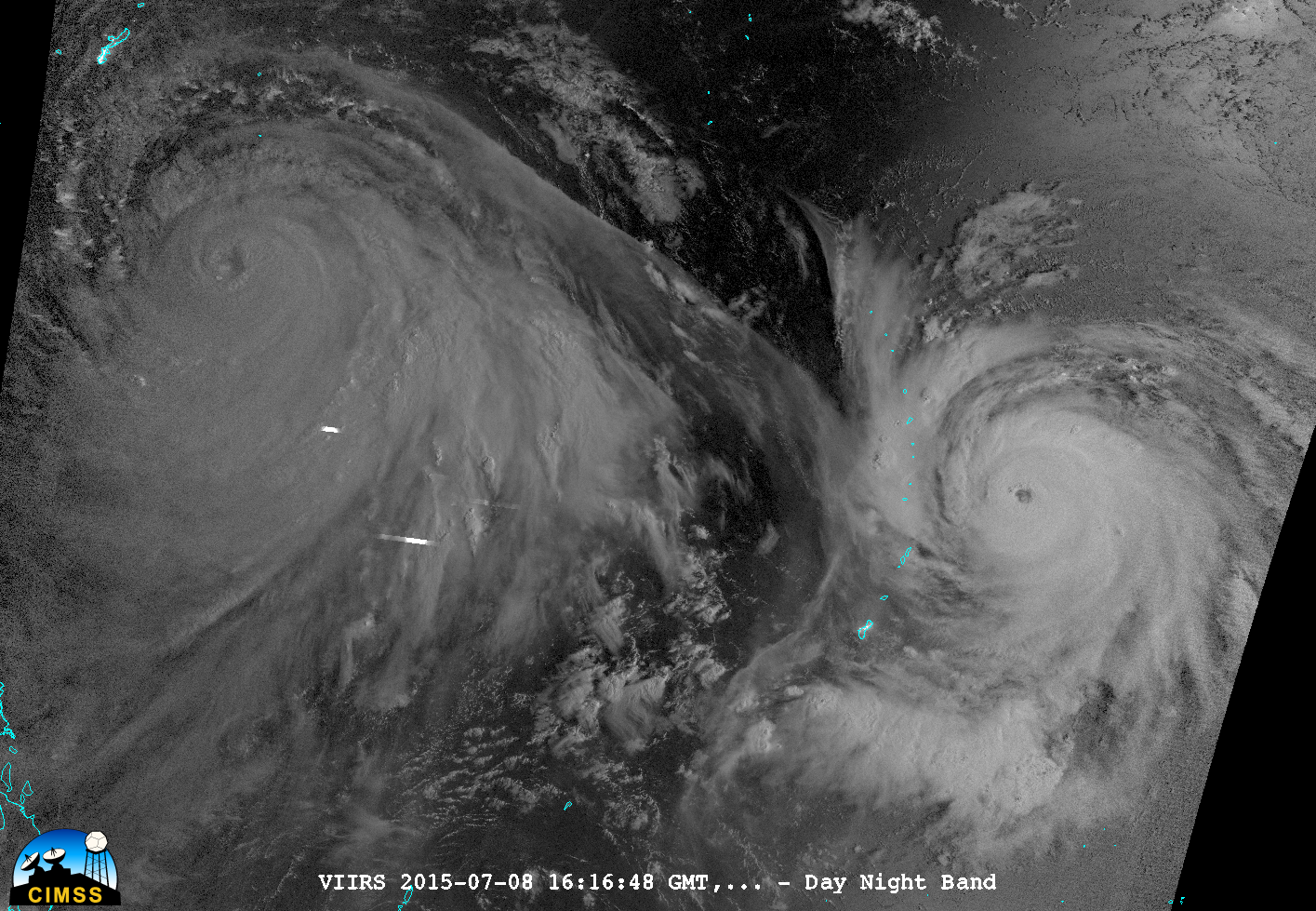
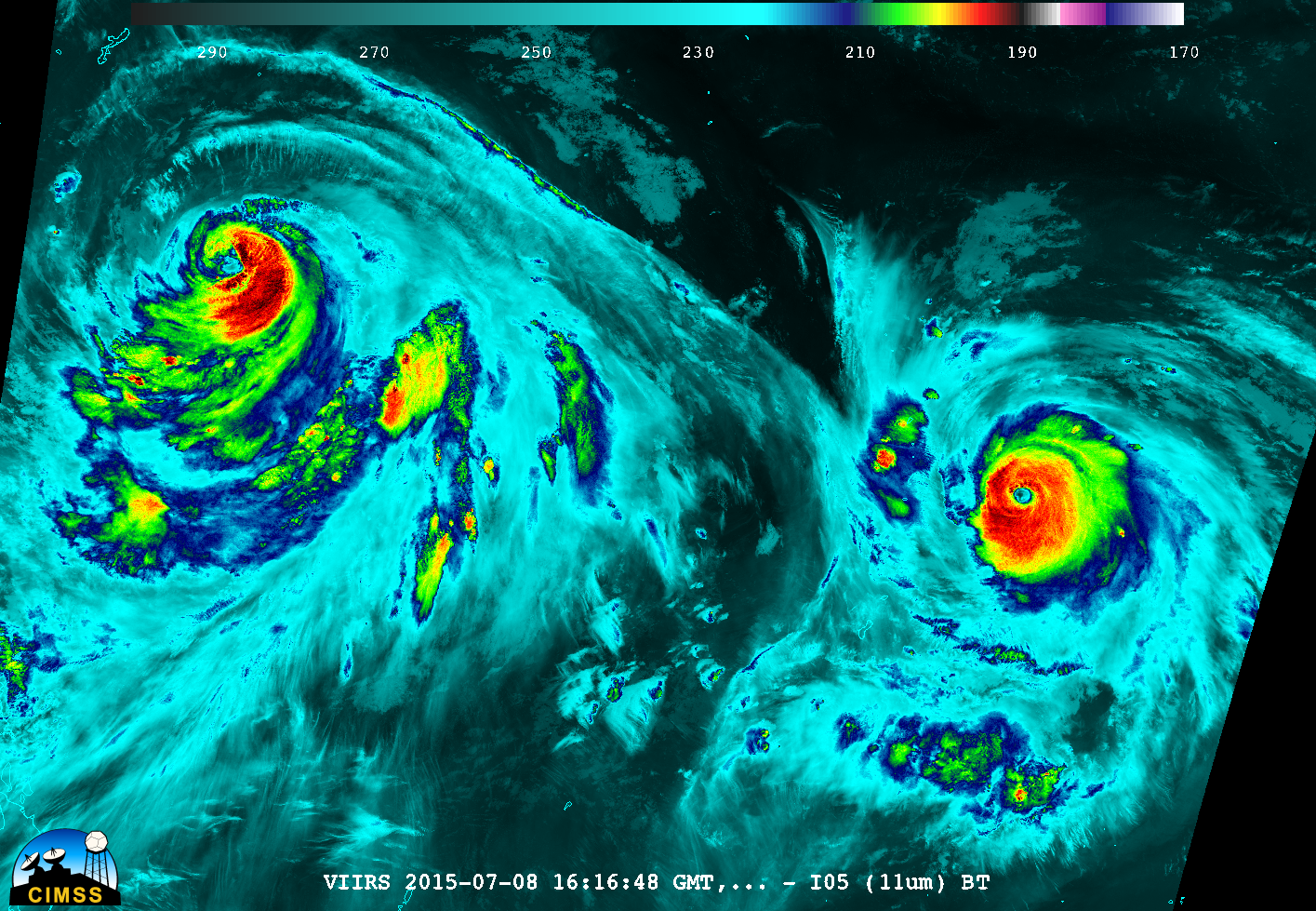
Typhoons Chan-Hom and Nangka in the same Suomi NPP VIIRS Overpass

Suomi NPP Day/Night Band (0.70 µm) and Infrared Window Channel (11.45 µm) images at 1616 UTC on 8 July 2015 (click to enlarge)
The toggle above shows Suomi NPP VIIRS 0.7 µm Day/Night Band and the 11.45 µm Infrared images (courtesy of William Straka, SSEC). It is unusual because two strong tropical cyclones (Category 2 Typhoon Chan-Hom on the left, and Category 4 Typhoon Nangka on the right) are captured in one satellite overpass.
The Day/Night Band (DNB) image shows little evidence of lightning (bright white streaks) with either storm; due to ample illumination from a Third Quarter Moon (at 54% of Full), the DNB was able to provide a “visible image at night”. Both images show Nangka to be the stronger storm: the eye is more pronounced, and is more symmetric. More information on these storms is available here.