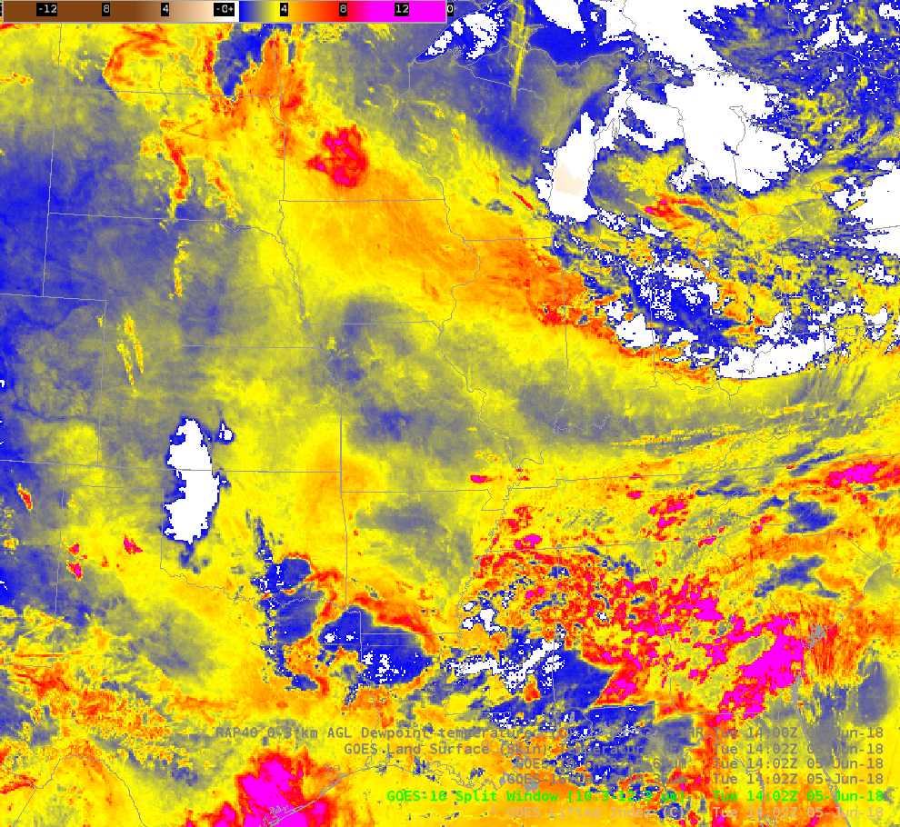
GOES-16 ABI Split Window Difference (10.3 µm – 12.3 µm) at 1402 UTC on 5 June 2018 (Click to enlarge)
The Split Window Difference field (SWD, the 10.3 µm brightness temperature minus the 12.3 µm brightness temperature) can be used to identify regions of moisture and dust in the atmosphere. (Click here for a previous blog post). On 5 June 2018, the SWD showed a strong gradient over the upper Midwest, with large values over Iowa and relatively smaller values to the northeast over Wisconsin (and to the south over Missouri). Is this showing a moisture gradient between Iowa and Wisconsin? Do you trust its placement? Given that convection will frequently fire along the gradient of a field (HWT Link; Old HWT link), it’s important to trust the placement of the gradient.
The toggle below shows both the SWD and the (clear sky only) Baseline Derived Stability Lifted Index. The Lifted Index shows negative values over the southern Plains, and also a lobe of instability stretching WNW-ESE from southwestern Minnesota to Chicago. If you look carefully, you will note that the axis of instability in the Lifted Index is offset from the Split Window Difference field. Why?
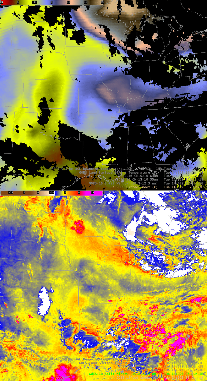
GOES-16 ABI Baseline Derived Stability Index Lifted Index and GOES-16 Split Window Difference (10.3 µm – 12.3 µm) at 1402 UTC on 5 June 2018 (Click to enlarge)
The toggles below show the Split Window Difference field and the Rapid Refresh Model estimates of moisture in the lowest 3 km of the atmosphere, followed by the Split Window Difference toggled with the Baseline Land Surface Temperature field. The maximum in moisture is along the northern edge of the Split Window Difference field, and aligns well with the Lifted Index (Toggle between those two is here).
The Split Window Difference better matches the Land Surface Temperature Baseline product, and that reinforces an important caveat in the use of the SWD to detect moisture: SWD is greatly influenced by the skin temperature. Gradients in surface temperature and gradients in moisture both will affect the Split Window Difference. Make sure you understand the underlying cause of the gradient in the Split Window Difference field.

Toggle between the GOES-16 ABI Split Window Difference (10.3 µm – 12.3 µm) and Mean 0-3km AGL Dewpoint from the Rapid Refresh Model, 1402 UTC on 5 June (Click to enlarge)
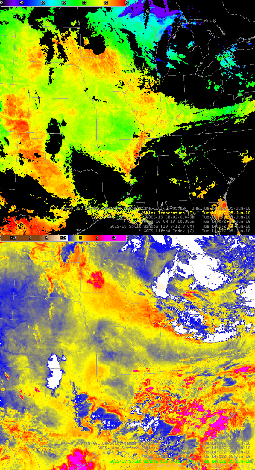
GOES-16 ABI Split Window Difference (10.3 µm – 12.3 µm) and Land Surface Temperature Baseline Product, 1402 UTC on 5 June 2018 (Click to enlarge)
By 2002 UTC on 5 June, the GOES-16 Lifted Index fields and the SWD more closely align, in part because the axis of moisture has shifted southward. See the toggle below.
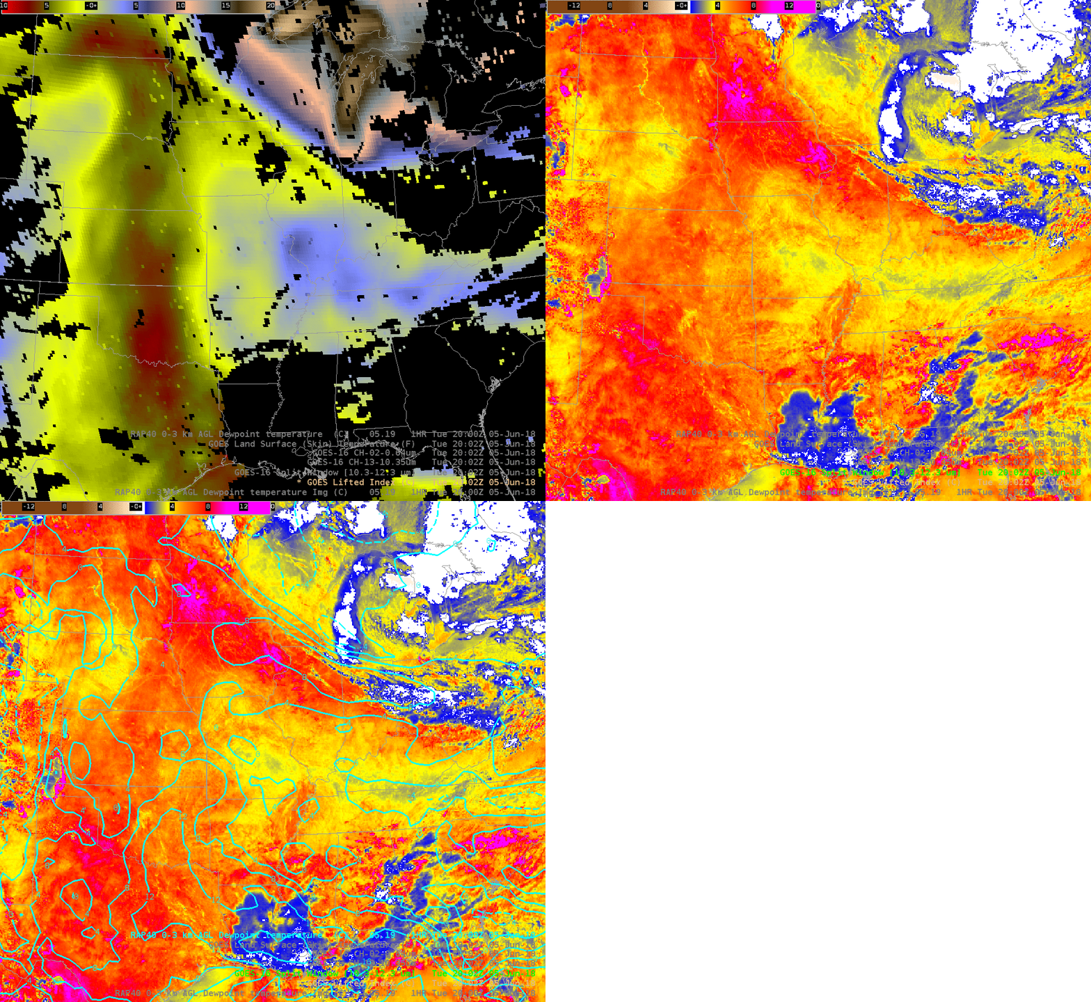
GOES-16 ABI Baseline Lifted Index, Split Window Difference (10.3 µm – 12.3 µm) and 0-3 km AGL Rapid Refresh Dewpoint, 2002 UTC on 5 June 2018 (Click to enlarge)
View only this post Read Less


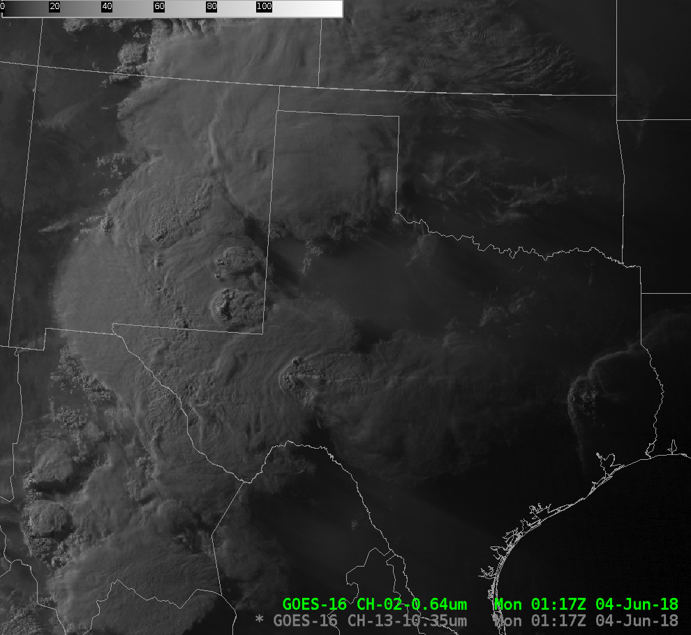

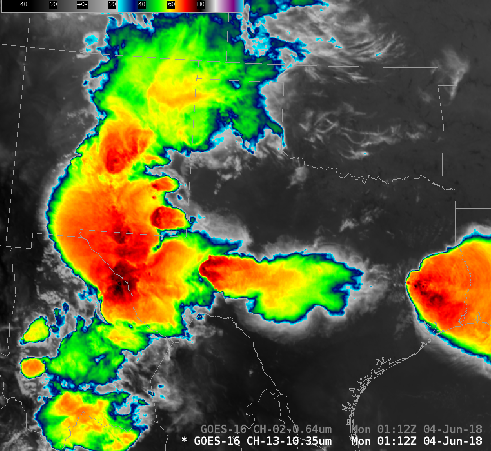
![GOES-16 Infrared (11.2 µm, left) and Visible (0.64 µm, right) images, with plots of the aircraft location [click to play animation]](https://cimss.ssec.wisc.edu/satellite-blog/wp-content/uploads/sites/5/2018/06/AA1897_ir_vis_aircraft.jpeg)
![GOES-16 Visible/Infrared Sandwich product [click to play MP4 animation]](https://cimss.ssec.wisc.edu/satellite-blog/wp-content/uploads/sites/5/2018/06/180604_sandwich.jpeg)
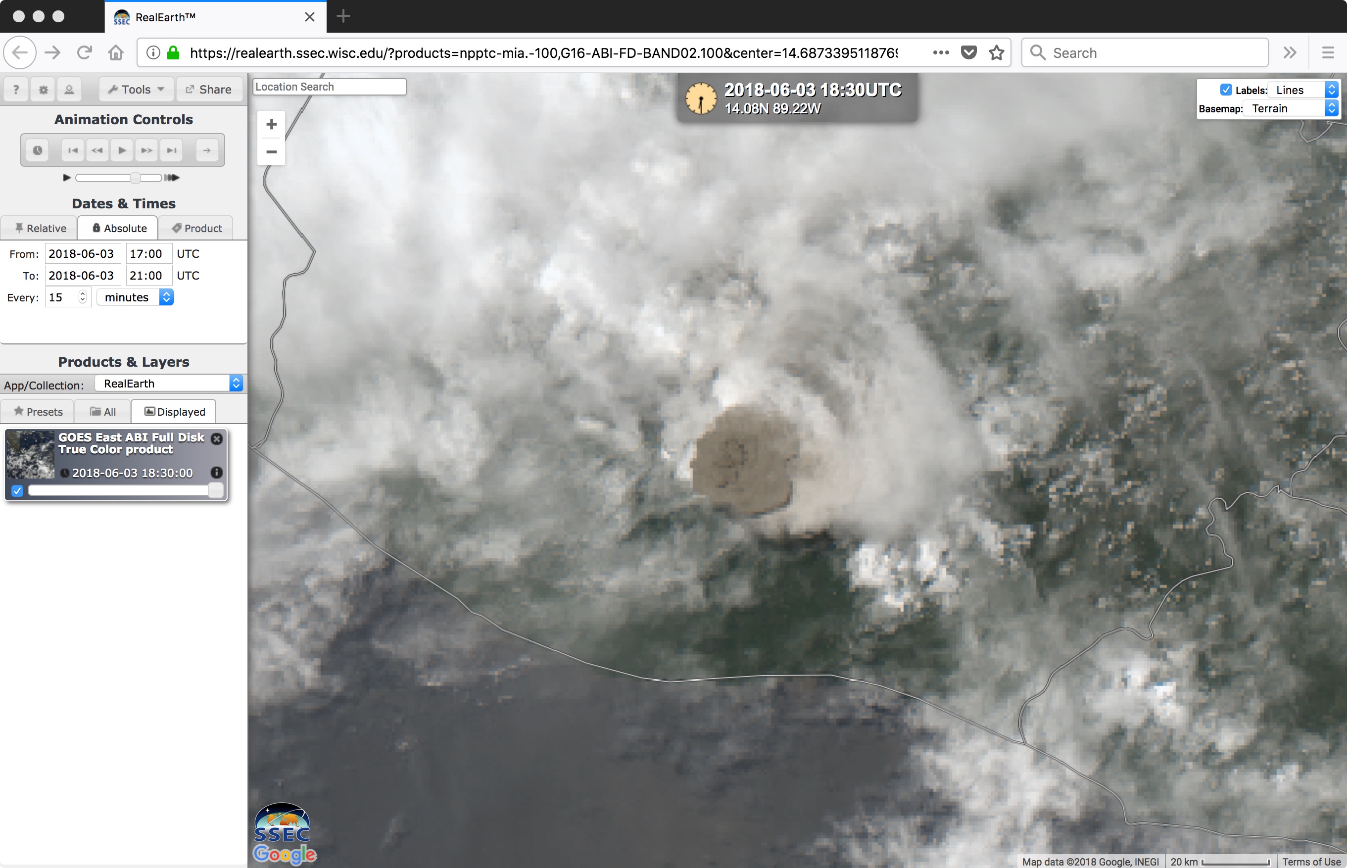
![GOES-16 true-color RGB images [click to play animation]](https://cimss.ssec.wisc.edu/satellite-blog/wp-content/uploads/sites/5/2018/06/fuego_1830.jpeg)
![GOES-16 Shortwave Infrared (3.9 µm) images [click to play MP4 animation]](https://cimss.ssec.wisc.edu/satellite-blog/wp-content/uploads/sites/5/2018/06/Fuego_swir.jpeg)
![16-panel composite of all ABI bands [click to play MP4 animation]](https://cimss.ssec.wisc.edu/satellite-blog/wp-content/uploads/sites/5/2018/06/Fuego_16panel.jpeg)
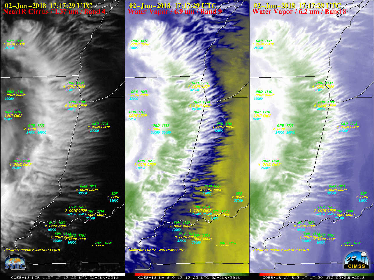
![Aqua MODIS Water Vapor (6.7 µm) and Cirrus (1.37 µm) images, with pilot reports of turbulence [click to enlarge]](https://cimss.ssec.wisc.edu/satellite-blog/wp-content/uploads/sites/5/2018/06/180602_1848utc_aqua_modis_water_vapor_cirrus_pireps_anim.gif)
