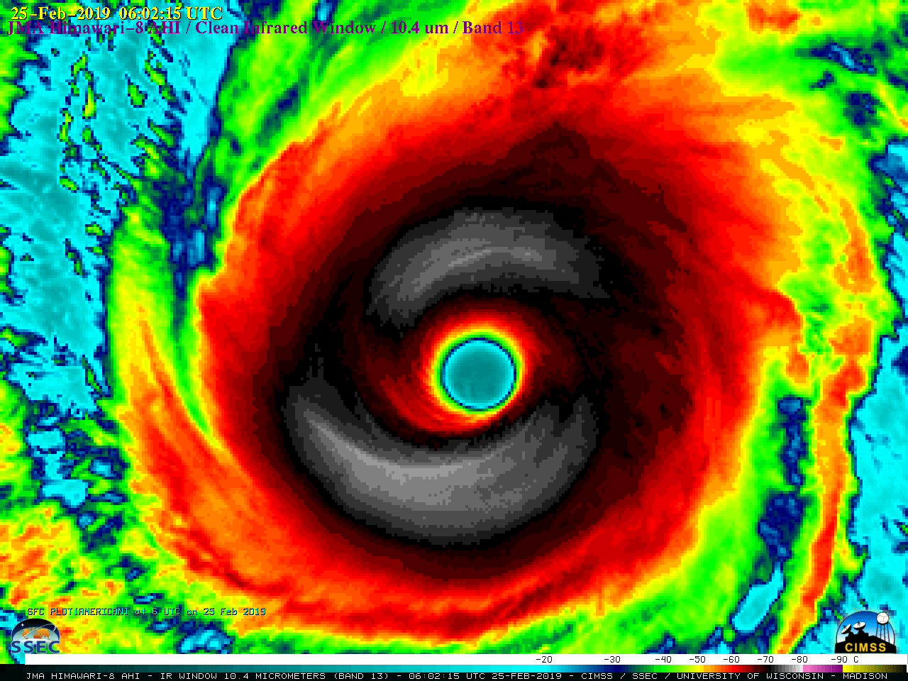
Tropical systems over the western Pacific are in a region where surface observations are few and far between. Imagers on geostationary satellites, such as the Advanced Himawari Imagery (AHI) on Himawari-8, shown above, capably track such systems, but sounders do a much better job diagnosing the atmosphere through and towards... Read More
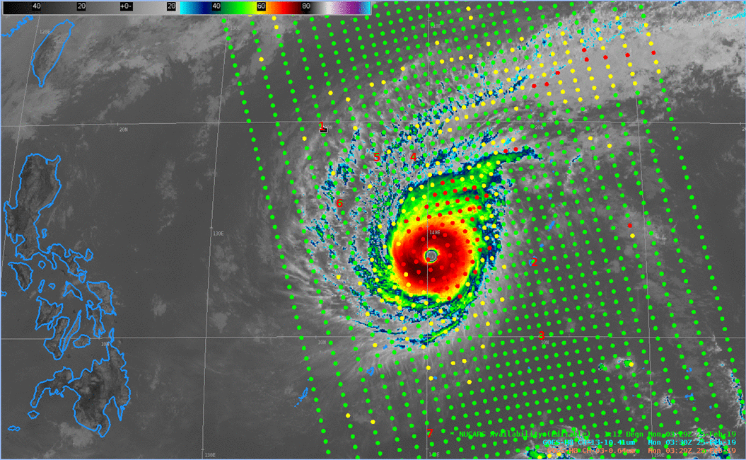
Himawari-8 Advanced Himawari Imagery (AHI) “Clean Window” Band 13 (10.41 µm) at 0330 UTC on 25 February 2019 (Click to enlarge)
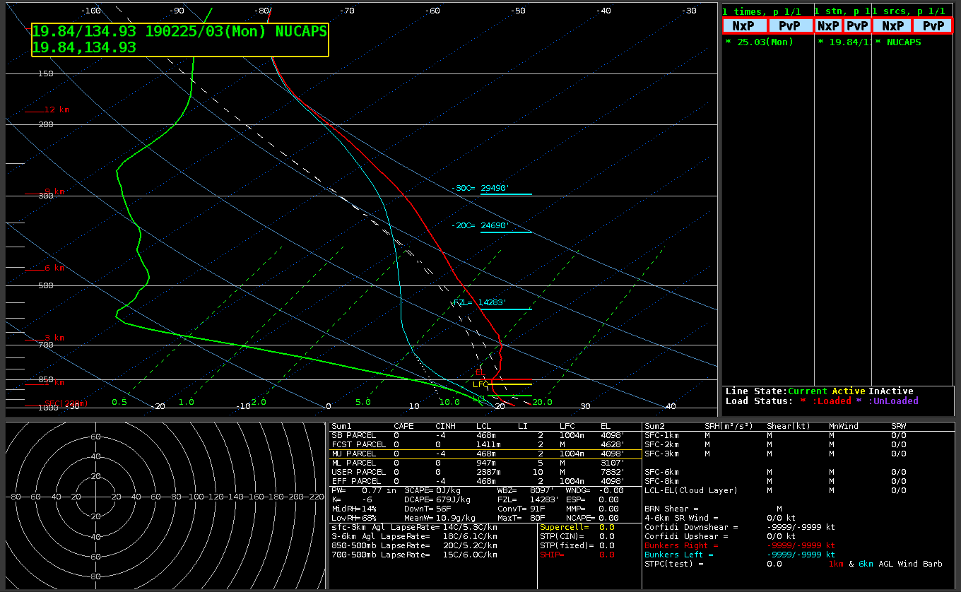
Tropical systems over the western Pacific are in a region where surface observations are few and far between. Imagers on geostationary satellites, such as the Advanced Himawari Imagery (AHI) on Himawari-8, shown above, capably track such systems, but sounders do a much better job diagnosing the atmosphere through and towards which storms are moving. Data from the Cross-track Infrared Sounder (CrIS) on Suomi NPP (and NOAA-20) is combined with microwave sounder from ATMS (the Advanced Technology Microwave Sounder) also on Suomi NPP (and NOAA-20) to produce NUCAPS (NOAA-Unique Combined Atmospheric Profiling System) Soundings. These vertical profiles (independent of numerical model simulations) can provide information that is difficult to find elsewhere. The AHI Clean Window image above is overlain with a swath of NUCAPS Sounding points, and seven (noted on the image as 1-7) are shown below. In the image, NUCAPS profile points coded green denote successful infrared and microwave retrievals; yellow denotes an infrared retrieval that failed, but a microwave retrieval was successful; red denotes failure in both infrared and microwave retrievals — typically meaning that they both failed to converge. Infrared retrievals are most likely to fail in regions of thick clouds, microwave retrievals are most likely to fail in regions of heavy precipitation.
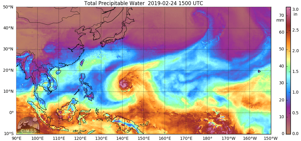
MIMIC Total Precipitable Water, 1500 UTC 24 February – 1400 UTC 25 February 2019 (Click to enlage)
Microwave data alone can also be used to diagnose precipitable water, and an estimate from the MIMIC Total Precipitable Water website for the 24 hours ending at 1400 UTC on 25 February 2019 is shown above. There is considerable dry air in advance of Wutip, and dry air is also wrapping around the south and east of the storm.
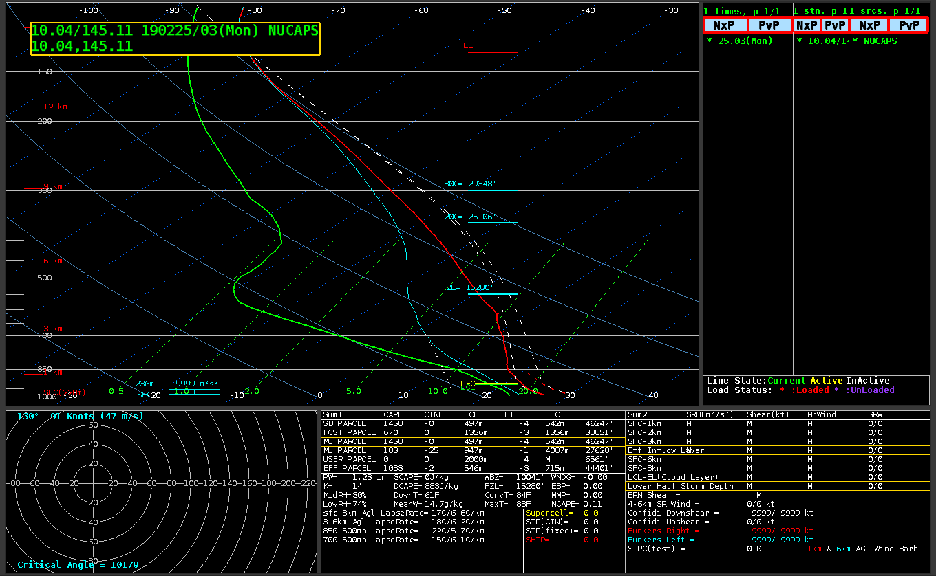
Profile 2 for example, was taken over Guam at 0329 UTC on 25 February 2019 and is shown below. Total Precipitable Water at this time was 1.32″, fairly low for a tropical region. The animation of the Guam radiosondes from 0000 UTC on 24 February to 1200 UTC on 25 February is shown beneath the NUCAPS profile. Total Precipitable Water values over Guam as determined by the radiosonde exceeded 2.3″ on 24 February before dropping to 1.86″ at 00 UTC on the 25th, and 1.37″ on 1200 UTC on 25 February. The NUCAPS plot over Guam gives an extra observation point — at 0330 UTC, in between ‘normal’ synoptic times — to confirm the arrival of dry air.
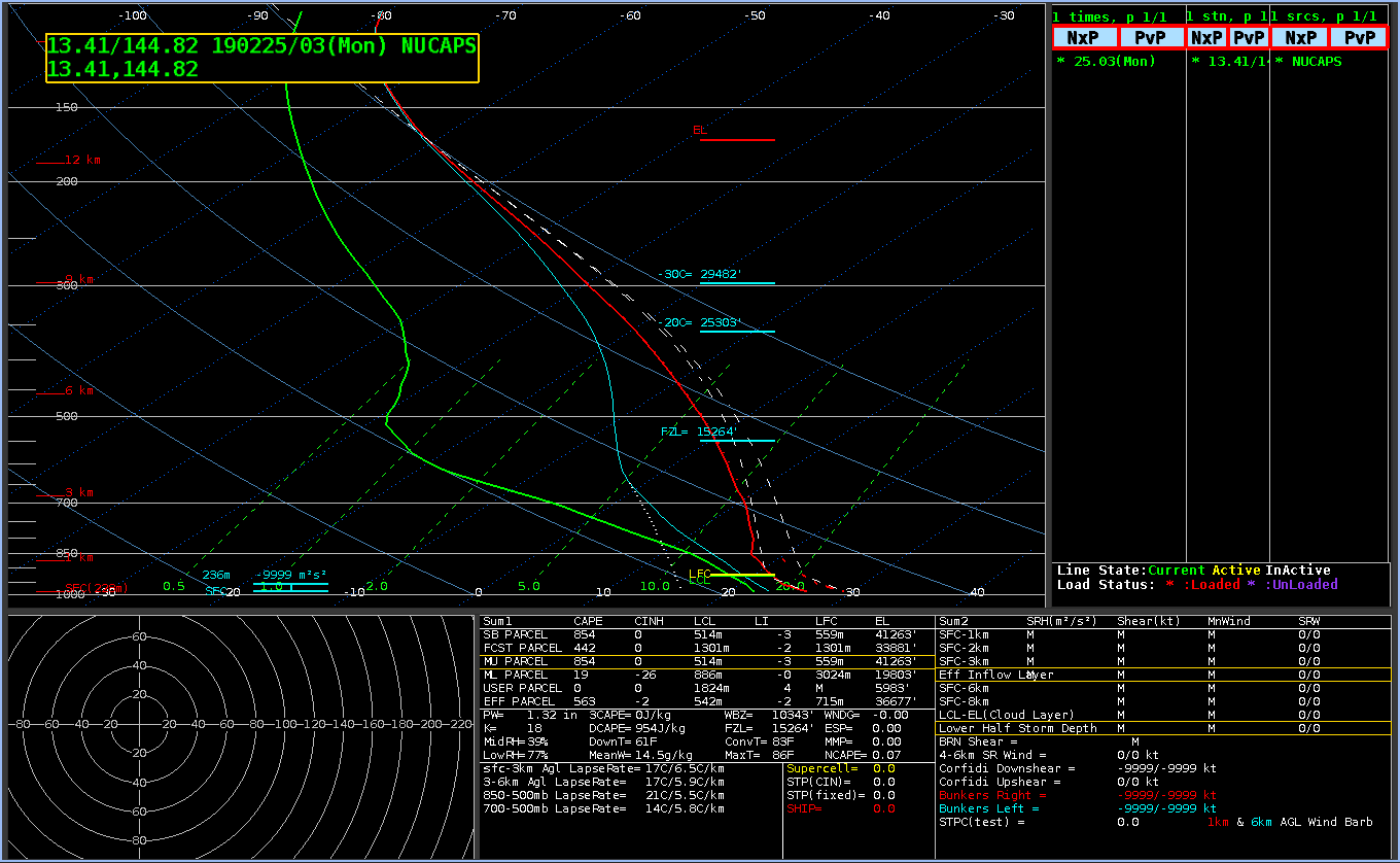
NSharp readout of NUCAPS profile over Guam (point 2) at 0329 UTC on 25 February 2019 (Click to enlarge)
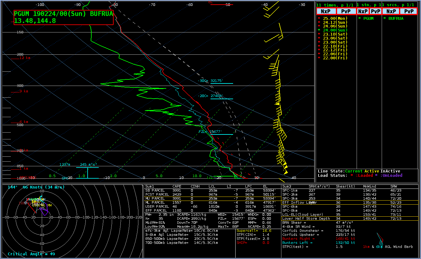
PGUM Rawinsondes, 0000 and 1200 UTC on 24 and 25 February 2019 (Click to enlarge)
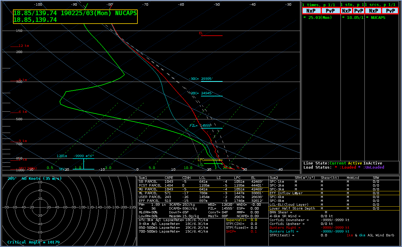
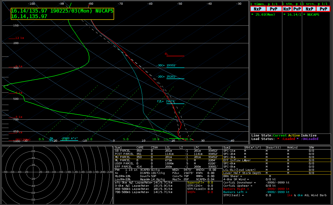
NUCAPS suggests that the dry air south of Wutip is exceptionally dry indeed. The NUCAPS plot from Point 7, above, shown below, shows a total Precipitable water in the deep tropics of only 0.5″!
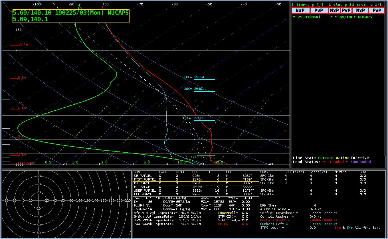
NSharp readout of NUCAPS profile at 5.7 N, 140.1 E (point 7) at 0329 UTC on 25 February 2019 (Click to enlarge)
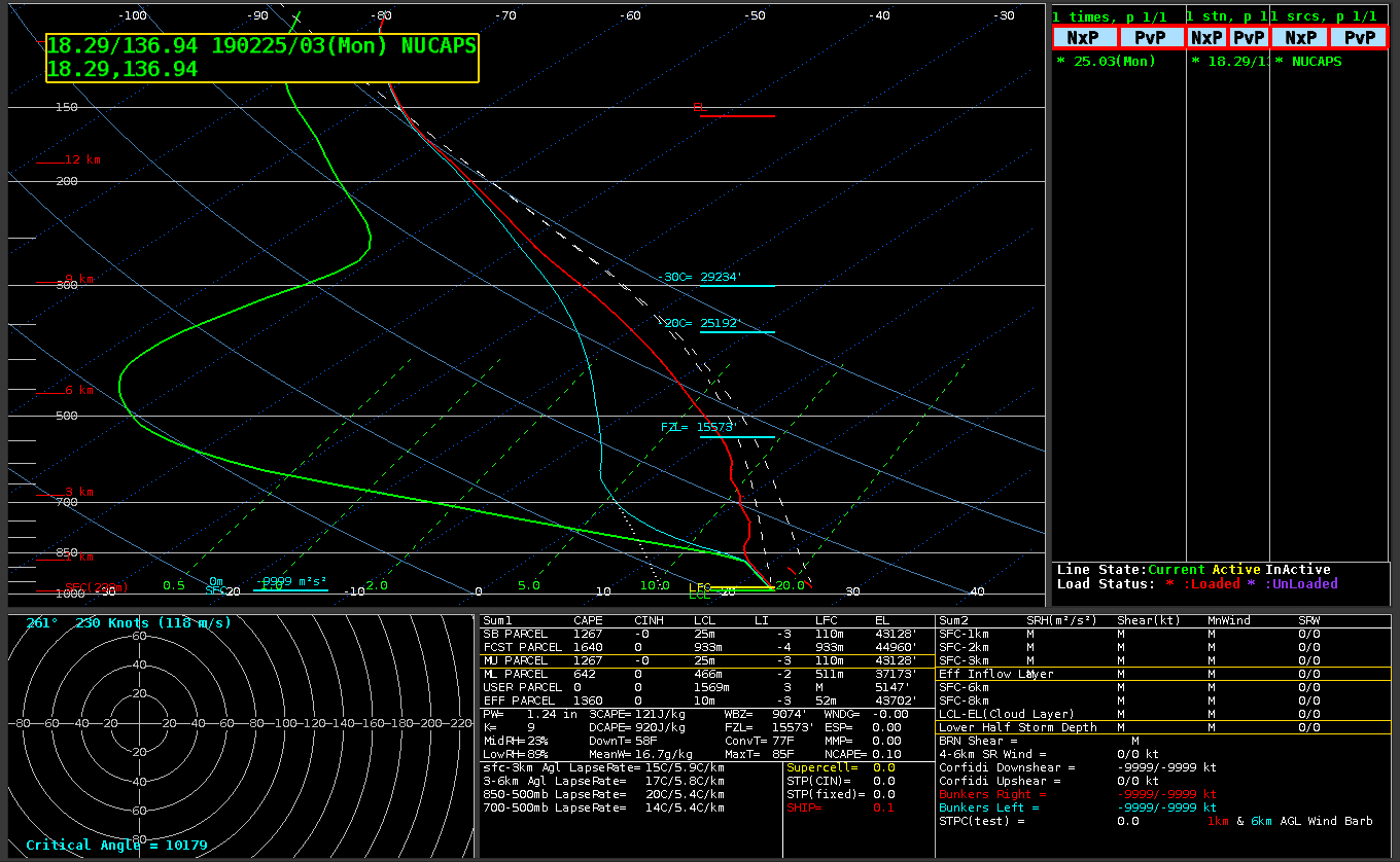
You can also view other NUCAPS profiles by clicking on the number: 1, 3, 4, 5, 6. Point 4, to the north of Wutip, shows more moisture than the other points. Equilibrium Levels for each of the points north of Wutip are near the tropopause.
Horizontal fields derived from NUCAPS values (for example, Dewpoint temperature at 700 mb) will be available in AWIPS later this year. Himawari imagery in this post courtesy of the Japan Meteorological Agency (JMA).
View only this post
Read Less

![Himawari-8 Infrared and Infrared-Water Vapor brightness temperature difference (BTD) images [click to enlarge]](https://cimss.ssec.wisc.edu/satellite-blog/wp-content/uploads/sites/5/2019/02/190225_infrared_irwvdiff_Wutip_anim.gif)
![Himawari-8 "Red" Visible (0.64 µm) images [click to play MP4 animation]](https://cimss.ssec.wisc.edu/satellite-blog/wp-content/uploads/sites/5/2019/02/HIM08_VIS_WUTIP_25FEB2019_2019056_060215_HIMAWARI-8_0001PANEL.GIF)
![Himawari-8 Water Vapor (6.9 µm) images, with contours of deep-layer wind shear [click to enlarge]](https://cimss.ssec.wisc.edu/satellite-blog/wp-content/uploads/sites/5/2019/02/190225_shear_Wutip_anim.gif)
![Storm-centered Himawari-8 Water Vapor (6.9 µm) images, with plots of satellite-derived winds [click to enlarge]](https://cimss.ssec.wisc.edu/satellite-blog/wp-content/uploads/sites/5/2019/02/190225_atmosphericMotionVectors_Wutip_anim.gif)
![Ocean Heat Content and Sea Surface Temperature [click to enlarge]](https://cimss.ssec.wisc.edu/satellite-blog/wp-content/uploads/sites/5/2019/02/190225_oceanHeatContent_seaSurfaceTemperature_Wutip_anim.gif)

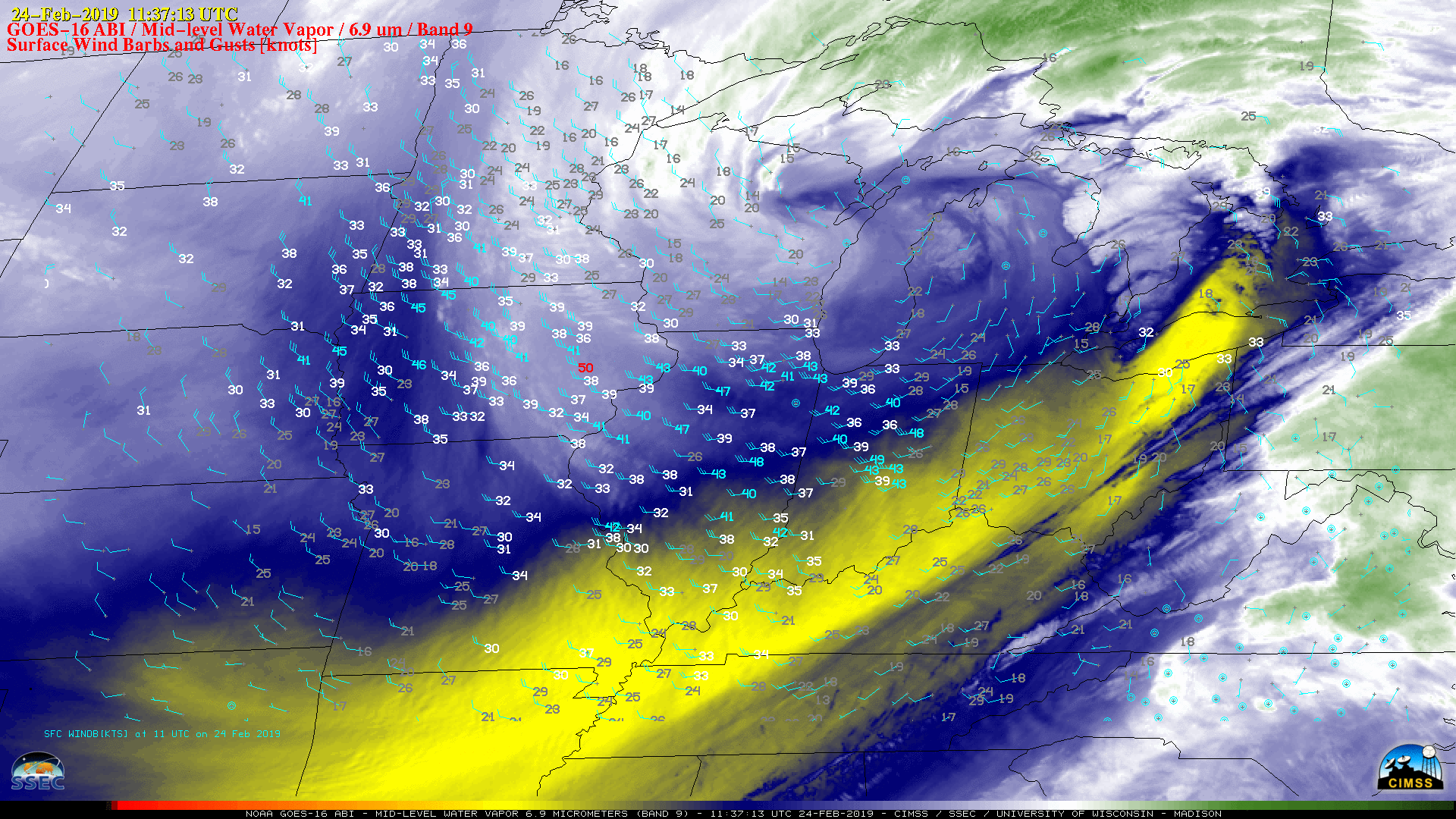
![GOES-16 Mid-level Water Vapor (6.9 µm) images, with hourly plots of surfave winds and gusts in knots [click to play MP4 animation]](https://cimss.ssec.wisc.edu/satellite-blog/wp-content/uploads/sites/5/2019/02/G16_WV9_WINDS_24FEB2019_2019055_113713_GOES-16_0001PANEL.GIF)
![GOES-16 "Red" Visible (0.64 µm) images, with hourly plots of surfave winds and gusts in knots [click to play MP4 animation]](https://cimss.ssec.wisc.edu/satellite-blog/wp-content/uploads/sites/5/2019/02/G16_VIS_WINDS_LAKE_MICHIGAN_24FEB2019_2019055_210151_GOES-16_0001PANEL.GIF)
