Hurricane Dorian reaches Category 5 intensity
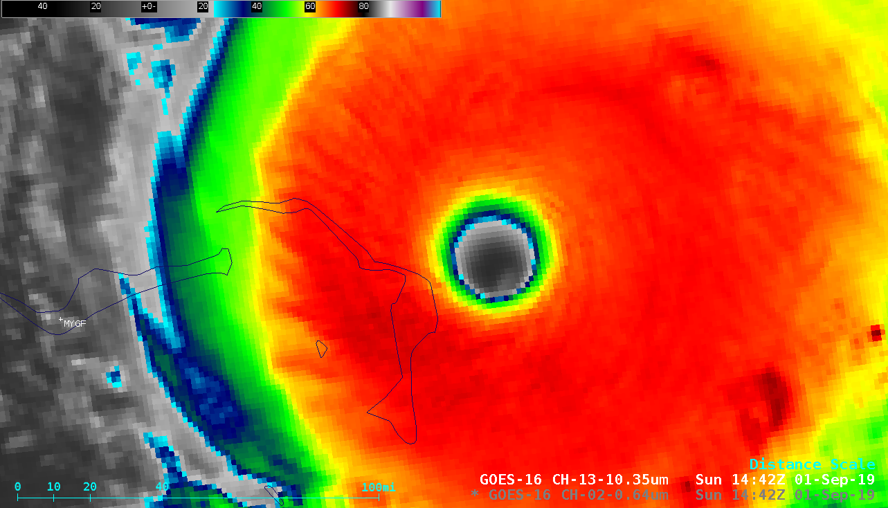
Overlapping 1-minute Mesoscale Domain Sectors provided GOES-16 (GOES-East) “Red” Visible (0.64 µm) and “Clean” Infrared Window (10.35 µm) images at 30-second intervals (above) as Hurricane Dorian reached Category 5 intensity just east of Great Abaco Island in the Bahamas during the morning hours on 01 September 2019. West of Dorian, station Identifier MYGF is Freeport on... Read More