Record 24-hour rainfall in Nome, Alaska
![MIMIC Total Precipitable Water product [click to play animation | MP4]](https://cimss.ssec.wisc.edu/satellite-blog/wp-content/uploads/sites/5/2019/08/190801_190803_mimicTPW_AK_anim.gif)
MIMIC Total Precipitable Water product [click to play animation | MP4]
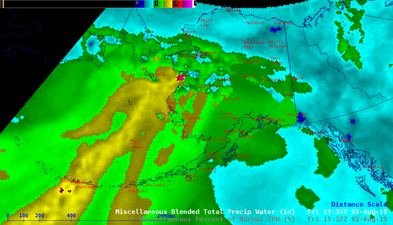
Blended TPW values reached 2.7 inches near Nome at 1537 UTC on 02 August — and broad areas of TPW greater than 200% of normal (yellow) were seen across the Bering Sea as the atmospheric river approached the Seward Peninsula (below).
![Blended Total Precipitable Water and Percent of Normal [click to play animation | MP4]](https://cimss.ssec.wisc.edu/satellite-blog/wp-content/uploads/sites/5/2019/08/190731_190803_blendedTPW_percentNormalTPW_AK_anim.gif)
Blended Total Precipitable Water and Percent of Normal TPW [click to play animation | MP4]
![Time series of surface data from Nome, Alaska [click to enlarge]](https://cimss.ssec.wisc.edu/satellite-blog/wp-content/uploads/sites/5/2019/08/190802_190803_PAOM_SFCMG.GIF)
Time series of surface data from Nome, Alaska [click to enlarge]
![Plot of rawinsonde data from Nome at 12 UTC on 02 August [click to enlarge]](https://cimss.ssec.wisc.edu/satellite-blog/wp-content/uploads/sites/5/2019/08/190802_12UTC_PAOM_RAOB.GIF)
Plot of rawinsonde data from Nome at 12 UTC on 02 August [click to enlarge]
Rainfall totals since Thursday AM around Alaska. At any one place most of the rain fell in ~24 hours: any amounts over 1.5″ are very significant. Note: not all of these totals are completely accurate: instrument, reporting & decoding all sources of error. #akwx @Climatologist49 pic.twitter.com/xqJalsCOKv
— Rick Thoman (@AlaskaWx) August 3, 2019